Grand Manan facts for kids
Quick facts for kids
Grand Manan
|
||
|---|---|---|
|
Village
|
||
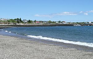
Beach along Grand Manan's North Head
|
||
|
||
| Nickname(s):
"Queen of the Fundy Isles"
|
||
| Country | Canada | |
| Province | New Brunswick | |
| County | Charlotte | |
| Settled | 1784 | |
| Incorporated | 1854 | |
| Government | ||
| • Type | Village | |
| Area | ||
| • Land | 150.56 km2 (58.13 sq mi) | |
| Elevation | 78 m (255 ft) | |
| Population
(2021)
|
||
| • Total | 2,595 | |
| • Density | 17.2/km2 (45/sq mi) | |
| • Change (2016–21) | ||
| Time zone | UTC-4 (Atlantic) | |
| • Summer (DST) | UTC-3 (Atlantic) | |
| Postal code |
E5G0A1
|
|
| Area code(s) | 506 | |
| LORAN | 4443.00N | |
| LORAN | 06648.00W | |
| WMO Id: | 71030 | |
| LFA (Lobster Fishing Area) | Area 38 | |
| Demonym | "Grand Mananer" | |
| Website | www.grandmanannb.com | |
Grand Manan is a beautiful Canadian island located in the Bay of Fundy. It is part of the province of New Brunswick. Grand Manan is also the name of a village that includes the main island and many smaller islands nearby. However, some islands like White Head Island and Machias Seal Island are not part of the village.
The closest point on the mainland to Grand Manan is near Lubec, Maine in the United States. This is about 15 kilometers (9.3 miles) across the Grand Manan Channel. The island is also about 32 kilometers (20 miles) south of Blacks Harbour, New Brunswick.
Contents
The Name of Grand Manan
The name "Manan" comes from an old word, mun-an-ook or man-an-ook. This word means "island place" or "the island" in the language of the Maliseet-Passamaquoddy-Penobscot First Nations people.
According to their stories, these First Nations used Grand Manan and the islands around it as a safe place for older people during winter. It was also a special burial ground. In 1606, explorer Samuel de Champlain stayed on nearby White Head Island. He made a map and first called the island "Manthane," later changing it to "Menane" or "Menasne."
A Look Back at Grand Manan's History
The area around Grand Manan was first mapped by Portuguese explorer João Álvares Fagundes around 1520. However, the island didn't clearly appear on a map until 1558, made by another Portuguese mapmaker, Diogo Homem.
In 1693, the island was given to Paul D'Ailleboust as part of "New France" (what the French called their lands in North America). But he never took control of it. So, it went back to the French King. In 1713, it was given to the British in a deal called the Treaty of Utrecht.
The first people to settle permanently on Grand Manan arrived in 1784. Moses Gerrish brought a group of settlers to an area he named Ross Island. During the American Revolution, many naval battles happened near the island between American privateers (ships that attacked other ships for profit) and British ships.
For a while, the United States thought Grand Manan should belong to them because it was so close to Maine. But in 1794, the Jay's Treaty officially gave the island to Britain.
From 1812 to 1814, the Bay of Fundy had many privateers who raided villages. The ownership of islands in Passamaquoddy Bay was finally settled in 1817. That's when the United States officially gave up its claim to Grand Manan and the islands around it.
By 1832, schools were started by the Anglican Church. While other islands focused on whaling, Grand Manan became known for fishing and building ships.
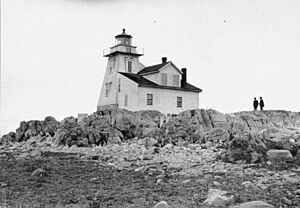
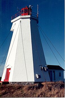
In 1831, the Gannet Rock Lighthouse was built on a small rocky island south of Grand Manan. This lighthouse helped guide ships safely to Saint John, New Brunswick. It is the oldest lighthouse on Grand Manan.
This time was also known for many shipwrecks off the island's rocky coast. For example, in 1857, the ship Lord Ashburton crashed into the cliffs during a hurricane, and many lives were lost.
By 1851, almost 1,200 people lived on the island, and most of them worked in fishing. By 1884, Grand Manan became the world's biggest supplier of smoked herring. By 1920, it produced a huge amount: one million boxes, or twenty thousand tons, of smoked herring, all caught in the local waters.
Later, in the Victorian era, people started visiting Grand Manan for vacations. Famous author Willa Cather loved the island's quiet beauty. Painters like Alfred Thompson Bricher and John James Audubon also came to capture the island's "unique majesty" and its wildlife.
Grand Manan's Geography
Grand Manan Island is the largest of the Fundy Islands. It's the main island in a group of islands called the Grand Manan archipelago. This group includes smaller islands like White Head Island, Ross and Cheney Islands, and the Wood Islands. There are also many rocky areas around them.
The western side of the main island and the smaller islands have many narrow passages, small bays (coves), and rocky reefs.
Grand Manan is about 34 kilometers (21 miles) long and up to 18 kilometers (11 miles) wide. Its total area is about 137 square kilometers (53 square miles).
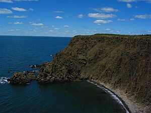
Most people who live on Grand Manan live on the eastern side of the island. The western side has tall cliffs, some as high as 90 meters (300 feet), and strong winds. Because of this, not many homes are built on the western side.
Island Geology: Rocks and Minerals
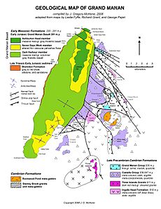
The western part of Grand Manan Island has thick layers of lava rock called basalt. These rocks formed a very long time ago, when a huge amount of lava flowed across the land. This lava flow is also found under most of the Bay of Fundy. These rocks are part of an even bigger volcanic event that happened before the supercontinent Pangaea broke apart.
Over time, many cool minerals have filled the cracks and bubbles in these cooled lava rocks. You can find zeolite minerals like chabazite and stilbite. You might also find beautiful quartz-related minerals like amethyst, agate, and jasper. Good places to look for these minerals include Seven Days Work, Indian Beach, and Bradford Cove.
The harbors along the eastern coast were formed by the wearing away of older, complex rock formations. These older rocks are made of changed sedimentary and volcanic rocks. You can see a major fault line (a crack in the Earth's crust) at Red Point. This fault separates the older eastern rocks from the basalt rocks on the western side.
These older rocks are between 539 and 618 million years old. They were originally rocks like basalt, sandstone, and shale. But they have been changed by heat and pressure into different types of rocks like greenstone and schist. These rocks also show many bends and breaks from being pushed and pulled over millions of years.
Grand Manan's Climate
Grand Manan has a climate that brings comfortable spring, summer, and fall weather. However, winters can be tricky, with a mix of snow, rain, freezing rain, and mild days.
The highest temperature ever recorded on Grand Manan was 33.3°C (91.9°F) on July 26, 1963. The coldest temperature ever recorded was -30.6°C (-23.1°F) on January 10, 1890.
| Climate data for Grand Manan (Seal Cove), 1981–2010 normals, extremes 1883–present | |||||||||||||
|---|---|---|---|---|---|---|---|---|---|---|---|---|---|
| Month | Jan | Feb | Mar | Apr | May | Jun | Jul | Aug | Sep | Oct | Nov | Dec | Year |
| Record high °C (°F) | 16.1 (61.0) |
15.0 (59.0) |
25.6 (78.1) |
23.9 (75.0) |
30.5 (86.9) |
32.8 (91.0) |
33.3 (91.9) |
32.5 (90.5) |
31.9 (89.4) |
27.0 (80.6) |
18.3 (64.9) |
18.7 (65.7) |
33.3 (91.9) |
| Mean daily maximum °C (°F) | −0.3 (31.5) |
−0.3 (31.5) |
3.0 (37.4) |
8.1 (46.6) |
14.0 (57.2) |
18.0 (64.4) |
20.7 (69.3) |
21.0 (69.8) |
17.8 (64.0) |
12.6 (54.7) |
7.2 (45.0) |
2.0 (35.6) |
10.3 (50.5) |
| Daily mean °C (°F) | −4.6 (23.7) |
−4.5 (23.9) |
−0.8 (30.6) |
4.1 (39.4) |
9.1 (48.4) |
13.1 (55.6) |
15.7 (60.3) |
16.1 (61.0) |
12.8 (55.0) |
8.3 (46.9) |
3.6 (38.5) |
−1.8 (28.8) |
5.9 (42.6) |
| Mean daily minimum °C (°F) | −8.9 (16.0) |
−8.6 (16.5) |
−4.5 (23.9) |
0.0 (32.0) |
4.3 (39.7) |
8.0 (46.4) |
10.7 (51.3) |
11.1 (52.0) |
7.7 (45.9) |
4.0 (39.2) |
0.0 (32.0) |
−5.6 (21.9) |
1.5 (34.7) |
| Record low °C (°F) | −30.6 (−23.1) |
−26.3 (−15.3) |
−23.9 (−11.0) |
−13.6 (7.5) |
−3.9 (25.0) |
−5.0 (23.0) |
3.0 (37.4) |
0.7 (33.3) |
−2.5 (27.5) |
−7.6 (18.3) |
−16.7 (1.9) |
−28.0 (−18.4) |
−30.6 (−23.1) |
| Average precipitation mm (inches) | 128.9 (5.07) |
87.5 (3.44) |
114.5 (4.51) |
98.6 (3.88) |
101.1 (3.98) |
81.9 (3.22) |
74.9 (2.95) |
73.3 (2.89) |
112.7 (4.44) |
123.2 (4.85) |
134.0 (5.28) |
121.6 (4.79) |
1,252.2 (49.30) |
| Average rainfall mm (inches) | 79.5 (3.13) |
52.7 (2.07) |
78.1 (3.07) |
83.1 (3.27) |
100.9 (3.97) |
81.9 (3.22) |
74.9 (2.95) |
73.3 (2.89) |
112.7 (4.44) |
123.2 (4.85) |
127.8 (5.03) |
95.0 (3.74) |
1,082.9 (42.63) |
| Average snowfall cm (inches) | 49.5 (19.5) |
34.8 (13.7) |
36.5 (14.4) |
15.5 (6.1) |
0.2 (0.1) |
0.0 (0.0) |
0.0 (0.0) |
0.0 (0.0) |
0.0 (0.0) |
0.0 (0.0) |
6.1 (2.4) |
26.6 (10.5) |
169.3 (66.7) |
| Average precipitation days (≥ 0.2 mm) | 13.1 | 9.9 | 13.1 | 14.6 | 15.8 | 15.9 | 14.6 | 14.9 | 15.6 | 15.7 | 16.4 | 13.9 | 173.6 |
| Average rainy days (≥ 0.2 mm) | 7.1 | 5.3 | 9.6 | 13.3 | 15.7 | 15.9 | 14.6 | 14.9 | 15.6 | 15.7 | 15.8 | 10.3 | 153.9 |
| Average snowy days (≥ 0.2 cm) | 6.5 | 5.4 | 5.0 | 2.2 | 0.08 | 0.0 | 0.0 | 0.0 | 0.0 | 0.0 | 1.3 | 4.5 | 25.0 |
| Source: Environment Canada | |||||||||||||
Grand Manan's Economy
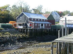
Grand Manan's economy relies on fishing, fish farming (aquaculture), and tourism. Fishermen often catch lobster, herring, scallops, and crab. Many people also make a living from ocean salmon farms, collecting dulse (a type of seaweed), rock weed, and digging for clams. These jobs are all connected to the ocean.
Tourism is becoming a very important and profitable industry for the island. Fun activities for tourists include whale watching, birdwatching, camping, and kayaking. Many visitors and retired people buy homes on the island and stay for the summer or even live there permanently. About 54% of the island is owned by people who don't live there all the time.
You can find freshwater ponds, lakes, and beaches on Grand Manan. These are great places for sunbathing, looking for interesting things on the beach, and having picnics. Other cool things to discover on Grand Manan are magnetic sand and a natural rock formation called "The Hole-In-The Wall" in Whale Cove. The Anchorage Provincial Park is also on the island's southeastern coast.
People of Grand Manan
In 2021, the population of Grand Manan was 2,595 people. This was a 10% increase from 2016. The island has a land area of about 150.56 square kilometers (58.13 square miles).
Most of the people on the island (99.17%) are White. The rest of the population is mostly Indigenous. About 89% of the people living there are from families who have been on the island for three or more generations.
There were 1,045 households in 2016. About 23% of these households had children under 18 living with them. The average family size was 2.90 people.
The population of Grand Manan is spread out in terms of age. About 25% of the people are 19 years old or younger. The median age (the middle age) on the island was 40.3 years.
The average income for a family was $48,190. Most people (63%) aged 15 and older had at least a high school diploma. About 22% had some college or university training.
Grand Manan's Infrastructure
How Grand Manan is Governed
The village of Grand Manan includes almost all of Grand Manan Parish. However, White Head Island, Machias Seal Island, and a few other small islands are not part of the village.
The village of Grand Manan was created in 1995. This happened when several smaller communities joined together. These included the villages of Grand Harbour, North Head, and Seal Cove. Also joining were the local service districts of Castalia, Woodwards Cove, and the parish of Grand Manan.
Schools on the Island
The Anglophone South School District runs the Grand Manan Community School. This school teaches students from kindergarten all the way through grade 12.
Getting To and Around Grand Manan
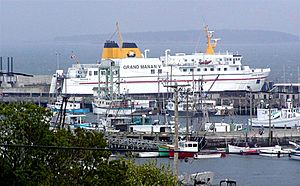
Coastal Transport Limited operates a ferry service that connects Blacks Harbour to Grand Manan Island. The ferry ride takes about one and a half hours.
There's also a ferry that goes from Grand Manan Island to White Head Island. This ferry serves the 220 people who live on White Head Island. It leaves from Ingalls Head on Grand Manan, and the trip takes about half an hour.
If you need to travel by plane, there is the Grand Manan Airport. You can fly from here to most places in the Maritime region of Canada and some places in the New England States in the USA.
New Brunswick Route 776 is the main road on Grand Manan. It runs north and south along the island's eastern coast.
See also
 In Spanish: Isla Grand Manan para niños
 | Calvin Brent |
 | Walter T. Bailey |
 | Martha Cassell Thompson |
 | Alberta Jeannette Cassell |


