Passamaquoddy Bay facts for kids
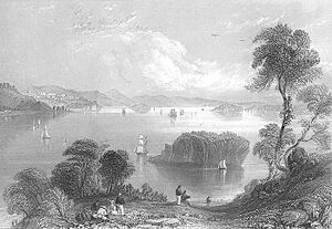
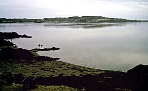
Passamaquoddy Bay is a large inlet of the Bay of Fundy. It sits between the U.S. state of Maine and the Canadian province of New Brunswick. The St. Croix River flows into it. Most of the bay is in Canada. Its western side touches Washington County, Maine. The bay's southern tip is at West Quoddy Head in Lubec, Maine. From there, it stretches northeast past Campobello Island, New Brunswick and Deer Island, New Brunswick. It reaches the New Brunswick mainland at L'Etete, New Brunswick in Charlotte County, New Brunswick.
Contents
Exploring Passamaquoddy Bay

For a long time, figuring out the exact border in Passamaquoddy Bay was a challenge. Both the United States and Britain (which later became Canada) had different ideas. The Treaty of Ghent, which ended the War of 1812, tried to solve this. It said that people would be chosen to divide the islands in the bay. But even after that, there was still some confusion about where the border truly was.
Where is the Border?
The southern parts of the bay can be confusing because Deer Island blocks some of the open water. However, a special agreement from 1910, called the Passamaquoddy Bay Treaty, helps explain it. This treaty says that Passamaquoddy Bay goes south of Treat Island. Treat Island is one of the islands that makes up the city of Eastport, Maine. The treaty also states that the bay runs between Campobello Island and Lubec, Maine.
The treaty describes the border as a series of seven straight lines. These lines run through Passamaquoddy Bay and into the middle of the Grand Manan Channel. This agreement helped to clearly define the boundary between the two countries in this area.
Communities and Passages
The biggest town right on Passamaquoddy Bay is St. Andrews, New Brunswick. However, the towns of Calais and St. Stephen are sometimes included. They are actually located on the St. Croix River, which flows into the bay. The city of Eastport, Maine sits between Passamaquoddy Bay and Cobscook Bay.
There are three main ways to enter Passamaquoddy Bay from the Bay of Fundy. These are Letete Passage, Head Harbour Passage, and Quoddy Narrows. Letete Passage is northeast of Deer Island. Head Harbour Passage is southeast of Deer Island and northwest of Campobello Island. Quoddy Narrows is between southern Lubec, Maine, and southern Campobello Island. The International Boundary between Canada and the United States also runs through these passages.
Head Harbour Passage
The Head Harbour Passage is a very deep waterway. It is the main entry point for large ships coming into the bay. Both the U.S. and Canadian governments agree that this passage is part of Canada. The U.S. government believes that international law allows commercial ships to pass through freely. However, the Canadian government thinks it can control who uses the passage. They have considered making rules to stop very large oil tankers from using it. This is because there have been plans for plants that would turn natural gas into a liquid on the American side of the bay.
A History of Smuggling
After the American Revolution, Passamaquoddy Bay became a busy place for smuggling. Smuggling means moving goods secretly and illegally. This activity was very popular in 1808 during something called Jefferson's Embargo. During this time, smugglers secretly moved huge amounts of American flour from the U.S. into New Brunswick.
Later, during the War of 1812, people were secretly trading British goods. After that war, the main item being smuggled was gypsum from Nova Scotia. Gypsum is a mineral used in building materials. It was often put directly onto American ships near the border. People living in the area, and even some officials, often ignored this smuggling. They did not want outside authorities from Britain or America to stop it.
 | Selma Burke |
 | Pauline Powell Burns |
 | Frederick J. Brown |
 | Robert Blackburn |


