Magalloway River facts for kids
Quick facts for kids Magalloway River |
|
|---|---|

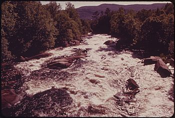
Magalloway River below Aziscohos Dam in western Maine
|
|
| Country | United States |
| States | Maine, New Hampshire |
| Counties | Oxford, ME, Coos, NH |
| Townships | North Oxford, ME, Lincoln Plantation, ME, Magalloway Plantation, ME, Second College Grant, NH, Wentworth's Location, NH, Errol, NH |
| Physical characteristics | |
| Main source | Confluence of West Branch and Third East Branch North Oxford, ME 1,850 ft (560 m) 45°15′26″N 71°1′37″W / 45.25722°N 71.02694°W |
| River mouth | Androscoggin River Errol, NH 1,245 ft (379 m) 44°47′0″N 71°3′53″W / 44.78333°N 71.06472°W |
| Length | 48 mi (77 km) |
| Basin features | |
| Tributaries |
|
The Magalloway River is a cool river that flows through parts of Maine and New Hampshire in the United States. It's like a smaller stream that feeds into a bigger river called the Androscoggin River. The Androscoggin River then joins the Kennebec River in Maine, eventually reaching the Atlantic Ocean.
The river is about 30 miles (48 km) long. If you include the distances across the lakes it flows through, it stretches to about 48 miles (77 km). Its name comes from a Native American language. It means "large tail," which is a fun way to describe a river!
Contents
Where the Magalloway River Flows
The Magalloway River starts in the far northwestern corner of Maine. It begins where two smaller streams, the West Branch and the Third East Branch, meet up.
Journey Through Lakes and Forests
The river flows south through an area known for logging. It first enters Parmachenee Lake, which is about 2.5 miles (4.0 km) long. After leaving Parmachenee Lake, the river flows for another 2.6 miles (4.2 km) until it reaches Aziscohos Lake. This lake is much larger, stretching about 15 miles (24 km).
Below the dam at Aziscohos Lake, the Magalloway River turns west. It drops about 250 feet (76 m) in just 2 miles (3.2 km). This part of the river flows past the small village of Wilsons Mills, Maine. Then, it turns south again and follows the border between New Hampshire and Maine.
The River's End
The Magalloway River finishes its journey when it joins the water flowing out of Umbagog Lake. This meeting point is where the Androscoggin River officially begins.
Smaller Streams Joining In
Many smaller streams, called tributaries, flow into the Magalloway River. These include:
- The West Branch
- The First, Second, and Third East Branches
- The Little Magalloway River
- The Dead Diamond River
The river also passes through several different areas. In Maine, it goes through Parmachenee, Lynchtown, Parkertown, Lincoln, and Magalloway Plantation. In New Hampshire, it flows through Second College Grant and Wentworth's Location.
Aziscohos Lake
| Aziscohos Lake | |
|---|---|
| Lua error in Module:Location_map at line 420: attempt to index field 'wikibase' (a nil value). | |
| Location | Oxford County, Maine |
| Max. length | 15 mi (24 km) |
| Surface area | 6,872 acres (2,781 ha) |
| Max. depth | 60 feet (18 m) |
| Water volume | 157,945 acre⋅ft (194,822,000 m3) |
| Surface elevation | 1,516 ft (462 m) |
Aziscohos Lake is a large lake that stretches upstream from the Aziscohos Dam. This dam is located in Lincoln Plantation, Maine. The lake also extends into Parkertown and Lynchtown.
Wildlife in the Lake
This lake is a great home for certain types of fish. You can find brook trout and a special kind of Atlantic salmon here. These salmon are "land-locked," meaning they live their whole lives in fresh water and don't go out to the ocean.
If you want to visit Aziscohos Lake, there's a public place to launch boats. It's located at the southern end of the lake, right off Maine State Route 16.
 | May Edward Chinn |
 | Rebecca Cole |
 | Alexa Canady |
 | Dorothy Lavinia Brown |


