
Errol, New Hampshire facts for kids
Quick facts for kids
Errol, New Hampshire
|
|
|---|---|
|
Town
|
|

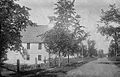
Main Street in Errol
|
|

Location in Coös County, New Hampshire
|
|
| Country | United States |
| State | New Hampshire |
| County | Coös |
| Incorporated | 1836 |
| Area | |
| • Total | 69.5 sq mi (179.9 km2) |
| • Land | 60.3 sq mi (156.3 km2) |
| • Water | 9.1 sq mi (23.5 km2) 13.09% |
| Elevation | 1,227 ft (374 m) |
| Population
(2020)
|
|
| • Total | 298 |
| • Density | 5/sq mi (1.9/km2) |
| Time zone | UTC-5 (Eastern) |
| • Summer (DST) | UTC-4 (Eastern) |
| ZIP code |
03579
|
| Area code(s) | 603 |
| FIPS code | 33-25140 |
| GNIS feature ID | 0873593 |
Errol is a small town in Coös County, New Hampshire, in the United States. In 2020, about 298 people lived there.
Errol is located north of the White Mountains. It sits along Route 16 where it meets Route 26. The town also has a small airport with an unpaved runway. Errol is part of the larger Berlin, NH-VT micropolitan statistical area.
Contents
History of Errol
Errol was first given as a land grant by Governor John Wentworth in 1774. The name "Errol" comes from Scotland. In 1789, the people who owned the land in Errol asked the government for a good road. They wanted a road connecting Errol to Conway.
The government agreed in 1781. This led to the creation of what is now Route 16. Another important road was built in 1804. This road connected Errol to Portland for trade. Today, this is part of Route 26.
The first people to settle in Errol arrived in 1806. By 1820, the town had 36 residents. Errol officially became an incorporated town in 1836.
Even though the soil was not the best, it was good for growing hay, oats, and potatoes. Because of its large forests, the main job in town was lumbering. By 1859, Errol had 130 people. It also had two sawmills, a gristmill (for grinding grain), and a machine for making clapboard (a type of siding for houses).
Geography and Location
Errol covers a total area of about 179.9 square kilometers (about 69.5 square miles). Most of this is land (156.3 sq km or 60.3 sq mi). The rest is water (23.5 sq km or 9.1 sq mi), which is about 13% of the town's total area.
The Androscoggin River starts in Errol. This happens where the Magalloway River meets the water flowing out of Umbagog Lake. The highest point in Errol is about 1,227 feet (374 meters) above sea level. This spot is near Signal Pond, on the western side of town. All of Errol is part of the Androscoggin River watershed. This means all the water in Errol eventually flows into the Androscoggin River.
The town is served by two main state roads: Route 16 and Route 26.
- Route 16 goes north towards Wentworth Location. It goes south through Dummer and Milan to the city of Berlin.
- Route 26 goes east towards Cambridge and then into Maine. It goes west through Dixville Notch to the town of Colebrook.
Neighboring Towns
Errol shares borders with several other towns:
- Wentworth Location (to the north)
- North Oxford, Maine (to the northeast)
- Upton, Maine (to the southeast)
- Cambridge (to the south)
- Dummer (to the southwest)
- Millsfield (to the west)
- Dixville (to the northwest)
Climate in Errol
Errol has a humid continental climate. This means it has big changes in temperature throughout the year. Summers are warm to hot and often humid. Winters are cold, sometimes very cold.
| Climate data for Errol Airport, New Hampshire (1991–2020 normals) | |||||||||||||
|---|---|---|---|---|---|---|---|---|---|---|---|---|---|
| Month | Jan | Feb | Mar | Apr | May | Jun | Jul | Aug | Sep | Oct | Nov | Dec | Year |
| Mean daily maximum °F (°C) | 23.4 (−4.8) |
26.0 (−3.3) |
35.5 (1.9) |
48.7 (9.3) |
62.8 (17.1) |
71.8 (22.1) |
76.9 (24.9) |
75.3 (24.1) |
68.3 (20.2) |
54.9 (12.7) |
41.1 (5.1) |
29.3 (−1.5) |
51.2 (10.7) |
| Daily mean °F (°C) | 12.3 (−10.9) |
12.7 (−10.7) |
23.4 (−4.8) |
37.3 (2.9) |
50.7 (10.4) |
60.0 (15.6) |
64.5 (18.1) |
62.8 (17.1) |
55.6 (13.1) |
43.5 (6.4) |
32.1 (0.1) |
19.8 (−6.8) |
39.6 (4.2) |
| Mean daily minimum °F (°C) | 1.2 (−17.1) |
−0.6 (−18.1) |
11.3 (−11.5) |
25.9 (−3.4) |
38.5 (3.6) |
48.2 (9.0) |
52.0 (11.1) |
50.2 (10.1) |
42.9 (6.1) |
32.0 (0.0) |
23.1 (−4.9) |
10.2 (−12.1) |
27.9 (−2.3) |
| Average precipitation inches (mm) | 2.99 (76) |
2.62 (67) |
2.82 (72) |
3.46 (88) |
3.63 (92) |
4.75 (121) |
4.13 (105) |
4.17 (106) |
3.65 (93) |
5.12 (130) |
3.51 (89) |
3.75 (95) |
44.6 (1,134) |
| Source: NOAA | |||||||||||||
People of Errol (Demographics)
| Historical population | |||
|---|---|---|---|
| Census | Pop. | %± | |
| 1810 | 38 | — | |
| 1820 | 26 | −31.6% | |
| 1830 | 82 | 215.4% | |
| 1840 | 104 | 26.8% | |
| 1850 | 138 | 32.7% | |
| 1860 | 178 | 29.0% | |
| 1870 | 178 | 0.0% | |
| 1880 | 161 | −9.6% | |
| 1890 | 178 | 10.6% | |
| 1900 | 305 | 71.3% | |
| 1910 | 211 | −30.8% | |
| 1920 | 241 | 14.2% | |
| 1930 | 293 | 21.6% | |
| 1940 | 235 | −19.8% | |
| 1950 | 224 | −4.7% | |
| 1960 | 220 | −1.8% | |
| 1970 | 199 | −9.5% | |
| 1980 | 313 | 57.3% | |
| 1990 | 292 | −6.7% | |
| 2000 | 298 | 2.1% | |
| 2010 | 291 | −2.3% | |
| 2020 | 298 | 2.4% | |
| U.S. Decennial Census | |||

In the year 2000, there were 298 people living in Errol. These people made up 137 households, and 90 of those were families. The town had about 4.9 people per square mile.
Most of the people in Errol (98.66%) were White. A small number were from other backgrounds. About 1% of the population was Hispanic or Latino.
Out of the 137 households, about 19.7% had children under 18 living with them. Most households (60.6%) were married couples. About 24.8% of households were single people living alone. The average household had 2.15 people.
The median age in Errol was 47 years old. This means half the people were younger than 47, and half were older. About 16.4% of the population was under 18.
The median income for a household was $35,625. For families, the median income was $47,500. The average income per person in the town was $22,440. About 13.1% of all people in Errol lived below the poverty line. This included 24.2% of those under 18 and 15.2% of those 65 or older.
Education in Errol
Students from Errol who are in grades 7 through 12 attend Berlin Middle High School. They are bused to this school in Berlin.
Fun Places to Visit
- Androscoggin Wayside Park
- Mollidgewock State Park
- Umbagog Lake State Park
- L. L. Cote Sports Center
Images for kids
-
Main Street in 1914
.jpg)
See also
In Spanish: Errol (Nuevo Hampshire) para niños
