Dixville, New Hampshire facts for kids
Quick facts for kids
Dixville, New Hampshire
|
|
|---|---|

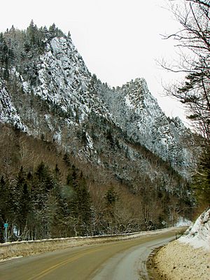
Dixville Notch in 2012
|
|

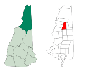
Location in Coös County, New Hampshire
|
|
| Country | United States |
| State | New Hampshire |
| County | Coös |
| Area | |
| • Total | 49.2 sq mi (127.3 km2) |
| • Land | 49.0 sq mi (126.9 km2) |
| • Water | 0.2 sq mi (0.4 km2) 0.35% |
| Elevation | 2,400 ft (700 m) |
| Population
(2020)
|
|
| • Total | 4 |
| • Density | 0.08/sq mi (0.03/km2) |
| Time zone | UTC-5 (Eastern) |
| • Summer (DST) | UTC-4 (Eastern) |
| ZIP code |
03576
|
| Area code(s) | 603 |
| FIPS code | 33-007-18420 |
| GNIS feature ID | 871095 |
Dixville is a small area in Coös County, New Hampshire, in the United States. It's not a regular town. Instead, it's called a "township." This means it's an undeveloped part of a county that isn't part of any town. It has very little self-government.
In 2020, only 4 people lived in Dixville. This was a big drop from 12 people in 2010. Dixville is famous for being one of the very first places in the U.S. to cast votes in presidential elections.
This area is home to Dixville Notch State Park and The Balsams Grand Resort Hotel. The small village of Dixville Notch is located within Dixville.
Contents
History of Dixville
Dixville was given by the government to Timothy Dix Jr. in 1805. He paid $4,500 for about 29,340 acres (118.7 square kilometers) of land.
The area became organized for voting in 1960. Since then, the village of Dixville Notch has become well-known. It's often the first place in the United States to report its votes in major elections. This happens just after midnight on Election Day!
The original land grant also included an eastern part. This area is now known as Dix's Grant.
Geography and Nature
Dixville covers a total area of about 127.3 square kilometers (49.2 square miles). Most of this is land (126.9 sq km or 49.0 sq mi). A small part, about 0.4 sq km (0.15 sq mi), is water.
Dixville Notch: A Mountain Pass
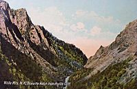
A special place called Dixville Notch is in the southwestern part of the township. A "notch" is a local word for a low area or pass between mountains. It's like a natural pathway through a mountain range.
Dixville Notch is about 2,400 feet (730 meters) above sea level. It marks the highest point between two river systems. Rivers flowing west from here go into the Connecticut River. Rivers flowing east go into the Androscoggin River. This beautiful area is part of Dixville Notch State Park.
The highest point in the township is Dixville Peak. It stands tall at 3,482 feet (1,061 meters).
Roads and Connections
New Hampshire Route 26 is a main road that goes through Dixville. It passes right through Dixville Notch. This highway connects Dixville to other towns. It goes west to Colebrook and southeast to Errol.
Population of Dixville
| Historical population | |||
|---|---|---|---|
| Census | Pop. | %± | |
| 1810 | 12 | — | |
| 1820 | 2 | −83.3% | |
| 1830 | 2 | 0.0% | |
| 1840 | 4 | 100.0% | |
| 1870 | 8 | — | |
| 1880 | 32 | 300.0% | |
| 1890 | 11 | −65.6% | |
| 1900 | 15 | 36.4% | |
| 1910 | 12 | −20.0% | |
| 1920 | 24 | 100.0% | |
| 1930 | 25 | 4.2% | |
| 1940 | 13 | −48.0% | |
| 1950 | 13 | 0.0% | |
| 1960 | 18 | 38.5% | |
| 1970 | 18 | 0.0% | |
| 1980 | 36 | 100.0% | |
| 1990 | 50 | 38.9% | |
| 2000 | 75 | 50.0% | |
| 2010 | 12 | −84.0% | |
| 2020 | 4 | −66.7% | |
| U.S. Decennial Census | |||
Dixville has always had a very small population. In 2020, only 4 people lived there. This makes it one of the least populated areas in New Hampshire.
Looking back at the 2000 census, there were 75 people living in Dixville at that time. They lived in 10 households. All of these households were made up of married couples. About 40% of these households had children under 18 living with them.
The population in 2000 was quite spread out in terms of age. About 9% were under 18. A large portion, 65%, were 65 years or older. The average age was 76 years old.
See also
 In Spanish: Dixville (Nuevo Hampshire) para niños
 | Sharif Bey |
 | Hale Woodruff |
 | Richmond Barthé |
 | Purvis Young |


