Sagadahoc County, Maine facts for kids
Quick facts for kids
Sagadahoc County
|
||
|---|---|---|

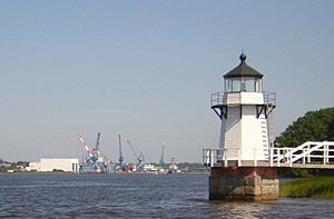
Doubling Point Light and Bath Iron Works
|
||
|
||

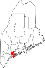
Location within the U.S. state of Maine
|
||
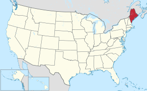
 Maine's location within the U.S. |
||
| Country | ||
| State | ||
| Founded | February 14, 1854 | |
| Named for | Abenaki word meaning "mouth of the big river;" a former name for the Kennebec River | |
| Seat | Bath | |
| Largest city | Topsham | |
| Area | ||
| • Total | 370 sq mi (1,000 km2) | |
| • Land | 254 sq mi (660 km2) | |
| • Water | 116 sq mi (300 km2) 31%% | |
| Population
(2020)
|
||
| • Total | 36,699 | |
| • Density | 99.2/sq mi (38.3/km2) | |
| Time zone | UTC−5 (Eastern) | |
| • Summer (DST) | UTC−4 (EDT) | |
| Congressional district | 1st | |
Sagadahoc County (/ˈsæɡədəhɒk/ SAG-ə-DƏ-hok) is a special area called a county in the state of Maine, USA. In 2020, about 36,699 people lived there. The main town, or "county seat," is Bath. It is the smallest county in Maine by land size.
Sagadahoc County is also part of a bigger area. This area is known as the Portland–South Portland Metropolitan Statistical Area.
Contents
History of Sagadahoc County
Early Exploration and Settlement
Sagadahoc County was not always its own county. It used to be part of York and then Lincoln County. It officially became its own county in 1854. The name "Sagadahoc" comes from an old name for the Kennebec River. This name means "mouth of the big river" in the Abenaki language.
The first Europeans known to visit this area were led by Samuel de Champlain. This happened a long time ago. In 1607, English settlers started the Popham Colony in what is now Phippsburg. They left after only one year. However, English fishermen and trappers kept visiting the area. John Smith explored the region in 1614. He told King Charles I about it. The King then named the Sagadahoc area "Leethe."
In 1635, a large piece of land was given to private owners. This land was on the east side of the Kennebec River. Over time, these owners claimed even more land. They bought land from Native Americans. They also used unclear land borders to expand their claims. By 1660, English people owned all the land that is now Sagadahoc County.
Conflicts and New Beginnings
When King Philip’s War started in 1675, there was not much fighting in Sagadahoc County at first. But in August 1676, three settlements were attacked. Native Americans captured 53 people. Most settlers then left the area. No one settled there permanently again until 1715. That is when Arrowsic and Brunswick were founded.
More Scotch-Irish Presbyterians started moving to the area. There was still some fighting now and then. This violence stopped in 1759. That is when the French and Indian Wars ended in Maine.
Later American Conflicts
Sagadahoc County did not see much fighting during the American Revolutionary War. People were worried about attacks from British ships. Two British armed ships sailed up the Kennebec River towards Bath. But they turned back after being attacked. In the War of 1812, a famous event happened nearby. The British ship HMS Boxer was captured. During the American Civil War, Sagadahoc County sent 2,488 men to fight for the Union.
The Nineteenth Century
Steam power was first used on the Kennebec River in 1818. It helped move boats. A train line, which became part of the Maine Central Railroad, was finished in 1849. Another train line, the Knox and Lincoln Railroad, opened in 1871. The first newspaper in the county was printed in 1820.
Sagadahoc County officially became a separate county in 1854. It was split off from Lincoln County. Bath became its main town, or county seat. The county's population grew over the years. From 1880 to 2000, the number of people living there almost doubled. It went from 19,276 to 35,214.
Geography and Natural Features
Sagadahoc County covers a total area of about 370 square miles. About 254 square miles of this is land. The other 116 square miles (31%) is water. It is the smallest county in Maine by its total area.
Neighboring Counties
Sagadahoc County shares borders with several other counties:
- Kennebec County is to the north.
- Lincoln County is to the east.
- Cumberland County is to the west.
- Androscoggin County is to the northwest.
Protected Natural Areas
One special natural area in the county is the Pond Island National Wildlife Refuge. This refuge helps protect wildlife.
Population and Demographics
| Historical population | |||
|---|---|---|---|
| Census | Pop. | %± | |
| 1860 | 21,790 | — | |
| 1870 | 18,803 | −13.7% | |
| 1880 | 19,272 | 2.5% | |
| 1890 | 19,452 | 0.9% | |
| 1900 | 20,330 | 4.5% | |
| 1910 | 18,574 | −8.6% | |
| 1920 | 23,021 | 23.9% | |
| 1930 | 16,927 | −26.5% | |
| 1940 | 19,123 | 13.0% | |
| 1950 | 20,911 | 9.3% | |
| 1960 | 22,793 | 9.0% | |
| 1970 | 23,452 | 2.9% | |
| 1980 | 28,795 | 22.8% | |
| 1990 | 33,535 | 16.5% | |
| 2000 | 35,214 | 5.0% | |
| 2010 | 35,293 | 0.2% | |
| 2020 | 36,699 | 4.0% | |
| 2023 (est.) | 37,513 | 6.3% | |
| U.S. Decennial Census 1790-1960 1900-1990 1990-2000 2010-2016 |
|||
2010 Census Information
In 2010, there were 35,293 people living in Sagadahoc County. These people lived in 15,088 households. About 9,869 of these were families. The county had about 139 people per square mile. Most people (96.2%) were white. Other groups included Asian (0.8%), Black or African American (0.7%), and American Indian (0.4%). About 1.3% of the population was of Hispanic or Latino origin.
Many people in the county had ancestors from different places. About 26.9% had English roots. Another 16.8% were Irish. German ancestors made up 11.8%. French Canadian people were 8.1%. Italian people were 6.6%, and Scottish people were 6.5%. About 6.4% identified as American.
The average age of people in the county was 44.1 years old. The average household had 2.32 people. The average family had 2.81 people.
Cities and Towns
Sagadahoc County has one city and several towns. It also has one unorganized territory.
City
- Bath (This is the county seat, the main town for county government.)
Towns
Unorganized Territory
- Perkins Township (This includes Swan Island.)
Census-Designated Places
These are specific areas within towns that the census tracks:
Images for kids
See also
 In Spanish: Condado de Sagadahoc para niños
 | Kyle Baker |
 | Joseph Yoakum |
 | Laura Wheeler Waring |
 | Henry Ossawa Tanner |


