Androscoggin County, Maine facts for kids
Quick facts for kids
Androscoggin County
|
|
|---|---|

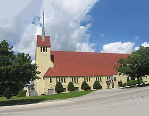
Holy Cross Church, Lewiston
|
|

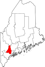
Location within the U.S. state of Maine
|
|
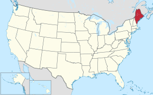
 Maine's location within the U.S. |
|
| Country | |
| State | |
| Founded | March 18, 1854 |
| Named for | the Androscoggin tribe |
| Seat | Auburn |
| Largest city | Lewiston |
| Area | |
| • Total | 497 sq mi (1,290 km2) |
| • Land | 468 sq mi (1,210 km2) |
| • Water | 29 sq mi (80 km2) 5.9%% |
| Population
(2020)
|
|
| • Total | 111,139 |
| • Density | 223.62/sq mi (86.34/km2) |
| Time zone | UTC−5 (Eastern) |
| • Summer (DST) | UTC−4 (EDT) |
| Congressional district | 2nd |
Androscoggin County is a county in the state of Maine, USA. It was named after the Androscoggin tribe. In 2020, about 111,139 people lived there. The main town where the county government is located is Auburn. The biggest city in the county is Lewiston.
Androscoggin County is part of a larger area called the Lewiston-Auburn, Maine metropolitan statistical area. This means that Lewiston and Auburn are important cities that are closely connected. Bates College, a well-known school, is also located in Lewiston.
Contents
History of Androscoggin County
Why a New County Was Needed
Long ago, people living in Lewiston had to travel a very long way to reach Wiscasset. Wiscasset was the county seat of Lincoln County, where Lewiston used to be. This was a big problem for people who needed to go to court or handle official business. Also, Lewiston's neighbor, Auburn, was in a different county called Cumberland County. As Lewiston and Auburn grew closer, it made sense for them to be in the same county.
People talked about different ideas. One idea was for Lewiston to join Cumberland County. But eventually, the idea of creating a brand new county came up.
Choosing the County Center
Once a new county was decided, the next big question was: which town would be the most important? Towns like Bath, Brunswick, and Lewiston all wanted to be the main center. Lewiston eventually won this debate. Androscoggin County was officially created in 1854. It was made up of towns that used to be in Lincoln, Cumberland, Kennebec, and Oxford counties.
Where to Put the County Seat
After the county was formed, Lewiston and Auburn both wanted to be the "county seat." This is the town where the main government buildings are. They both offered different ideas to make it cheaper for other towns to build the new county offices. In the end, the decision was put to a vote. People living on each side of the Androscoggin River voted for the town on their side. Since more people lived west of the river at that time, Auburn won the vote.
Geography of Androscoggin County
Size and Water Features
Androscoggin County covers about 497 square miles. Most of this area, about 468 square miles, is land. The rest, about 29 square miles, is water. This means about 5.9% of the county is covered by water. It is the second-smallest county in Maine. Only Sagadahoc County, which is nearby, is smaller.
The Androscoggin River is very important to the county. It flows right through the middle of it. The river also forms a small part of the border with Sagadahoc County in the south. You can find the Androscoggin Riverlands State Park along the river, just north of Auburn. The county is also home to Poland Spring, which is where the famous bottled water brand gets its name.
Neighboring Counties
Androscoggin County shares its borders with these other counties:
- Franklin County – to the north
- Kennebec County – to the northeast
- Sagadahoc County – to the southeast
- Cumberland County – to the south
- Oxford County – to the west
Main Roads
Many important roads run through Androscoggin County. These roads help people travel and connect different towns. Some of the major highways include:
 I-95
I-95 US 202
 SR 4
SR 4 SR 9
SR 9 SR 11
SR 11 SR 26
SR 26 SR 106
 SR 108
 SR 117
 SR 121
 SR 122
 SR 125
 SR 126
 SR 132
 SR 133
 SR 197
 SR 219
People of Androscoggin County (Demographics)
| Historical population | |||
|---|---|---|---|
| Census | Pop. | %± | |
| 1860 | 29,726 | — | |
| 1870 | 35,866 | 20.7% | |
| 1880 | 45,042 | 25.6% | |
| 1890 | 48,968 | 8.7% | |
| 1900 | 54,242 | 10.8% | |
| 1910 | 59,822 | 10.3% | |
| 1920 | 65,796 | 10.0% | |
| 1930 | 71,214 | 8.2% | |
| 1940 | 76,679 | 7.7% | |
| 1950 | 83,594 | 9.0% | |
| 1960 | 86,312 | 3.3% | |
| 1970 | 91,279 | 5.8% | |
| 1980 | 99,657 | 9.2% | |
| 1990 | 105,259 | 5.6% | |
| 2000 | 103,793 | −1.4% | |
| 2010 | 107,702 | 3.8% | |
| 2020 | 111,139 | 3.2% | |
| 2023 (est.) | 113,765 | 5.6% | |
| U.S. Decennial Census 1790–1960 1900–1990 1990–2000 2010–2016 2017 |
|||
Population Changes
The population of Androscoggin County has grown steadily over many years. In 2010, there were 107,702 people living there. By 2020, the population had increased to 111,132 people. This shows that more people are choosing to live in the county.
Diversity in the County
Androscoggin County is home to a diverse group of people. In 2010, most people were white (92.8%). There were also people who identified as black or African American (3.6%), Asian (0.7%), and American Indian (0.4%). About 1.5% of the population was of Hispanic or Latino background. Many people have English, French Canadian, French, and Irish family backgrounds.
By 2020, the county continued to be diverse. About 90.6% of people were white, and 5.4% were black or African American. About 1.1% were Asian. People of Hispanic or Latino origin made up 2.2% of the population. Many residents have roots from places like England, France, Ireland, and Germany. About 10.6% of people over age 5 speak a language other than English at home.
Media in Androscoggin County
Newspapers
The main newspaper in the county is the Sun Journal. It prints a newspaper every day with different versions for different parts of the state. The Sun Journal has won awards, including being named the New England Daily Newspaper of the Year in 2008 and the Maine Press Association Newspaper of the Year in 2009.
Communities in Androscoggin County
Cities and Towns
Androscoggin County has several cities and towns:
- Auburn
- Durham
- Greene
- Leeds
- Lewiston
- Lisbon
- Livermore
- Livermore Falls
- Mechanic Falls
- Minot
- Poland
- Sabattus
- Turner
- Wales
Census-Designated Places (CDPs)
These are areas that are like towns but are not officially incorporated as cities or towns:
- Greene
- Lisbon
- Lisbon Falls
- Livermore Falls
- Mechanic Falls
- Sabattus
- Turner
Economy of Androscoggin County
Androscoggin County has some farming. It is especially known for raising poultry (like chickens). In fact, it's the number one county in Maine for producing poultry and eggs. There are 77 farms that produce these products. The county is also a top producer of hogs and pigs in the state.
See also
 In Spanish: Condado de Androscoggin para niños
 | Dorothy Vaughan |
 | Charles Henry Turner |
 | Hildrus Poindexter |
 | Henry Cecil McBay |

