Webb River facts for kids
Quick facts for kids Webb River |
|
|---|---|

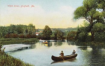
Scene at Dixfield in 1910
|
|
| Country | United States |
| Physical characteristics | |
| Main source | Maine |
The Webb River is a river in western Maine, USA. It is about 16.8 miles (27.0 kilometers) long. This river is like a smaller stream that flows into a bigger river called the Androscoggin River. From there, the water travels to the Kennebec River and eventually reaches the huge Atlantic Ocean.
Contents
What is the Webb River?
The Webb River is an important waterway in Maine. It helps carry water from lakes and smaller streams towards the ocean. Rivers like the Webb are vital for the environment and for the towns they flow through. They provide homes for animals and can be used for fun activities.
Where Does the River Start?
The journey of the Webb River begins at the bottom of Webb Lake. This lake is located near the southern edge of a town called Weld. Imagine the lake as a giant bathtub, and the river is the drain where the water starts to flow out.
Journey Through Maine Towns
After leaving Webb Lake, the river quickly flows south. It soon enters the town of Carthage. In Carthage, the river makes a turn, heading southwest for a bit, and then turns south again. For its last 6 miles (9.7 kilometers), the Webb River acts like a natural border. It separates the towns of Mexico and Dixfield.
Where the Webb River Ends
The Webb River's journey finishes when it joins the larger Androscoggin River. This meeting point is just west of the small village of Dixfield. If you ever visit this area, you might notice that Maine Route 142 runs right next to the entire length of the Webb River. This means you can drive alongside the river for its whole path!
 | Charles R. Drew |
 | Benjamin Banneker |
 | Jane C. Wright |
 | Roger Arliner Young |

