Waitsfield (CDP), Vermont facts for kids
Quick facts for kids
Waitsfield, Vermont
|
|
|---|---|

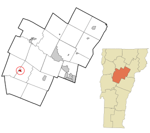
Location in Washington County and the state of Vermont
|
|
| Country | United States |
| State | Vermont |
| County | Washington |
| Area | |
| • Total | 0.40 sq mi (1.03 km2) |
| • Land | 0.39 sq mi (1.00 km2) |
| • Water | 0.02 sq mi (0.04 km2) |
| Elevation | 700 ft (200 m) |
| Population
(2010)
|
|
| • Total | 164 |
| • Density | 412/sq mi (159.2/km2) |
| Time zone | UTC-5 (Eastern (EST)) |
| • Summer (DST) | UTC-4 (EDT) |
| ZIP code |
05673
|
| Area code(s) | 802 |
| FIPS code | 50-75250 |
Waitsfield is a small community in Vermont, a state in the United States. It is known as a census-designated place (CDP). This means it's a special area that the government counts for population, but it's not a separate town or city. Waitsfield is part of the larger town of Waitsfield in Washington County. In 2010, about 164 people lived here.
Where is Waitsfield?
Waitsfield is located in a beautiful part of Vermont. It covers a total area of about 1.03 square kilometers (which is about 0.4 square miles). Most of this area is land, with a small part (about 0.04 square kilometers) being water.
This community sits right next to the Mad River, which is a lovely natural feature. It's also found along Vermont Route 100, a main road that helps people get around.
Waitsfield is located:
- About 1.1 miles (1.8 km) north of a nearby village called Irasville.
- About 6 miles (9.7 km) north of the town of Warren.
- About 12 miles (19 km) south of Waterbury.
See also
 In Spanish: Waitsfield (condado de Washington) para niños
 | Anna J. Cooper |
 | Mary McLeod Bethune |
 | Lillie Mae Bradford |

