
Interstate 91 facts for kids
Quick facts for kids
|
|
|---|---|
| Lua error in Module:Infobox_road/map at line 15: attempt to index field 'wikibase' (a nil value). | |
| Route information | |
| Length | 290.37 mi (467.31 km) |
| Major junctions | |
| South end | |
| North end | |
| Highway system | |
| Main route of the Interstate Highway System Main • Auxiliary • Business |
|

Interstate 91 (often called I-91) is a really important highway on the East Coast of the United States. It's part of the Interstate Highway System, which helps people travel across the country. This highway is about 290 miles (467 kilometers) long.
I-91 starts in New Haven, Connecticut, way down south. It then travels north, all the way to Derby Line, Vermont. This northern end is very close to the Canadian border. For a big part of its journey, I-91 follows the beautiful Connecticut River.
Contents
Traveling on Interstate 91
Interstate 91 passes through three states: Connecticut, Massachusetts, and Vermont. It connects many cities and towns along the way. Let's take a look at some of the main places it goes through.
Connecticut Section
I-91 begins in New Haven, Connecticut, where it connects with I-95. As it heads north, it goes through several towns.
- New Haven: This is where I-91 starts. It has connections to other major roads like Route 34 and US 5.
- North Haven: The highway continues through here, with exits for local routes.
- Wallingford: I-91 passes through this town, offering more connections to local roads.
- Meriden: Here, I-91 meets Route 15 and I-691, which can take you to other parts of the state.
- Cromwell: The highway crosses the Connecticut River near here.
- Rocky Hill: You can find Dinosaur State Park not too far from an exit in Rocky Hill.
- Wethersfield: I-91 continues its journey north through this historic town.
- Hartford: This is a big city and a major point on I-91. Here, I-91 crosses paths with I-84, another important interstate. There's also an HOV Lane (High-Occupancy Vehicle Lane) on I-91 in the Hartford area, which helps cars with multiple passengers travel faster.
- Windsor: North of Hartford, I-91 goes through Windsor, connecting to I-291 and other state routes.
- Windsor Locks: The highway continues through here before reaching the state line.
- Enfield: This is one of the last towns I-91 passes through in Connecticut before entering Massachusetts.
Massachusetts Section
After leaving Connecticut, I-91 enters Massachusetts. It continues to follow the Connecticut River valley.
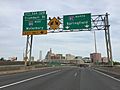
- Springfield: This is a very important city for I-91 in Massachusetts. Here, I-91 connects with I-291 and US 20. It also has a major connection to the Massachusetts Turnpike (I-90), which is a toll road that crosses the entire state.
- Chicopee: North of Springfield, I-91 meets I-391.
- West Springfield: The highway crosses the Connecticut River again in this area.
- Holyoke: I-91 passes through Holyoke, connecting to US 202 and Route 141.
- Northampton: This college town is another stop for I-91, with connections to US 5 and Route 9.
- Deerfield: As I-91 heads further north, it goes through Deerfield.
- Greenfield: This is a significant town where I-91 connects with Route 2, a major east-west route in the state.
- Bernardston: This is the last town I-91 travels through in Massachusetts before crossing into Vermont.
Vermont Section
I-91 enters Vermont and continues its journey north, often running very close to the Connecticut River.
- Brattleboro: This is the first major town I-91 reaches in Vermont. It connects with US 5 and VT Route 9.
- Westminster: The highway continues through this area.
- Rockingham: I-91 passes through Rockingham, connecting to VT Route 103.
- Springfield: Another town named Springfield, this one in Vermont, is along I-91.
- White River Junction: This is a very important junction in Vermont. Here, I-91 meets I-89, which goes towards New Hampshire or Montpelier, Vermont's capital.
- Norwich: I-91 continues north from White River Junction.
- Thetford: The highway passes through Thetford, connecting to VT Route 113.
- Bradford: I-91 goes through Bradford, with connections to VT Route 25.
- Newbury: Near here, I-91 connects with US 302.
- Barnet: The highway continues its path through Barnet.
- Waterford: In Waterford, I-91 has a connection to I-93, which heads into New Hampshire.
- St. Johnsbury: This is another important town in northern Vermont. I-91 connects with US 2 here.
- Lyndon: I-91 passes through Lyndon, with exits for local routes like VT Route 114.
- Barton: The highway continues its journey through Barton.
- Derby: This is the final stretch of I-91 in the United States. It connects with US 5 and VT Route 105.
At Derby Line, Vermont, Interstate 91 ends at the Canadian border. It then continues into Quebec, Canada, as Autoroute 55.
Images for kids
-
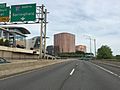
I-91 in Hartford, CT.
-
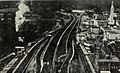
Interstate 91 in 1969, just after completion of the viaduct which would separate Springfield from the Connecticut River, St. Joseph's Church and the Campanile can be seen in the foreground, as well as an incomplete Tower Square
-
The beginning of I-91 in New Haven, CT.
-
I-91 north at exit 32 (I-84 west) in Hartford, CT.
-
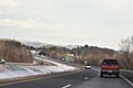
I-91 looking northbound in Brattleboro, VT.
-
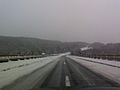
Northbound I-91 just north of exit 6 in Rockingham, VT.
-
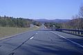
Southbound I-91 in Wheelock, VT.
_in_Hartford,_Hartford_County,_Connecticut.jpg)


_in_Hartford,_Hartford_County,_Connecticut.jpg)


