Royalton, New York facts for kids
Quick facts for kids
Royalton
|
|
|---|---|
| Town of Royalton | |

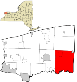
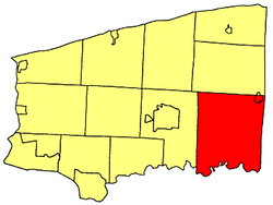
Location in Niagara County and the state of New York.
|
|
| Country | United States |
| State | New York |
| County | Niagara |
| Government | |
| • Type | Town Council |
| Area | |
| • Total | 70.28 sq mi (182.01 km2) |
| • Land | 69.97 sq mi (181.21 km2) |
| • Water | 0.31 sq mi (0.80 km2) |
| Elevation | 643 ft (196 m) |
| Population
(2010)
|
|
| • Total | 7,660 |
| • Estimate
(2016)
|
7,541 |
| • Density | 107.78/sq mi (41.61/km2) |
| Time zone | UTC-5 (Eastern (EST)) |
| • Summer (DST) | UTC-4 (EDT) |
| FIPS code | 36-64034 |
| GNIS feature ID | 0979439 |
Royalton is a town in Niagara County, New York, United States. It's located in the southeast part of the county. In 2010, about 7,660 people lived there.
The Town of Royalton is east of the City of Niagara Falls.
Contents
History of Royalton
The Town of Royalton was created in 1817. It was formed from a part of the Town of Hartland. We don't know for sure where the name "Royalton" came from.
Famous People from Royalton
Royalton has been home to several important people:
- Michael Huskey – He received the Medal of Honor, a very brave award.
- Belva Ann Lockwood – She was a teacher, a lawyer, and a feminist. This means she worked for equal rights for women.
- Peter P. Murphy – He used to be a New York State Senator. A senator helps make laws for the state.
- George F. Thompson – He also served as a New York State Senator.
- Charles G. Williams – He was a U.S. Representative from Wisconsin. A representative speaks for their area in the national government.
Geography of Royalton
The United States Census Bureau says that Royalton covers about 70.1 square miles (182.01 square kilometers). Most of this area is land, about 69.8 square miles (181.21 square kilometers). A small part, about 0.3 square miles (0.80 square kilometers), is water.
The Tonawanda Creek forms the southern border of the town. The Erie Canal, a famous waterway, runs through the northern part of Royalton. The Village of Middleport is also along the canal.
Nearby Towns and Cities
Royalton shares its borders with several other towns and counties:
- Town of Lockport – To the west.
- Erie County, Town of Clarence – To the southwest.
- Erie County, Town of Newstead – To the south.
- Orleans County – To the east.
- Town of Hartland – To the north.
Main Roads in Royalton
Several important roads pass through the Town of Royalton:
 New York State Route 31 (Rochester Rd., Telegraph Rd.) – This road goes east-west through the northern part of town. It runs close to the Erie Canal and goes through Middleport.
 New York State Route 77 (Chesnut Ridge Rd., Lewiston Rd.) – This road goes north-south. It passes through the town and into the Tonawanda State Wildlife Management Area.
 New York State Route 93 (Akron Rd., Dysinger Rd.) – This road also goes east-west. It crosses Tonawanda Creek on its way to Akron.
 New York State Route 271 (Main St.(Middleport)) – This road goes north-south. It ends at Telegraph Rd. (NY 31) in Middleport.
Population and People
| Historical population | |||
|---|---|---|---|
| Census | Pop. | %± | |
| 1820 | 1,849 | — | |
| 1830 | 3,138 | 69.7% | |
| 1840 | 3,549 | 13.1% | |
| 1850 | 4,024 | 13.4% | |
| 1860 | 4,793 | 19.1% | |
| 1870 | 4,726 | −1.4% | |
| 1880 | 4,888 | 3.4% | |
| 1890 | 4,632 | −5.2% | |
| 1900 | 4,797 | 3.6% | |
| 1910 | 4,956 | 3.3% | |
| 1920 | 4,485 | −9.5% | |
| 1930 | 4,660 | 3.9% | |
| 1940 | 4,617 | −0.9% | |
| 1950 | 5,297 | 14.7% | |
| 1960 | 6,586 | 24.3% | |
| 1970 | 7,375 | 12.0% | |
| 1980 | 7,765 | 5.3% | |
| 1990 | 7,453 | −4.0% | |
| 2000 | 7,710 | 3.4% | |
| 2010 | 7,660 | −0.6% | |
| 2016 (est.) | 7,541 | −1.6% | |
| U.S. Decennial Census | |||
In 2000, there were 7,710 people living in Royalton. These people lived in 2,810 households, and 2,121 of these were families. The population density was about 110 people per square mile.
About 35.3% of households had children under 18 living with them. Most households (63.7%) were married couples. About 20% of households had just one person living alone.
The average household had 2.71 people. The average family had 3.13 people.
The population was spread out by age:
- 26.5% were under 18 years old.
- 6.8% were between 18 and 24.
- 30.0% were between 25 and 44.
- 23.6% were between 45 and 64.
- 13.1% were 65 years or older.
The median age was 37 years. This means half the people were younger than 37 and half were older. For every 100 females, there were about 98 males.
The median income for a household was $43,516. For a family, it was $48,375. About 6.8% of the population lived below the poverty line. This included 7.3% of those under 18.
Places and Communities in Royalton
Here are some of the smaller communities and interesting spots in the Town of Royalton:
- Dysinger – A small community on Route 93.
- Gasport – A community located on the Erie Canal and Route 31.
- Gilberts Corners – Another small community on Route 77.
- Leslie – A community found on Tonawanda Creek Road and Rapids Road.
- McNalls Corners – A community on NY-77, west of Royalton Center.
- Middleport – This is a village in the northeast part of the town.
- Orangeport – A community on the Erie Canal, west of Gasport.
- Reynales Basin – A place along the Erie Canal, east of Gasport.
- Royalton Airport (9G5) – A small airport for general aviation, south of Gasport.
- Royalton Center – A community on NY-77. It was once called "Carringtons Corners."
- Royalton Ravine County Park – A park located south of Gasport, great for outdoor activities.
- Terrys Corners – A small community on NY-77, near the western edge of the town.
- Tonawanda Wildlife Management Area – Part of this area, which helps protect nature, is in the southeast of the town.
- Tonawanda Reservation – A part of this Native American reservation is in the town, but it is not inhabited.
- Wolcottsville – A community in the southeast part of the town.
See Also
 In Spanish: Royalton (Nueva York) para niños
 | Mary Eliza Mahoney |
 | Susie King Taylor |
 | Ida Gray |
 | Eliza Ann Grier |


