Tonawanda Reservation facts for kids
Quick facts for kids
Tonawanda Reservation
Tonawanda Creek Reservation
|
|
|---|---|

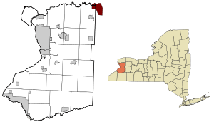
Location of Tonawanda Reservation in New York
|
|

Location of New York in the United States
|
|
| Country | United States |
| State | New York |
| Counties | Erie, Genesee, and Niagara |
| Area | |
| • Total | 0.80 sq mi (2.07 km2) |
| • Land | 0.80 sq mi (2.07 km2) |
| • Water | 0.00 sq mi (0.00 km2) |
| Population
(2010)
|
|
| • Total | 2,662 |
| Time zone | UTC-5 (EST) |
| • Summer (DST) | UTC-4 (EDT) |
| Area code(s) | 716 |
The Tonawanda Indian Reservation is a special area of land in western New York, United States. It is the home of the Tonawanda Seneca Nation. This group is a federally recognized tribe, which means the U.S. government officially recognizes them.
In 2010, about 693 people lived on the reservation. The land is mostly in Genesee County. Parts of it also reach into Erie and Niagara counties. It is surrounded by towns like Alabama, Pembroke, Newstead, and Royalton.
The Tonawanda Reservation is also called the Tonawanda Creek Reservation. You can find several businesses here, especially along Bloomingdale Road. Some of these businesses sell things like cigarettes and gasoline at lower prices because they are not taxed. Other shops offer traditional Seneca crafts, groceries, and food.
Contents
History of the Tonawanda Seneca
The Tonawanda Seneca are part of the Haudenosaunee, also known as the Iroquois Confederacy. This group of five (later six) Native American nations formed a powerful alliance long ago. The Seneca were one of the original five nations. The land where the Tonawanda Reservation is today is thought to be near the old border between the Seneca homeland and their neighbors, the Neutral Nation.
Early Agreements and Conflicts
The Iroquois people, including the Seneca, made agreements with the British government. During the French and Indian War, the Iroquois and British won against New France. After this, a large area of land was set aside as an Indian Reserve for Native peoples.
During the American Revolutionary War, most Iroquois sided with the British. They hoped this would stop colonists from taking more of their land. This led to conflicts with the American forces. The Continental Army carried out a military campaign that destroyed many Seneca homes and crops.
Land Loss and New Treaties
After the British lost the war, some Seneca and other Iroquois moved to a new reservation in Canada. This was the Grand River reservation in what is now Ontario.
However, most Seneca stayed in western New York. They were later forced to give up much of their land through treaties. Important treaties included the Canandaigua Treaty of 1794 and the Treaty of Big Tree in 1797. These treaties created the reservations in western New York, which were much smaller than their original lands.
Over time, more land was lost. This happened through sales that the tribe did not fully agree to. Also, a dam was built in the Allegheny area, which covered much of their farmland. These actions often happened without the tribe's permission.
Forming the Tonawanda Band
In 1848, the Seneca Nation of Indians was formed. This group was created to represent the Seneca people to the government. However, there was a disagreement about how the government should be run. Some Seneca wanted a modern, American-style government. Others, like the Tonawanda, wanted to keep their traditional ways.
Because of this, the Tonawanda Band of Seneca Indians was formed in 1857. This group represents the Tonawanda territory. Unlike the Seneca Nation of Indians, the Tonawanda Band continues to use traditional Seneca practices. This includes choosing their leaders based on family heritage.
Important Collaborations
In the mid-1800s, the Seneca on this reservation worked with Lewis H. Morgan. He was a self-taught expert on human cultures. They taught him about the Iroquois family and social structures. He wrote a book in 1851 called The League of the Ho-de-no-sau-nee or Iroquois.
Much of the information for his book came from his friend, Ely S. Parker. Parker was a Seneca man born on the reservation in 1828. Morgan dedicated his book to Parker and gave him credit for their shared research. Their work helped many people understand Native American societies better.
Life on the Reservation Today
Over the years, the reservation's size has become smaller. This was due to land sales forced by the state of New York. The Tonawanda Reservation is also a place where people from different backgrounds live together. The Tonawanda Band has been more open to non-Native people living on their land. This is different from some other Seneca lands, where tribes have worked hard to prevent non-Native settlement. They did this to protect their land from being taken without permission.
Geography of the Reservation
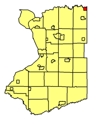
The Tonawanda Reservation covers different areas in three counties.
- The part in Niagara County is about 0.8 square miles (2.1 square kilometers) of land.
- The part in Genesee County is about 9.2 square miles (23.8 square kilometers) of land. It also has a small amount of water.
- The part in Erie County is about 1.8 square miles (4.8 square kilometers) of land.
The Tonawanda Creek flows through the entire reservation. It separates the part in Niagara County from the parts in Erie and Genesee counties. This creek acts as a natural barrier. Because of the creek and fewer paved roads, fewer people live in the Niagara County part of the reservation.
The northern edge of the reservation in Niagara County is next to the Tonawanda Wildlife Management Area. This is a protected area for wildlife.
Population and People
| Historical population | |||
|---|---|---|---|
| Census | Pop. | %± | |
| 2010 | 34 | — | |
| 2020 | 20 | −41.2% | |
The United States Census Bureau collects information about the people living on the reservation. They look at each county's part separately.
Erie County Population
In 2010, there were 34 people living in the Erie County part of the reservation. There were 9 households, which are groups of people living together. Most households were families. The average household had about 3 to 4 people.
The population included many young people. About half of the residents were under 20 years old. The median age was 19.5 years. This means half the people were younger than 19.5, and half were older. There were slightly more females than males.
The average yearly income for a household in this area was $21,250. No one in this part of the reservation was reported to be living below the poverty line in 2010.
Genesee County Population
In 2000, there were 533 people living in the Genesee County part of the reservation. There were 186 households. The population density was about 58 people per square mile.
The people living here came from different backgrounds. About 39% were Native American. About 52% were White, and 2.6% were Black or African American. Some people were from other races or had mixed heritage. About 4.8% of the population was Hispanic or Latino.
Many households had children under 18. The population included people of all ages. About 29% were under 18, and 12.9% were 65 or older. The median age was 35 years.
The average yearly income for a household was $25,208. For families, it was $36,563. About 16% of the people and 12% of the families were living below the poverty line.
Niagara County Population
As of the 2010 census, there were no people reported living in the Niagara County part of the reservation.
Education
Children and teens who live on the Tonawanda Reservation go to schools in the Akron Central School District.
See also
 In Spanish: Reserva india Tonawanda para niños
 | Toni Morrison |
 | Barack Obama |
 | Martin Luther King Jr. |
 | Ralph Bunche |


