Porter, New York facts for kids
Quick facts for kids
Porter
|
|||
|---|---|---|---|
| Town of Porter | |||
|
|||

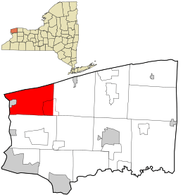
Location in Niagara County and the state of New York.
|
|||
| Country | United States | ||
| State | New York | ||
| County | Niagara | ||
| Named for | Augustus Porter | ||
| Government | |||
| • Type | Town Council | ||
| Area | |||
| • Total | 37.71 sq mi (97.68 km2) | ||
| • Land | 33.05 sq mi (85.61 km2) | ||
| • Water | 4.66 sq mi (12.07 km2) | ||
| Elevation | 305 ft (93 m) | ||
| Population
(2010)
|
|||
| • Total | 6,771 | ||
| • Estimate
(2016)
|
6,595 | ||
| • Density | 199.52/sq mi (77.03/km2) | ||
| Time zone | UTC-5 (Eastern (EST)) | ||
| • Summer (DST) | UTC-4 (EDT) | ||
| FIPS code | 36-59267 | ||
| GNIS feature ID | 0979386 | ||
| Website | https://www.townofporter.net | ||
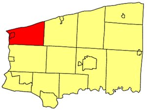
Porter is a town in Niagara County, New York, in the United States. It's located in the northwest corner of Niagara County, just north of the famous City of Niagara Falls. In 2010, about 6,771 people lived here. The town was named after a judge named Augustus Porter.
Contents
Porter's Story: A Trip Through Time
For thousands of years, different groups of Native American people lived in this area. When Europeans first arrived, the powerful Iroquois Confederacy lived here.
Permanent European-American settlements began around 1801, after the American Revolution. By then, many Iroquois people had moved across the Niagara River into what is now Canada.
The Town of Porter was officially created in 1812. It was formed from a larger area called the Town of Cambria. However, the War of 1812 slowed down the town's growth. This war between the United States and Great Britain included a ban on trade with Canada, which made things difficult for the local economy. The fighting along the border continued until 1814.
Where is Porter? Geography Fun Facts
The town of Porter covers about 37.7 square miles (97.68 square kilometers). Most of this area is land, but about 4.5 square miles (12.07 square kilometers) is water.
The northern edge of the town touches Lake Ontario. The western edge is the Niagara River, which forms the border between the United States and Canada. On this western side, Porter is right next to the town of Niagara-on-the-Lake, in Ontario, Canada.
Famous People from Porter
Some interesting people have come from Porter:
- Oliver Dyer – He was the first person to record what was said in the U.S. Congress using shorthand.
- William Hawley – He was a brigadier general in the military.
Neighbors of Porter
Porter shares its borders with a few other places:
- Town of Lewiston – To the south
- Town of Wilson – To the east
- Niagara-on-the-Lake, Ontario – To the west, across the Niagara River
- Lake Ontario – To the north
Roads That Run Through Porter
Several important roads help people get around the Town of Porter:
 New York State Route 18 (Lake Road, Creek Road) – This road goes east-west across the northern part of town, near Lake Ontario.
 New York State Route 18F (Lower River Road, Lake Road) – This road runs north-south, following the Niagara River and Lake Ontario. It passes through the Village of Youngstown.
 New York State Route 93 (Youngstown-Lockport Road) – This road goes east-west through the town, ending in the Village of Youngstown.
 Niagara Scenic Parkway – This highway runs north-south through the town, connecting to Route 18 near Lake Ontario.
Who Lives in Porter? Population Facts
| Historical population | |||
|---|---|---|---|
| Census | Pop. | %± | |
| 1820 | 850 | — | |
| 1830 | 1,490 | 75.3% | |
| 1840 | 2,177 | 46.1% | |
| 1850 | 2,455 | 12.8% | |
| 1860 | 2,353 | −4.2% | |
| 1870 | 2,042 | −13.2% | |
| 1880 | 2,278 | 11.6% | |
| 1890 | 2,210 | −3.0% | |
| 1900 | 2,235 | 1.1% | |
| 1910 | 2,655 | 18.8% | |
| 1920 | 2,682 | 1.0% | |
| 1930 | 2,954 | 10.1% | |
| 1940 | 3,361 | 13.8% | |
| 1950 | 4,276 | 27.2% | |
| 1960 | 7,309 | 70.9% | |
| 1970 | 7,429 | 1.6% | |
| 1980 | 7,251 | −2.4% | |
| 1990 | 7,110 | −1.9% | |
| 2000 | 6,920 | −2.7% | |
| 2010 | 6,771 | −2.2% | |
| 2016 (est.) | 6,595 | −2.6% | |
| U.S. Decennial Census | |||
According to the census from 2000, there were 6,920 people living in Porter. Most people (about 97.66%) were White. Small percentages were African American, Native American, or Asian. About 0.66% of the population was Hispanic or Latino.
There were 2,616 households in the town. About 32.1% of these households had children under 18 living with them. Most households (61.5%) were married couples living together. The average household had about 2.60 people.
The population was spread out by age:
- 24.6% were under 18 years old.
- 7.3% were between 18 and 24.
- 26.4% were between 25 and 44.
- 27.2% were between 45 and 64.
- 14.6% were 65 years or older.
The average age in Porter was 40 years.
The median income for a household in Porter was about $50,425. For families, the median income was higher, around $60,373. This means that half the households earned more than this amount, and half earned less.
Places and Communities in Porter
The Town of Porter has several smaller communities and interesting spots:
- Blairville – A small community southeast of Youngstown.
- Fillmore Chapel – A community in the northeast part of the town.
- Fort Niagara – A very old fort located in Fort Niagara State Park. It has a lot of history!
- Fort Niagara State Park – A park right where the Niagara River meets Lake Ontario.
- Four Mile Creek – A stream that flows north through the town and into Lake Ontario.
- Four Mile Creek State Park – A park on the shore of Lake Ontario, great for camping and enjoying nature.
- Porter Center – A community located in the middle of the town.
- Old Fort Niagara State Historic Site – This is an official historic site that includes the famous Fort Niagara.
- Ransomville – A community in the southeast part of the town.
- Ransomville Speedway – A racetrack located near Ransomville.
- Towers Corners – A community in the northeast part of the town.
- Youngstown – A village located on the western edge of the town, along the Niagara River.
See also
 In Spanish: Porter (Nueva York) para niños
 | Aaron Henry |
 | T. R. M. Howard |
 | Jesse Jackson |


