Youngstown, New York facts for kids
Quick facts for kids
Youngstown
|
|||
|---|---|---|---|
| Village of Youngstown | |||
|
|||
| Nickname(s):
Y-Town
|
|||

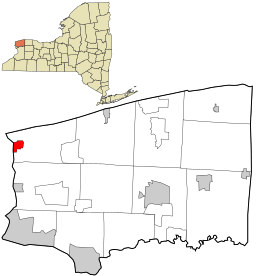
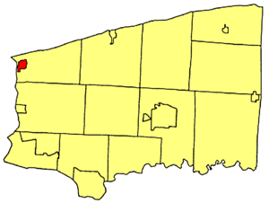
Location in Niagara County and the state of New York.
|
|||
| Country | |||
| State | |||
| County | Niagara | ||
| Named for | John Young | ||
| Area | |||
| • Total | 1.34 sq mi (3.46 km2) | ||
| • Land | 1.08 sq mi (2.80 km2) | ||
| • Water | 0.26 sq mi (0.66 km2) | ||
| Elevation | 295 ft (90 m) | ||
| Population
(2020)
|
|||
| • Total | 1,859 | ||
| • Density | 1,719.70/sq mi (664.08/km2) | ||
| Time zone | UTC-5 (Eastern (EST)) | ||
| • Summer (DST) | UTC-4 (EDT) | ||
| ZIP code |
14174
|
||
| Area code(s) | 716 | ||
| FIPS code | 36-84143 | ||
| GNIS feature ID | 0971860 | ||
| Website | www.youngstownnewyork.us | ||
Youngstown is a small village in Niagara County, New York, United States. In 2020, about 1,859 people lived there. It's part of the larger Buffalo–Niagara Falls area.
Youngstown is located on the western edge of the town of Porter. It sits right on the border with Canada, across from Niagara-on-the-Lake, Ontario. It is also just north of the famous city of Niagara Falls.
Contents
History of Youngstown
The village of Youngstown grew up around the protection of Fort Niagara. This fort was very important for its safety.
In 1813, during the War of 1812, the British army destroyed the village. But Youngstown was rebuilt! The Village of Youngstown officially became a village in 1854. It was named after a man named John Young.
Youngstown is a historic village located where the Niagara River flows into Lake Ontario. Native Americans knew this area for hundreds of years. A French explorer named La Salle built a small fort nearby in 1670. Later, the French built a larger structure called the "Castle" in 1727, which became the main part of Old Fort Niagara.
John Young, who lived across the river, saw a good opportunity here. He built a store in 1809. In 1811, he bought a large piece of land that stretched from what is now Falkner Park south to Campbell Street, and from the river east to the Niagara Scenic Parkway.
Before the War of 1812 began, Young sold some of his land. By then, many log cabins had been built. Skilled workers and storekeepers moved to the area because the Fort needed many supplies and services.
During the War of 1812, American forces captured Fort George across the river. Later, they retreated and burned a Canadian village. In return, the British and Native Americans captured Fort Niagara. They burned most of the buildings and homes south of it.
Slowly, the village was rebuilt. By the 1840s, Youngstown was a strong community with many nice homes and stores. The mild weather, great fishing, and easy access by boats helped Youngstown grow. The rich soil was perfect for growing fruit, which brought many farmers. This led to new businesses like making barrels, packing fruit, and drying apples. Carpenters and blacksmiths were also important because of the lumber and shipbuilding industries.
Over the years, many things changed. Wooden sidewalks were replaced with concrete ones. The dirt road to Lewiston became a safe paved highway. The fire company grew from a small hose cart to a fully equipped fire department. Water and sewer systems were also installed. Mail delivery started in a judge's home and finally became house-to-house delivery in 1959.
Three railroads were built to the village. Two of them failed quickly in the 1850s. But an electric train line brought supplies to the village and fort. It also brought thousands of people to an old beach amusement park.
Some important places in Youngstown are listed on the National Register of Historic Places. These include Fort Niagara Light, John Carter Farmstead, St. John's Episcopal Church, and the Old Fort Niagara-Colonial Niagara Historic District.
Youngstown's Special Spots
Old Fort Niagara
Old Fort Niagara is a very important historic place. It is a National Historic Landmark and a New York State Historic Site. More than 100,000 people visit it every year! You can see original military buildings from the 1700s and 1800s here. They also have live history events, exhibits, and educational programs.
The history of Old Fort Niagara goes back more than 300 years. During the old wars in North America, a fort at the mouth of the Niagara River was super important. It controlled who could get to the Great Lakes and the lands to the west. After the Erie Canal was finished in 1825, the fort became less important for defense. However, it was still an active military base well into the 1900s.
Three flags fly over the fort's parade ground every day. They show the three countries that have controlled Fort Niagara: France, Britain, and the United States. Each of these countries also wanted the support of a fourth group: the powerful Iroquois Confederacy. The French built the first fort here in 1679. In 1726, France built the impressive "French Castle." Britain took control of Fort Niagara in 1759 during the French & Indian War. They held it during the American Revolution but had to give it to the United States in 1796. The British recaptured Fort Niagara in 1813. But it was given back to the United States in 1815 after the War of 1812 ended.
Famous People from Youngstown
- Micheal Barrett: He was the Sergeant Major of the Marine Corps from 2011 to 2015.
- Dave Clawson: He is the head coach for the Wake Forest Demon Deacons college football team.
- Sid Jamieson: He was a longtime lacrosse coach for Bucknell University.
- Daryl Johnston: He is a former Dallas Cowboys NFL player.
- Gary Schiff: He was a City Councilman in Minneapolis, Minnesota.
- Kevin Sylvester: He is an author and broadcaster.
Where is Youngstown?
Youngstown has a total area of about 1.4 square miles (3.46 square kilometers). Most of this is land, and a small part is water.
New York State Route 18F (also called Lower River Road) runs next to the Niagara River through the village. It meets Lockport Street, which is New York State Route 93.
New York State Route 93 (Lockport St. in the village) starts at NY 18F in the village.
Nearby Areas
The village is on the east bank of the Niagara River. It is north of the city of Niagara Falls and the town of Lewiston. Youngstown is west of the Niagara Scenic Parkway. It is also at the western end of the Youngstown-Lockport Road (NY-93). The entire village is inside the town of Porter. Across the Niagara River is the town of Niagara-on-the-Lake, Ontario, in Canada.
Toronto is directly across Lake Ontario to the north. On a clear day, you can see the Toronto skyline from Old Fort Niagara State Park!
Climate
Northwestern Niagara County has a climate with hot summers and cold winters. The average temperature in January and February is about 27°F (-3°C).
| Climate data for Youngstown, New York (1991–2020 normals, extremes 2000–present) | |||||||||||||
|---|---|---|---|---|---|---|---|---|---|---|---|---|---|
| Month | Jan | Feb | Mar | Apr | May | Jun | Jul | Aug | Sep | Oct | Nov | Dec | Year |
| Record high °F (°C) | 68 (20) |
74 (23) |
79 (26) |
85 (29) |
94 (34) |
95 (35) |
99 (37) |
97 (36) |
96 (36) |
89 (32) |
76 (24) |
71 (22) |
99 (37) |
| Mean daily maximum °F (°C) | 33.6 (0.9) |
35.5 (1.9) |
43.0 (6.1) |
55.1 (12.8) |
67.6 (19.8) |
77.4 (25.2) |
82.9 (28.3) |
81.2 (27.3) |
74.1 (23.4) |
61.5 (16.4) |
49.5 (9.7) |
38.5 (3.6) |
58.3 (14.6) |
| Daily mean °F (°C) | 26.4 (−3.1) |
27.4 (−2.6) |
34.1 (1.2) |
44.9 (7.2) |
56.8 (13.8) |
67.2 (19.6) |
72.7 (22.6) |
71.0 (21.7) |
63.9 (17.7) |
52.7 (11.5) |
41.6 (5.3) |
32.3 (0.2) |
49.2 (9.6) |
| Mean daily minimum °F (°C) | 19.2 (−7.1) |
19.2 (−7.1) |
25.3 (−3.7) |
34.7 (1.5) |
46.1 (7.8) |
57.1 (13.9) |
62.5 (16.9) |
60.8 (16.0) |
53.7 (12.1) |
43.9 (6.6) |
33.7 (0.9) |
26.0 (−3.3) |
40.2 (4.6) |
| Record low °F (°C) | −10 (−23) |
−9 (−23) |
−4 (−20) |
20 (−7) |
28 (−2) |
40 (4) |
46 (8) |
44 (7) |
30 (−1) |
23 (−5) |
9 (−13) |
0 (−18) |
−10 (−23) |
| Average precipitation inches (mm) | 2.35 (60) |
2.22 (56) |
2.72 (69) |
4.06 (103) |
2.89 (73) |
3.23 (82) |
3.16 (80) |
2.19 (56) |
3.21 (82) |
2.93 (74) |
2.72 (69) |
2.72 (69) |
34.40 (874) |
| Average snowfall inches (cm) | 12.8 (33) |
20.8 (53) |
8.1 (21) |
1.7 (4.3) |
0.0 (0.0) |
0.0 (0.0) |
0.0 (0.0) |
0.0 (0.0) |
0.0 (0.0) |
0.0 (0.0) |
2.0 (5.1) |
9.8 (25) |
55.2 (140) |
| Average precipitation days (≥ 0.01 in) | 18.7 | 15.3 | 11.6 | 14.9 | 14.1 | 12.4 | 10.8 | 11.4 | 11.9 | 18.3 | 14.5 | 16.1 | 170.0 |
| Average snowy days (≥ 0.1 in) | 11.7 | 11.5 | 4.9 | 1.6 | 0.0 | 0.0 | 0.0 | 0.0 | 0.0 | 0.0 | 2.2 | 8.0 | 39.9 |
| Source: NOAA | |||||||||||||
Population Information
| Historical population | |||
|---|---|---|---|
| Census | Pop. | %± | |
| 1880 | 500 | — | |
| 1890 | 490 | −2.0% | |
| 1900 | 547 | 11.6% | |
| 1910 | 556 | 1.6% | |
| 1920 | 539 | −3.1% | |
| 1930 | 639 | 18.6% | |
| 1940 | 799 | 25.0% | |
| 1950 | 932 | 16.6% | |
| 1960 | 1,848 | 98.3% | |
| 1970 | 2,169 | 17.4% | |
| 1980 | 2,191 | 1.0% | |
| 1990 | 2,075 | −5.3% | |
| 2000 | 1,957 | −5.7% | |
| 2010 | 1,935 | −1.1% | |
| 2020 | 1,859 | −3.9% | |
| U.S. Decennial Census | |||
In 2000, there were 1,957 people living in Youngstown. The population density was about 1,687 people per square mile. The average household had about 2.42 people. The median age in the village was 41 years old.
See also
In Spanish: Youngstown (Nueva York) para niños
 | Janet Taylor Pickett |
 | Synthia Saint James |
 | Howardena Pindell |
 | Faith Ringgold |


