Simcoe Island facts for kids
| Geography | |
|---|---|
| Location | Lake Ontario |
| Coordinates | 44°10′05″N 76°31′27″W / 44.16806°N 76.52417°W |
| Archipelago | Thousand Islands |
| Administration | |
|
Canada
|
|
| Province | Ontario |
| County | Frontenac County |
| Township | Frontenac Islands |
| Demographics | |
| Population | 82 (2017) |
Simcoe Island is a small island located in Lake Ontario, Canada. It is about 6 kilometers (3.7 miles) long and 1.5 kilometers (0.9 miles) wide at its widest point. The island is found near Wolfe Island, close to the city of Kingston, Ontario, and Amherst Island.
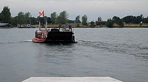
Most of Simcoe Island is used for farming. You can reach it by taking a ferry from Wolfe Island. Simcoe Island is part of Frontenac County. It forms a larger area called the Frontenac Islands, Ontario township. This township also includes Wolfe Island, Howe Island, and other smaller, privately owned islands like Garden Island and Horseshoe Island.
Contents
The Island's Name and History
Simcoe Island has an interesting history behind its name. On July 16, 1792, a leader named John Graves Simcoe named a group of islands. These islands are at the start of the St. Lawrence River. He named them after important generals from a battle called the Battle of the Plains of Abraham.
How Simcoe Island Got Its Name
The generals honored were James Wolfe, Jefferey Amherst, William Howe, Guy Carleton, and Thomas Gage. Simcoe Island was originally named after Thomas Gage.
Early French settlers first called the island "Isle de Foret," which means "Forest Island." However, most of the trees were cut down for farming over time. Today, only small groups of trees remain. The name Gage Island was also used for a while. Eventually, the island was renamed Simcoe Island to honor John Graves Simcoe.
Important Places on Simcoe Island
There are two main points of interest on Simcoe Island. These are the cable ferry and the Nine Mile Point Lighthouse.
The Cable Ferry
The island's cable ferry is one of the smallest in Ontario. It can carry a maximum of three cars at a time. This ferry is the main way for people and vehicles to get to and from Simcoe Island.
Nine Mile Point Lighthouse
The Nine Mile Point Lighthouse is another important landmark. You can reach it by driving on the island's only main dirt road, called Nine Mile Point Road. This lighthouse was built in 1833 by a skilled stonemason named Robert Matthews.
A Historic Lighthouse
The Nine Mile Point Lighthouse is one of the earliest "Imperial" lighthouses in North America. It has been working continuously since it was finished almost 200 years ago. This makes it the oldest active Canadian lighthouse on the Great Lakes. It is also one of the oldest active lighthouses in the entire Western Hemisphere.
Lighthouse Keepers and Automation
For most of its history, people called "light keepers" operated and took care of this lighthouse. Some of their families still live on the island today. In 1987, the lighthouse became automated, meaning machines now run it.
A Memorial to Lost Ships
Besides guiding ships, the lighthouse also serves as a memorial. It remembers the many lives lost and ships that sank near its shores. This area is sometimes called the "Graveyard of Lake Ontario." Some ships that sank here include the Comet, a paddle steamer from the United States, and the Aloha, a 171-foot-long vessel. The Effie Mae also sank after colliding with the Aloha.
 | Mary Eliza Mahoney |
 | Susie King Taylor |
 | Ida Gray |
 | Eliza Ann Grier |


