Toronto Islands facts for kids
|
Native name:
Mnisiing "on the islands"
Nickname: The Island
|
|
|---|---|
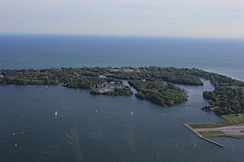
The Toronto Islands seen from the CN Tower
|
|
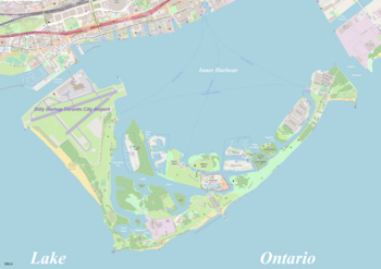
Map of Toronto Islands
|
|
| Geography | |
| Location | Lake Ontario |
| Coordinates | 43°37′15″N 79°22′43″W / 43.62083°N 79.37861°W |
| Total islands | 15 |
| Major islands | Centre Island |
| Area | 332 ha (820 acres) |
| Administration | |
|
Canada
|
|
| Province | Ontario |
| Single-tier municipality | City of Toronto |
| Demographics | |
| Population | 700 |
| Languages | English |
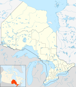
The Toronto Islands are a group of 15 small islands. They are located in Lake Ontario, just south of downtown Toronto, Ontario, Canada.
These islands are the only group of islands in the western part of Lake Ontario. They protect Toronto Harbour from the open lake. The islands are home to Toronto Island Park, the Billy Bishop Toronto City Airport, and several private yacht clubs. You can also find a public marina, Centreville Amusement Park, and a neighbourhood where people live all year. It's the largest car-free community in North America!
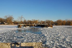
You can get to the islands by public ferries or private water taxis. A special tunnel connects the mainland to the airport. The Toronto Islands are a very popular spot for tourists and for having fun. You can bring your bike on the ferry for free or rent one there. You can also rent canoes, kayaks, and paddle boats. There's even a disc golf course! Many beaches, playgrounds, and gardens make it a great place for picnics. In winter, if the ice is thick enough, people even go ice skating on the lagoons.
Contents
- Island History: How the Islands Formed and Grew
- Island Geography: Exploring the Land and Water
- Island Climate: Weather on the Water
- Island Culture: Life and Fun on the Islands
- Education: Learning on the Islands
- Politics: How the Islands are Governed
- Transportation: Getting Around the Islands
- In Popular Culture: Islands in Stories and Films
- Timeline: Key Moments in Island History
- Notable People: Famous Islanders
Island History: How the Islands Formed and Grew
For thousands of years, Indigenous peoples used these islands and sandbars. They were a special place for gatherings and healing. The Mississaugas of the Credit called this area "Mnisiing." For the descendants of the Ojibwa, now the Mississaugas of the Credit First Nation, the Toronto Islands are sacred land.
In the late 1700s, British records show that the islands were part of a land deal called the Toronto Purchase. However, the Mississaugas later said the islands were not included and that the payment was not fair. In 2010, a settlement was reached, and the Mississaugas gave up their claim to the islands.
Early European Settlers and Buildings
In the 1790s, the British built some of the first structures on the island. The Gibraltar Point Blockhouse was built in 1794. It helped support the main military base on the mainland. Later, another blockhouse was built, but it was destroyed in the Battle of York.
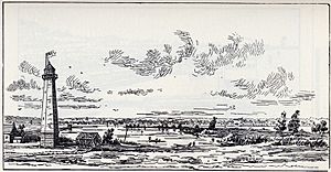
The Gibraltar Point Lighthouse was built in 1809. It is famous for the mysterious death of its first keeper, John Paul Radelmüller, in 1815. This story is one of Toronto's oldest ghost tales.
How the Peninsula Became Islands
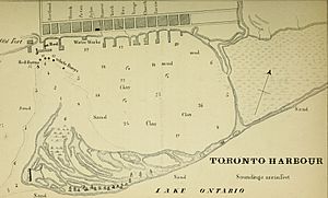
The land that is now the Toronto Islands was once a long peninsula. It was connected to the mainland. In 1852, a storm cut off the eastern part of the peninsula. A breakwater was built, but another powerful storm on April 13, 1858, created a wide channel. This storm permanently separated the islands from the mainland.
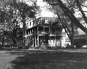
After this, the Hanlan family was among the first to live on the islands all year round, starting in 1862. In 1867, the City of Toronto bought the islands. They divided the land into lots for summer cottages, amusement areas, and hotels. The west side of the island became a popular summer spot. In 1878, a hotel was built by John Hanlan. This area became known as Hanlan's Point. John's son, Ned Hanlan, became a famous rower.
Growth of Island Communities
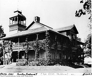
As Hanlan's Point grew, other areas also developed. Along Centre Island, large Victorian summer homes were built. Wealthy Toronto families came to escape the summer heat. They were also drawn by the Royal Canadian Yacht Club, which moved to the islands in 1881.
Ward's Island started as a tent community in the 1880s. William E. Ward built a hotel and rented tents to visitors. By 1913, the tent community had grown so much that the city organized it into streets. These tents eventually turned into a community of seasonal cottages.
Schools and Amusements
A one-room school opened near the Gibraltar Lighthouse around 1888. It became a permanent school in 1896. Today, the Island Public/Natural Science School teaches students from Junior Kindergarten to grade 6. It also has a science program for visiting students and a daycare.
In 1894, a land reclamation project created space for an amusement park at Hanlan's Point. In 1897, the Hanlan's Point Stadium was built for the Toronto Maple Leaf baseball team. In 1914, Babe Ruth hit his first professional home run into Lake Ontario from this stadium! The baseball team later moved to the mainland.
The Airport and Island Changes
In 1937, work began on a new airport. This meant the stadium and most of the amusement park were torn down. The cottages at Hanlan's Point had to move. Residents could move their cottages further south or to Algonquin Island. Algonquin Island was originally a sandbar that was expanded with new land. In 1938, 31 cottages were moved by barge to Algonquin Island.
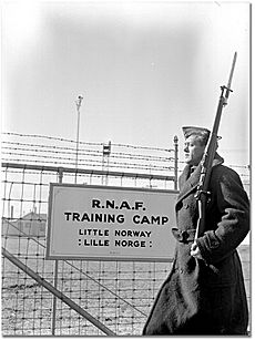
The airport opened in 1939. During the early years of World War II, Norwegian pilots trained there. A park on the mainland, Little Norway Park, remembers this time.
Protecting the Island Homes
After World War II, Toronto City Council allowed people to live on the islands all year. This was to help with housing shortages. At its peak in the 1950s, about 630 homes were on the islands. There were also shops, hotels, and a movie theatre.
However, in 1953, the new Metropolitan Toronto Council decided to remove the community. They wanted to create more public parkland. They started tearing down homes. By 1970, 250 homes on Ward's and Algonquin Islands were saved. The Islanders formed the Toronto Islands' Residents Association (TIRA) in 1969. They fought to keep their homes.
After many years of legal battles, the provincial government stepped in. In 1993, a law was passed called the Toronto Islands Residential Community Stewardship Act. This law gave Islanders 99-year leases on their land. It also created a Land Trust to manage the sale of properties. This means homes can only be sold to a child or spouse of the owner, or to someone on a special waiting list. This helps keep the community unique and affordable. As of 2018, there are 262 homes on Ward's Island and Algonquin Island.
Island Geography: Exploring the Land and Water
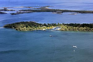
The Toronto Islands cover about 332 hectares (820 acres). The largest island is Centre Island. It is shaped like a crescent moon. Algonquin Island (once called Sunfish Island) and Olympic Island are also major islands. Algonquin is mostly homes, while Olympic is a public park. What many call Ward's Island is actually the eastern part of Centre Island. It is also mostly homes.
The Centre Island dock and Centreville Amusement Park are on Middle Island. This is why Middle Island is often mistaken for Centre Island. Sometimes, people just say "Toronto Island" (singular) to avoid confusion.
Main Islands and Waterways
Here are some of the other islands:
- Mugg's Island: Home to the Island Yacht Club.
- Forestry Island: Covered in trees, no direct link to other islands.
- Snake Island: Has a beach facing Toronto Harbour. You can get there from a bridge on Centre Island.
- North Chippewa Island: Used by the Royal Canadian Yacht Club for storing boats.
- South Chippewa Island: Heavily forested.
- South Island: Used by the Royal Canadian Yacht Club for boats. It has a tennis court.
- RCYC Island: Home to the Royal Canadian Yacht Club's main building and boat docks.
- Hanlan's Island: Heavily forested, located near Lighthouse Pond.
There are also three small, unnamed islands in what used to be Block House Bay and Long Pond.
How the Islands Were Formed
The islands were originally a long, narrow piece of land called a peninsula or sand spit. This land was formed by sand and dirt washing down from the Scarborough Bluffs. The water in Lake Ontario flows from east to west, which slowly built up these sand deposits.
In 1852, a storm created a channel east of Ward's Island. This channel became wider and permanent after a big storm in 1858. It is now known as the Eastern Gap. The land to the west became the Toronto Islands.
The islands would naturally shrink over time, but strong shorelines have been built to stop erosion. Over the years, new land has been added to the islands through land reclamation. This means sand and dirt from the harbour bottom were used to make the islands bigger. Algonquin Island, for example, was created this way. The area where the airport is now was also built up with landfill.
Island Waterways
Many waterways allow boats to travel around the islands:
- Allan Lamport Regatta Course: Between Centre Island and Middle Island.
- Block House Bay: On the east side of Hanlan's Point.
- Deep Pike Cut: On the east side of Mugg's Island.
- Hanlan's Bay: Between Centre Island and Hanlan's Island.
- Lighthouse Pond: Next to the Gibraltar Point lighthouse.
- Long Pond: Between Allan Lamport Regatta Course and Block House Bay.
- Snake Pond: Between Snug Harbour and Algonquin Island.
- Snug Harbour: Between Snake Island and Olympic Island.
- Sunfish Cut: Between Snake Island and Algonquin Island.
- Trout Pond: West of Lighthouse Bay on Hanlan's Point.
Island Climate: Weather on the Water
The Toronto Islands have a humid continental climate. This means they have warm summers and cold winters.
The weather on the islands is a bit different from the mainland. The cool lake water keeps spring, summer, and early fall days about 2–3°C cooler. In winter, the lake water can be warmer than the air, so temperatures are similar to downtown Toronto but warmer than areas further from the lake. Fog and low clouds are more common on the island. The lake only freezes near the shore after a long period of very cold weather.
The highest temperature ever recorded on Toronto Island was 37.2°C on June 15, 1919. The coldest temperature ever recorded was -30.0°C on January 13, 1914.
Island Culture: Life and Fun on the Islands
Island Community Life
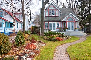
About 300 homes are located on the Toronto Islands. Most of these are on Ward's Island and Algonquin Island. As mentioned, there are special rules about buying and selling these homes to keep the community unique.
The islands have two daycare centres, one school, and one church. The Toronto Island Public School is a public school for island residents and other students up to grade 6. It also has a science program for visiting students and a pre-school nursery. The Waterfront Montessori Children's Centre is another pre-school nursery on Algonquin Island. St. Andrew-by-the-Lake Church is an Anglican church on Centre Island. It was built in 1884.
The Ward's Island residential community covers about 12 acres. It has about 150 homes. The streets have kept their original names since 1915, like First, Second, and Third Streets.
Artscape Gibraltar Point is a place for artists. It has studios for painters, sculptors, musicians, and theatre groups. Artists can rent studios and bedrooms there.
Recreation and Activities
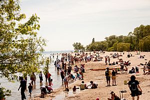
The islands have several beaches for swimming. These include Centre Island Beach, Manitou Beach, Gibraltar Point Beach, Hanlan's Point Beach, and Ward's Island Beach.
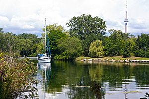
Boating has been popular here for over 100 years. The Toronto Island Sailing Club was started in 1965. It offers sailing courses and races. The islands are also home to four yacht clubs: Harbour City Yacht Club, Island Yacht Club, Queen City Yacht Club, and the Royal Canadian Yacht Club. There's a public marina called the Toronto Island Marina. You can also find the Sunfish Cut Boat Club and the Toronto Island Canoe Club].
The islands have a dragon boat race course. The Toronto International Dragon Boat Race Festival is held here every year. You can rent canoes, kayaks, and paddle boats.
Centreville Amusement Park is a children's amusement park. It opened in 1967 and has a 1900s theme. It has a miniature railway and an antique carousel. The park is open daily in summer. Nearby is Far Enough Farm, where you can see farm animals. Franklin's Garden is a children's garden. There's also a splash pad, a hedge maze, and a playground.
On Ward's Island, there is a flying disc golf course. You can find public tennis courts at Hanlan's Point and a community tennis club on Ward's Island.
The islands have hosted many events over the years, including the Olympic Island Festival and the Wakestock festival. The Canadian Open Frisbee Championships were also held here.
Education: Learning on the Islands
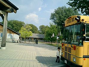
The Toronto District School Board (TDSB) runs the public schools in Toronto, including the Toronto Islands. The only elementary school on the islands is Island Public/Natural Science School on Centre Island. In 2013, it had 179 students. Most students live in the city and take the ferry to school.
Some island students also attend other TDSB schools on the mainland. These include The Waterfront School and various high schools.
There are also other public school boards that serve Toronto Island residents. These include French-language school boards and Catholic school boards.
Politics: How the Islands are Governed
The Toronto Islands are part of the Spadina—Fort York area for federal and provincial elections. They are also part of the Spadina–Fort York Ward 10 for city government. The islands are represented by their elected officials at each level of government.
Transportation: Getting Around the Islands
Billy Bishop Toronto City Airport
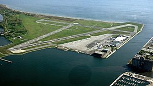
The Billy Bishop Toronto City Airport, also known as the Toronto Island Airport, is on the north-western tip of the islands. It is used for civil aviation, including airlines, flight training, and private aviation. Since 1984, it has been used by regional airlines. A pedestrian tunnel to the airport opened in 2015. This tunnel does not connect to the rest of the island park.
Ferry Services
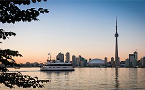
There are no roads connecting the mainland to the Toronto Islands. So, people rely on ferries, water taxis, and other boats.
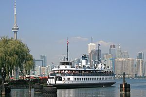
Three public ferry routes take visitors, residents, and service vehicles from the Jack Layton Ferry Terminal to Hanlan's Point, Centre Island Park, and Ward's Island. The ferry to Ward's Island runs all year. Another public ferry connects the mainland to the airport. You cannot walk between the airport and the rest of the islands.
Many yacht clubs and marinas on the islands also have their own private boat services.
Roads and Buses
The roads on the islands are paved, except for a long wooden boardwalk on Ward's Island. Only City of Toronto government service vehicles (like park vehicles or ambulances) can use motor vehicles. Bicycles are allowed on the ferries and the island. You can also rent bicycles and quadricycles. Lakeshore Avenue is the main road for vehicles. The six bridges on the island are only for people walking, biking, or using all-terrain vehicles.
Sometimes, an Island Bus runs when ferries cannot operate due to bad weather or ice. This usually happens in winter. The bus crosses airport runways, so it needs an escort.
In Popular Culture: Islands in Stories and Films
The Toronto Islands have appeared in many Canadian books and films.
- Margaret Atwood's The Robber Bride and Robert Rotenberg's Old City Hall feature the islands.
- The novel Heyday by Marnie Woodrow has parts set on Ward's Island today and Hanlan's in 1909.
- Claudia Dey's novel Stunt is also set on Ward's Island.
- In the 2011 film Take This Waltz, the main character rides a ride at Centreville Amusement Park.
- The second season of the TV show Sensitive Skin is set mostly on the islands.
- Canadian singer-songwriter Jordan Paul wrote his song "Ward's Island" after visiting the island.
- In the 2013 film The F Word, characters Allan and Nicole get married on the Island.
Timeline: Key Moments in Island History
- 1787 – Toronto Purchase: The British and the Mississaugas agree on land north of Toronto Harbour.
- 1793 – A blockhouse is built by the Queen's Rangers at Gibraltar Point.
- 1805 – The Toronto Purchase agreement is renegotiated.
- 1809 – The Lighthouse is built at Gibraltar Point.
- 1833 – The first hotel, "The Retreat on the Peninsula," opens.
- 1834 – Fisherman David Ward and shipbuilder John Hanlan are among the first European settlers.
- 1858 – A storm permanently separates the Toronto Islands from the mainland.
- 1867 – The City of Toronto takes ownership of the Islands.
- 1870s-1880s – Summer homes are built on the island.
- 1874 – John Hanlan opens Hanlan's Hotel.
- 1879-1912 – The size of the islands grows through adding landfill, creating Algonquin Island.
- 1880 – The Royal Canadian Yacht Club is established on the island.
- 1882 – William Ward opens Ward's Hotel.
- 1888 – The first elementary school is established near the Gibraltar Point Lighthouse.
- 1897 – The first amusements open at Hanlan's Point.
- 1897 – A baseball and lacrosse stadium is built at Hanlan's Point.
- 1914 – Babe Ruth hits his first professional home run at Hanlan's Point Stadium.
- 1916 – Ward's Island doubles in size due to harbour dredging.
- 1937 – Construction of the Island airport begins. Some cottages move to Algonquin Island.
- 1939 – The Sam McBride ferry begins service.
- 1947 – The City allows year-round residency due to housing shortages after World War II.
- 1956 – The new Metro Toronto government starts demolishing cottages.
- 1959 – Far Enough Farm opens.
- 1967 – Centreville Amusement Park opens.
- 1967 – Toronto Island Marina opens.
- 1975-1985 – The Canadian Open Frisbee Championships are held on Olympic and Ward's Island.
- 1993 – The Toronto Islands Residential Community Stewardship Act is passed. This law gives homeowners 99-year leases.
- 2010 – The Canadian government and Mississaugas settle disagreements over the Toronto Purchase.
- 2015 – The island airport pedestrian tunnel opens.
- 2017 – Lake Ontario water levels reach a record high, causing flooding. Parts of the islands close.
- 2019 – Water levels are high again, requiring sandbags and pumps to prevent flooding.
- 2020 – The islands are closed to visitors due to the COVID-19 pandemic in Ontario. Ferry service later resumes with limited capacity.
- 2021 – The City of Toronto begins a new plan to improve Toronto Island Park and highlight Indigenous history.
Notable People: Famous Islanders
- Peter Gzowski – a well-known broadcaster
- Ned Hanlan – an Olympic rower
- Paul Henderson – an Olympic sailor
- W. A. Hewitt – a sports executive and journalist
- Foster Hewitt – a famous sports radio broadcaster
- Patrick Loubert – a producer
- Sam McBride – a former Toronto mayor
- Terry McLaughlin – an Olympic sailor
- John Millen – an Olympic sailor
- Mariah Millen – an Olympic sailor
- Allan Sparrow – a City councillor
 | Dorothy Vaughan |
 | Charles Henry Turner |
 | Hildrus Poindexter |
 | Henry Cecil McBay |


