El Malpais National Monument facts for kids
Quick facts for kids El Malpais National Monument and National Conservation Area |
|
|---|---|
|
IUCN Category V (Protected Landscape/Seascape)
|
|
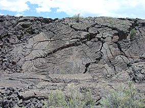
Pahoehoe lava flow in El Malpais National Monument
|
|
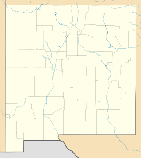
| Location | Cibola County, New Mexico, USA |
| Nearest city | Grants, NM |
| Area | 114,276 acres (462.46 km2) |
| Established | December 31, 1987 |
| Visitors | 105,356 (in 2011) |
| Governing body | National Park Service |
| Website | El Malpais National Monument |
El Malpais National Monument is a special protected area in western New Mexico, USA. Its name, "El Malpais," comes from a Spanish word meaning "badlands." This is because the area has amazing and rugged landscapes formed by volcanoes. You can find it along the Trails of the Ancients Byway, a beautiful scenic road in New Mexico.
Contents
Exploring the Volcanic Landscape
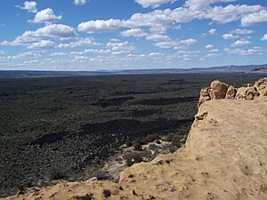
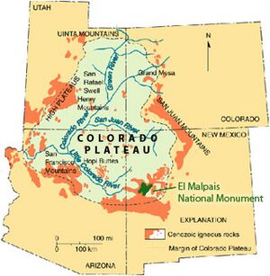
The cool lava flows, cone-shaped hills called cinder cones, and other volcanic features at El Malpais are part of the Zuni-Bandera volcanic field. This is the second largest volcanic area in the Basin and Range Province. This active area is on the edge of the Colorado Plateau. It sits on an old crack in the Earth's crust called the Jemez Lineament. This crack allows molten rock (magma) to rise, causing volcanoes to form.
The Zuni-Bandera eruptions created rough lava flows. These flows filled a big basin between tall flat-topped mountains (mesas). These include the Acoma Pueblo mesas to the east, Mt. Taylor to the north, and the Zuni Mountains to the northwest. The lava flows include two main types:
- Pahoehoe (pronounced "pah-HOY-hoy") lava is smooth and ropey.
- ʻAʻā (pronounced "ah-AH") lava is rough and jagged.
Volcanoes like Bandera Crater and El Calderon were the sources for these flows. Many older cinder cones also stretch in a line west of the monument.
Amazing Caves and Views
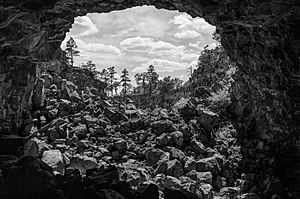
El Malpais has many lava tubes that you can explore! These are like underground tunnels formed by flowing lava. You can explore them without a guide, but you need a free caving permit. You can get a permit at the park's visitor centers.
Currently, four caves are open for exploration:
- Junction Cave
- Xenolith Cave (both in the El Calderon area)
- Big Skylight Cave
- Giant Ice Cave (both in the Big Tubes area)
From 2010 to 2013, all caves were closed for a while. This was to protect bats from a disease called White Nose Syndrome. Now, the park has a special permit process to help keep the bats safe.
You can also visit a scenic spot called Sandstone Bluffs. From here, you get amazing wide views of the monument's lava flows.
Unique Plant Life
El Malpais Monument is home to some of the oldest Douglas fir trees on Earth. These trees are a special kind called Rocky Mountain Douglas-fir. They have survived for a very long time in this rugged environment.
A Look at the Past
People have used the area around El Malpais for thousands of years. Ancient cultures, Native American tribes, and Spanish explorers all traveled through and lived here. You can still find old archaeological sites in the park today.
During World War II, the U.S. military used parts of the lava field. It was a training area for pilots to practice bombing.
After the war, the land was managed by the Bureau of Land Management. Then, in 1987, President Reagan signed a law. This law created El Malpais National Monument. It became part of the National Park Service. The monument is managed together with the nearby El Morro National Monument.
Protecting El Malpais
The National Park Service works to protect and manage El Malpais National Monument. They also help visitors understand its natural and historical importance. They have two Visitor Centers where you can find information, maps, and helpful staff:
- The El Malpais Visitor Center is near Grants, New Mexico.
- The El Malpais Information Center is further south on Highway 53.
Next to the monument is the El Malpais National Conservation Area. This area is protected and managed by the Bureau of Land Management. They have a Ranger Station on State Highway 117.
The Cibola National Forest also helps protect large natural areas, wildlife, and their homes in the surrounding region.
 | Jewel Prestage |
 | Ella Baker |
 | Fannie Lou Hamer |


