Katahdin Woods and Waters National Monument facts for kids
Quick facts for kids Katahdin Woods and Waters National Monument |
|
|---|---|
| Location | North Central Maine, United States |
| Nearest city | Bangor |
| Area | 87,563 acres (35,435 ha) |
| Established | Monument: August 24, 2016 |
| Governing body | National Park Service |
| Website | Katahdin Woods and Waters National Monument |
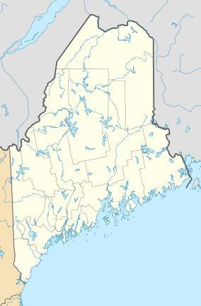
The Katahdin Woods and Waters National Monument is a special protected area in northern Maine, United States. It covers about 87,563 acres (35,435 hectares) of mountains and forests. This amazing place includes part of the East Branch Penobscot River. You can find it right next to Maine's Baxter State Park. It is managed by the National Park Service.
Contents
How the Monument Was Created
A Gift for Future Generations
The idea for the Katahdin Woods and Waters National Monument started with Roxanne Quimby. She helped create a company called Burt's Bees. In 2001, her foundation began buying land near Baxter State Park.
In 2011, she shared her dream: she wanted the land to become a national park. However, some politicians did not agree with this idea. So, Ms. Quimby changed her plan. She decided to aim for a national monument instead. A president can create a national monument using a special rule called the Antiquities Act.
Presidential Proclamation
On August 23, 2016, Ms. Quimby's foundation gave the land to the U.S. government. The land was worth about $60 million. They also gave $20 million to help run the monument at first. Plus, they promised another $20 million for future support.
The very next day, August 24, 2016, President Barack Obama officially declared the 87,563 acres as the Katahdin Woods and Waters National Monument. This happened just before the National Park Service celebrated its 100th birthday.
Discussions About the Monument
Why Some People Disagreed
Not everyone was happy about the monument being created. Some people worried that the federal government was getting too involved in Maine's lands.
One person who strongly disagreed was Paul LePage. He was the Governor of Maine starting in 2011. He said that creating the monument was "unilateral action." This meant he felt it was done without the agreement of the people in rural Maine.
Future of the Monument
Some people hoped that President Donald Trump would change the monument's status. During his 2016 campaign, President Trump had also questioned the monument's creation. However, supporters of the monument said that changing it would be a "destructive step."
In December 2017, United States Secretary of the Interior, Ryan Zinke, looked into the monument. He did not suggest making it smaller or getting rid of it. Instead, he advised only small changes to how the monument would be managed. In the end, President Trump did not make any changes to the monument.
People and the Land
Early Inhabitants
People have lived in this area for about 11,000 years. Native peoples used the woods and rivers for their homes, food, and travel. The Penobscot Indian Nation and other Wabanaki tribes still see the Penobscot River as a very important part of their culture.
European Exploration and Logging
The first time Europeans explored this region was in 1793. This was part of a survey ordered by the Commonwealth of Massachusetts. Maine was part of Massachusetts back then. After Maine became a state in 1820, its government also started surveying these lands.
For over 100 years, from the early 1800s to the late 1800s, logging was the main business in the area. People cut down trees to use for wood.
Famous Visitors
The Maine Woods became famous because of the writings of Henry David Thoreau in the 1850s. Later, important people like President Theodore Roosevelt visited. Maine Governor Percival Baxter also visited. He later set aside the land next to the monument to become Baxter State Park.
The Land's Story in Rocks
Ancient Rocks and Fossils
The rocks at Katahdin Woods and Waters tell a story that goes back over 150 million years. These rocks are from the Paleozoic era. You can see clear layers of rock with visible fossils.
West of the Penobscot River's East Branch, you'll find volcanic rock. This rock is from the Devonian period. Most of it is Katahdin granite, and some is Traveler rhyolite.
Oldest Rocks in the Monument
The oldest rock in the monument is about 500 million years old. It is a light greenish-gray quartzite and slate. This rock is from the early Cambrian period. You can see it along the riverbank of the East Branch at a river rapid called Grand Pitch. This ancient rock shows how mountains were formed in this part of Maine long ago.
 | Lonnie Johnson |
 | Granville Woods |
 | Lewis Howard Latimer |
 | James West |


