
Admiralty Island National Monument facts for kids
Quick facts for kids Admiralty Island National Monument |
|
|---|---|

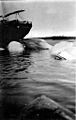
Windfall Harbor
|
|

Admiralty Island National Monument
Location in Alaska
|
|
| Location | Hoonah-Angoon Census Area and Juneau, Alaska, United States |
| Nearest city | Juneau, AK |
| Area | 955,747 acres (3,867.77 km2) |
| Governing body | U.S. Forest Service |
| Website | http://www.fs.usda.gov/tongass/ |

Admiralty Island National Monument is a special protected area in Southeast Alaska, United States. It's located on Admiralty Island and is part of the huge Tongass National Forest. This monument was created on December 1, 1978. It covers a massive 955,747 acres (about 3,868 square kilometers). Most of this area, except for a small part, is also a wilderness area called the Kootznoowoo Wilderness. This means it's kept wild and protected from development. The United States Forest Service helps manage this amazing place from their offices in Juneau.
Contents
About Admiralty Island National Monument
Admiralty Island is a very large island in Alaska. It was made a National Monument to protect its unique nature and history. A "National Monument" is a place with important natural or historical features that the U.S. government wants to keep safe. Because the island is so far away from cities, most of it is also a "wilderness area." This means it's protected from buildings and other human changes, keeping it wild for animals and plants.
Amazing Wildlife and Plants
Admiralty Island is covered in a thick, green rainforest. The main trees you'll see are Western hemlock, Sitka spruce, and western redcedar. This lush environment is home to many animals.
- Brown Bears: The island has more brown bears than all of the lower 48 states combined! It's one of the best places in the world to see these incredible animals.
- Bald Eagles: You can also find one of the highest numbers of bald eagles anywhere on Earth here. These majestic birds are a common sight.
- Other Animals: Many kinds of salmon swim in the island's waters. You might also spot whales in the surrounding ocean and deer roaming through the forests.
A Special Place for the Tlingit People
Admiralty Island is a very important and sacred place for the Angoon Tribe of Tlingit people. They live in the community of Angoon on the western coast of the island. The Tlingit people have a long history with the island. They worked hard to make sure the island was protected. Today, many people from Angoon use the monument daily for hunting, fishing, and gathering food, just as their ancestors did. They also help take care of the island's natural resources.
Fun Activities to Do
One popular way to explore Admiralty Island is by taking the Cross Admiralty Canoe Route. This route is about 32 miles long and is great for canoeing and kayaking. It crosses the whole island using a series of lakes, streams, and trails where you carry your boat. Along the way, you can find cabins and shelters to rest in. While the modern route was built in the 1930s, it follows paths that the island's native people used for many years for hunting, fishing, and trading.
Greens Creek Mine
On the northwest side of the island, there's a place called the Greens Creek Mine. This is an underground mine where people dig for silver, gold, zinc, and lead. It's located within the national monument but outside the wilderness area. The mine started working in 1989.
Images for kids
-
Whales tied to moorings at the Tyee Company whaling station, photo by John Nathan Cobb
.jpeg)
See also
 In Spanish: Isla del Almirantazgo para niños
