
Admiralty Island facts for kids

Colt Island and Horse Island with Admiralty Island in the background
|
|

Admiralty
Location in Alaska
|
|
| Geography | |
|---|---|
| Location | ABC islands of Alaska |
| Coordinates | 57°44′N 134°20′W / 57.733°N 134.333°W |
| Archipelago | Alexander Archipelago |
| Area | 1,646.4 sq mi (4,264 km2) |
| Length | 90 mi (140 km) |
| Width | 35 mi (56 km) |
| Highest elevation | 4,800 ft (1,460 m) |
| Administration | |
|
United States
|
|
| State | Alaska |
| Demographics | |
| Population | 650 (2000) |
| Pop. density | 0.39 /sq mi (0.151 /km2) |
Admiralty Island is a large island located in Southeast Alaska. It's part of a group of islands called the Alexander Archipelago. The island is about 145 kilometers (90 miles) long and 56 kilometers (35 miles) wide. This makes it one of the biggest islands in the United States! It's also one of the famous ABC islands in Alaska.
A long, narrow waterway called the Seymour Canal almost cuts the island in half. Most of Admiralty Island is a special protected area called the Admiralty Island National Monument. This area is managed by the Tongass National Forest. It has huge, ancient forests that are home to amazing animals like brown bears, bald eagles, and Sitka black-tailed deer.

The island was named by George Vancouver to honor the British Admiralty, which was like the navy department in Britain. In 1794, Joseph Whidbey explored the island, sailing all the way around it.
Contents
Home of the Bears
The Tlingit people, who are the native people of this area, call Admiralty Island Xootsnoowú. This name means "Fortress of the Bear(s)". And it's true! Admiralty Island has the most brown bears in all of North America. There are about 1,600 brown bears living on the island, which is almost three times more bears than people!
The only town on the island is Angoon, a traditional Tlingit community. About 572 people live there. A small, unpopulated part of the city of Juneau also touches the northern end of the island. In the year 2000, the total population of the island was 650 people.
Mining on the Island
The Greens Creek mine is an underground mine located on the northwest side of Admiralty Island. This mine digs for valuable metals like silver, gold, zinc, and lead. It started operating in 1989.
Fun Things to Do
Admiralty Island is a great place for outdoor adventures! The United States Forest Service has cabins you can rent on the island. They also maintain the Cross Admiralty Canoe Route. This route connects many of the island's lakes with short paths where you carry your canoe.
One of the most exciting things to do is visit the Pack Creek Brown Bear Viewing Area. Here, you can safely watch brown bears in their natural home. During the summer, you might see them fishing for salmon or interacting with each other. You need a special permit from the Forest Service to visit Pack Creek.
Point Retreat Lighthouse
The Point Retreat Light is a lighthouse located at the very northern tip of Admiralty Island. It was once a very important light to help ships navigate safely in the waters around the island.
Images for kids
-
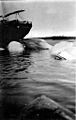
Whales tied to moorings at the Tyee Company whaling station.
.jpeg)
See also
 In Spanish: Isla del Almirantazgo para niños
