Vermilion Cliffs National Monument facts for kids
Quick facts for kids Vermilion Cliffs National Monument |
|
|---|---|

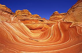
The Wave in the Coyote Buttes
|
|
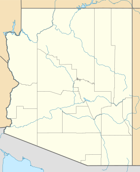
| Location | Coconino County, Arizona, United States |
| Nearest city | Page, Arizona |
| Area | 293,689 acres (118,852 ha) |
| Established | November 9, 2000 |
| Governing body | U.S. Bureau of Land Management |
| Website | https://www.blm.gov/national-conservation-lands/arizona/vermilion-cliffs/ |
The Vermilion Cliffs National Monument is a huge, protected area in northern Arizona, right next to the Utah border. It covers about 293,689 acres, which is like protecting a giant outdoor museum! This special place keeps safe amazing natural wonders like the Paria Plateau, the famous Vermilion Cliffs, Coyote Buttes, and Paria Canyon. The land here goes from about 3,100 feet to 6,500 feet above sea level, showing off many different landscapes.
Contents
How the Monument Was Created
The Vermilion Cliffs National Monument was officially created on November 9, 2000. It was set aside by a special order from President Bill Clinton. This monument was made from land that was already owned and managed by the U.S. Government in northern Coconino County, Arizona. The monument is looked after by the U.S. Bureau of Land Management, which is part of the U.S. Department of the Interior. The beautiful Vermilion Cliffs themselves run along the southern and eastern edges of this protected area. Much of the monument's land is a flat area called the Paria Plateau, which stretches out from the top of the cliffs.
Exploring the Vermilion Cliffs

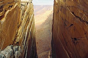
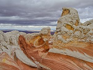
The Vermilion Cliffs are very steep, eroded rock formations. They are mostly made of sandstone, siltstone, limestone, and shale. These cliffs can rise as much as 3,000 feet from their bases! For millions of years, these sedimentary rocks have been slowly worn away by wind and water. This process has revealed hundreds of layers of rock, each with its own rich color. You can also find flat-topped hills called mesas, smaller hills called buttes, and large tablelands. These are mixed with deep, narrow canyons where small streams flow, providing enough water for some wildlife to live.
Amazing Animals and Plants
The monument is home to many different kinds of animals and plants. More than twenty types of raptors, which are birds that hunt for food, have been seen here. These include powerful bald eagles and golden eagles, fast peregrine falcons, and several kinds of hawks.
One very special bird found here is the California condor. These birds are an endangered species, meaning there are very few left in the world. They have been brought back to this area because it is so remote and has few people, which helps them stay safe.
You might also spot large mammals like Desert bighorn sheep, pronghorns (which are very fast), and mountain lions. There are also about 30 other species of smaller mammals. In the streams of the monument, you can find rare fish species, such as the flannelmouth sucker and the speckled dace.
A unique plant called Welsh's milkweed also grows here. This plant is a threatened species, and it helps to hold sand dunes in place. It is known to grow only in the Vermilion Cliffs National Monument and one other small area in nearby Utah.
A Look at Human History
People have lived in this region for a very long time, going back about 12,000 years! You can find hundreds of ancient Native American pueblo sites spread across the monument. These are the remains of old villages, with houses, places to store food, burial areas, and other ruins.
The monument also has one of the largest collections of rock art sites in any protected area in the United States. Many of these petroglyphs, which are images carved into rock, are thought to be among the oldest in the country.
The first European explorers to visit this region were Spanish missionaries and explorers in 1776. Later, Mormon explorers came through in the 1860s. Some of them even settled on land that is now part of the monument. They built one of the first ferry crossings on the Colorado River in 1871. In the same year, John Wesley Powell explored this area as part of his scientific trips along the Colorado River plateau.
Below the Vermilion Cliffs, there's a historic path called the "Honeymoon Trail." This was a wagon route used by Mormons who traveled to St. George, Utah, to get married in the temple there, and then returned home. It was a remote route and not used very often for other purposes. Today, historical markers help tell the story of this trail.
Even now, the area around the monument is mostly untouched. There are almost no permanent residents left, and only a few roads lead into the area, keeping it wild and beautiful.
 | John T. Biggers |
 | Thomas Blackshear |
 | Mark Bradford |
 | Beverly Buchanan |


