Kings Canyon National Park facts for kids
Quick facts for kids Kings Canyon National Park |
|
|---|---|
|
IUCN Category II (National Park)
|
|
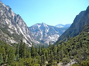
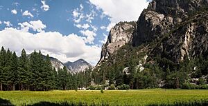
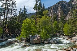
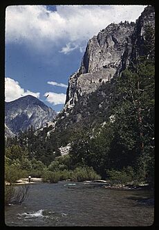
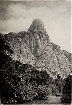
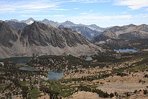
View of Kings Canyon, looking south from Paradise Valley. The Sphinx centered.
|
|
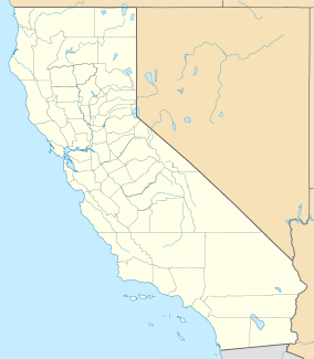
| Location | Fresno and Tulare counties, California |
| Nearest city | Fresno |
| Area | 461,901 acres (1,869.25 km2) |
| Established | October 1, 1890 (General Grant National Park) March 4, 1940 (Kings Canyon National Park) |
| Visitors | 640,986 (in 2022) |
| Governing body | National Park Service |
Kings Canyon National Park is a beautiful national park in California, USA. It is located in the southern Sierra Nevada mountains. The park was first created in 1890 as General Grant National Park. It was made much bigger and renamed Kings Canyon National Park in 1940.
The park is famous for its deep, rugged valleys carved by glaciers. Kings Canyon itself is over a mile (1,600 meters) deep! You can also find very tall mountains, green meadows, fast rivers, and some of the world's largest giant sequoia trees here. Kings Canyon is right next to Sequoia National Park. Both parks are managed together by the National Park Service.
Most of the park's 461,901 acres (186,920 hectares) is a protected wilderness. Two main areas have visitor services. These are Grant Grove and Cedar Grove. Grant Grove is home to the General Grant tree. This is the second largest tree in the world! Cedar Grove is deep inside Kings Canyon. To see most of the park's high country, you need to hike for days. This area is covered in deep snow for much of the year. The Pacific Crest Trail and John Muir Trail run through the park from north to south.
General Grant National Park was first made to protect a small group of giant sequoia trees from logging. Even though John Muir helped people notice the huge wilderness area, it took over 50 years to make the rest of Kings Canyon a national park. Many groups wanted to protect the area. But some people wanted to build hydroelectric dams in the canyon. President Franklin D. Roosevelt expanded the park in 1940. Still, the fight continued until 1965. That's when the Cedar Grove and Tehipite Valley dam sites were finally added to the park.
After World War II, more people started visiting the park. There was a debate about whether to build more resorts or keep the park natural for hiking and camping. Those who wanted to preserve the park won. Today, Kings Canyon has limited services. It is the least visited of the major Sierra parks. This is because of its limited services and fewer roads.
Contents
Exploring the Park's Geography
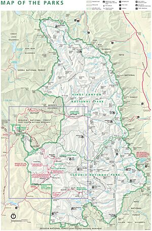
Kings Canyon National Park is on the western side of the Sierra Nevada mountains. It is east of the San Joaquin Valley. The park has two main parts. The smaller, older western part is around Grant Grove. This area has many sequoia trees and most of the visitor facilities. The larger eastern part is mostly wilderness. It has the deep canyons of the Middle and South Forks of the Kings River.
Cedar Grove is at the bottom of Kings Canyon. It is the only part of the eastern section you can reach by road (via Highway 180). Most of the park is covered in forests. But much of the eastern part is high alpine land above the tree line. This high country is usually only free of snow from late June to late October. You can only reach it by walking or riding horses.
The Sequoia-Kings Canyon Wilderness covers over 768,000 acres (310,800 hectares). This is almost 90 percent of Kings Canyon and Sequoia National Parks combined. Besides Sequoia National Park to the south, Kings Canyon is surrounded by other national forests and wilderness areas. These include the Sierra National Forest, Sequoia National Forest, and Inyo National Forest. The John Muir Wilderness is around the northern half of the park. The Monarch Wilderness is between the park's two sections.
Mountains and Valleys of Kings Canyon
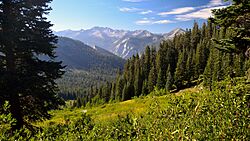
Kings Canyon has some of the steepest changes in elevation in North America. Many peaks along the park's eastern border are over 14,000 feet (4,300 meters) high. The valley floor at Cedar Grove is much lower, at 4,500 feet (1,400 meters). This is only about 10 miles (16 km) to the west. The Sierra Crest forms the park's eastern boundary. It runs from Mount Goethe in the north to Junction Peak in the south. Several high passes, like Bishop Pass and Kearsarge Pass, cross this crest. All these passes are above 11,000 feet (3,400 meters).
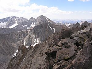
There are several mountain ranges within the park. The Palisades are along the eastern border. They have four peaks over 14,000 feet (4,300 meters). This includes North Palisade, the highest point in the park at 14,248 feet (4,343 meters). The Great Western Divide runs through the south-central part of the park. It also has many peaks over 13,000 feet (4,000 meters), like Mount Brewer. The Monarch Divide is between the lower Middle and South Forks of the Kings River. It has some of the hardest-to-reach areas in the park. In the northwest, there are other steep ranges like the Goddard Divide. These areas have many high mountain lakes and deep canyons.
Most of the mountains and canyons are made of hard rocks like granite. These rocks formed over 100 million years ago. But the Sierra Nevada mountains themselves are young, only about 10 million years old. Huge forces deep in the Earth caused the land to tilt and rise. This created the mountains' gentle slope to the west and the steep drop to the east. Many cave systems, like Boyden Cave, are also found in the rock layers.
How Glaciers Shaped the Land
The high country's shape was mostly created by glaciers during the Ice Ages. These ice ages happened over the last 2.5 million years. Huge valley glaciers moved down the South and Middle Forks of the Kings River. They carved out the deep, U-shaped valleys you see at Cedar Grove and Paradise Valley. Tehipite Valley on the Middle Fork was also shaped this way. The glaciers did not reach the very end of the canyons. So, the parts of the canyons further downstream are V-shaped, like typical river gorges.
These glacial valleys have flat floors and tall granite cliffs. These cliffs can be thousands of feet high. They look a lot like the famous Yosemite Valley to the north. In the 1800s, John Muir even used the term "yosemite" to describe these valleys. In an article from 1891, Muir wrote about Kings Canyon:
In the vast Sierra wilderness far to the southward of the famous Yosemite Valley, there is a yet grander valley of the same kind. It is situated on the south fork of the Kings River, above the most extensive groves and forests of the giant sequoia, and beneath the shadows of the highest mountains in the range, where the cañons are deepest and the snow-laden peaks are crowded most closely together. It is called the Big King's River Cañon, or King's River Yosemite ... The stupendous rocks of purplish gray granite that form the walls are from 2500 to 5000 feet in height, while the depth of the valley is considerably more than a mile.
The bottom of the valley ... is diversified with flowery meadows and groves and open sunny flats, through the midst of which the crystal river, ever changing, ever beautiful, makes its way; now gliding softly with scarce a ripple over beds of brown pebbles, now rustling and leaping in wild exultation across avalanche rock-dams or terminal moraines ... From this long, flowery, forested, well-watered park the walls rise abruptly in plain precipices or richly sculptured masses partly separated by side cañons baring wonderful wealth and variety of architectural forms.
From the brink of the walls on either side the ground still rises in a series of ice-carved ridges and basins, superbly forested and adorned with many small lakes and meadows where deer and bear find grateful homes; while from the head of the valley other mountains rise beyond in glorious array, every one of them shining with rock crystals and snow, and with a network of streams that sing their way down from lake to lake through a labyrinth of ice-burnished cañons.
Another important glacial feature is Tehipite Dome. It is the largest granite dome in the Sierra. It rises 3,500 feet (1,100 meters) above Tehipite Valley. In Kings Canyon, these steep granite cliffs can have sudden rockfalls. This is due to rock peeling and frost weathering (water freezing and expanding in cracks). Over thousands of years, these rockfalls have created large piles of broken rock called talus slopes at the base of the valleys.
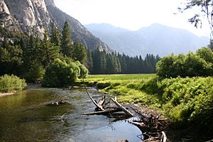
Zumwalt Meadow is one of the few flat areas in the park. It formed when dirt and rocks built up behind a terminal moraine. A moraine is a ridge of debris left by a retreating glacier. In Kings Canyon, there are four such moraines. The Kings River flows over them, creating whitewater rapids. This happens in an area where the river usually flows calmly through meadows. These "nested moraines" were made by glaciers of different lengths during different ice ages.
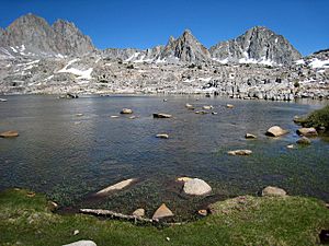
In the high country, the landscape is mostly bare rock and talus. It has hanging valleys, waterfalls, jagged ridges (arêtes), bowl-shaped hollows (cirques), and hundreds of alpine lakes (tarns). Some of the highest peaks still have permanent snowfields and even glaciers. Palisade Glacier, the largest in the Sierra, is near the park's edge. These glaciers are not from the Ice Ages. They likely formed during cold periods in the last 1,000 years. The park's glaciers are now melting quickly because of rising temperatures. They might disappear completely in a few decades.
Rivers and Waterways
Many major Sierra rivers start in the park. The South Fork Kings River begins near Taboose Pass. It drains much of the park's southern half. This river carved the canyon that gives the park its name. The Middle Fork Kings River starts near Mount Powell. It drains most of the park's northern half. A smaller part in the park's northern tip is drained by the South Fork of the San Joaquin River. The Kings River drops over 13,000 feet (4,000 meters) from the Sierra crest to Pine Flat Reservoir. This is the longest undammed drop of any North American river.
Most of the park's borders follow watershed divides. These are ridges that separate river basins. The eastern border follows the Sierra Crest. To the east, the Owens River drains into the Great Basin. The southern border with Sequoia National Park separates the Kings, Kaweah, and Kern Rivers. Part of the western border follows the divide between the Middle and North Forks of the Kings River.
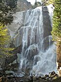
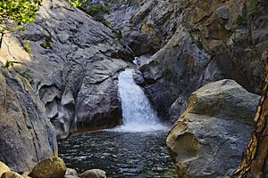
The forks of the Kings River meet a few miles outside the park's western boundary. Here, they form the main Kings River. This river creates one of the deepest canyons in North America. Its walls rise as much as 8,200 feet (2,500 meters) from the river to the rim. This is about half a mile (0.8 km) deeper than the Grand Canyon. The canyons upstream at Cedar Grove are also over 5,000 feet (1,500 meters) deep. Kings Canyon does not have waterfalls as tall as those in Yosemite. But it has several strong, shorter waterfalls. These include Mist Falls, Roaring River Falls, and Grizzly Falls near Cedar Grove. The backcountry has some much higher falls. Silver Spray Falls in Tehipite Valley drops about 700 feet (210 meters) in several steps. In 1910, Ernestine Winchell described the falls and Tehipite Valley:
... We paused a moment at the colossal doorway where Tehipite, shimmering through spaces of summer sunshine, in peaceful grandeur compelled our reverential gaze ... Across the river and below the dome Crown Creek races in sparkling cascades to grind a score of horrible pot-holes big enough to swallow a horse and rider; leaves that ferocious task to foam lightly down a cliff as Silver Spray Fall, whirls lazily at its foot, and then hurries to join King's River in its journey to the desert.
Both the Kings and San Joaquin Rivers flow west into the dry San Joaquin Valley. The San Joaquin eventually flows into San Francisco Bay. But the Kings River ends in the terminal sink of Tulare Lake. Before its water was used for farming, Tulare Lake was one of the largest freshwater lakes in the western United States. The park's rivers rise and fall with the seasons. Heavy snowfall usually happens from November to April. Then, the snow melts quickly in May and June. River flow drops a lot by late July. By autumn, rivers are usually just a trickle. Snow in the higher areas of Kings Canyon National Park can be very deep. It often totals hundreds of inches. But the amount of snow changes a lot between wet and dry years.
Climate and Weather
Kings Canyon National Park has a Mediterranean climate. This means it has warm, dry summers and mild, wet winters. The lowest parts of the park have hot summers. Higher up, the summers are warm. The average lowest temperature in Cedar Grove is about 12.3°F (-10.9°C).
| Climate data for Grant Grove, California, 1991–2020 normals, extremes 1940–present | |||||||||||||
|---|---|---|---|---|---|---|---|---|---|---|---|---|---|
| Month | Jan | Feb | Mar | Apr | May | Jun | Jul | Aug | Sep | Oct | Nov | Dec | Year |
| Mean daily maximum °F (°C) | 46.2 (7.9) |
46.0 (7.8) |
48.3 (9.1) |
51.8 (11.0) |
59.8 (15.4) |
70.7 (21.5) |
78.8 (26.0) |
78.5 (25.8) |
72.7 (22.6) |
62.6 (17.0) |
52.5 (11.4) |
45.5 (7.5) |
59.5 (15.3) |
| Daily mean °F (°C) | 35.9 (2.2) |
35.5 (1.9) |
37.8 (3.2) |
41.0 (5.0) |
48.7 (9.3) |
58.2 (14.6) |
65.6 (18.7) |
65.4 (18.6) |
60.1 (15.6) |
50.7 (10.4) |
42.2 (5.7) |
35.4 (1.9) |
48.0 (8.9) |
| Mean daily minimum °F (°C) | 25.7 (−3.5) |
25.0 (−3.9) |
27.2 (−2.7) |
30.2 (−1.0) |
37.6 (3.1) |
45.7 (7.6) |
52.5 (11.4) |
52.3 (11.3) |
47.4 (8.6) |
38.8 (3.8) |
31.9 (−0.1) |
25.4 (−3.7) |
36.6 (2.6) |
| Average precipitation inches (mm) | 8.03 (204) |
7.33 (186) |
7.81 (198) |
3.58 (91) |
1.37 (35) |
0.53 (13) |
0.27 (6.9) |
0.16 (4.1) |
0.32 (8.1) |
2.37 (60) |
3.26 (83) |
6.63 (168) |
41.66 (1,057.1) |
| Source: NOAA | |||||||||||||
Plants and Animals of Kings Canyon
Over 1,200 types of plants grow in Kings Canyon and Sequoia Parks. This is about 20 percent of all plant species in California. In 1976, UNESCO named Kings Canyon part of the Sequoia-Kings Canyon Biosphere Reserve. Because the park has a wide range of elevations, it has several main plant communities. At lower elevations, the park has dry Sierra foothill areas. These areas mostly have chaparral, which are brush and shrubs. Oaks, sycamores, and willows often grow along streams at lower elevations.
In the middle elevations, most of the park has montane mixed-conifer forests. These include ponderosa pine, incense cedar, white fir, and sugar pine. There are also scattered groves of giant sequoias in places like Cedar Grove. In Kings Canyon, which runs east to west, the north wall is hotter and drier. It gets more sunlight. The south wall is cooler and shadier. It has more trees. Higher up, near the subalpine zone, you find more red fir and lodgepole pine. Whitebark pine, mountain hemlock, and foxtail pine grow near the tree line. Sequoia and Kings Canyon National Parks share over 202,430 acres (81,920 hectares) of old-growth forests.
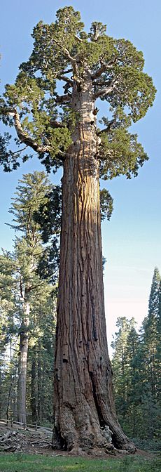
Sequoia National Park is more famous for its giant sequoias. But Kings Canyon also has large groups of these trees. This includes the General Grant tree, the second largest tree on Earth. It is in the middle of General Grant Grove. The Redwood Mountain Grove, a bit south, is the largest living sequoia grove in the world. It covers over 2,500 acres (1,000 hectares). It also has the tallest known sequoia, at 311 feet (95 meters). The Converse Basin Grove, just outside the park, was once twice as big. But it was almost completely cut down in the late 1800s. Many sequoia groves destroyed by logging, like the Big Stump Grove, are starting to grow back. This will take many hundreds of years.
The forests are home to many mammals. These include mule deer, Sierra Nevada bighorn sheep, mountain lions, and black bears. There are also many types of birds and reptiles. The Park Service is working to bring back the bighorn sheep. They are an endangered animal in this area. In 2014, some bighorns were released into the Sequoia-Kings Canyon area. Grizzly bears used to live in the park. But they were hunted until they disappeared by the early 1900s. The Kings River is also known for its wild trout. It is called "one of the finest large trout fisheries in the state."
In the high alpine country, plants are mostly meadows, herbs, and shrubs. There are also some groups of foxtail pine and small, twisted whitebark pine trees. Trees often grow in krummholtz formations. This means their branches stay close to the ground. Talus slopes are home to small mammals like pikas and yellow-bellied marmots. Birds like gray-crowned rosy finches and American pipits live here. Sensitive amphibians, like mountain yellow-legged frogs and Yosemite toads, eat insects near alpine lakes. Larger animals like bears may go into the alpine zone to find food. But they do not stay there for winter.
Human Impact and Park Management
Most of the park is now wilderness. But human activities have changed the environment since Native American times. Native Americans used to set controlled burns. This cleared areas for hunting and helped certain plants grow. In the early 1900s, a ""complete fire suppression" policy" was used. This led to a lot of dead plants and wood building up in the forests. By the 1960s, it was clear this was harming the sequoias. Sequoia bark is fire resistant. But the trees need regular fires to clear out competing plants like white firs. In 1963, scientists purposely set fire to part of the Redwood Mountain Grove. This was the first fire in any of the park's sequoia groves in 75 years. Thousands of new sequoia seedlings grew. This success led to the park's first planned burn program in 1972.
In the late 1800s and early 1900s, summer livestock grazing caused a lot of damage. Especially sheep grazing in areas like Tehipite Valley. Ranchers brought their herds up into the Sierra Nevada to escape the dry heat of the San Joaquin Valley. Thousands of hooves trampled meadows. This led to more erosion and damaged water sources. Grizzly bears and wolves hunted livestock. So, they were shot, trapped, and poisoned. They disappeared from the Sierra by the early 1900s.
The Sierra Forest Reserve was created in 1893. It included what would become Kings Canyon and Sequoia National Parks. But as many as half a million sheep were still grazed there illegally. In 1917, the government started to stop illegal grazing. They set up a system to manage and restore the land. Sheep were banned from Kings Canyon completely after the park was created in 1940. Livestock grazing is still allowed in some national forest lands around the park. Sometimes, hikers might see gated drift fences in the wilderness. These are to control where livestock move. Visitors must close all gates behind them. This stops livestock from going into protected areas.
The number of deer greatly increased in the early 1900s. This was because natural predators were gone and park visitors fed them. This led to too much grazing. The plants under the trees were almost gone in large areas. When the park grew in 1940, the Park Service started shooting deer. This was to reduce the herd size. This culling helped reduce deer numbers to a healthier level. But some people did not like this method. Today, only pack horses and mules are allowed in the park. They are only allowed in certain areas along major trails. They are usually not allowed early in the season. This protects meadows when they are wet and soft.
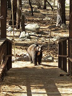
The park still has a healthy population of black bears. They are usually not aggressive towards people. But they do try to steal human food. The Park Service has put bear lockers in campgrounds. They also require people to use bear canisters for food. They try to move bears away from busy areas. This has worked well in the backcountry. Bears there have mostly stopped linking backpackers with food. But it is still a problem near developed campgrounds. Visitors should store all food and scented items in lockers. They should also put trash in bearproof garbage cans. Sometimes, rangers still have to kill "problem bears" that get used to human food.
Human History of Kings Canyon
Early Peoples of the Canyon
People have lived in the Kings Canyon National Park area for about 6,000–7,000 years. The Owens Valley Paiutes visited the region. Their homeland was east of the Sierra Nevada, near Mono Lake. The Paiutes mainly ate acorns. They also hunted deer and other small animals. They created trade routes that connected the Owens Valley with the Central Valley. The Yokuts lived in the Central Valley. They also went into the mountains in summer to gather plants, hunt, and trade. They did not build permanent villages in the high country because of the harsh winters. Before Europeans arrived, there were about 15,000 to 20,000 Yokuts. There were about 6,000 Monos.
Around the 1500s AD, some Eastern Mono people moved across the Sierra Nevada. They settled in the Central Valley. They lived near Yokuts territory in the Sierra foothills near the Kings River. This group became known as the Monaches, or Western Mono. They eventually split into six different groups. One group lived near Grant Grove. The native population suffered greatly when Americans expanded in the 1800s. A smallpox outbreak killed most of the Monache in 1862. Very few remain in the area today.
First Explorers and Loggers
Early Spanish explorers in California mostly missed what is now Kings Canyon National Park. In 1805, Gabriel Moraga led an expedition through the Central Valley. He crossed what is now the Kings River. He named it Rio de los Santo Reyes (River of the Holy Kings). Fur trappers visited the area in the 1820s. But they likely did not go into the high country. This is because beavers were only found at lower elevations. Gold prospectors followed them during the California Gold Rush, which began in 1848. However, not much gold or other minerals were found here. Hale Tharp, a gold miner, is credited with finding Giant Forest in Sequoia National Park in 1858. This led to more exploration and the discovery of other sequoia forests, including Grant Grove.
In the 1860s, a road was built to Grant Grove. Many sequoia trees there were cut down. The first sawmill opened in 1862. Logging grew and almost completely destroyed Converse Basin. This was once one of the largest sequoia groves in the world. But the Boole tree, the grove's biggest, was saved. The General Grant tree was found by Joseph H. Thomas, a sawmill operator, in 1862. Thomas's business partners, the Gamlin brothers, owned the land around Grant Grove. Their home, built around 1872, is now a historic site.
In the 1870s, a government survey showed how special General Grant Grove was. Israel Gamlin was convinced to give up his land claim so the area could be saved. But this did not completely stop logging. In 1875, a 300-foot (91-meter) sequoia was cut down. A section was sent to the Philadelphia Centennial Exposition of 1876. People in the East reportedly "refused to accept the exhibit as part of a single tree and called it the 'California Hoax'." The Centennial Stump and most of the tree are still important features in Grant Grove. "Ladies from a nearby logging camp used to hold Sunday school services for their children on the stump."
Wilderness Exploration

The first non-native people to go into the Kings Canyon backcountry were likely John C. Fremont's group in 1844. They tried to cross the Sierra Nevada using the Kings River. But a snowstorm stopped them, and they had to go back to the Central Valley. In 1858, the J.H. Johnson group successfully crossed the Sierra. They used the route Fremont had tried to find, through Kearsarge Pass at the far eastern end of Kings Canyon.
The first scientific trip to the area was the 1864 Whitney Survey. It was done by the Geological Survey of California and led by William Brewer. After failing to reach the top of Mount Whitney, Brewer's group went down into Kings Canyon. They used Native American paths. They noticed it looked like Yosemite and were amazed by the tall cliffs. Even though the rough land made travel hard, they found a way up the north wall of the canyon. They named several important features, like Mount King, Mount Gardiner, the Palisades, and Mount Brewer. From the top of the peak named after him, Brewer described the view:
Such a landscape! A hundred peaks in sight over thirteen thousand feet—many very sharp—deep canyons, cliffs in every direction almost rival Yosemite, sharp ridges inaccessible to man, on which human foot has never trod—all combined to produce a view of sublimity of which is rarely equaled, one which few are privileged to behold.
Brewer's group left Kings Canyon through Kearsarge Pass. There, they met a group of prospectors led by Thomas Keough. Not much is known about the Keough expedition. But the miners had been looking for gold on the North Fork of the Kings River. They were returning home to the Owens Valley. This means they must have crossed the Middle Fork. At the time, white settlers thought this area was impossible to reach. This makes them the first non-natives to do so. Around 1869, a sheep herder named Frank Dusy found and named the Middle Fork's Tehipite Valley. He later grazed his sheep there. Besides these occasional uses, most of the high country was rarely visited and explored.
Creating the Park
Kings Canyon did not get public attention until John Muir visited in 1873. Muir loved how similar the canyon was to Yosemite Valley. This supported his idea that massive glaciers carved the valleys during the last ice age. This was different from Josiah Whitney's popular idea that earthquakes formed the mountain valleys. Muir's writings about the park's geology and its amazing sequoia groves led to calls for the area to be protected. Muir himself continued to work for this cause. In 1880, the federal government stopped logging claims in the Grant Grove area. This was largely due to the efforts of Colonel George W. Stewart.
In March 1890, a bill (H.R. 8350) was introduced to Congress. It suggested creating Yosemite National Park. Later, another bill (H.R. 12187) replaced it. This new bill also included plans for a General Grant National Park and to make Sequoia National Park bigger. How this bill came about is still a mystery. But local politicians who wanted to save the park were likely involved. Daniel K. Zumwalt, an agent for the Southern Pacific Railroad, may have seen the park as a way to push their logging competitors out of business. On October 1, 1890, President Benjamin Harrison signed the bill into law. This created General Grant National Park, the fourth national park in the United States. Today, it is part of the smaller western section of Kings Canyon National Park.
For many years, the main way for tourists to reach General Grant National Park was the Stephens Grade. This was a rough wagon road. A stagecoach ran on it from Visalia starting in the early 1900s. At first, the U.S. Army had to send troops to protect the park from illegal grazing and hunting. These problems eventually stopped. But the growing number of visitors created new issues with sanitation and waste. In the summer of 1907, about 1,100 people visited the park. A new road reached General Grant National Park by 1913. That summer, almost 2,800 tourists visited. In 1914, the park was handed over from military to civilian control. The National Park Service was officially created in 1916.
Later History and Park Growth
The new Kings Canyon administration struggled to manage the huge park at first. It was more than 700 times the size of the original Grant Grove unit. In the early years, staff and knowledge were often borrowed from Sequoia National Park. In 1943, the management of Kings Canyon and Sequoia National Parks was combined. This was to save money during World War II. After the war, this arrangement continued. Today, the two parks are still managed as one. After the war, park visits increased greatly. From just over 82,000 in 1945, it jumped to 450,000 in 1951. There was more demand for tourist facilities at Cedar Grove. This valley was not officially part of the park. It had been left out because of water development interests. Extending the road through the valley was debated because of possible harm to the environment. By 1947, the Park Service had a plan for tourist lodges, shops, and a pack station.
Then, in 1948, Los Angeles again applied to build dams in Kings Canyon. The Kings River Conservation District (KRCD) also filed claims for the same sites. KRCD did not plan to build dams. They just wanted to stop Los Angeles from possibly taking their water supply. The Federal Power Commission rejected Los Angeles' application. But the city kept refiling until 1963. Then, both the California State Water Board and the federal government denied it.
One reason the project failed was that the Cedar Grove dam site was outside the park. But the project needed two more dams to be built upstream to be worth the cost. Those sites were now inside the park boundary from 1940. On August 6, 1965, Cedar Grove and Tehipite Valley were finally added to the park. This made them permanently safe from new dams. These additions (except for a tiny part in 1984) made Kings Canyon National Park its current size.
Starting in the 1950s, more people visited national parks. The Park Service started Mission 66. This plan suggested large new visitor facilities for Kings Canyon and other parks. This included new visitor centers at Grant Grove and Cedar Grove. It also planned for electricity, sewage systems, and more lodging, trails, and parking.
The Cedar Grove development was delayed by the dam issue. In 1972, the Park Service released a new plan. It included cabins for 260 people and a large store and cafeteria. They hoped to develop the area like Yosemite Valley. In 1974, the park had 1,216,800 visitors. This number has not been beaten since. But by 1975, public meetings showed strong opposition to so much development. In the end, only a small lodge and store were added to the canyon.
More visitors to the backcountry also created problems. These included litter, illegal campfires, and contact with dangerous animals like bears. In 1966 and 1971, the Park Service suggested making most of the park a wilderness. This would put much stricter rules on its use. In 1973, the number of backpackers was limited for the first time. This was done with a quota system. Finally, on September 28, 1984, Congress made over 85 percent of Kings Canyon and Sequoia National Parks into wilderness. In 1987, the Middle and South Forks of the Kings River were named Wild and Scenic.
Fun Things to Do in Kings Canyon
| Annual visitation | ||
|---|---|---|
| Year | Pop. | ±% |
| 1910 | 1,178 | — |
| 1920 | 19,661 | +1569.0% |
| 1930 | 43,547 | +121.5% |
| 1940 | 201,545 | +362.8% |
| 1950 | 337,840 | +67.6% |
| 1960 | 759,800 | +124.9% |
| 1970 | 1,019,000 | +34.1% |
| 1974* | 1,216,800 | +19.4% |
| 1980 | 819,065 | −32.7% |
| 1990 | 1,062,867 | +29.8% |
| 2000 | 528,987 | −50.2% |
| 2010 | 598,205 | +13.1% |
| 2016 | 607,479 | +1.6% |
| Source: *Note: Year of record visitation. | ||
Grant Grove is the only car entrance to the park. It is 60 miles (97 km) east of Fresno via Highway 180. You can also get there from Sequoia National Park in the south using Highway 198, the Generals Highway. These roads meet in Grant Grove Village. From there, Highway 180 continues 35 miles (56 km) northeast to Cedar Grove. You cannot drive into the park from Highway 395 on the eastern side. There is no public transportation to Kings Canyon National Park right now.
The National Park Service has visitor centers at Grant Grove and Cedar Grove. Grant Grove Village is the most developed part of the park. It has the 36-room John Muir Lodge (the park's biggest hotel), cabins, a restaurant, and a general store. Cedar Grove also has a small market. But its facilities are much more limited. The Grant Grove section is open all year, unless there is extreme weather. Cedar Grove is closed in winter. Highway 180 is only plowed as far as Princess Meadow in winter.
Kings Canyon gets fewer visitors than Sequoia and Yosemite National Parks. This is because it has limited road access. From 1970 to 1990, it had almost a million visitors per year. But in the 21st century, it has averaged about 560,000. In 2016, it saw an increase to 607,479 visitors. Since records began in 1904, about 53 million people have visited Kings Canyon.
Camping and Day Hikes
In Grant Grove, there are three main campgrounds: Azalea, Crystal Springs, and Sunset. They have 319 sites in total. Except for Sunset, they are first-come, first-served. Cedar Grove has 314 sites in Sentinel, Sheep Creek, and Moraine Campgrounds. These are also first-come, first-served. Sites at the Canyon View group camp must be reserved. During busy times, more campsites might be put on a reservation system. All campgrounds have flush toilets and showers. But water use might be limited depending on the season.
There are many day hikes in the parts of Kings Canyon National Park that you can reach by road. In the Grant Grove area, a one-mile (1.6 km) trail leads to the General Grant Tree. Several longer trails go to nearby places like Redwood Mountain, the largest sequoia grove. In Cedar Grove, easy hikes include the boardwalk path through Zumwalt Meadow. This offers wide views of Kings Canyon. There is also a short walk to Roaring River Falls. Many longer day hikes are available, like an 8-mile (13 km) round trip to Mist Falls. Or a 13-mile (21 km) round trip climb to Lookout Peak above Kings Canyon.
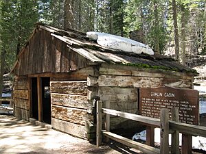
Several historical sites in the park are easy to reach by short walks. These include Gamlin Cabin, built around 1872 by the Gamlin brothers. They had a timber claim at Grant Grove before it became a national park. It is thought to be the first permanent building in the park area. Knapp Cabin, listed on the National Register of Historic Places, is the oldest building still standing in Cedar Grove. It dates back to 1925. Another interesting place is the Boyden Cave system. Its entrance is just outside the park's western boundary. As of 2016, the cave was closed due to damage from the Rough Fire.
Backcountry Adventures
Since most of Kings Canyon is wilderness, and roads only go a short way into the park, backpacking (and sometimes horsepacking) is the only way to see most of it. If you plan to stay overnight, you need a wilderness permit. You can get this from a ranger station or visitor center. During the busiest season (May to September), there is a limit on permits. 75 percent are for reservations, and the rest are for walk-ins. You still need a permit outside this time, but there is no limit. Even though backpackers are a small part of visitors, some backcountry trails are still very busy. Because some backcountry camps are popular, stays might be limited to one or two nights. In the summer, the Park Service has rangers at backcountry stations like Rae Lakes.
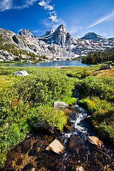
Road's End at Cedar Grove is a main starting point for backcountry trips. The Rae Lakes Loop, 41.4 miles (66.6 km) long, is one of the most popular backpacking trips. It goes through the deep canyons of Paradise Valley, over the high Woods Creek suspension bridge, and through open alpine country. It then reaches Rae Lakes, a chain of lakes formed by glaciers. These lakes are below 13,000-foot (4,000-meter) peaks. Hikers on the Rae Lakes Loop also climb over Glen Pass. From the top of the pass, you can see views of Rae Lakes and the area around it. The combined Pacific Crest Trail/John Muir Trail is the main part of the trail system. It winds about 77 miles (124 km) from Piute Canyon in the north to Forester Pass, 13,153 feet (4,009 meters) high, in the south. Many hikes in Kings Canyon, including Rae Lakes, use parts of the PCT/JMT. There are also trailheads at Grant Grove. These lead to easier hikes in the lower western Sierra Nevada, many in the Jennie Lakes Wilderness (just outside the national park).
Many parts of the park, like the Middle Fork of the Kings River, are harder to reach. They need multi-day hikes over tough land. Simpson Meadow on the Middle Fork is a 23-mile (37 km) one-way hike from Cedar Grove. It has over 12,000 feet (3,700 meters) of elevation change. Other trailheads outside the park let you reach more isolated places. One is Tehipite Valley, a 14-mile (23 km) one-way hike from the Wishon Dam trailhead. The 3,000-foot (910-meter) exposed and unmaintained climb down into the valley is known as one of the park's hardest hikes. Several trails also go into the park from the Owens Valley to the east. All of them cross passes over 11,000 feet (3,400 meters) high. The closest and most used eastern approach is via Onion Valley Road. This road ends about a mile (1.6 km) east of the park boundary. The Kearsarge Pass Trail starts at Onion Valley Campground. It connects to the PCT/JMT through the pass.
In spring and early summer, crossing rivers can be dangerous. The Park Service has built bridges along some major trails to help. By late August or September, rivers are usually at safe levels. The high country is typically snow-free between May and November. But in very wet years, large areas of snow might stay until July. In winter, cross-country skiing and snowshoeing are popular. The Park Service offers ranger-led snowshoe walks. They also maintain some groomed trails in the Grant Grove area. Longer trips into the backcountry are also possible. But this is only for skilled winter travelers. This is because of the rough land, deep snows, and lack of rangers in winter. Just like backpacking, you need wilderness permits for any overnight winter trips.
Climbing and Canyoneering
The large, exposed granite cliffs and domes in Kings Canyon are great for rock climbing. But many of these places need long or winding hikes to reach them. This stops many climbers. Some climbing spots include The Obelisk, which overlooks Kings Canyon. There are also multipitch climbs at Charlito Dome and Charlotte Dome. These are well up the Bubbs Creek Trail. Tehipite Dome needs a nearly 30-mile (48 km) roundtrip hike just to get to it. Many of the park's tall peaks also need technical climbing. This includes North Palisade, the highest point in the park. In The High Sierra: Peaks, Passes, Trails (2009), North Palisade is called "the classic peak of the High Sierra ... It is striking from a distance and has routes that will challenge climbers of all abilities and preferences."
Canyoneering, bouldering, bushwhacking, and rappelling are often needed to explore parts of the backcountry without trails. A very challenging route is down Enchanted Gorge. Here, Disappearing Creek goes under huge piles of rock. It then comes out several miles downstream, which is how it got its name. Nearby Goddard Canyon is an easier route, but still rugged. It is known for its scenic meadows and many waterfalls. The Gorge of Despair above Tehipite Valley is known for its cliffs, waterfalls, and deep pools. Its 3,000-foot (910-meter) descent needs rappelling gear and wetsuits. The park is very large. It has no cell service and limited search and rescue teams. So, only experienced cross-country travelers should try to hike off trail.
Water Sports and Fishing
In Cedar Grove, about 10 miles (16 km) of the South Fork are good for fly fishing. The Park Service stopped stocking the river with trout in the 1970s. They wanted the fish to return to natural conditions. Rainbow, brown, and brook trout are found in different parts of the river. But only rainbow trout are native to the Sierra Nevada. The others were put there by fishermen in the early 1900s. The river is usually low and warm enough for wading by early autumn. To protect the natural fish, only catch and release is allowed for rainbow trout. Visitors 16 years or older need a California state fishing license. The rainbow trout in the Kings River are small, usually no more than 8 to 9 inches (20 to 23 cm).
To protect the river habitat, the slow-flowing South Fork is closed to boating in Cedar Grove. This is between Bubbs Creek and the park's western boundary. However, swimming is allowed in some parts of the river. Muir Rock and the Red Bridge are popular swimming spots. The park has many alpine lakes at high elevations. But most are too hard to reach for boating or swimming. Nearby Hume Lake is in the Sequoia National Forest. It is between the two sections of the park. It is used for boating, swimming, and fishing.
Most of the park's other rivers are very steep and fast. They are only good for advanced kayaking. The Kings River above Pine Flat Reservoir is used for commercial whitewater rafting. The starting point is near the park's western boundary. But most of the trip is in the national forest. Most rivers inside the park cannot be reached by road. The Middle Fork is one of the hardest whitewater runs to reach in California. Boats and gear must be carried for miles through the backcountry to get to it. Canoe Kayak magazine calls the Middle Fork run "the very definition of epic." Kayakers take about five days to go down the Class V Middle Fork. They start at its 12,000-foot (3,700-meter) headwaters and end at 900 feet (270 meters) at Pine Flat Reservoir.
See also
 In Spanish: Parque nacional Cañón de los Reyes para niños
 | Selma Burke |
 | Pauline Powell Burns |
 | Frederick J. Brown |
 | Robert Blackburn |


