Kaweah River facts for kids
Quick facts for kids Kaweah River |
|
|---|---|
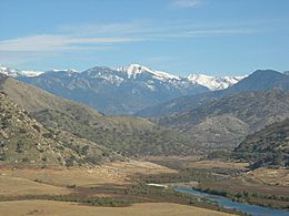
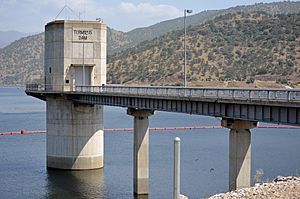
The Kaweah River above Terminus Dam
|
|
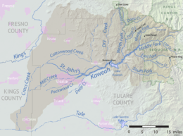
Map of the Kaweah River watershed
|
|
| Country | United States |
| State | California |
| County | Tulare County |
| Physical characteristics | |
| Main source | Confluence of Middle Fork and Marble Fork Sequoia National Park, Sierra Nevada 2,012 ft (613 m) 36°30′53″N 118°48′7″W / 36.51472°N 118.80194°W |
| River mouth | San Joaquin Valley Near Visalia 357 ft (109 m) 36°20′12″N 119°13′23″W / 36.33667°N 119.22306°W |
| Length | 33.6 mi (54.1 km) |
| Basin features | |
| Basin size | 1,523 sq mi (3,940 km2) |
The Kaweah River is a river in California, United States. It flows through Tulare County. The river gets most of its water from melting snow high up in the Sierra Nevada mountains.
The Kaweah River starts as four different streams in Sequoia National Park. This area is famous for its beautiful mountain views and huge giant sequoia trees. These are the biggest trees on Earth! The river then flows southwest into Lake Kaweah. This is the only large reservoir (a human-made lake) on the river.
After the lake, the Kaweah River reaches the San Joaquin Valley. Here, it splits into many smaller channels across a flat, fertile area near Visalia. The river drops a lot in height very quickly. Its highest starting point is almost 13,000 feet (4,000 m) above sea level. This makes it one of the steepest rivers in the United States. The main part of the Kaweah River is only 33.6 miles (54.1 km) long. But if you count all its starting streams and lower branches, it's almost 100 miles (160 km) long!
The lower part of the river and its many smaller streams, like the St. John's River and Mill Creek, form the Kaweah Delta. This is a very good area for farming, covering over 300,000 acres (120,000 ha). Long ago, before people used its water for irrigation (watering crops), the river flowed into Tulare Lake. This lake is now dry. It was once a large lake with no outlet to the ocean. The Kern, Tule, and Kings rivers also fed into it.
The name "Kaweah" comes from a native Yokutsan word. It might mean "crow cry." The Yokuts and Western Mono were the main Native American groups living near the Kaweah River. Spanish explorers visited the area in the early 1800s. After the 1850s, American settlers started cutting down many trees. The upper parts of the river became part of Sequoia National Park in 1890.
Contents
River's Journey: Where the Kaweah Flows
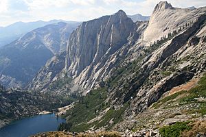
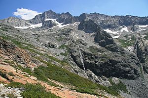
The Kaweah River starts in the Great Western Divide. This is a mountain range with peaks as high as 13,000 feet (4,000 m). It's located in the middle of Sequoia National Park. This mountain range separates the Kaweah River's area from the Kern River's area to the east.
The Middle Fork is one of the main starting streams. It flows southwest from where Lone Pine Creek and Hamilton Creek meet. These creeks start from lakes high up, around 12,000 feet (3,700 m). The Marble Fork begins in a high, flat area called the Tableland. It drops 1,200 feet (370 m) over a cliff, forming Tokopah Falls. Then it flows west past Lodgepole Village and turns south. These two forks meet in a deep gorge below Moro Rock. This is where the main Kaweah River officially begins.
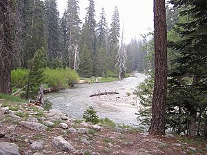
The Kaweah River flows southwest, with Highway 198 running next to it. Just outside Sequoia National Park, the East Fork joins the river from the left. The East Fork starts high up in the Mineral King valley. The river then flows past the town of Three Rivers. Here, the North Fork joins it. The North Fork starts near the Grant Grove area of Kings Canyon National Park.
The South Fork joins the river from the left before it enters Lake Kaweah. This lake is formed by Terminus Dam in the Sierra Nevada foothills. Terminus Dam is a 255-foot (78 m) tall earth dam. Its main job is to control floods. It also provides water for farming and makes electricity.
Below the dam, the Kaweah River flows past Lemon Cove. It then receives Dry Creek (also called Lime Kiln Creek) from the right. Finally, it flows into the San Joaquin Valley. Here, it splits into several major distributaries (smaller channels that branch off).
At McKay Point Dam, the St. John's River branches off to the northwest. It makes a big loop around Visalia. The main Kaweah River channel continues southwest through farmland. Outside Creek and Deep Creek also split off to the south. Then the Kaweah itself divides into Mill Creek and Packwood Creek. Mill Creek flows west through Visalia. Packwood Creek goes south of the city and ends in a small flood control area. Mill Creek eventually joins Cross Creek, which flows south to the old Tulare Lake bed. This area is near Corcoran. The Kaweah Delta region covers about 340,000 acres (140,000 ha) in Tulare and Kings Counties. The main cities here are Visalia and Tulare.
The main part of the Kaweah River is 33.6 miles (54.1 km) long. This is from where the Middle and Marble Forks meet to where Mill and Packwood Creeks split. But if you include all its branches, the river system is much longer. For example, Mill Creek flows west for 25.1 miles (40.4 km). If you add the Middle Fork (about 15 miles (24 km) long) and Cross Creek below Mill Creek (21.7 miles (34.9 km)), some water in the Kaweah system travels 95 miles (153 km)!
Most of the Kaweah River's water comes from the mountains above Visalia. This area covers 658 square miles (1,700 km2). If you include all the land drained by its many branches down to the Tulare Lake bed, the Kaweah River area covers 1,523 square miles (3,940 km2). The river gets the most water in May and June, when snow melts. In winter, it's usually just a trickle. But heavy rainstorms can cause floods. Most of the water is used for farming and to refill underground water supplies. Water rarely flows all the way downstream to the old Tulare Lake bed, except in very wet years.
Nature and Wildlife Along the Kaweah River
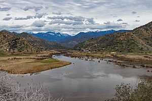
The Kaweah River drops a lot from the Sierra Nevada mountains to the San Joaquin Valley. Because of this, it goes through many different climate and plant zones in a short distance. In the past, the lower Kaweah flowed into huge wetlands around Tulare Lake. These wetlands would flood every season. Today, almost all of them have been drained for farming.
The foothill area has mostly grasslands and open fields. California oak woodlands grow along the Kaweah River and its streams. Further upstream and higher up, the area is mostly mixed forest with pines and firs. The biggest groups of giant sequoias grow here. They only grow on the western side of the Sierra Nevada mountains. They are usually found at about 6,600 feet (2,000 m) elevation.
The Kaweah area includes Giant Forest. This is the most visited sequoia grove. It's located between the Middle and Marble Forks. It has the General Sherman Tree, which is the largest tree in the world by how much wood it contains. Redwood Mountain Grove, the biggest sequoia grove in the world (3,100 acres (1,300 ha)), is also in the Kaweah area. There are 21 other sequoia groves here too. A small part of the Kaweah basin is high, rocky mountain land. These treeless areas with lakes are mostly along the Great Western Divide.
Today, mule deer are the largest wild animals in the valley and foothill areas. Long ago, large groups of tule elk lived here. But their habitat in the Kaweah Delta is almost gone due to farming. There are many types of foxes, wildcats, squirrels, and rabbits. This includes the special San Joaquin kit fox and San Joaquin antelope squirrel. California grizzly bears and beavers used to be common. But they were hunted or trapped until they disappeared by the early 1900s.
The mountain areas still have black bears, mule deer, and bighorn sheep. The Kaweah River above Three Rivers has native rainbow trout. It also has brown trout and bass that were brought there by people. In the high mountain areas above the trees, small mammals like marmots and pika are common.
History of the Kaweah River Area
The Kaweah River area was first home to the Yokuts people. They lived in the Central Valley. About 3,000 years ago, a group called the Wukchumni had permanent homes along the river. Most Native American settlements were in the foothills of the Kaweah River, where Three Rivers and Lake Kaweah are today. The Wukchumni hunted and gathered plants in the summers along the East Fork. They also traded with the Paiute people from the Great Basin. Around 700 to 500 years ago, the Western Mono also came to live in the region.
Oak trees grew a lot along the streams at lower elevations. Their acorns were a main food source. People used them to make cakes and bread. Native Americans ground acorns into a mush using holes in the local granite rocks as mortars. Winter homes in the foothills were pit houses. They were covered with tules (a type of marsh plant) and could be up to 31 feet (9.4 m) wide. Hospital Rock, a flat area next to the Middle Fork, was used as a camp as early as the 1300s AD.
Spanish explorers came to the Kaweah River area in the early 1800s. It's not clear who first explored the Kaweah Delta. It might have been the Gabriel Moraga group in 1806. The Spanish sent several trips into the area to bring Native Americans into their mission system. Father Pedro Muñoz thought the Kaweah would be a good place for a mission. But no missions were built there because it was too far from the coast and hard to defend. Later, Native American resistance led to many military raids. Many natives died from these raids or from European diseases.
After California became a U.S. state, the California Gold Rush brought some gold seekers to the Kaweah in the 1850s. But not much gold was found. During this time, the Kaweah was often called the "River Francis." Hale Tharp, an early settler, found the Giant Forest in 1858 with help from Native American guides. In 1861, Tharp returned and used a hollowed-out fallen sequoia log as a cabin. In 1873, a silver boom in Mineral King brought thousands of people to the high mountain valley along the East Fork. Mining slowed down by 1882. After silver mining ended, Mineral King became a popular summer vacation spot.
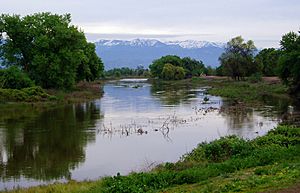
The timber industry (cutting down trees) was very successful in the Kaweah area. Many logging camps appeared in the forests, including in the sequoia groves. The Kaweah Colony was a community founded in 1886. It was located along the Kaweah River in what is now Sequoia National Park. Giant sequoia wood is usually too soft for building. But many sequoias were cut down between the 1860s and 1880s. The U.S. government started protecting timber areas in 1890. This was due to pressure from conservationists like John Muir. Logging mostly stopped after Sequoia National Park was created in 1890.
The Kaweah Delta was one of the first places in the San Joaquin Valley to be settled and farmed by U.S. settlers. But before Terminus Dam was built, the whole area often flooded. The Great Flood of 1862 even changed the river's path. Farming began in the Kaweah Delta around 1864. People dug canals to bring water to farms. The people of Visalia hired Native Americans to extend a canal from Mill Creek. This canal powered the town's flour mill. It wasn't until after the Wright Act of 1887 that farming grew a lot. This act allowed the creation of the Tulare Irrigation District. It started building a network of canals across the Kaweah Delta.
By the early 1900s, Tulare Lake had disappeared. By the 1930s, farming had grown so much that there wasn't enough local water. In the 1960s, Disney wanted to build a ski resort in Mineral King. This would have been a huge development. Environmentalists fought against the plan for many years. In 1978, the National Parks and Recreation Act made the area part of Sequoia National Park.
How the River Has Been Changed
To make the Kaweah Delta good for farming and cities, the many small channels and marshes had to be drained. As early as the 1870s, local irrigation companies were digging out creeks and blocking off side channels. This was to send floodwater away from farms. A big project in the early 1900s was making Mill Creek straighter, deeper, and wider. This creek runs through Visalia and used to cause big floods. Dams were built in the 1920s and 1930s to control water flow. Today, the Kaweah Delta looks very different from how it used to. Most streams have either disappeared or been changed into straight channels. Tulare Lake is now a dry basin that only floods very rarely.
The Kaweah Delta Water Conservation District manages water distribution. It sends water to farms and cities over a 340,000-acre (140,000 ha) area. The main crops grown are cotton, fruits, nuts, and other field crops. Besides river water, the district also uses water from the Central Valley Project. This water comes from the San Joaquin River through the Friant-Kern Canal. This adds to the water supply for users in the Kaweah Delta.
Underground water (called groundwater) is another important source. The local underground water supply has been used too much for many decades. About 40,000 acre-feet (49,000,000 m3) more water is pumped out each year than is refilled. To help refill the underground water, more than 40 special basins have been built. These basins cover 5,000 acres (2,000 ha). They allow floodwaters to soak into the ground.
Making electricity from water (called hydroelectric power) started on the Kaweah River in 1899. The Mount Whitney Power Company built a power plant on the East Fork. By 1913, they had built three power plants. These plants brought electricity to Visalia for the first time. Farmers also used the power to pump underground water. Later, Southern California Edison took over the system. Today, it has six dams, three powerhouses, and many miles of water channels.
Terminus Dam was built in 1962 by the U.S. Army Corps of Engineers. Its goal was to help stop the Kaweah Delta from flooding. Before the dam, the river could have very high flows during winter storms. In December 1955, it reached a maximum of 80,700 cubic feet per second (2,290 m3/s). But the main river channel can only hold 5,500 cubic feet per second (160 m3/s). Four years after the dam was built, it prevented $19.6 million in damage during a storm in 1966. However, the lake behind the dam, Lake Kaweah, was too small for the biggest floods. This changed in 2004 when a project added six huge fuse gates to the dam. These are the largest of their kind in the world. The reservoir can now safely hold 185,600 acre-feet (228,900,000 m3) of water. This is a 30 percent increase from its original size.
Fun Activities on the Kaweah River
All the branches of the Kaweah River are in Sequoia National Park. More than 1.2 million people visit the park each year. The river is a big attraction for boating and fishing. But it can be "extremely dangerous" during high water in spring and summer. Several companies offer Class IV rafting trips on the Kaweah River. These trips are between the Pumpkin Hollow bridge and Lake Kaweah. Experienced kayakers often go to the Class V Middle Fork at Hospital Rock, further upstream. The North Fork is a wilder trip, where boaters have to carry all their gear. The river flows freely above Lake Kaweah. So, the rafting season depends on the natural snowmelt, usually from April to July.
It can be hard to access the Kaweah River for fishing, swimming, and playing in the water near Three Rivers. This is because most of the riverbanks are on private land. In Sequoia National Park, the river flows at the bottom of a deep canyon, making it hard to reach. The river just above Lake Kaweah is open to the public at the Slick Rock Recreation Area. However, this spot is often underwater in summer when Lake Kaweah is full. Slick Rock, also known as "Boulder Beach," has areas for rock climbing and old Native American rock mortars. Lake Kaweah itself offers fishing from the shore and calm water for boating. The upper South Fork in Sequoia National Park has good fishing for wild rainbow trout. But you need to hike a long way to get there. Visitors older than 16 need a California fishing license in the park.
The upper Kaweah area also has many hiking trails. You can take day hikes along the Marble Fork to the 1,200-foot (370 m) Tokopah Falls. The Mineral King area along the East Fork also has several short trails. Backpacking is popular on the High Sierra Trail. This trail goes from Giant Forest through the Middle Fork canyon. It crosses the Great Western Divide at Kaweah Gap on its way to the John Muir Trail and Mount Whitney. The Bearpaw Meadow High Sierra Camp is located along the High Sierra Trail near the start of the Middle Fork.
 | Jackie Robinson |
 | Jack Johnson |
 | Althea Gibson |
 | Arthur Ashe |
 | Muhammad Ali |


