Mineral King facts for kids
Quick facts for kids Mineral King Valley |
|
|---|---|
 |
|
| Length | 7 miles (11 km) |
| Width | 1 mile (2 km) |
| Geography | |
| Location | Sequoia National Park, Sierra Nevada, Tulare County, California, North of Porterville, |
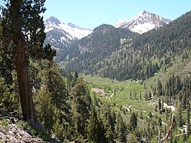
Mineral King is a beautiful valley found in the southern part of Sequoia National Park in California. It's a special place high up in the mountains, formed long ago by glaciers. The valley is where the East Fork of the Kaweah River begins. This river flows through the valley and then heads northwest.
You can reach Mineral King by a long, winding road. It's a very popular spot for people who love to hike and explore the outdoors.
Long ago, the Yokuts tribe used to live in the valley during the summer. They came here to escape the heat of the Central Valley. They would hunt animals and gather plants. They also met with other tribes from the eastern side of the Sierra Nevada mountains to trade goods.
In the 1870s, people found silver in the mountains above Mineral King. A road was built in 1873 to help miners get there. This road was made better over many years.
Later, in 1966, Walt Disney Productions wanted to build a big ski resort here. But many people, especially a group called the Sierra Club, fought against it. They wanted to protect the valley's natural beauty. Because of this strong opposition, the ski resort was never built. In 1978, Mineral King became part of Sequoia National Park.
The name Mineral King also refers to the old mining camps and towns nearby. These include places like Silver City and Cabin Cove. All these old settlements together are called the Mineral King Road Cultural Landscape. This area was added to the National Register of Historic Places in 2003 because of its important history.
Contents
Exploring Mineral King Valley
Mineral King is a valley about 7.5-mile-long (12.1 km) and 1-mile-wide (1.6 km). The valley floor is about 7,400 feet (2,300 m) high. The tall granite mountains around it reach over 11,000 feet (3,400 m). Mineral King is located about 20 miles (32 km) southeast of Three Rivers.
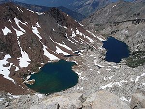
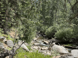
The valley floor has wide, open meadows. A narrow strip of trees and bushes grows along the East Fork Kaweah River. As you move from the flat meadows to the rocky slopes, you'll see many conifer trees like pines. These trees climb the slopes up to the tree line, where it gets too cold for them to grow. Above the tree line, there are very steep granite cliffs. These cliffs form mountains like Sawtooth Peak, Empire Mountain, and Mineral Peak.
There are two main mountain passes that lead out of Mineral King. Timber Gap goes towards the Middle Fork Kaweah River. Farewell Gap, at the very end of the valley, leads to the Kern River area.
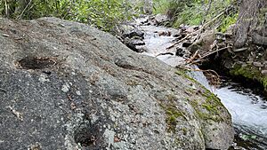
Many creeks flow down the steep valley walls, forming long waterfalls. These creeks are fed by melting snow, springs, and many lakes high up in the granite bowls. Some of these waterfalls include Tufa Falls, Crystal Creek Falls, and Franklin Falls. Lakes in this area include the Mosquito Lakes, Eagle Lake, the Franklin Lakes, and the Crystal Lakes. The East Fork Kaweah River then drops over Mineral King Falls and East Fork Falls. It continues down a steep, narrow canyon, following the Mineral King Road.
Mineral King has some of the oldest communities in the High Sierra mountains. Many families have owned cabins here for many generations. Some of these communities started during the silver mining boom in the 1870s and people have lived there ever since.
A Look Back at Mineral King's Past
Long ago, Native American groups like the Wikchúmni Yokuts and the Tübatulabal used Mineral King. They set up summer camps to hunt and gather food. Their main villages were in the larger valley nearby, where Lake Kaweah is now. They also traded with the Paiute people, who lived east of the Sierra Nevada mountains.
The first European explorer known to visit Mineral King was Harry "Parole" O'Farrell in 1862. He was a hunter for a trail-building crew. O'Farrell and a Paiute friend found the valley by crossing Farewell Gap from the south. He later came back to look for minerals and built a summer camp.
The Silver Rush and Road Building
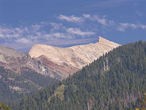
In the 1870s and 1880s, people found valuable metals in White Chief Canyon and on Empire Mountain. This led to the growth of a mining town called Beulah. Silver was first found in Mineral King Valley in 1872.
After silver was discovered, the Mineral King Wagon and Toll Road Company was started in December 1873. Their goal was to build a wagon road. The first road followed the south side of the East Fork Canyon. Before this, only rough paths led to Mineral King. More silver was found in 1878, bringing more miners to the area. A second Mineral King Road was built in 1879, following a different path on the north side of the canyon. This new route became much of the present-day Mineral King Road.
The Mineral King Road goes through two groves of giant sequoia trees: the Redwood Creek Grove and the Atwell Grove. In 1890, these groves became part of the new Sequoia National Park. Mineral King itself was not included in the park at first. The Mineral King entrance was the most used way into the park until 1903.
A man named Tom Fowler bought the Empire Mine, which was the biggest mine in the area. He started the Empire Gold and Silver Mining Company. The lowest part of the road was rebuilt in 1915 to its current path. Over time, people realized that it was too expensive to get the minerals out of the ground. So, not much mining ever happened. But the valley kept its hopeful name: Mineral King.
By the 1920s, Mineral King became a popular place for recreation. Many mining buildings were destroyed by landslides after the 1906 San Francisco earthquake. Mineral King was used as a summer camping area. Private cabins were built here until 1942, making the communities of Cabin Cove, Silver City, and Beulah grow. In 1926, the United States Congress made Mineral King a Sequoia Game Refuge, protecting its wildlife.
Disney's Ski Resort Idea and Park Addition
In the 1960s, Walt Disney Productions planned to build a huge ski resort called "Disney's Mineral King Ski Resort." Walt Disney was interested in skiing and thought Mineral King would be a perfect spot. Many skiers believed it could be the biggest resort in California. Disney's plan was chosen over others because it was the largest. Disney also worked with famous ski coach Willy Schaeffler to design the resort.
At first, the Sierra Club supported the idea. But Disney's plans grew much bigger. They wanted to build 14 ski lifts, hotels, and huge parking lots. The final plan included 27 ski lifts and facilities for two million visitors each year! That's when the Sierra Club said no to the project.
The ski resort was never built. Many environmental groups, led by the Sierra Club, worried about the damage it would do to nature. After many years of legal battles, the Mineral King Valley became part of Sequoia National Park in 1978. This law stopped any plans to build a ski resort there.
Wildlife in Mineral King
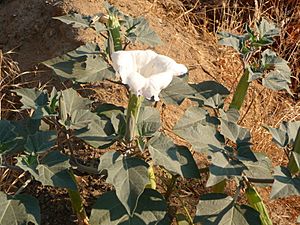
The upper part of Mineral King is mostly wild and untouched. The lower part has some buildings. Many animals live in the valley, including black bears, mule deer, and yellow-bellied marmots. Sometimes, you might even see mountain lions. The East Fork of the Kaweah River is a small, fast-flowing stream. It is home to many different birds and insects. Mining activities long ago harmed the river's environment below the Empire mine. But the wildlife has slowly come back.
Fun Things to Do in Mineral King
You can get to the Mineral King Valley by a long, winding mountain road. It's about 25 miles (40 km) from Highway 198 near Three Rivers. At the end of the road is the Mosquito-Eagle Trailhead. From here, hikers can start trails that lead out of the valley. There are also hiking trails that go north through Timber Gap.
Mineral King has two campgrounds in Sequoia National Park: Atwell Mill Campground and Cold Springs Campground. They have a total of 61 campsites for tents.
There are no stores or services in Mineral King Valley. Visitors must bring their own food, camping gear, firewood, and other important supplies. The cabins in the area do not have electricity. Most use propane for lights, cooking, and heat. There are a few public telephones, but cell phones usually don't work because the area is so remote.
Remember, there is no gas available after you leave Highway 198. The drive on Mineral King road takes about 90 minutes. The National Park Service charges fees to use the campsites. Bears, marmots, and other wild animals live here, so campers must protect their food and vehicles. The Park Service posts signs with safety tips at the campgrounds. You are not allowed to camp anywhere along the road except in the official campgrounds.
Protecting Mineral King's Heritage
The Mineral King road area was added to the National Register of Historic Places on October 24, 2003. Several important groups of vacation homes are protected along Mineral King Road.
About a mile before the main Mineral King cabins, there's a group of about 30 cabins called Faculty Flat. Most of these cabins were built in the 1920s. Many are listed on the National Register of Historic Places. The name Faculty Flat comes from a group of teachers from Los Angeles who first lived there.
The Cabin Cove settlement has seven cabins, and six of them are historic buildings. West Mineral King grew around a place called Barton's Camp. It has 35 cabins, all still in their original spots and considered historic. East Mineral King, also known as the Beulah Tract, was built near Crowley's Hotel. There are 24 cabins in East Mineral King.
The cabins are usually simple wooden buildings with metal roofs. Besides the cabins, the Atwell Mill ranger residence is also preserved. It shows the National Park Service rustic style of building. The Lookout Point entrance station and residence were built in the Mission Revival style. Several water troughs along the road, used to cool overheated car radiators, are also historic structures.
Two groups are dedicated to preserving Mineral King:
- The Mineral King District Association: This group focuses on getting Mineral King recognized as a living historic community.
- The Mineral King Preservation Society: This is a non-profit group that works to protect the natural and historic parts of Mineral King. Since 1986, they have done research, restored old buildings, and planned for preservation. They also work with Sequoia National Park on volunteer projects and educational activities.
Images for kids
 | Laphonza Butler |
 | Daisy Bates |
 | Elizabeth Piper Ensley |


