Sawtooth Peak facts for kids
Quick facts for kids Sawtooth Peak |
|
|---|---|

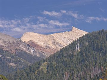
Sawtooth Peak's west face over the Mineral King Valley, September 2005
|
|
| Highest point | |
| Elevation | 12,348 ft (3,764 m) NAVD 88 |
| Prominence | 663 ft (202 m) |
| Parent peak | Needham Mountain |
| Listing | Sierra Peaks Section |
| Geography | |
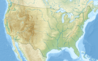
| Location | Sequoia National Park, Tulare County, California, U.S. |
| Topo map | USGS Mineral King |
| Geology | |
| Mountain type | Granite |
| Climbing | |
| First ascent | 1871 Joseph Lovelace |
| Easiest route | Scramble, class 2 |
Sawtooth Peak is a tall, jagged mountain located in Sequoia National Park in California. It stands at a height of about 12,343 feet (3,762 meters). This impressive peak is a famous landmark in the Mineral King area of the Sierra Nevada mountain range. Long ago, people knew it as Miner's Peak.
Exploring Sawtooth Peak
Sawtooth Peak is a popular spot for hikers and climbers who love adventure in the mountains.
Hiking Adventures
If you want to hike up Sawtooth Peak, your journey begins in a place called Mineral King. This spot is about 23 miles (37 kilometers) from Highway 198, along Mineral King Road. The hiking path starts at the very end of Mineral King Road, where there is a parking area.
The full hike to the peak and back is about 11.5 miles (18.5 kilometers) long. It is considered a difficult hike because of how much the trail climbs. The last half-mile of the trail is especially tricky, with loose rocks and steep turns called switchbacks. The starting point of the trail is at 7,800 feet (2,377 meters) above sea level, and it climbs all the way up to 12,400 feet (3,780 meters) at the top of the pass.
The best time to go hiking here is usually from May to October, when the weather is good. If you plan to stay overnight in the wilderness, you will need to get a special permit.
Climbing to the Top
The easiest way to climb Sawtooth Peak is by going through Sawtooth Pass first. From there, you can climb up the northwest side of the peak. The very first person to climb Sawtooth Peak was Joseph Lovelace in 1871, during a deer hunt.
Today, climbers follow a clear trail to Sawtooth Pass. After the pass, they continue off the main trail to reach the peak. The part of the trail from Monarch Lakes to Sawtooth Pass is very steep and has a lot of loose granite sand, which can make it slippery. The main starting point for this climb is in the Mineral King Valley, about half a mile (0.8 kilometers) uphill from the Ranger Station. This route starts at about 7,500 feet (2,286 meters) and reaches the peak at 12,343 feet (3,762 meters).
 | William M. Jackson |
 | Juan E. Gilbert |
 | Neil deGrasse Tyson |


