San Joaquin Valley facts for kids
Quick facts for kids San Joaquin Valley |
|
|---|---|
| Valle de San Joaquín (Spanish) | |
San Joaquin Valley
|
|
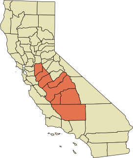
A map of the counties encompassing the San Joaquin Valley ecoregion
|
|
| Geography | |
| Location | California, United States |
| Population centers | Stockton, Tulare, Porterville, Modesto, Turlock, Merced, Fresno, Visalia, Bakersfield, Clovis, Hanford, Madera, Tracy, Lodi, Manteca and Ceres. |
| Borders on | Sierra Nevada (east), Sacramento–San Joaquin River Delta (north), Coast Range, San Francisco Bay (west), Tehachapi Mountains (south) |
| Traversed by | Interstate 5, State Route 99 |
| Rivers | San Joaquin River |
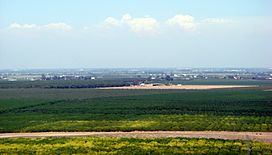
The San Joaquin Valley (pronounced SAN wah-KEEN) is the southern part of California's Central Valley. It is often called a "breadbasket" because it grows so much food. This valley produces a huge amount of California's farm products.
The valley covers parts of eight counties in Northern California and one in Southern California. These include all of San Joaquin and Kings counties. It also covers most of Stanislaus, Merced, and Fresno counties. Parts of Madera and Tulare counties are also in the valley. A large part of Kern County in Southern California is also included. Even though the valley is mostly farmland, it has three big cities. These are Stockton/Modesto, Fresno/Visalia, and Bakersfield.
Contents
Exploring the Valley's Geography
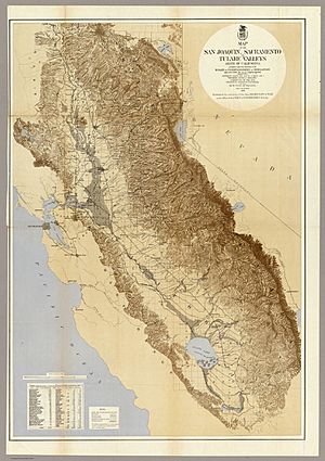
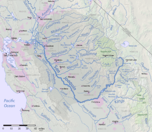
The San Joaquin Valley is the southern half of California's Central Valley. It stretches from the Sacramento–San Joaquin River Delta in the north. To the south, it reaches the Tehachapi Mountains. On the west, it's bordered by the California coastal ranges. These include the Diablo and Temblor mountains. To the east, you'll find the Sierra Nevada mountains.
The valley has two large river systems, one in the north and one in the south. The northern part is called the San Joaquin Basin. This area is drained by the San Joaquin River and its smaller rivers. These rivers flow northwest into the Sacramento–San Joaquin River Delta. Eventually, this water reaches the Pacific Ocean. The southern part is larger and is called the Tulare Basin. This basin used to have a big lake called Tulare Lake. Rivers like the Tule River, Kings River, and Kern River fed this lake. However, much of this water is now used for farming. This means the lower parts of these rivers are often dry.
How the San Joaquin Valley Formed
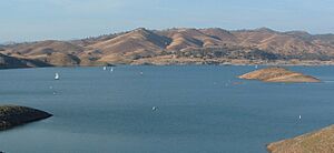
The San Joaquin Valley started forming about 66 million years ago. For a long time, ocean water covered different parts of the valley. This happened because sea levels changed a lot. About 5 million years ago, the ocean outlets began to close. This was due to mountains rising and sediment building up in the valley.
Starting 2 million years ago, the valley often became a freshwater lake. This happened during periods of cold weather called glacial episodes. Lake Corcoran was the last huge lake to fill the valley. This was about 700,000 years ago. More recently, in the late 1800s and 1900s, farming used up much of the river water. This caused big lakes like Tulare Lake and Kern Lake to dry up. Today, only small parts of Buena Vista Lake remain.
Understanding the Valley's Climate
The San Joaquin Valley has very hot, dry summers. Its winters are mild and often have thick tule fog. The rainy season usually runs from November to April. Since the early 2010s, the valley has been in a very bad megadrought. This drought affects both people and wildlife. Farmland has been hit especially hard.
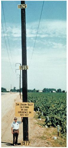
In 2015, experts said that groundwater levels were at record lows. This was due to increased pumping of water from underground. Some parts of the valley have even sunk because of this. Land near Corcoran sank 13 inches in 8 months. This sinking can damage wells, roads, and flood control systems. In the long run, taking too much groundwater could permanently reduce the valley's water storage.
The National Weather Service has an office in Hanford. They provide weather forecasts and climate information for the valley.
Early People and Settlements
The San Joaquin Valley was originally home to the Yokuts and Miwok peoples. The first European to visit the valley was Pedro Fages in 1772.
The Tejon Indian Tribe of California is a recognized tribe of Kitanemuk, Yokuts, and Chumash people. Their traditional lands were in the southern San Joaquin Valley. Today, they live in Kern County, California, near Wasco and Bakersfield, California.
Other recognized tribes in the valley include the Picayune Rancheria of Chukchansi Indians of California. They are a Yokuts tribe located in Madera County. The Santa Rosa Rancheria belongs to the Tachi Yokuts tribe. It is located near Lemoore, California. Recent droughts have made water security a big challenge for these communities.
Who Lives in the San Joaquin Valley?
In 2011-2015, the San Joaquin Valley had over 4 million people. About 50% of the people were Hispanic or Latino. About 35% were Non-Hispanic White. Other groups included Asian, Black or African American, and American Indian. Most adults in the valley (72.7%) have finished high school.
Poverty and Health Access
Some counties in the San Joaquin Valley have high rates of poverty. In 2006, six valley counties had the highest poverty rates in California. They were also among the highest in the United States. The average household income in the valley was $46,713. About 23.7% of individuals lived below the poverty line. Some researchers have compared the valley's economic situation to the Appalachia region.
Access to healthcare can be a problem in the valley. For example, many pregnant people in Merced County did not get early prenatal care. This is important for the health of mothers and babies. The valley also has fewer doctors per person compared to the rest of California. This means it can be harder to see a doctor. The University of California, Merced is working to open a medical school. They hope this will help more doctors settle in the valley.
Diverse Cultures and Communities
The San Joaquin Valley is home to many different cultural groups.
Latino and Mexican Communities
Today, Latino and Mexican people make up a large part of the valley's population. For many years, most farmworkers in the area have been of Mexican background. In the 1960s and 1970s, there were tensions between Mexican-Americans and the valley's large farm owners. César Chávez led the United Farm Workers in many strikes. They called for boycotts of table grapes. This movement gained a lot of support across the United States.
European Groups
The San Joaquin Valley has many European groups. For example, there are more Azorean Portuguese people here than in the Azores islands. Many groups live in specific cities. Assyrians are mostly in Turlock. Dutch people are in Ripon. Croats are in Delano. Kingsburg is known for its Swedish heritage. Other groups found across the valley include Portuguese, Germans, Armenians, and Basques. Many people also came from the Midwest and Southern United States. These are often called "Okies" and "Arkies".
Asian American Communities
The San Joaquin Valley has a large and varied Asian American population. Many people are from Punjab (India and Pakistan), the Philippines, Laos, and Cambodia.
Punjabi Sikh Americans have lived in the valley since the early 1900s. Punjabi is the third most spoken language here. The first Sikh temple (Gurdwara) was built in Stockton in 1915. After immigration rules changed in the 1960s, more people from India and Pakistan settled here.
The late 1970s and 1980s saw many immigrants from Southeast Asia. These include Hmong, Laotian, Cambodian, and Vietnamese people. Many settled in Stockton, Modesto, Merced, and Fresno. Fresno has the second-largest Hmong population in the U.S. Stockton has a large percentage of Cambodian Americans.
Filipino Americans are mainly found in Delano and Lathrop. Stockton also has a strong Filipino history.
African American History
Colonel Allensworth State Historic Park is a special place. It marks the only California town founded, paid for, and run by African Americans. This farming community started in 1908. It was created to help African Americans improve their lives. However, problems like a drop in the water supply led to the town's decline.
"Okies" and "Arkies" Migrations
Many people moved to the San Joaquin Valley during the Great Depression. These were migrants from the South and Midwest. They are well-known thanks to John Steinbeck's book The Grapes of Wrath. By 1910, farming in the southern Great Plains was becoming difficult. Many people left states like Kansas, Oklahoma, and Arkansas. Conditions worsened during the drought that created the Dust Bowl. Many farmers lost their land. They packed their belongings and drove west to California.
Many "Okies" and "Arkies" left the valley during World War II. They went to cities like Los Angeles and San Francisco to work in war factories. Those who stayed often moved to Bakersfield and Oildale. The southern San Joaquin Valley became important for oil production. Country music stars like Buck Owens and Merle Haggard came from Bakersfield. They created a unique "Bakersfield sound."
Economy and Industries
Farming in the Valley
The San Joaquin Valley produces 12.8% of California's farm products by value. It's called a "breadbasket" but focuses more on fruits, vegetables, and nuts than grain. Major crops include grapes (for wine, eating, and raisins), cotton, almonds, pistachios, citrus, and many vegetables. Other successful crops are walnuts, oranges, peaches, and garlic.
Some places are famous for specific crops. Stockton grows most of the asparagus eaten in the U.S. Fresno County is the biggest producer of raisins. Raising cattle and sheep is also very important. In recent years, dairy farming has grown a lot. Many dairy farmers have moved their herds to Kings, Tulare, and Kern counties.
Between 1990 and 2004, over 70,000 acres of farmland were lost to new buildings. A long drought since 2014 has changed farming here. Farmers now use smart irrigation systems and treated wastewater. Many have switched from growing cotton to almonds.
Oil and Gas Production
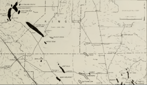
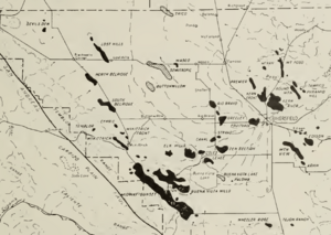
California is a major oil-producing state. The San Joaquin Valley is now the main oil production area. You can find oil wells all over the region. Huge oil fields, like the Midway-Sunset Oil Field, have many pumps. This field is the third largest in the United States.
A big oil refinery in Bakersfield was sold in 2005 and later shut down. In 2009, new oil and gas reserves were found in Kern County. The valley still has more oil reserves than any other part of California. Six fields in the San Joaquin Valley have over 100 million barrels of oil.
Other Major Jobs
Because the San Joaquin Valley is large and has a need for jobs, the state has built many prisons here. Some notable prisons are in Corcoran, Avenal, and Chowchilla.
The main military base in the area is Naval Air Station Lemoore. This is a large air base southwest of Hanford. Its importance has grown since the 1990s.
Recent Changes in the Valley
The California real estate boom in the late 1990s changed the valley a lot. The cost of living in coastal cities like Los Angeles and San Francisco became very high. This pushed young families and businesses to move further inland. Cities like Stockton, Modesto, and Tracy now have many people who commute to San Francisco and Silicon Valley.
Bakersfield has seen many former Los Angeles business owners move in. Big companies like Wal-Mart, IKEA, and Amazon have built huge distribution centers here. This is because of easy access to major highways and lower local wages. The valley is becoming more connected to the rest of California.
Getting Around the Valley
Roads for Travel
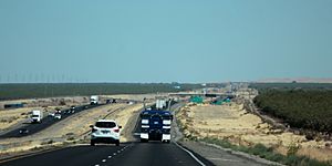
Interstate 5 (I-5) and State Route 99 (SR 99) run almost the entire length of the valley. I-5 is on the western side and bypasses the big cities. SR 99 goes through the major cities. Both highways meet at the southern end of the valley, heading towards Los Angeles. There are talks about making SR 99 an Interstate highway.
State Route 58 (SR 58) is a freeway in Bakersfield. It's a very important route for truckers. It helps them cross the Sierra Nevada mountains without going through Los Angeles traffic. There are plans to make this highway an extension of I-40. This would give Bakersfield an Interstate connection. Other important highways include State Route 46 and State Route 41. These link the valley to the California Central Coast. State Route 152 connects Silicon Valley to growing towns like Los Banos.
Airports in the Valley
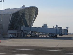
The busiest airport in the San Joaquin Valley is Fresno Yosemite International Airport. It has flights to major U.S. cities and Mexico. There are also three other airports: Meadows Field Airport near Bakersfield, Stockton Metropolitan Airport, and Merced Municipal Airport.
Train Travel
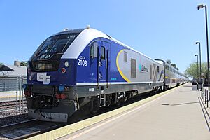
The San Joaquins train service carries passengers between Bakersfield and Stockton. Some trains go to Sacramento or Oakland. Amtrak trains do not go south of Bakersfield. This is because the Union Pacific Railroad does not allow passenger trains on the busy route over Tehachapi Pass. Passengers must take Amtrak Thruway buses instead.
The San Joaquin Valley is also where the California High-Speed Rail project will start. This high-speed train will run 171 miles from Bakersfield to Merced. Freight trains are operated by BNSF Railway, Union Pacific Railroad, and San Joaquin Valley Railroad.
Cities and Counties of the Valley
Cities with More Than 500,000 People
Cities with 100,000 to 500,000 People
Cities with 20,000 to 100,000 People
Cities with Fewer Than 20,000 People
The San Joaquin Valley in Pop Culture
The San Joaquin Valley has greatly influenced American music. This includes country, soul, nu metal, R&B, and hip hop music. The "Bakersfield Sound" in country music is famous. Many musicians have come from the valley. These include country singers like Buck Owens and Merle Haggard. Bands like Korn (nu metal) and groups like The Paradons (doo-wop) are also from here.
The valley is also home to many Indie Hip Hop labels and artists. These include Fashawn and Planet Asia. The valley also has a strong tradition of poetry. Famous poets like Gary Soto and former U.S. Poet Laureate Juan Felipe Herrera are from this area.
Images for kids
-
César Chávez at a United Farmworkers rally, 1974
See also
 In Spanish: Valle de San Joaquín para niños
 | Jessica Watkins |
 | Robert Henry Lawrence Jr. |
 | Mae Jemison |
 | Sian Proctor |
 | Guion Bluford |


