Taft, California facts for kids
Quick facts for kids
Taft, California
|
||
|---|---|---|
|
||
|
||
| Motto(s):
"Energized For The Future "
|
||
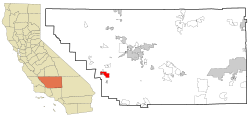
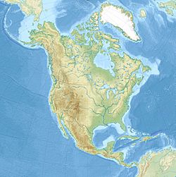
Location in Kern County and the state of California
|
||
| Country | ||
| State | ||
| County | Kern | |
| Incorporated | November 7, 1910 | |
| Named for | William Howard Taft | |
| Area | ||
| • Total | 15.26 sq mi (39.53 km2) | |
| • Land | 15.26 sq mi (39.53 km2) | |
| • Water | 0.00 sq mi (0.00 km2) 0% | |
| Elevation | 955 ft (291 m) | |
| Population
(2020)
|
||
| • Total | 8,546 | |
| • Density | 560.03/sq mi (216.19/km2) | |
| Time zone | UTC-8 (PST) | |
| • Summer (DST) | UTC-7 (PDT) | |
| ZIP code |
93268
|
|
| Area code | 661 | |
| FIPS code | 06-77574 | |
| GNIS feature IDs | 1661543, 2412026 | |
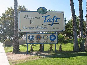
Taft is a city in California, located in the foothills of the San Joaquin Valley. It's in Kern County. The city is about 32 miles (51 km) west-southwest of Bakersfield, sitting at 955 feet (291 meters) above sea level. In 2010, about 9,327 people lived here. The city covers an area of 15.1 square miles (39.1 km²).
Taft was named in 1909 after William Howard Taft, who was the President of the United States at the time.
Contents
A Look Back in Time
The town started as "Siding Number Two" on the Sunset Railroad. Around 1900, local people wanted to name the train station "Moro." However, a railroad official said no because it sounded too much like "Morro Bay," a town on the coast. So, the railroad decided to call it "Moron." At that time, the word "moron" did not have the meaning of someone who isn't smart.
After a big fire destroyed much of the town, its name was changed to Taft. This was done to honor President William Howard Taft.
Taft and the Oil Industry
Taft is in a big area where petroleum (oil) and natural gas are produced in California. It's one of the few towns in the United States that exists mainly because of nearby oil. Oil was first found in this area in the late 1800s, near Maricopa, about 7 miles (11 km) south of Taft.
Many other oil and gas fields were found around Taft in the early and mid-1900s. These include the Midway field and the Sunset field, which are now known as the Midway-Sunset Oil Field. The town of Taft is built right between these two huge oil fields. The work done in these fields, along with the Elk Hills Oil Field north of Taft, has been the main source of income for the town for over 100 years.
The Midway-Sunset field is very large and has produced about 2.8 billion barrels of oil. To get this thick oil out of the ground, companies use a method called "steam injection." This process has been used since the 1960s and helps to recover much more oil.
Standard Oil, which later became Chevron, made Taft its main base for operations. At one point, it's said that up to 6,000 people in Taft worked for Standard Oil. This main hub was called "11-C Camp." It had everything needed to run a large oil company, including offices, workshops, and homes for employees. It even had a playground, baseball field, swimming pool, and a clubhouse. Over many years, this large complex slowly closed down.
Many other oil companies also worked in the area, like Shell, Texaco, and Exxon. Even though many company names have changed over time due to mergers, oil production has continued steadily.
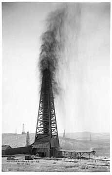
In the early days of oil drilling, before modern safety tools, oil wells would often "gush" out of control. The most famous one was the Lakeview Gusher. At its peak, it produced 100,000 barrels of oil every day! In total, the Lakeview No.1 well produced about 9 million barrels of oil. You can find the well and its historical marker along Petroleum Club road, south of town.
Recent History of Taft
Taft was also home to Gardner Army Airfield, a military airport used to train pilots during World War II. After the base closed, its old airstrip was used for secret drag races for many years.
The railroad that was built to move oil out and bring water in is no longer there. However, the oil industry is still very important to the area.
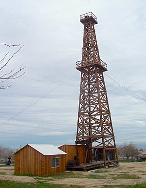
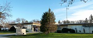
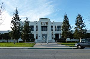
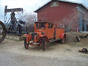
A private prison, Taft Correctional Institution, is located south of town. Taft also has a large, modern high school and Taft College, a community college. The West Kern Oil Museum has many items, including old pumps, trucks, and a historic wooden oil derrick. It also has photos and displays about local history. The town's newspaper, the Midway Driller, is published twice a week.
The city owns a 46-acre (19 ha) former railroad property in the center of town. Here, you can find the West Kern Oilworker's Monument. This is a 37-foot (11 m) tall bronze sculpture of human figures on an oil derrick. It was created by artist Benjamin Victor and paid for by donations. The city is using this area to bring in new businesses and homes.
Taft's Climate
Taft has a desert climate. This means it has long, hot, and dry summers, and short, cool, and wet winters. On average, only about 5.39 inches (137 mm) of rain falls each year, mostly in winter and spring. It usually doesn't rain from June to September.
The highest temperature ever recorded in Taft was 112°F (44°C) on July 11, 2008. The lowest was 24°F (-4°C) on December 23, 1998.
| Climate data for Taft, California (1994–2012 normals) | |||||||||||||
|---|---|---|---|---|---|---|---|---|---|---|---|---|---|
| Month | Jan | Feb | Mar | Apr | May | Jun | Jul | Aug | Sep | Oct | Nov | Dec | Year |
| Record high °F (°C) | 79 (26) |
84 (29) |
94 (34) |
97 (36) |
107 (42) |
108 (42) |
112 (44) |
111 (44) |
107 (42) |
100 (38) |
91 (33) |
80 (27) |
112 (44) |
| Mean daily maximum °F (°C) | 57.8 (14.3) |
62.2 (16.8) |
69.6 (20.9) |
75.2 (24.0) |
84.2 (29.0) |
91.8 (33.2) |
98.4 (36.9) |
97.3 (36.3) |
91.8 (33.2) |
79.6 (26.4) |
66.1 (18.9) |
58.4 (14.7) |
77.7 (25.4) |
| Mean daily minimum °F (°C) | 41.0 (5.0) |
44.0 (6.7) |
47.3 (8.5) |
49.7 (9.8) |
56.1 (13.4) |
60.5 (15.8) |
67.2 (19.6) |
65.0 (18.3) |
61.4 (16.3) |
53.9 (12.2) |
46.3 (7.9) |
40.9 (4.9) |
52.8 (11.6) |
| Record low °F (°C) | 26 (−3) |
28 (−2) |
29 (−2) |
30 (−1) |
40 (4) |
44 (7) |
42 (6) |
52 (11) |
45 (7) |
35 (2) |
26 (−3) |
24 (−4) |
24 (−4) |
| Average precipitation inches (mm) | 1.07 (27) |
1.29 (33) |
0.75 (19) |
.5 (13) |
.37 (9.4) |
.03 (0.76) |
0 (0) |
.01 (0.25) |
.06 (1.5) |
.28 (7.1) |
.38 (9.7) |
.65 (17) |
5.39 (137) |
| Average precipitation days (≥ 0.01 in) | 8 | 7 | 5 | 4 | 2 | 0 | 0 | 0 | 1 | 2 | 4 | 6 | 39 |
| Source: TAFT, CALIFORNIA: Period of Record General Climate Summary | |||||||||||||
People of Taft
| Historical population | |||
|---|---|---|---|
| Census | Pop. | %± | |
| 1920 | 3,317 | — | |
| 1930 | 3,442 | 3.8% | |
| 1940 | 3,205 | −6.9% | |
| 1950 | 3,707 | 15.7% | |
| 1960 | 3,822 | 3.1% | |
| 1970 | 4,285 | 12.1% | |
| 1980 | 5,316 | 24.1% | |
| 1990 | 5,902 | 11.0% | |
| 2000 | 6,400 | 8.4% | |
| 2010 | 9,327 | 45.7% | |
| 2019 (est.) | 9,272 | −0.6% | |
| U.S. Decennial Census | |||
Population in 2010
In 2010, Taft had a population of 9,327 people. About 68% of the people lived in regular homes. About 30% of the population was in institutions, like the prison.
Most people in Taft (79.2%) were White. About 11% were from other races, and 2.6% were from two or more races. People of Hispanic or Latino background made up about 35.9% of the population.
There were 2,254 households in Taft. About 40% of these households had children under 18 living there. The average household had 2.83 people.
The population was spread out by age. About 19.8% were under 18 years old. About 37.8% were between 25 and 44 years old. The average age in Taft was 34.9 years.
Population in 2000
In 2000, Taft had 6,400 people living in the city. There were 2,233 households. The average household size was 2.62 people.
About 83% of the people were White. About 10% were from other races. About 15.5% of the population was Hispanic or Latino.
The median income for a household in Taft was $33,861 per year. The median income for a family was $42,468. About 17.5% of the population lived below the poverty line.
Education in Taft
The Taft City School District runs several elementary and junior high schools:
- Jefferson Elementary School
- Parkview Elementary School
- Conley Elementary School
- Taft Primary School
- Roosevelt Elementary School
- Lincoln Junior High School
Taft Union High School is the local high school for older students.
Taft College is the community college, offering higher education.
Fun and Culture
In October 2010, Taft celebrated its 100th birthday!
Every five years in October, Taft holds a special birthday celebration called "Oildorado." This event honors Taft's history as an oil-producing town. It started in 1930 and became a regular event after World War II.
Oildorado is a week-long party with many activities:
- There are skill contests related to the oilfield, like welding and pipe fitting.
- A beauty pageant chooses an Oildorado Queen.
- There are talent shows, barbecues, street fairs, and parades.
- People often dress in cowboy boots and cowboy hats during the week.
It's also a tradition for all men to grow facial hair during Oildorado. If a man doesn't grow facial hair, he needs to buy a special permit and wear a "Smooth Puss Badge." If he's caught clean-shaven without his badge, a group called the "Posse" might "arrest" him. The Posse wears western clothes and carries toy pistols. They put the man in a jail truck called "The Hoosegow" and drive him around town for everyone to see!
The Posse patrols the streets and even has make-believe shootouts with the "Bandits." Other fun parts of Oildorado include wooden nickels, dinner theaters, classic car shows, and rodeos.
Places to Visit
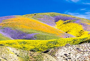
Taft is the closest town to the Carrizo Plain National Monument, which is about an hour west. This area is known for its beautiful "superblooms" of wildflowers in spring. Be aware that some roads to it are dirt and might be hard to drive on after heavy rains.
The Temblor Recreation Area is less than 3 miles (5 km) southwest of Taft. It's a great place for outdoor activities.
Getting Around Taft
Taft is located where California State Route 33 and California State Route 119 meet.
The City of Taft has its own bus service called Taft-Maricopa Area Transit. It serves Taft and Maricopa. Kern Transit also offers bus service between Taft and Bakersfield.
The Taft-Kern County Airport is on the east side of town. It's a popular spot for parachutists in the area.
Famous People From Taft
- Sam Andrew: An artist and a founding member and guitarist of the band Big Brother and the Holding Company.
- Bill Bagnall: An editor and publisher, and a member of the Motorcycle Hall of Fame.
- Jordan Belfort: A businessman who spent time at Taft Correctional Institution.
- Jeanne Cooper: An actress.
- Loren Cunningham: Co-founder of Youth With A Mission.
- Dennis Fimple: An actor.
- Leon Goldman: A surgeon from San Francisco.
- Ron Graham: A mathematician and juggler.
- Billy Nelson: An Olympian in track and field in 2008.
- Tracy Rogers: An NFL football player.
- Ryan Shuck: A guitarist.
- Benjamin Victor: A sculptor.
See also
 In Spanish: Taft (California) para niños
 | Jessica Watkins |
 | Robert Henry Lawrence Jr. |
 | Mae Jemison |
 | Sian Proctor |
 | Guion Bluford |


