Maricopa, California facts for kids
Quick facts for kids
City of Maricopa
|
|
|---|---|

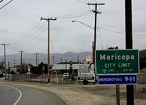
Northern city limit of Maricopa; the fire in the center is a gas flare from an active oil well
|
|

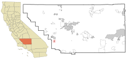
Location in Kern County and the state of California
|
|
| Country | |
| State | |
| County | Kern |
| Incorporated | July 25, 1911 |
| Named for | Exonym given to the Quechan by the Akimel O'odham |
| Area | |
| • Total | 1.50 sq mi (3.89 km2) |
| • Land | 1.50 sq mi (3.89 km2) |
| • Water | 0.00 sq mi (0.00 km2) 0% |
| Elevation | 883 ft (269 m) |
| Population
(2020)
|
|
| • Total | 1,026 |
| • Density | 684.0/sq mi (263.8/km2) |
| Time zone | UTC-8 (PST) |
| • Summer (DST) | UTC-7 (PDT) |
| ZIP code |
93252
|
| Area code | 661 |
| FIPS code | 06-45736 |
| GNIS feature IDs | 1652749, 2411033 |
Maricopa is a small city in Kern County, California. It is about 6.5 miles (10.5 km) southeast of Taft. The city sits at an elevation of 883 feet (269 meters) above sea level.
In 2010, about 1,154 people lived in Maricopa. This was a small increase from 1,111 people in 2000. Maricopa is near the Carrizo Plain and the huge Midway-Sunset Oil Field. This oil field is one of the largest in the United States.
Contents
Exploring Maricopa's Location
Maricopa is located in the very southwest part of the San Joaquin Valley. It sits on the first hills leading up to the Coast Ranges. The Temblor Range is to the northwest, following the San Andreas Fault. The San Emigdio Mountains are to the southeast.
Maricopa's Climate and Weather
The weather in Maricopa is hot and mostly dry. Summer temperatures often go above 100 degrees Fahrenheit (38 degrees Celsius). Winters can have freezing temperatures. There are usually about 275 days without frost each year. Maricopa gets about six inches (15 cm) of rain annually.
Maricopa's Past: A Brief History
The first post office in Maricopa opened in 1901. The city officially became a city in 1911. Maricopa was named after the Maricopa Indians.
Who Lives in Maricopa?
Maricopa has a small but growing population. Here's a look at how the number of people has changed over time.
| Historical population | |||
|---|---|---|---|
| Census | Pop. | %± | |
| 1920 | 1,121 | — | |
| 1930 | 1,071 | −4.5% | |
| 1940 | 670 | −37.4% | |
| 1950 | 800 | 19.4% | |
| 1960 | 648 | −19.0% | |
| 1970 | 740 | 14.2% | |
| 1980 | 946 | 27.8% | |
| 1990 | 1,193 | 26.1% | |
| 2000 | 1,111 | −6.9% | |
| 2010 | 1,154 | 3.9% | |
| 2019 (est.) | 1,192 | 3.3% | |
| U.S. Decennial Census | |||
Maricopa's Population in 2010
In 2010, Maricopa had 1,154 residents. This means there were about 768 people per square mile (297 people per square kilometer). Most residents, about 83%, were White. About 2.3% were Native American, and 1.4% were Asian. About 20% of the population was Hispanic or Latino.
All residents lived in homes, not in group living situations. There were 414 households in total. Many households, about 38%, had children under 18. The average household had about 2.79 people. The average family size was 3.20 people.
The median age in Maricopa was 39.4 years. This means half the people were younger than 39.4, and half were older. About 26.5% of residents were under 18. About 11.7% were 65 or older.
Most homes, about 64.7%, were owned by the people living in them. The rest were rented.
Maricopa's Population in 2000
In 2000, Maricopa had 1,111 people. The population density was about 740 people per square mile (286 people per square kilometer). The racial makeup was similar to 2010, with about 86% White residents. About 13.5% of the population was Hispanic or Latino.
There were 404 households. About 34% of these households had children under 18. The average household size was 2.75 people. The average family size was 3.22 people.
The median age in 2000 was 36 years. About 29.8% of residents were under 18. About 11.3% were 65 or older.
Getting Around Maricopa
Maricopa is located where two main roads meet: Route 166 and Route 33.
The nearby City of Taft runs a bus service called Taft-Maricopa Area Transit. This bus service helps people travel between Taft and Maricopa.
See also
 In Spanish: Maricopa (California) para niños
 | Delilah Pierce |
 | Gordon Parks |
 | Augusta Savage |
 | Charles Ethan Porter |


