San Emigdio Mountains facts for kids
Quick facts for kids San Emigdio Mountains |
|
|---|---|

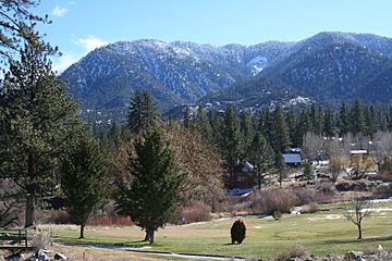
Mt. Pinos at top right
|
|
| Highest point | |
| Peak | San Emigdio Mountain |
| Elevation | 7,492 ft (2,284 m) |
| Geography | |
| Country | United States |
| Parent range | Transverse Ranges |
The San Emigdio Mountains are a mountain range in Southern California. They are part of the Transverse Ranges, which are mountains that mostly run east to west. These mountains stretch from Interstate 5 near Lebec in the east to Highway 33–166 in the west.
The San Emigdio Mountains connect the Tehachapi Mountains and the Temblor Range. They also form the southern edge of the San Joaquin Valley. The range gets its name from Emygdius, who was an early Christian martyr.
Contents
Geography of the San Emigdio Mountains
This mountain range is located in Kern County. The highest point in the range is San Emigdio Mountain. It stands tall at 7,492 feet (2,284 m). Like many mountains in the Transverse Ranges, the San Emigdio Mountains generally run from east to west.
Several towns and communities are close to the San Emigdio Mountains. These include Frazier Park, Lake of the Woods, and Pine Mountain Club.
Highest Peaks in the San Emigdio Mountains
Here are some of the tallest peaks in the San Emigdio Mountains:
- San Emigdio Mountain 7,492 ft (2,284 m)
- Tecuya Mountain 7,160+ ft (2,182+ m)
- Escapula Peak 7,080+ ft (2,158+ m)
- Brush Mountain 7,048 ft (2,148 m)
- Antimony Peak 6,848 ft (2,087 m)
- Eagle Rest Peak 6,005 ft (1,830 m)
Mountains Near the San Emigdio Range
The San Emigdio Mountains are surrounded by other mountain ranges. These nearby ranges are also part of the Transverse Ranges. They often have special areas called wildlife corridors. These corridors help animals move safely between different natural areas.
Here are some of the ranges next to the San Emigdio Mountains:
- Tehachapi Mountains — to the northeast
- Sierra Pelona Mountains — to the east
- Santa Susana Mountains — to the south
- Topatopa Mountains — to the southwest
- San Rafael Mountains — to the west
- Santa Ynez Mountains — to the southwest
- San Joaquin Valley — to the north
- Temblor Range — to the northwest
See also
 In Spanish: Sierra de San Emigdio para niños
 | Madam C. J. Walker |
 | Janet Emerson Bashen |
 | Annie Turnbo Malone |
 | Maggie L. Walker |


