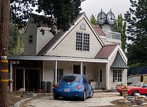
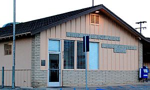
Lebec, California facts for kids
Quick facts for kids
Lebec, California
|
|
|---|---|
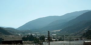
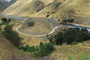
Lebec as seen from I-5 southbound in 2021
|
|
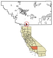
Location of Lebec in Kern County, California
|
|
| Country | |
| State | |
| County | Kern |
| Area | |
| • Total | 15.329 sq mi (39.702 km2) |
| • Land | 15.329 sq mi (39.701 km2) |
| • Water | 0 sq mi (0.001 km2) 0.002% |
| Elevation | 3,481 ft (1,061 m) |
| Population
(2020)
|
|
| • Total | 1,239 |
| • Density | 80.83/sq mi (31.207/km2) |
| Time zone | UTC−8 (PST) |
| • Summer (DST) | UTC−7 (PDT) |
| ZIP Code |
93243
|
| Area code(s) | 661 |
| FIPS code | 06-40956 |
Lebec is a small community in southwestern Kern County, California. It's called an "unincorporated community" because it doesn't have its own city government. Instead, it's run by the county. It's also a "census-designated place," which means the United States Census Bureau has defined it for gathering population data. In 2020, about 1,239 people lived there.
Contents
Where is Lebec Located?
Lebec is found in the Castac Valley. This valley sits between two mountain ranges: the San Emigdio Mountains and the Tehachapi Mountains. It's part of a group of towns known as the Mountain Communities of the Tejon Pass.
Lebec is about 40 miles (64 km) south of a larger city called Bakersfield. The community covers an area of about 15.3 square miles (39.7 km²). It's located near Tejon Pass at an elevation of about 3,481 feet (1,061 meters) above sea level.
What is Lebec's History?
Lebec is named after Peter Lebeck, a French trapper. In 1837, a grizzly bear sadly killed him in this area. People found a message carved into an old oak tree that said: "PETER LEBECK / KILLED BY A X BEAR / OCTR 17 / 1837."
Later, the tree bark grew over the carving. But in the late 1800s, a group from Bakersfield found the inscription. Today, you can see this piece of history at the museum in Fort Tejon State Historic Park.
Fort Tejon and Early Settlements
In 1853, Lieutenant R.S. Williamson camped near the same oak grove. He was on a mission to map a possible railway route from the Mississippi River to the Pacific Ocean. Just a year later, on August 10, 1854, the United States Army set up Fort Tejon here. It was the first military fort in California's inland areas. The fort was badly damaged during a big earthquake in 1857.
Lebec got its first post office in 1895. It was moved from a nearby place called Tejon.
The Lebec Hotel
The Lebec Hotel was a very large and fancy hotel built in 1921. It was designed in a Spanish Colonial Revival style. The hotel was located on the old Ridge Route road. Before World War II, many famous Hollywood movie stars and executives stayed there. The hotel closed in 1968 and was taken down in 1971.
How Many People Live in Lebec?
| Historical population | |||
|---|---|---|---|
| Census | Pop. | %± | |
| 2000 | 1,224 | — | |
| 2010 | 1,468 | 19.9% | |
| 2020 | 1,239 | −15.6% | |
| U.S. Decennial Census | |||
In 2010, Lebec had 1,468 people living in 533 homes. By 2020, the population was 1,239. Most people in Lebec live in houses they own.
In 2000, the average age of people in Lebec was 36 years old. This was very close to the average age for the entire United States. Lebec also had more military veterans compared to the national average.
Most adults in Lebec had jobs. They usually spent about 27 minutes traveling to work, which is similar to the rest of the country. The average household income in Lebec was a bit lower than the national average in 2000.
How Do People Get Around Lebec?
Interstate 5 is the main highway that goes through Lebec. This major highway connects many parts of California. For local travel, people use roads like Lebec Road, Peace Valley Road, and Frazier Mountain Park Road.
There is also a bus service called Kern Transit. During the summer, on Thursdays and Saturdays, you can take a bus to nearby towns like Frazier Park and Pine Mountain Club.
On weekdays, Kern Transit also offers bus service from the Flying J gas station. Route 130 can take you to the Santa Clarita Metrolink station. From there, you can connect to many other bus routes, even reaching North Hollywood and Downtown Los Angeles.
What About Lebec's Water?
Lebec has its own water system called the Lebec County Water District. It started providing water in 1969. This district serves about 836 people.
In 2012, a report mentioned that the water had tiny amounts of certain natural elements. These were within safe limits for drinking water.
A local committee looked into some concerns about how the water district was managed. They suggested that the people in charge should get more training to help them work better together and serve the community. The water board disagreed with some of the committee's findings.
In 2014, the water board decided to start each meeting with a moment of silence or prayer.
Businesses in Lebec
Lebec is home to the Tejon Ranch Company. This large ranch has been used as a filming location for several movies. Some films shot here include The Kid Ranger (1936), Pals of Silver Sage (1940), and Wild Bill (1995).
What is the Climate Like?
Lebec has a climate with warm to hot, dry summers. The winters are mild to cool, and sometimes it snows. The average monthly temperatures don't go above 71.6°F (22°C). This type of weather is known as a warm-summer Mediterranean climate.
| Climate data for Lebec, California (1991–2020 normals, extremes 2000–2022) | |||||||||||||
|---|---|---|---|---|---|---|---|---|---|---|---|---|---|
| Month | Jan | Feb | Mar | Apr | May | Jun | Jul | Aug | Sep | Oct | Nov | Dec | Year |
| Record high °F (°C) | 73 (23) |
77 (25) |
85 (29) |
90 (32) |
101 (38) |
103 (39) |
109 (43) |
103 (39) |
102 (39) |
95 (35) |
83 (28) |
78 (26) |
109 (43) |
| Mean maximum °F (°C) | 66.7 (19.3) |
70.1 (21.2) |
74.8 (23.8) |
81.8 (27.7) |
86.0 (30.0) |
95.1 (35.1) |
98.7 (37.1) |
96.9 (36.1) |
95.1 (35.1) |
85.5 (29.7) |
77.7 (25.4) |
67.4 (19.7) |
100.0 (37.8) |
| Mean daily maximum °F (°C) | 54.3 (12.4) |
56.1 (13.4) |
59.3 (15.2) |
64.6 (18.1) |
71.7 (22.1) |
79.8 (26.6) |
87.3 (30.7) |
87.6 (30.9) |
82.0 (27.8) |
72.8 (22.7) |
62.3 (16.8) |
54.0 (12.2) |
69.3 (20.7) |
| Daily mean °F (°C) | 44.4 (6.9) |
45.7 (7.6) |
47.7 (8.7) |
52.1 (11.2) |
59.2 (15.1) |
66.8 (19.3) |
73.5 (23.1) |
73.7 (23.2) |
67.7 (19.8) |
59.5 (15.3) |
50.7 (10.4) |
44.1 (6.7) |
57.1 (13.9) |
| Mean daily minimum °F (°C) | 34.5 (1.4) |
34.8 (1.6) |
36.5 (2.5) |
40.0 (4.4) |
46.8 (8.2) |
55.2 (12.9) |
59.7 (15.4) |
59.8 (15.4) |
53.4 (11.9) |
46.2 (7.9) |
39.1 (3.9) |
34.1 (1.2) |
45.0 (7.2) |
| Mean minimum °F (°C) | 22.9 (−5.1) |
23.3 (−4.8) |
25.5 (−3.6) |
30.1 (−1.1) |
37.0 (2.8) |
41.3 (5.2) |
52.5 (11.4) |
49.6 (9.8) |
43.1 (6.2) |
36.1 (2.3) |
27.4 (−2.6) |
21.2 (−6.0) |
18.5 (−7.5) |
| Record low °F (°C) | 8 (−13) |
12 (−11) |
12 (−11) |
15 (−9) |
26 (−3) |
23 (−5) |
34 (1) |
34 (1) |
34 (1) |
24 (−4) |
15 (−9) |
12 (−11) |
8 (−13) |
| Average precipitation inches (mm) | 2.65 (67) |
2.99 (76) |
2.18 (55) |
1.05 (27) |
0.49 (12) |
0.13 (3.3) |
0.16 (4.1) |
0.06 (1.5) |
0.17 (4.3) |
0.61 (15) |
0.82 (21) |
1.92 (49) |
13.23 (335.2) |
| Average snowfall inches (cm) | 1.1 (2.8) |
1.4 (3.6) |
0.5 (1.3) |
0.0 (0.0) |
0.0 (0.0) |
0.0 (0.0) |
0.0 (0.0) |
0.0 (0.0) |
0.0 (0.0) |
0.0 (0.0) |
0.0 (0.0) |
0.9 (2.3) |
3.9 (10) |
| Average precipitation days (≥ 0.01 in) | 6.2 | 6.7 | 5.0 | 3.8 | 2.6 | 0.6 | 0.5 | 0.2 | 0.6 | 2.0 | 3.5 | 5.9 | 37.6 |
| Average snowy days (≥ 0.1 in) | 0.4 | 0.3 | 0.2 | 0.0 | 0.0 | 0.0 | 0.0 | 0.0 | 0.0 | 0.0 | 0.0 | 0.2 | 1.1 |
| Source 1: NOAA | |||||||||||||
| Source 2: National Weather Service (mean maxima/minima 2006–2020, average high/mean/low 2000–2022) | |||||||||||||
See also
 In Spanish: Lebec para niños
 | Stephanie Wilson |
 | Charles Bolden |
 | Ronald McNair |
 | Frederick D. Gregory |


