Temblor Range facts for kids
Quick facts for kids Temblor Range |
|
|---|---|

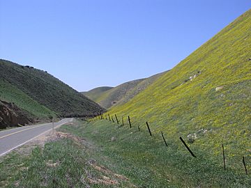
Temblor Mountains in spring; view from near State Route 58 summit
|
|
| Highest point | |
| Elevation | 1,176 m (3,858 ft) |
| Geography | |
| Country | United States |
| State | California |
| District | San Luis Obispo County & Kern County |
| Range coordinates | 35°19′25.877″N 119°47′48.469″W / 35.32385472°N 119.79679694°W |
| Parent range | California Coast Ranges |
| Borders on | San Emigdio Mountains and Diablo Range |
| Topo map | USGS McKittrick Summit |
| Biome | California interior chaparral and woodlands |
The Temblor Range is a mountain range in California, United States. It is part of the California Coast Ranges. These mountains stretch from northwest to southeast. They form a natural border between Kern County and San Luis Obispo County.
The name "Temblor" comes from a Spanish word meaning "tremor" or "earthquake." This name makes sense because the famous San Andreas Fault runs right next to the western side of the range. This fault is where two large pieces of the Earth's crust meet and slide past each other.
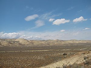
The Temblor Range sits next to the Carrizo Plain on its west side. To the northeast is the Antelope Plain. This area is home to huge oil fields, where a lot of oil is found deep underground.
Mountains and Highways
The peaks in the Temblor Range are usually about 3,500 feet (1,100 meters) high. The highest point is McKittrick Summit, which reaches 4,331 feet (1,320 meters). This summit is about 35 miles (56 km) west of Bakersfield.
California State Route 58 crosses the range. The highest point on this road is 3,750 feet (1,143 meters) above sea level. Another road, California State Route 46, crosses the northern part of the range at Polonio Pass. This pass is much lower, at 1,407 feet (429 meters).
How the Mountains Formed

The rocks in the Temblor Range tell a long story about how the Earth has changed. Many rocks here are from the Monterey Formation. These rocks formed about 9 to 20 million years ago. They are mostly made of tiny fossils from sea creatures. This shows that the area used to be covered by ocean water.
Later, about 4 million years ago, more marine fossils were found. This tells us that the California Coast Ranges and the Temblor Range are quite young mountains. They mostly rose up during the Pleistocene Epoch, which was in the last few million years. This uplift happened because of the movement of the Earth's plates along the San Andreas Fault.
Long ago, more than 1.8 million years ago, a huge part of the Temblor Range slid down. This was a massive slide of rock, about six miles (10 km) long and a mile wide. It covered a distance of about three miles (5 km). This giant rock slide even covered an oil field called McKittrick Oil Field. This made the oil field very unusual because most oil fields are trapped by rock layers, not by a huge slide.
The southern end of the Temblor Range meets the San Emigdio Mountains. This area is near Maricopa. The northern end of the range is near Cholame. Here, it meets the Diablo Range at Polonio Pass.
See also
 In Spanish: Cordillera de Temblor para niños
 | Madam C. J. Walker |
 | Janet Emerson Bashen |
 | Annie Turnbo Malone |
 | Maggie L. Walker |


