Sutter's Fort facts for kids
Quick facts for kids |
|
|
Sutter's Fort
|
|
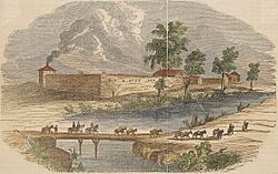
Sutter's Fort, 1840s illustration
|
|
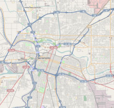
| Location | 2701 L Street Sacramento, California |
|---|---|
| NRHP reference No. | 66000221) |
| Added to NRHP | October 15, 1966 |
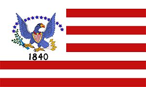
Sutter's Fort was a busy farming and trading center in the 1800s. It was located in what was then the Mexican province of Alta California. John Sutter started this colony in 1839, calling it New Helvetia (meaning "New Switzerland"). The fort itself began to be built in 1841.
This fort was the first non-Indigenous settlement in California's Central Valley. Sadly, many Indigenous workers faced very harsh conditions and forced labor here. Sutter's Fort is famous for its connections to the Donner Party, the exciting California gold rush, and the founding of the city of Sacramento. It was also an important stop for travelers at the end of the California and Siskiyou Trails.
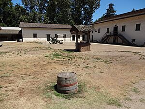
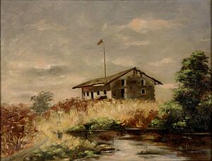
Today, the fort's original adobe building has been carefully restored. It is now managed by the California Department of Parks and Recreation. In 1961, it was recognized as a National Historic Landmark.
Contents
The Story of Sutter's Fort
To create his colony, John Sutter received a huge land grant from the Mexican governor. This land was about 50,000 acres in the Central Valley. The main building of the fort, a two-story adobe structure, was built between 1841 and 1843. It was constructed using forced labor from Indigenous people. This building is the only original part of the fort that still stands today.
On January 28, 1848, James Marshall secretly met with John Sutter inside this building. Marshall showed Sutter the gold he had found just four days earlier. This discovery happened while building Sutter's Mill along the American River. Sutter built the fort with very thick walls, about 2.5 feet thick and 15 to 18 feet high. Pioneers began to settle near Sutter's Fort around 1841. After the California Gold Rush began, most people left the fort by the 1850s, and it started to fall apart.
Building the Fort
John Sutter and his group arrived on the bank of the American River in August 1839. The group included three Europeans and a Native American boy, who likely helped as an interpreter. Some of the first workers brought to the colony were Native Hawaiian people, called Kanakas. Sutter had an agreement with the governor of Hawaii to bring these eight men and two women to work for three years. Once the first camp was set up, Sutter used local Miwok, Nisenan, and "missionized" Native Californians to build the first adobe building.
A Farming Colony
After the fort was built, Sutter started a large farming colony. The way work was organized here was similar to large farms in the Southern United States or old European feudal systems. The colony focused on raising animals and growing wheat crops. European settlers were in charge of the Native Californian and Native Hawaiian workers. These workers often faced very harsh conditions, including forced labor. Sutter used a system to make sure the smaller group of European settlers stayed in control. While some laborers worked willingly, many were treated like enslaved people or serfs.
Why the Fort Declined
After gold was found at Sutter's Mill on January 24, 1848, many people left Sutter's Fort. Everyone wanted to go look for gold, and the fort was mostly abandoned.
Saving the Fort
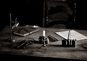
In 1891, a group called the Native Sons of the Golden West bought Sutter's Fort. They wanted to protect important California landmarks. The city of Sacramento had planned to tear it down. The repair work was finished in 1893, and the Native Sons of the Golden West gave the fort to the State of California. In 1947, the fort became part of California State Parks and was named Sutter's Fort State Historic Park.
Important Locations Nearby
Sutter's Fort is located on flat ground, about 20 feet above sea level. The land slopes down towards the American River to the north and the Sacramento River to the west.
Sutter's Landing
Sutter's Landing is the exact spot where Captain John A. Sutter landed in August 1839. He arrived at the American River after traveling up the Sacramento River from Yerba Buena. After landing, Sutter set up a base camp, which later led to the building of Sutter's Fort. This landing site is recognized as California Historical Landmark #591.
Coloma Road
The old Coloma Road opened in 1847. It connected Sutter's Fort to the city of Coloma. James Marshall used this road to tell Captain John A. Sutter about his gold discovery. During the 1849 Gold Rush, thousands of miners traveled this road looking for gold. Coloma Road at Sutter's Fort is California Historical Landmark No. 745. California's first stagecoach line, the California Stage Company, started using this road in 1849.
See also
- New Helvetia Cemetery
- California State Indian Museum
- Old Sacramento State Historic Park
- History of Sacramento, California
- List of California State Historic Parks
- California Historical Landmarks in Sacramento County, California
- National Register of Historic Places listings in Sacramento County, California
- John Sutter's relationship with Native Americans
- Ranchos of California
 | Misty Copeland |
 | Raven Wilkinson |
 | Debra Austin |
 | Aesha Ash |


