
California State Route 152 facts for kids
Quick facts for kids
|
||||
|---|---|---|---|---|
| Lua error in Module:Infobox_road/map at line 15: attempt to index field 'wikibase' (a nil value).
Map of western California with SR 152 highlighted in red
|
||||
| Route information | ||||
| Defined by S&HC § 452 | ||||
| Maintained by Caltrans | ||||
| Length | 104.419 mi (168.046 km)
(plus about 1.5 mi (2.5 km) on US 101)
|
|||
| History | State highway in 1916; SR 152 in 1934 | |||
| Tourist routes |
||||
| Restrictions | No tractor-trailer combinations over 45 feet (14 m) in length through Hecker Pass | |||
| Major junctions | ||||
| West end | ||||
| East end | ||||
| Location | ||||
| Counties: | Santa Cruz, Santa Clara, Merced, Madera | |||
| Highway system | ||||
| State highways in California(list • pre-1964) History • Unconstructed • Deleted • Freeway • Scenic
|
||||

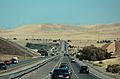
State Route 152 (SR 152) is a major road in California. It runs from west to east across the middle of the state. The road starts in Watsonville and ends near Chowchilla. It connects the coast to the Central Valley.
This highway is about 104 miles (167 km) long. It helps people travel between cities like Gilroy and San Jose. It also connects them to places like Southern California. Part of SR 152 is also known as Pacheco Pass Road.
Contents
What is State Route 152 Like?

Route 152 begins in Watsonville. Here, it uses local streets like East Lake Avenue. It then becomes a winding two-lane road. This part crosses the Santa Cruz Mountains through Hecker Pass to reach Gilroy. In Gilroy, it uses more local streets. For a short distance, it shares the road with U.S. Route 101.
After leaving Gilroy, the road often has one lane in each direction. It has narrow shoulders and no center divider. The speed limit is usually 55 mph (89 km/h). Drivers must use their headlights all the time on this section. This part of the road can get very busy. It's a key link between the Bay Area and the Central Valley.
Near Hollister, the road gets wider. It becomes two lanes in each direction. It then climbs through the Diablo Range mountains. This section goes through Pacheco Pass and into the San Joaquin Valley. SR 152 is one of only three main roads that cross the Diablo Range.
Driving Through Pacheco Pass
After the mountains, Route 152 becomes a four-lane highway. It goes along the northern and eastern side of the huge San Luis Reservoir. You'll pass the San Luis Dam and the O'Neill Forebay. The road continues east and meets Interstate 5.
Then, it becomes a city street called Pacheco Blvd. as it goes through Los Banos. After Los Banos, it turns back into a highway. It ends when it meets Route 99. This is near Chowchilla. If you want to go north on Route 99, you can take Route 233 through Chowchilla. Another option is to take State Route 59 north to Merced.
What Can You See Along SR 152?
There are several interesting places along Route 152. These include the famous Pacheco Pass. You can also find Gilroy Gardens, a fun amusement park. The large San Luis Reservoir is another landmark. Other spots are Casa de Fruta and the Merry Cherries.
SR 152 is part of California's important highway system. It's considered vital for the country's economy and travel. Part of SR 152 is also a "Scenic Highway." This means it passes through beautiful landscapes. It's a special road that people enjoy driving on.
How Old is State Route 152?
.jpg)


|
Highway 152 Tree Row
|
|
 |
|
| Nearest city | Gilroy, California |
|---|---|
| Built | 1930-1931 |
| NRHP reference No. | 07000635 |
| Added to NRHP | July 3, 2007 |
The road that became SR 152 has a long history. It became popular during the California Gold Rush (1848-1855). Many people used it to travel east. From 1858 to 1861, the Butterfield Overland Mail used this route. This was a famous stagecoach service.
Part of Route 152 was a toll road from 1857 to 1878. This meant drivers had to pay to use it. Later, two counties bought the road. They made it a public highway. In 1915, it became part of California's state highway system. In 1923, a new road was built through Pacheco Pass.
Changes and Improvements Over Time
The original state route through Pacheco Pass had many curves. It also had steep hills. In 1939, a part of the highway was straightened. In 1950, the first four-lane section was built. This made the road much better for drivers.
Between 1963 and 1965, a new 12-mile (19 km) highway was built. This new section bypassed the San Luis Reservoir. The reservoir was being built at that time. A small part of the old road is still used today. It's called Dinosaur Point Road.
More improvements happened between 1982 and 1992. The road was widened from two to four lanes. This was done on a 10.5-mile (16.9 km) section. In 2008, a busy intersection with Route 156 was improved. A new overpass was built. This helped reduce traffic jams.
The Historic Tree Row
A special part of Route 152 is west of Gilroy. It has a line of deodar cedar trees. These trees were planted in 1930 and 1931. They were planted on Arbor Day. This section of the road is now listed on the National Register of Historic Places. It's a beautiful and historic entrance to Gilroy.
Images for kids
-
SR-152 as it crosses O'Neill Forebay, viewed while traveling east.

See also
 In Spanish: Ruta Estatal de California 152 para niños
