Merced County, California facts for kids
Quick facts for kids
Merced County, California
|
||
|---|---|---|
| County of Merced | ||
|
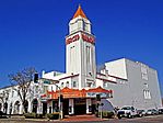
Images, from top down, left to right: The historic Merced Theatre, San Luis Reservoir, UC Merced, The B-29A Super Fortress exhibit at the Castle Air Museum in Atwater
|
||
|
||
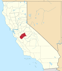
Location in the state of California
|
||
| Country | United States | |
| State | California | |
| Region | San Joaquin Valley | |
| Incorporated | April 19, 1855 | |
| Named for | Merced River, originally El Río de Nuestra Señora de la Merced ("River of Our Lady of Mercy" in Spanish). | |
| County seat | Merced | |
| Largest city | Merced | |
| Government | ||
| • Type | Council–CEO | |
| • Body | Board of Supervisors | |
| Area | ||
| • Total | 1,979 sq mi (5,130 km2) | |
| • Land | 1,935 sq mi (5,010 km2) | |
| • Water | 44 sq mi (110 km2) | |
| Highest elevation | 3,801 ft (1,159 m) | |
| Population
(2020)
|
||
| • Total | 281,202 | |
| • Density | 142.09/sq mi (54.862/km2) | |
| Time zone | UTC−8 (Pacific Time Zone) | |
| • Summer (DST) | UTC−7 (Pacific Daylight Time) | |
| ZIP code |
93620, 93635, 93661, 93665, 95301, 95303, 95312, 95315, 95317, 95322, 95324, 95333, 95334, 95388, 95340, 95341, 95343, 95344, 95348, 95365, 95369, 95374
|
|
| Area code | 209 | |
| FIPS code | 06-047 | |
| GNIS feature ID | 277288 | |
| Congressional district | 13th | |
Merced County (![]() i/mərˈsɛd/ mər-SED) is a county in California. It's located in the northern part of the San Joaquin Valley. This area is part of California's large Central Valley.
i/mərˈsɛd/ mər-SED) is a county in California. It's located in the northern part of the San Joaquin Valley. This area is part of California's large Central Valley.
In 2020, about 281,202 people lived here. The main city and county seat is Merced. The county gets its name from the Merced River. Merced County is north of Fresno County and southeast of Santa Clara County.
Contents
History of Merced County
Merced County gets its name from the Merced River. In 1806, an expedition led by Gabriel Moraga found the river. They named it El Río de Nuestra Señora de la Merced, which means "River of Our Lady of Mercy" in Spanish. They discovered it after a long, hot journey across the San Joaquin Valley.
Between 1841 and 1844, during Mexico's rule, four large land grants were made in this area. These grants were called Mexican land grants.
Merced County was officially formed in 1855. It was created from parts of Mariposa County. Later, in 1856, some of its land was given to Fresno County.
Geography and Nature
Merced County covers a total area of about 1,979 square miles. Most of this area, 1,935 square miles, is land. The remaining 44 square miles (about 2.2%) is water.
Protected Natural Areas
Merced County is home to important natural spaces. These areas help protect wildlife and their homes.
People of Merced County
The population of Merced County has grown a lot over the years. In 1860, only 1,141 people lived here. By 2020, the population had reached 281,202.
| Historical population | |||
|---|---|---|---|
| Census | Pop. | %± | |
| 1860 | 1,141 | — | |
| 1870 | 2,807 | 146.0% | |
| 1880 | 5,656 | 101.5% | |
| 1890 | 8,085 | 42.9% | |
| 1900 | 9,215 | 14.0% | |
| 1910 | 15,148 | 64.4% | |
| 1920 | 24,579 | 62.3% | |
| 1930 | 36,748 | 49.5% | |
| 1940 | 46,988 | 27.9% | |
| 1950 | 69,780 | 48.5% | |
| 1960 | 90,446 | 29.6% | |
| 1970 | 104,629 | 15.7% | |
| 1980 | 134,560 | 28.6% | |
| 1990 | 178,403 | 32.6% | |
| 2000 | 210,554 | 18.0% | |
| 2010 | 255,793 | 21.5% | |
| 2020 | 281,202 | 9.9% | |
| 2023 (est.) | 291,920 | 14.1% | |
| U.S. Decennial Census 1790–1960 1900–1990 1990–2000 2010 2020 |
|||
Who Lives in Merced County?
The people of Merced County come from many different backgrounds. This makes the county a diverse place.
In 2020, about 61.83% of the population was Hispanic or Latino. About 24.44% were White (not Hispanic). Other groups include Asian (7.05%), Black or African American (2.91%), and people of mixed races (2.69%).
Economy and Jobs
Merced County has many different types of businesses. These businesses provide jobs for local residents.
Some of the largest employers in Merced County include:
- Anberry Rehabilitation Hospital (healthcare)
- Atwater Elementary Teachers (education)
- Bianchi & Sons Packing Co (produce)
- E & J Gallo Winery (wine)
- Foster Farms (poultry)
- Golden Valley Health Center (healthcare)
- Hilmar Cheese Company (dairy products)
- J. Marchini & Son (farming)
- Liberty Packing Co (produce)
- Live Oak Farms (produce)
- Livingston District Office (education)
- Malibu Boats West Inc (boat manufacturing)
- McLane Pacific (wholesale food)
- Merced County Human Services (government services)
- Mercy Medical Center Merced (healthcare)
- Pacific Gas and Electric Company (utility)
- Quad/Graphics (printing)
- Sensient Dehydrated Flavors (food ingredients)
- University of California, Merced (education)
- Walmart (retail)
- Werner Co (ladders)
- Western Marketing & Sales (farming)
- Yosemite Wholesale Warehouse (wholesale)
Merced County is also famous for its farms. It grows 90% of California's sweet potato crop! This is thanks to people like John Buttencourt Avila, known as "the father of the sweet potato industry."
Getting Around: Transportation
Main Roads
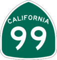
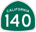
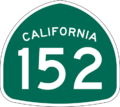
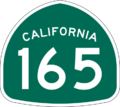
Several major highways run through Merced County. These roads connect the county to other parts of California.
 Interstate 5
 State Route 33
 State Route 59
 State Route 99
 State Route 140
 State Route 152
 State Route 165
Public Transport
You can get around Merced County using public transportation.
- Merced County Transit, also called "The Bus," offers local rides in Merced. It also connects most cities in the county.
- The University of California, Merced has its own bus system called Cat Tracks. This system connects with Merced County Transit.
- The Yosemite Area Regional Transportation System, or YARTS, can take you from Merced to Yosemite National Park.
- For longer trips, you can use Greyhound buses or Amtrak trains.
Airports
Merced County has several airports.
- Merced Regional Airport is near downtown Merced. It offers passenger flights.
- Other airports for general aviation (smaller planes) include Castle Airport, Gustine Airport, and Los Banos Municipal Airport.
Cities and Towns
Merced County has several cities and many smaller communities.
Cities in Merced County
- Atwater
- Dos Palos
- Gustine
- Livingston
- Los Banos
- Merced (This is the county seat, meaning it's where the county government is located.)
Smaller Communities (Census-Designated Places)
These are areas that are not officially cities but are recognized for census purposes.
Population Ranking of Communities
Here's how the cities and towns in Merced County ranked by population in 2010:
| Rank | City/Town/etc. | Municipal type | Population (2010 Census) | Population (2018 CA Department of Finance) |
|---|---|---|---|---|
| 1 | † Merced | City | 78,958 | 86,750 |
| 2 | Los Banos | City | 35,972 | 40,986 |
| 3 | Atwater | City | 28,168 | 31,235 |
| 4 | Livingston | City | 13,058 | 14,328 |
| 5 | Delhi | CDP | 10,755 | |
| 6 | Winton | CDP | 10,613 | |
| 7 | Franklin-Beachwood | CDP | 6,149 | |
| 8 | Gustine | City | 5,520 | 5,874 |
| 9 | Hilmar-Irwin | CDP | 5,197 | |
| 10 | Dos Palos | City | 4,950 | 5,679 |
| 11 | Planada | CDP | 4,584 | |
| 12 | McSwain | CDP | 4,171 | |
| 13 | Le Grand | CDP | 1,659 | |
| 14 | South Dos Palos | CDP | 1,620 | |
| 15 | Santa Nella | CDP | 1,380 | |
| 16 | Ballico | CDP | 406 | |
| 17 | Cressey | CDP | 394 | |
| 18 | El Nido | CDP | 330 | |
| 19 | Dos Palos Y | CDP | 323 | |
| 20 | Stevinson | CDP | 313 | |
| 21 | Bear Creek | CDP | 290 | |
| 22 | Volta | CDP | 246 | |
| 23 | Snelling | CDP | 231 | |
| 24 | Tuttle | CDP | 103 |
Education in Merced County
Merced County has many school districts for students of all ages.
K-12 School Districts
These districts serve students from kindergarten through 12th grade.
- Dos Palos-Oro Loma Joint Unified School District
- Delhi Unified School District
- Gustine Unified School District
- Hilmar Unified School District
- Los Banos Unified School District
- Turlock Unified School District
High School Districts
These districts focus on high school education.
- Le Grand Union High School District
- Merced Union High School District
Elementary School Districts
These districts are for younger students, usually from kindergarten to 8th grade.
- Atwater Elementary School District
- Ballico-Cressey Elementary School District
- El Nido Elementary School District
- Le Grand Union Elementary School District
- Livingston Union School District
- McSwain Union Elementary School District
- Merced City Elementary School District
- Merced River Union Elementary School District
- Plainsburg Union Elementary School District
- Planada Elementary School District
- Snelling-Merced Falls Union Elementary School District
- Weaver Union Elementary School District
- Winton School District
Higher Education
The University of California Merced is a major university located in the county.
Places to Visit
Merced County has some interesting places to see.
- The former Castle Air Force Base is a historic site.
- The United States Penitentiary, Atwater is a federal prison located near Atwater.
Images for kids
See also
 In Spanish: Condado de Merced para niños
 | Selma Burke |
 | Pauline Powell Burns |
 | Frederick J. Brown |
 | Robert Blackburn |


