Merced River facts for kids
Quick facts for kids Merced River |
|
|---|---|
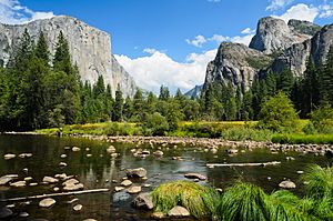
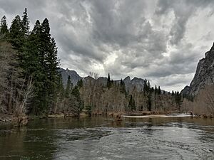
The Merced River in Yosemite Valley
|
|
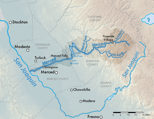
Map of the Merced River
|
|
| Country | United States |
| State | California |
| Region | Yosemite National Park, Central Valley (California) |
| Cities | El Portal, Livingston |
| Physical characteristics | |
| Main source | Confluence of Merced Peak and Triple Peak Forks Yosemite National Park, Madera County 8,017 ft (2,444 m) 37°41′47.05″N 119°20′53.54″W / 37.6964028°N 119.3482056°W |
| River mouth | San Joaquin River Hills Ferry, Stanislaus County 56 ft (17 m) 37°20′57″N 120°58′32″W / 37.34917°N 120.97556°W |
| Length | 145 mi (233 km) |
| Basin features | |
| Basin size | 1,726 sq mi (4,470 km2) |
| Tributaries |
|
| Type: | Wild, Scenic, Recreational |
| Designated: | November 2, 1987 |
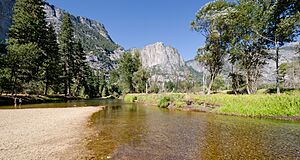
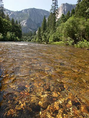
The Merced River is a 145-mile (233 km)-long river in California, United States. It flows from the high Sierra Nevada mountains into the San Joaquin Valley. The river is famous for its fast and steep journey through the southern part of Yosemite National Park. Here, it is the main waterway flowing through Yosemite Valley.
Once the Merced River reaches the flat San Joaquin Valley, it slows down. It becomes a gentle, winding stream. Millions of years ago, the river helped form the valley floor. During the Ice Ages, glaciers shaped the upper parts of the river's path, including Yosemite Valley. In the past, the river had many chinook salmon. It also had a rich riparian zone, which is the green area along the riverbanks. This area was home to many migrating birds.
Native American groups like the Miwok and Paiute lived along the river for thousands of years. Later, Spanish and Mexican explorers arrived in the early 1800s. The California Gold Rush brought many new people to the area. A railroad was built along the Merced canyon to help with mining and logging. It also carried tourists to Yosemite National Park. Over time, conflicts happened between settlers and native peoples.
In the late 1800s, large-scale irrigation began in the San Joaquin Valley. Many dams were built, which stopped salmon from migrating. This also harmed the river's natural habitats. Today, efforts are being made to help the river. These include protecting habitats and building a salmon hatchery.
Contents
The River's Journey
The Merced River starts high in the Sierra Nevada mountains. Its source is at 8,017 feet (2,444 m) in Yosemite National Park. Here, two smaller streams, the Triple Peak Fork and Merced Peak Fork, join together. The river flows north, picking up the Lyell Peak Fork.
It then turns northwest and flows through a deep canyon. The Red Peak Fork joins it, and the river flows into Washburn Lake. The Merced continues northwest into Merced Lake. After leaving Merced Lake, it flows through Echo Valley. The river then winds through a narrow, beautiful gorge with huge granite cliffs.
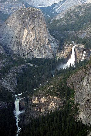
The Merced River drops over Nevada Falls and Vernal Falls. These are known as the "Giant Staircase." Then, Illilouette Creek joins it. The river flows into Yosemite Valley, where it winds through forests and meadows. Other creeks like Tenaya, Yosemite, and Bridalveil join the Merced here.
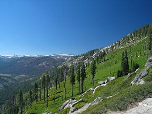
Beyond Yosemite Valley, the river flows through the steep Merced River Canyon. It picks up Cascade Creek and turns south near El Portal. The South Fork Merced River, its largest branch, joins from the left. The river then curves northwest to meet the North Fork. A few miles later, it flows into Lake McClure, which is formed by New Exchequer Dam.
Below Lake McClure, the river flows west through a farming area called the Central Valley. It passes through McSwain and Crocker-Huffman Dams. It also flows past towns like Hopeton, Delhi, and Livingston. Finally, it joins the San Joaquin River at Hills Ferry.
Merced River Watershed
The Merced River watershed is the area of land that drains into the river. It covers about 1,726 square miles (4,470 km2) in the central Sierra Nevada. To the north, it borders the Tuolumne River watershed. To the south, it borders the San Joaquin River watershed.
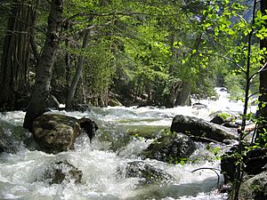
Much of the Merced River basin is high in the mountains. This area gets a lot of snow in winter, which melts in spring and summer. This melting snow causes the river to flow strongly. By late autumn, the river level drops a lot. Many smaller streams may even dry up. About 85% of the river's flow in the upper parts comes from melting snow.
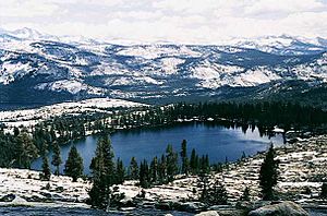
The river is also fed by many high mountain lakes. The biggest ones include Merced Lake, Tenaya Lake, and May Lake. Lower down, in the foothills, the climate is drier. The San Joaquin Valley floor is very dry, almost like a semi-desert.
The Merced River is the third largest branch of the San Joaquin River. Before dams were built, the river's natural flow was much higher. Today, the average flow at its mouth is about 661 cubic feet per second (18.7 m3/s). The United States Geological Survey measures the river's flow at different spots. The highest flow ever recorded was 92,500 cubic feet per second (2,620 m3/s) in 1955 near Lake McClure. In 1997, a large flood in Yosemite Valley caused the river to reach 10,100 cubic feet per second (290 m3/s) at Happy Isles. This flood damaged many areas in the valley.
Plants and Animals
The Merced River watershed is home to many different living things. A study in 2006 found 37 types of fish, 127 bird species, and 140 kinds of insects. The types of plants and animals change a lot from the high mountains to the lower valley.
In the lower part of the river, there are 26 types of fish. These include Sacramento sucker, smallmouth bass, and carp. Some fish, like chinook salmon, swim from the ocean up the river to lay their eggs. In the past, salmon could swim all the way to the waterfalls in Yosemite Valley. But dams now block their path. This has caused a big drop in salmon numbers. However, efforts to help the salmon have worked. The number of salmon has increased from a low of 500 in the 1950s to about 5,300 each year since the 1970s.
Many birds live along the Merced River. Some are migratory, meaning they only pass through at certain times of the year. Birds are more common along the slower, lower part of the river. This area has more riparian habitat (riverbank plants). Common birds include American robin and tree swallow. Endangered birds like the white-tailed kite also live here. In the middle and upper parts of the river, you might see mourning dove, woodpecker, and bald eagles.
Common insects found near the river include mayflies and stoneflies. However, some harmful invasive species have also been found, like the Asiatic clam.
Many plants grow in the middle and upper parts of the basin. These include California poppy, white alder, and different types of oak. Animals like squirrels, raccoons, beavers, mule deer, and black bears also live in the watershed.
A very rare animal, the limestone salamander, lives only in the Merced Canyon. It needs the limestone walls of the canyon to survive. To protect this salamander, a 20-mile (32 km) part of the canyon was named a "Critical Environmental Concern" area in 1986.
How the River Was Formed
The Merced River's landscape was shaped over millions of years. About 250 million years ago, the North American Plate and the Pacific Plate collided. This caused magma (melted rock) to rise and form the hard granite rock of the Sierra Nevada mountains. The Merced River began to cut its path through softer rock layers. Eventually, it reached the tough granite below.
Over time, a lot of sediment (tiny bits of rock and soil) was carried by the river. This sediment helped create the flat, fertile floor of the Central Valley. But the upper part of the Merced River's path was mostly shaped by glaciers.
During the Ice Age, huge valley glaciers filled the upper Merced River basin. These glaciers were up to 7,000 feet (2,100 m) thick. They stretched for 25 miles (40 km) past Yosemite Valley. These glaciers carved out the famous granite cliffs we see today, like Half Dome and El Capitán.
After the glaciers melted, they left behind piles of rock and dirt called moraines. One moraine at the mouth of Yosemite Valley formed a lake that filled almost the entire valley. Over time, sediment filled this lake, creating the wide, flat valley floor we see now.
History of the Merced River
Many Native American tribes lived along the Merced River for a long time. The Miwok and Paiute were among the most important. The Ahwahnechee people, a mix of Miwok and Paiute cultures, lived in Yosemite Valley. Their name comes from Ahwahnee, meaning "the valley shaped like a big mouth."
In 1806, a Spanish explorer named Gabriel Moraga reached the river. He named it Rio de Nuestra Señora de la Merced, which means "River of Our Lady of Mercy." This is where the name Merced River comes from. The Spanish explored the area to find places for new missions. In 1855, Merced County was named after the river.
After California became independent, many settlers came to the Merced River area. They built towns like Dover, Hopeton, and Snelling. Some towns, like Merced Falls, had mills that used the river's power. A railroad was built to carry lumber from the mountains. Later, other railroads caused many river towns to be deserted. But cities like Merced and Turlock grew.
The California Gold Rush in the 1850s brought more mining to the area. This led to conflicts between miners and the Ahwahnechee people. In 1851, the Mariposa Battalion was formed. They moved most of the Ahwahnechee out of Yosemite Valley. Many places in the valley are named after events from this time.
Even before Yosemite National Park was created, tourists visited the Merced Canyon and Yosemite Valley. The first roads were built in the 1870s. In 1890, Yosemite National Park was established. This led to many more tourists visiting the river. The Yosemite Valley Railroad carried tourists along the Merced River until the 1940s.
In the early 1900s, the Merced Irrigation District began building dams on the lower river. The New Exchequer Dam, completed in the 1920s, stores water for farming and flood control. Irrigation grew so much that it used almost all the river's water in dry years. This caused problems for fish like salmon. In 1991, the Merced River Hatchery was built. It helps salmon by providing pools for them to lay eggs.
In 1997, the Merced River flooded Yosemite Valley. This caused a lot of damage to the park.
River Modifications
Even though part of the Merced River is a "Wild and Scenic River," it has many dams. New Exchequer Dam is the biggest. It forms Lake McClure, which holds a lot of water for irrigation, flood control, and making electricity. An older dam, built in 1926, is now underwater when the lake is full.
Downstream of New Exchequer Dam are McSwain Dam and Merced Falls Dam. The lowest dam is the Crocker-Huffman Diversion Dam. This dam completely blocks fish from swimming upstream. These dams and diversions take almost half of the river's natural flow. In dry years, they take even more.
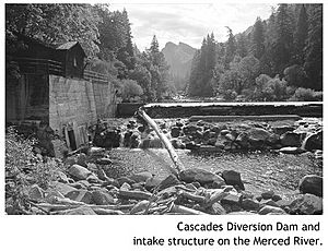
The Cascades Diversion Dam was built in 1917 near Yosemite Valley. It was used to make electricity. It was removed in the 1990s because it was old and dangerous. Today, the Merced River above Lake McClure flows freely without any dams.
The Merced Irrigation District manages most of the irrigation system on the lower river. This system provides water to a huge area of farmland. It includes about 4,000 control gates and 793 miles (1,276 km) of canals. Because so much water is used for farming, the lower river often becomes a small stream. Water that returns from irrigation can carry pollutants into the river. The district must allow at least 15,000 acre-feet (19,000,000 m3) of water to flow down the river each year.
Fun Activities on the Merced River
The Merced River is a popular place for fun activities, especially in Yosemite National Park. You can enjoy boating, fishing, camping, and hiking. Whitewater rafting is allowed in Merced River Canyon. This area has rapids that are rated Class III and Class IV, which means they are quite challenging. You can also go boating on Lake McClure.
Camping along the Merced River is usually allowed only in special campgrounds. Some campgrounds are at Railroad Flat, McCabe Flat, and Merced Lake. There is also a ski hut at Ostrander Lake.
The old Yosemite Valley Railroad path is now a public trail. Many other trails follow the Merced River. The John Muir Trail starts near Happy Isles. It climbs past Vernal and Nevada Falls into Little Yosemite Valley. It then goes north to join the Pacific Crest Trail. Trails also follow the river to its source in the mountains. However, some areas, like Tenaya Canyon, are very dangerous and do not have trails.
Images for kids
See also
 In Spanish: Río Merced para niños
 | Bayard Rustin |
 | Jeannette Carter |
 | Jeremiah A. Brown |


