
Turlock, California facts for kids
Quick facts for kids
Turlock, California
|
|
|---|---|
.jpg)
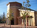
Aerial view of Turlock
|
|

Location in Stanislaus County and the U.S. state of California
|
|

Turlock, California
Location in the United States
|
|
| Country | United States |
| State | California |
| County | Stanislaus |
| Incorporated | February 15, 1908 |
| Government | |
| • Type | Council–manager |
| Area | |
| • Total | 16.93 sq mi (43.85 km2) |
| • Land | 16.91 sq mi (43.78 km2) |
| • Water | 0.03 sq mi (0.07 km2) 0% |
| Elevation | 62 ft (31 m) |
| Population
(2020)
|
|
| • Total | 72,740 |
| • Density | 4,296.5/sq mi (1,658.84/km2) |
| Time zone | UTC−8 (Pacific) |
| • Summer (DST) | UTC−7 (PDT) |
| ZIP codes |
95380–95382
|
| Area code | 209 |
| FIPS code | 06-80812 |
| GNIS feature IDs | 277622, 2412114 |


Turlock is a city in Stanislaus County, California, United States. It is the second-largest city in Stanislaus County, right after Modesto. In 2020, about 72,740 people lived there.
Contents
Discovering Turlock's Past
Turlock was started on December 22, 1871, by a successful farmer named John William Mitchell. At first, it was a small town with a post office, a train station, and a few other buildings. Mitchell didn't want the town named after himself. So, the name "Turlock" was chosen. People think the name came from an Irish village called Turlough. An old story from 1870 mentioned a town named "Turlock," and a local resident might have suggested it.
John Mitchell and his brother were very good at business. They bought a lot of land and raised many cattle and sheep. They sold these animals to gold miners and new settlers. They were also big wheat farmers. Eventually, the Mitchell family owned over 100,000 acres of land in the area. In the early 1900s, they sold smaller 20-acre plots for $20 each.
Turlock grew into a busy place by the late 1800s. It officially became a city on February 15, 1908. By then, farming was a huge part of the area, and it still is today. Many early settlers were from Sweden. An old newspaper even said that Scandinavians were great at dairy farming in the region.
Turlock: The "Heart of the Valley"
Turlock became known as the "Heart of the Valley" because of its strong farming industry. As the city grew, it also faced some challenges. In 1921, there was a disagreement involving Japanese cantaloupe pickers. Some white men tried to make them leave the area. However, fruit growers supported the Japanese workers, and they soon returned to their jobs. This event even caught the attention of the California Governor.

By 1930, about 20% of Turlock's population was Assyrian. Many of them came from a region in Iran called Urmia. Because of this, the southern part of Turlock was sometimes called "Little Urmia." In the 1930s, Turlock was famous for having many churches for its size. This was partly because different groups of people built their own churches. Today, you can find many different religious centers, like Sikh Gurdwaras and various Christian churches.
World War II and Growth
During World War II, after the attack on Pearl Harbor, the U.S. government created special centers for Japanese Americans. The Stanislaus County Fairgrounds in Turlock was one of these temporary "assembly centers." About 3,669 Japanese Americans, many of them U.S. citizens, stayed there. The U.S. Army also built the Ballico Auxiliary Field nearby for pilot training.
In 1960, California State University, Stanislaus, opened its doors. This university helped Turlock grow. In the 1970s, State Route 99 was built, which helped connect Turlock to other areas. The city has continued to grow westward towards this highway. Turlock has plans to manage its growth and keep it organized.
The city saw a lot of growth in homes and businesses in the 1980s and 1990s. Many people from the San Francisco Bay Area moved to Turlock because housing was more affordable. Recently, many new stores and shops have opened along Highway 99.
The Stanislaus County Fairgrounds are in Turlock. This land was first used for a "Melon Carnival" in 1911, celebrating the area's cantaloupe crops. Later, it became the Stanislaus County Fair. The fairgrounds are important for entertainment and education, especially for promoting farming and technology.
Where is Turlock Located?
Turlock is in Stanislaus County, California. It is located between the cities of Modesto and Merced. You can find it where State Route 99 and State Route 165 meet.
The city covers about 16.9 square miles (43.85 square kilometers) of land.
Turlock's Weather: Hot Summers, Cool Winters
Turlock has hot, mostly dry summers and cool, wet winters. In January, the average high temperature is about 54.9°F (12.7°C), and the average low is 39.8°F (4.3°C). In July, the average high is around 93.8°F (34.3°C), and the average low is 63.8°F (17.7°C).
On average, there are about 78 days each year when the temperature reaches 90°F (32°C) or higher. There are also about 20 days when the temperature drops to 32°F (0°C) or lower. The hottest temperature ever recorded was 114°F (46°C) in July 1896. The coldest was 18°F (-8°C) in January 1922 and December 1924.
Turlock gets about 12.39 inches (315 mm) of rain each year. Most of the rain falls in winter. Snow is very rare, but it did snow 3 inches (76 mm) in January 1922 and 2 inches (51 mm) in February 1976.
| Climate data for Turlock, California, 1991–2020 normals, extremes 1894–present | |||||||||||||
|---|---|---|---|---|---|---|---|---|---|---|---|---|---|
| Month | Jan | Feb | Mar | Apr | May | Jun | Jul | Aug | Sep | Oct | Nov | Dec | Year |
| Record high °F (°C) | 75 (24) |
79 (26) |
87 (31) |
96 (36) |
103 (39) |
111 (44) |
114 (46) |
113 (45) |
106 (41) |
98 (37) |
85 (29) |
73 (23) |
114 (46) |
| Mean daily maximum °F (°C) | 54.9 (12.7) |
61.1 (16.2) |
66.9 (19.4) |
72.1 (22.3) |
80.1 (26.7) |
87.8 (31.0) |
93.8 (34.3) |
92.8 (33.8) |
87.5 (30.8) |
77.2 (25.1) |
64.2 (17.9) |
55.0 (12.8) |
74.5 (23.6) |
| Daily mean °F (°C) | 47.0 (8.3) |
52.0 (11.1) |
56.7 (13.7) |
61.0 (16.1) |
67.7 (19.8) |
74.1 (23.4) |
78.8 (26.0) |
77.8 (25.4) |
73.8 (23.2) |
64.9 (18.3) |
54.3 (12.4) |
46.9 (8.3) |
62.9 (17.2) |
| Mean daily minimum °F (°C) | 39.8 (4.3) |
42.9 (6.1) |
46.5 (8.1) |
50.0 (10.0) |
55.3 (12.9) |
60.4 (15.8) |
63.8 (17.7) |
62.8 (17.1) |
60.1 (15.6) |
52.8 (11.6) |
44.3 (6.8) |
38.9 (3.8) |
51.5 (10.8) |
| Record low °F (°C) | 18 (−8) |
21 (−6) |
25 (−4) |
28 (−2) |
34 (1) |
40 (4) |
43 (6) |
41 (5) |
37 (3) |
32 (0) |
21 (−6) |
18 (−8) |
18 (−8) |
| Average precipitation inches (mm) | 2.63 (67) |
2.29 (58) |
1.85 (47) |
0.93 (24) |
0.59 (15) |
0.12 (3.0) |
trace | 0.01 (0.25) |
0.03 (0.76) |
0.61 (15) |
1.07 (27) |
2.26 (57) |
12.39 (315) |
| Average precipitation days (≥ 0.01 in) | 10.4 | 10.3 | 8.9 | 4.8 | 2.9 | 0.9 | 0.1 | 0.2 | 0.5 | 2.6 | 5.8 | 9.8 | 57.2 |
| Source: NOAA | |||||||||||||
Who Lives in Turlock?
| Historical population | |||
|---|---|---|---|
| Census | Pop. | %± | |
| 1880 | 175 | — | |
| 1890 | 203 | 16.0% | |
| 1910 | 1,573 | — | |
| 1920 | 3,394 | 115.8% | |
| 1930 | 4,276 | 26.0% | |
| 1940 | 4,839 | 13.2% | |
| 1950 | 6,235 | 28.8% | |
| 1960 | 9,116 | 46.2% | |
| 1970 | 13,992 | 53.5% | |
| 1980 | 26,287 | 87.9% | |
| 1990 | 42,198 | 60.5% | |
| 2000 | 55,810 | 32.3% | |
| 2010 | 68,549 | 22.8% | |
| 2020 | 72,740 | 6.1% | |
| U.S. Decennial Census | |||
Turlock's Population in 2010
In 2010, Turlock had a population of 69,733 people. The city had about 4,049 people per square mile. Most residents (69.8%) were White. Other groups included African American (1.7%), Native American (0.9%), and Asian (5.6%). About 36.4% of the population was Hispanic or Latino.
There were 22,772 households in Turlock. About 41% of these households had children under 18. The average household had almost 3 people. The population included many young people, with 27.5% under 18 years old. The median age was 32.5 years.
Turlock's Population in 2000
In 2000, Turlock's population was 55,810. The city had about 4,194 people per square mile. The racial makeup was similar to 2010, with 72.3% White and 29.4% Hispanic or Latino.
About 4.9% of Turlock's people in 2000 reported having Assyrian ancestry. This was one of the highest percentages in the United States for this group.
Turlock is also home to many people of South Asian descent (especially Sikhs), Mexican-Americans, and people from different parts of Europe. Early settlers included Swedes and Portuguese. Many Portuguese-speaking people have moved to Turlock from the Azores Islands in recent years. The Assyrian community started arriving in the 1910s for farming jobs. By the 1950s, 8% of Turlock's population was Assyrian. More Assyrians came in the 1970s and 1980s due to political issues in their home countries.
Turlock's Economy: Major Employers
Turlock has several large employers that help the city's economy. These include Foster Farms, a well-known food company, Emanuel Medical Center, a hospital, and the Turlock Unified School District. MedicAlert, a non-profit group that provides medical information in emergencies, has been based in Turlock since 1956. La Perla Tapatía Supermarkets also has its main office in Turlock.
Sports and Recreation in Turlock
Turlock is home to the Turlock Cal Express, an indoor soccer team that plays in the Major Arena Soccer League 2 (MASL2). Their games are held at the Turlock Indoor Soccer Complex. The city also hosts the California State University, Stanislaus Warriors, who compete in the National Collegiate Athletic Association (NCAA).
Learning and Education in Turlock
Colleges and Universities

Turlock is where California State University, Stanislaus is located. This is a liberal arts university and part of the large 23-campus California State University system. In 2023, over 10,500 students attended CSU Stanislaus, with most of them being undergraduate students.
High Schools in Turlock
Turlock has two public high schools: Turlock High School and John H. Pitman High School. Both are part of the Turlock Unified School District. Turlock High School opened in 1907, and Pitman High School opened in 2002 as the city grew. There is also Roselawn High School, which is a continuation high school.
Turlock Christian High School is a private high school in the city. Turlock also has two junior high schools, two middle schools, and nine elementary schools. One elementary school, Osborn Two-Way Immersion Academy, helps students learn both Spanish and English. They even have a traditional dance group called Los Lucero's de Osborn.
Elementary Schools in Turlock
The elementary schools within Turlock's city limits include Julien, Crowell, Wakefield, Osborn, Cunningham, Dennis Earl, Walnut, Medeiros, and Brown Elementary Schools.
Turlock News and Media
The local newspaper in Turlock is called the Turlock Journal. It has been publishing news continuously since 1904.
Getting Around Turlock
Turlock Transit provides local bus service within the city. The Stanislaus Regional Transit Authority offers bus routes that connect Turlock to other cities in Stanislaus County and to the Dublin/Pleasanton station. There are plans for a new Altamont Corridor Express commuter rail station in Turlock, expected to start service in 2027. You can also catch an Amtrak train at the nearby Turlock–Denair station.
Famous People from Turlock
Many notable people have connections to Turlock:
- Richard L. Bare, a television director known for Green Acres and The Twilight Zone.
- Tom Brandstater, an NFL player.
- Alison Cox, an Olympic silver medalist in women's rowing.
- Lester Hayes, a famous NFL athlete for the Oakland Raiders.
- Dot-Marie Jones, an athlete and actress.
- Colin Kaepernick, a well-known NFL quarterback.
- Brad Lesley, an actor and former MLB athlete.
- James Mitchell, an actor.
- Jonathan Quinn, a football player.
- Steve Soderstrom, a former MLB player.
- Tyler Soderstrom, an MLB baseball player for the Oakland Athletics.
- Cory Williams, an actor and YouTube personality.
- Kevin Kramer, an MLB athlete.
Images for kids
-
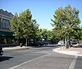
Main Street in Turlock
-
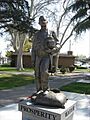
John W. Mitchell statue located at Turlock's downtown Central Park
-
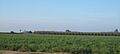
Various agriculture fields in Turlock
-
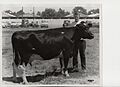
Cow exhibition at Stanislaus County Fair located in Turlock.
-
California State University, Stanislaus campus
See also
 In Spanish: Turlock para niños
