Happy Isles facts for kids

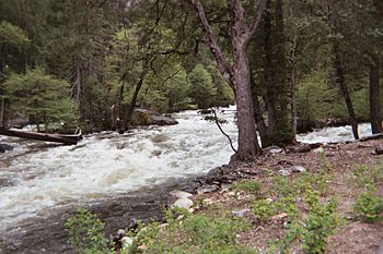
The Merced River in Happy Isles
|
|

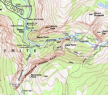
Topographic map of Happy Isles area
|
|
| Geography | |
|---|---|
| Coordinates | 37°43′54″N 119°33′31″W / 37.73171°N 119.558694°W |
Happy Isles is a beautiful spot in Yosemite National Park in California, USA. It's a group of small islands found in the Merced River. You can find these islands at the very eastern end of the Yosemite Valley.
This scenic area is a popular starting point for hikers. It's where the famous Mist Trail begins. Happy Isles is also the northern starting point for the John Muir Trail. Many people begin their adventures here to reach amazing places like Vernal Falls, Nevada Falls, and even Half Dome.
Exploring Happy Isles
Happy Isles is a special place where the Merced River changes. The river flows down from the mountains. At Happy Isles, the river's slope becomes less steep. It goes from a fast-moving section to the flatter Yosemite Valley floor.
River Flow and Rocks
The river at Happy Isles flows over a slope of about 2%. This part of the river is steeper than the rest of the Valley floor. The river has carved its path through strong, hard rocks. These rocks are mostly granitic boulders and talus. Talus is a pile of broken rocks at the bottom of a cliff.
Further down the Valley, the river flows over sand and gravel. Because of the steeper slope and the tough rocks, the river at Happy Isles flows in a straighter line. It doesn't curve and bend as much as it does in other areas. These curves are called meanders.
A Historic Rockslide
In 1996, a large rockslide happened near Happy Isles. This event caused some damage to the area. Today, you can find special signs near the islands. These signs tell the story of the rockfall. They help visitors understand the powerful forces of nature in Yosemite.
 | Jessica Watkins |
 | Robert Henry Lawrence Jr. |
 | Mae Jemison |
 | Sian Proctor |
 | Guion Bluford |

