Watsonville, California facts for kids
Quick facts for kids
Watsonville, California
|
|||
|---|---|---|---|
| City of Watsonville | |||
|
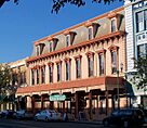
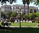
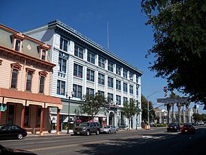
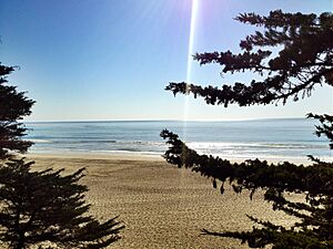
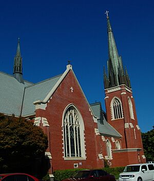
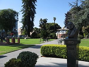
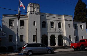
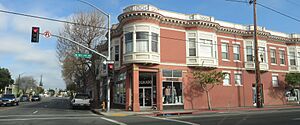
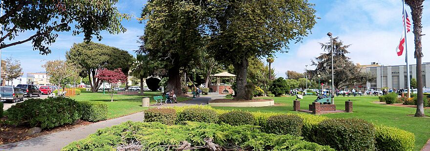
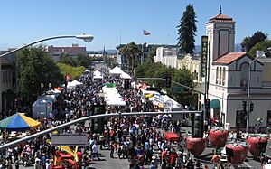
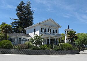
Top: Mansion House Hotel (left) and the City Plaza (right); middle: view of Downtown Watsonville; bottom: Fox Theatre (left), St. Patrick Church (center), and the Lettunich Building (right)
|
|||
|
|||
| Motto(s):
"Opportunity through diversity; unity through cooperation!"
|
|||
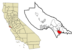
Location in Santa Cruz County and the state of California
|
|||
| Country | United States | ||
| State | California | ||
| County | Santa Cruz | ||
| Incorporated | March 30, 1868 | ||
| Government | |||
| • Type | Council–manager | ||
| Area | |||
| • Total | 6.80 sq mi (17.62 km2) | ||
| • Land | 6.71 sq mi (17.37 km2) | ||
| • Water | 0.10 sq mi (0.25 km2) 1.42% | ||
| Elevation | 29 ft (9 m) | ||
| Population
(2020)
|
|||
| • Total | 52,590 | ||
| • Estimate
(2019)
|
53,856 | ||
| • Density | 8,029.82/sq mi (3,100.33/km2) | ||
| Time zone | UTC-8 (Pacific) | ||
| • Summer (DST) | UTC-7 (PDT) | ||
| ZIP codes |
95076, 95077
|
||
| Area code | 831 | ||
| FIPS code | 06-83668 | ||
| GNIS feature IDs | 1660138, 2412194 | ||
Watsonville is a city in Santa Cruz County, California. It is located in the Monterey Bay Area on the Central Coast of California. In 2020, about 52,590 people lived there. Most people in Watsonville are of Latino heritage, and many vote for the Democratic Party.
Contents
History of Watsonville
The land where Watsonville now stands was first home to the Ohlone people. This Native American tribe lived along the Pajaro Dunes. The land was good for growing plants and raising animals.
Spanish Explorers Arrive
In 1769, the Portolá expedition was the first group of Europeans to explore this area. Soldiers described a large bird they saw near a big river. This story led to the river being named Rio del Pajaro, which means "River of the Bird".
The expedition camped near a lake north of town for five nights. Many soldiers were sick, so they moved slowly. While they rested, scouts looked for the best path forward. On the fifth day, a missionary named Juan Crespi wrote in his diary about seeing a "high, white mountain range."
On October 10, 1769, the explorers saw the Coast redwood tree for the first time. A special plaque at Pinto Lake marks this event. The area later became part of the Spanish province called Las Californias.
Mexican Rule and New Settlements
When Mexico became independent, it took control of Alta California. In the 1830s, the Spanish missions were closed. The Watsonville area became part of a large land grant called Rancho Bolsa del Pajaro.
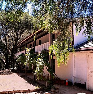
Under Mexico's rules, more people from Europe and the U.S. moved to the area. In 1833, Governor José Figueroa gave Rancho San Andrés to José Joaquín Castro. His son, Juan José Castro, built the Castro Adobe. This was the only two-story hacienda (large estate) in the area at that time. Today, the adobe is being restored as a state park.
Becoming Part of the United States
After the U.S. took control of California in 1848, many people moved to the region. These new settlers were mainly Americans from the East Coast and Europeans.
John H. Watson and D. S. Gregory planned the town in 1852. The community was officially made a town around March 30, 1868. It was named Watsonville after John H. Watson. It became a city around 1889.
Modern Times and Key Events
From 1904 to 1913, a railway connected Watsonville to Port Watsonville. From there, boats carried farm products to San Francisco overnight.
In January 1930, the Watsonville riots happened. Filipino American farmworkers were attacked by White Americans. One person, Fermin Tobera, was killed. In 2023, the local government apologized for these events.
On September 29, 2024, the Maggie Sue Earthquake struck near Watsonville. It had a magnitude of 4.5 and was felt strongly in the area.
In 1985, cannery workers in Watsonville went on strike for 18 months. They were protesting lower wages and benefits. The workers, many of whom were Latina women, won a new contract. This was an important victory for labor rights in the Mexicano/Chicano community.
Geography and Natural Features
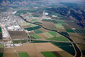
Watsonville is located in the Monterey Bay area, at the southern end of Santa Cruz County.
The city covers about 6.8 square miles (17.6 square kilometers). Most of this area is land, with a small part being water.
Watsonville has special areas that protect the Santa Cruz Tarweed, an endangered plant. The city has grown a lot since 1980. This growth has led to some natural areas being used for development.
Much of the coast near Watsonville is part of the Monterey Bay National Marine Sanctuary. This sanctuary protects the ocean and its creatures.
Watsonville Wetlands: A Natural Treasure
Another important natural area is the Watsonville wetlands. These are freshwater sloughs (slow-moving waterways) with open water and native plants. They stretch from the city to the ocean. These wetlands are one of the few remaining areas of their kind in the California Coastal Region.
The wetlands are home to many fish and over 200 types of birds. They are also a key stop for thousands of migrating birds on the Pacific Flyway. In 1990, groups worked together to protect these wetlands. The Watsonville Wetlands Watch was created to help restore and protect this natural habitat.
Climate and Weather
Watsonville has cool, wet winters and mild, dry summers. Fog and low clouds are common at night and in the morning, especially in summer. This happens when warm air from inland areas mixes with the cool, moist air from Monterey Bay.
January is usually the coldest month, with average high temperatures around 59.9°F (15.7°C). September is usually the warmest, with average highs around 73.2°F (22.9°C). It rarely gets very hot or very cold. Snowfall is very rare near Monterey Bay.
People and Population
| Historical population | |||
|---|---|---|---|
| Census | Pop. | %± | |
| 1860 | 398 | — | |
| 1870 | 1,151 | 189.2% | |
| 1880 | 1,799 | 56.3% | |
| 1890 | 2,149 | 19.5% | |
| 1900 | 3,528 | 64.2% | |
| 1910 | 4,446 | 26.0% | |
| 1920 | 5,013 | 12.8% | |
| 1930 | 8,344 | 66.4% | |
| 1940 | 8,937 | 7.1% | |
| 1950 | 11,572 | 29.5% | |
| 1960 | 13,293 | 14.9% | |
| 1970 | 14,719 | 10.7% | |
| 1980 | 23,662 | 60.8% | |
| 1990 | 31,099 | 31.4% | |
| 2000 | 44,265 | 42.3% | |
| 2010 | 51,199 | 15.7% | |
| 2020 | 52,590 | 2.7% | |
| U.S. Decennial Census | |||
Population in 2010
In 2010, Watsonville had a population of 51,199 people. About 81.4% of the people were Hispanic or Latino. Many families in Watsonville have children. The average household had about 3.75 people.
The population included many young people: 31.5% were under 18 years old. The average age was 29.2 years.
Population in 2000
In 2000, there were 44,265 people living in Watsonville. About 75.12% of the population was Hispanic or Latino, mostly of Mexican background.
Watsonville also has a history with Asian-American communities, including Chinese, Japanese, and Filipinos. These groups have been involved in farming and business in the area for a long time.
Economy and Jobs
Watsonville's main industries are building, farming, and making things. Some big companies based in Watsonville include Monterey Mushrooms, Driscoll's (known for berries), and Martinelli's (known for apple juice). Other large companies are Graniterock, Granite Construction, and West Marine.
Watsonville is famous for its farming business along the Northern Pacific Coast. Its economy relies on growing and sending crops all over the world. Important crops include strawberries, cauliflower, broccoli, lettuce, and raspberries. Companies like Driscoll's and California Giant spend a lot of money each year to process and transport fresh food. Watsonville is one of the most important farming cities in the U.S. for its agricultural market.
Top Employers in Watsonville
The biggest employers in Watsonville help many people find jobs. Here are some of the top employers:
| # | Employer | # of Employees |
|---|---|---|
| 1 | Pajaro Valley Unified School District | 4,108 |
| 2 | Monterey Mushrooms Inc. | 870 |
| 3 | Watsonville Community Hospital | 591 |
| 4 | Granite Construction | 557 |
| 5 | Lakeside Organic Gardens LLC | 450 |
| 6 | City of Watsonville | 427 |
| 7 | Salud Para La Gente | 422 |
| 8 | S Martinelli & Co. | 290 |
| 9 | Fox Factory | 265 |
| 10 | West Marine Products | 247 |
Parks and Fun Things to Do
Watsonville has 28 parks, including a skate park and an indoor soccer field. You can also find a lake with boat rentals, BBQ areas, tennis courts, and volleyball courts. The city offers many ways to have fun, like hiking, boating, sports, bird-watching, and beach access.
Exploring the Watsonville Wetlands
There are hiking trails throughout the city. A nature center gives you a close look at the Watsonville Wetlands. It's a great place to learn about nature and see local wildlife.
Fun Along the Pajaro River

You can find several trails in the city that lead to the Pajaro River. These trails are popular for walking, running, and biking. The city also has plans to create a public spot for canoes and kayaks on the river.
Pinto Lake Park Activities
The city runs one of two parks at Pinto Lake. Here you can find a boat ramp, picnic areas, an RV park, a baseball field, and a playground. You can also rent boats, go fishing, and watch birds. Because of algae, it's not safe to eat fish caught in Pinto Lake. The other park at Pinto Lake has nature trails and disc golf.
Pajaro Dunes for Tourists
The Pajaro Dunes area attracts visitors with its fancy beachfront condos and timeshares. It's a popular spot for people looking for a beach getaway.
Culture and Events
Watsonville hosts the yearly Strawberry Festival. This festival features many foods made with strawberries, live music, vendors, and rides. It's a sweet celebration for everyone!
Near the end of every summer, the Santa Cruz County Fair comes to town. Visitors from all over come for the rides, food, art, flower exhibits, pony rides, petting zoos, and live music.
The Santa Cruz County Fairgrounds also host other events. These include car races at the Ocean Speedway, dog training, weddings, and the annual Santa Cruz County Science Fair.
Education and Schools
Watsonville's public schools are part of the Pajaro Valley Unified School District. This district has about 18,000 students from kindergarten to 12th grade. The local high schools are Watsonville High School and Pajaro Valley High School.
Cabrillo College also has a campus in Watsonville.
There are several charter schools in Watsonville, such as Diamond Technology Institute and Watsonville Charter School of the Arts. Private schools in the city include Green Valley Christian School and Monte Vista Christian.
Media and News
Watsonville and the surrounding area have a local newspaper called The Pajaronian. You can also listen to radio stations like KSCO and KPIG-FM.
Notable People from Watsonville
Many interesting people have come from Watsonville, including:
- Tony Carey, a musician and composer
- Laurie R. King, an author
- Marv Marinovich, a football player and coach
- Ty Sambrailo, a football player
- Ken Sears, a professional basketball player
- Cody Webb, a motorcycle racer
Sister Cities
Watsonville has "sister cities" around the world. These are cities that have special friendly relationships with Watsonville:
- Velas, Sáo Jorge Island, Azore Islands, Portugal
- Cavtat, Croatia
- Jocotepec, Mexico
- Kawakami, Japan
- Pinghu, China
- San Pedro Masahuat, El Salvador
- Tangancícuaro, Mexico
See also
 In Spanish: Watsonville para niños
 | Jackie Robinson |
 | Jack Johnson |
 | Althea Gibson |
 | Arthur Ashe |
 | Muhammad Ali |


