
Watsonville, Queensland facts for kids
Quick facts for kids WatsonvilleQueensland |
|||||||||||||||
|---|---|---|---|---|---|---|---|---|---|---|---|---|---|---|---|

Watsonville mine pit after the treated water has been released
|
|||||||||||||||

Watsonville
Location in Queensland
|
|||||||||||||||
| Population | 176 (2021 census) | ||||||||||||||
| • Density | 0.6283/km2 (1.627/sq mi) | ||||||||||||||
| Postcode(s) | 4887 | ||||||||||||||
| Area | 280.1 km2 (108.1 sq mi) | ||||||||||||||
| Time zone | AEST (UTC+10:00) | ||||||||||||||
| Location | |||||||||||||||
| LGA(s) | Shire of Mareeba | ||||||||||||||
| State electorate(s) | Hill | ||||||||||||||
| Federal Division(s) | Kennedy | ||||||||||||||
|
|||||||||||||||
Watsonville is a small country town. It is also a locality in the Shire of Mareeba, Queensland, Australia. In 2021, about 176 people lived in Watsonville.
Contents
Exploring Watsonville's Location
Watsonville is located in the northern part of Queensland. It is about 107 kilometers (66 miles) south-west of Cairns. You can reach it by driving on several main roads. These include the Bruce Highway and the Herberton Petford Road.
Mountains and Hills in Watsonville
The eastern and southern parts of Watsonville are bordered by the Great Dividing Range. This is a large mountain range in Australia. Several mountains and hills are found within Watsonville itself.
- Cave Hill is 910 meters (2,986 feet) tall.
- Lion Mountain reaches 914 meters (2,999 feet) high.
- Mount Empress stands at 1,152 meters (3,780 feet).
- Rocky Bluff is 1,030 meters (3,379 feet) high.
- Specimen Hill is 1,025 meters (3,363 feet) tall.
- Wallum is the highest at 1,292 meters (4,239 feet).
- Western Hill is 1,098 meters (3,602 feet) high.
Watsonville's Past: A Mining Town
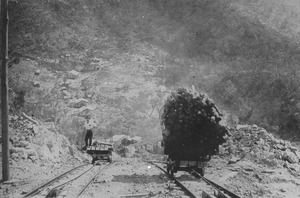
Watsonville used to be a busy mining town. It was named after Robert H. Watson. He was a tin prospector who found tin here on February 19, 1881. The town was officially mapped out in 1882.
Early Education in Watsonville
A school called Watsonville State School opened around 1882. It helped educate the children of the mining families. The school closed its doors around 1943. It was located where Ann, Mary, Ethel, and Edith Streets meet.
Changes in Local Government
Watsonville has always been part of the Shire of Mareeba. However, for a few years, from 2008 to 2013, it was part of the Tablelands Region. This change was not very popular. So, in 2014, Watsonville returned to being part of the Shire of Mareeba.
People Living in Watsonville
The number of people living in Watsonville has changed over the years.
- In 2011, the population was 344 people.
- By 2016, it had decreased to 191 people.
- In 2021, the population was 176 people.
Protecting Watsonville's History

Watsonville has some heritage-listed sites. This means they are important historical places. They are protected to make sure they last for future generations.
One important site is the Rocky Bluff Battery and Township. It is about 10 kilometers (6 miles) north-west of Watsonville. This site shows old mining equipment and the remains of a past township.
Learning Opportunities Near Watsonville
There are no schools directly in Watsonville today. Students usually travel to nearby towns for their education.
Primary School Options
The closest government primary schools are:
- Herberton State School in Moomin (south-east).
- Atherton State School in Atherton (north-east).
- Irvinebank State School in Irvinebank (south-west).
Secondary School Options
For older students, the nearest government secondary schools are:
- Herbert State School in Herberton (up to Year 10).
- Atherton State High School in Atherton.
Sometimes, these schools might be too far away for some students. In those cases, students can choose distance education. This means they learn from home using online lessons. Boarding school is another option, where students live at the school.
Places to Visit in Watsonville
The Watsonville Pioneer Cemetery is a historical site. It is located on Watsonville Cemetery Access Road. You can find it north-west of the town. It is a quiet place that tells stories of the past.
