Tolga, Queensland facts for kids
Quick facts for kids TolgaQueensland |
|||||||||||||||
|---|---|---|---|---|---|---|---|---|---|---|---|---|---|---|---|

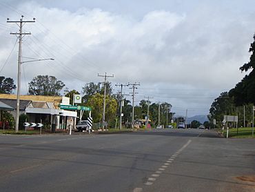
Kennedy Highway near the intersection with Main Street, Tolga
|
|||||||||||||||
| Population | 3,177 (2021 census) | ||||||||||||||
| • Density | 37.245/km2 (96.46/sq mi) | ||||||||||||||
| Established | 1885 | ||||||||||||||
| Postcode(s) | 4882 | ||||||||||||||
| Elevation | 760 m (2,493 ft) | ||||||||||||||
| Area | 85.3 km2 (32.9 sq mi) | ||||||||||||||
| Time zone | AEST (UTC+10:00) | ||||||||||||||
| Location | |||||||||||||||
| LGA(s) | Tablelands Region | ||||||||||||||
| State electorate(s) | Hill | ||||||||||||||
| Federal Division(s) | Kennedy | ||||||||||||||
|
|||||||||||||||
|
|||||||||||||||
Tolga is a rural town and area in the Tablelands Region of Queensland, Australia. In 2021, about 3,177 people lived there. It is known as a main spot for growing peanuts in the area. You can even see a giant peanut statue there!
Contents
Exploring Tolga's Location
Tolga is found on the Atherton Tableland. The main road, called the Kennedy Highway, goes right through the town. This highway runs from the north-west to the south of the area.
Nearby Areas in Tolga
There are a few smaller areas within Tolga. Mapee is a neighborhood in the middle of the area. Yadjin is another neighborhood located in the south-east.
Rivers and Mountains Around Tolga
The Barron River forms the north-east edge of Tolga. The south-western edge is marked by the Great Dividing Range. This mountain range separates the water that flows to the Coral Sea from the water that flows to the Gulf of Carpentaria.
The northern and eastern parts of Tolga are mostly flat. This flat land is perfect for growing crops. The western parts are more mountainous and are not as developed. Bones Knob is a peak to the west of the town. It stands about 962 meters (3,156 feet) above sea level.
The Tolga Scrub Rainforest
On the southern side of town, you'll find the Tolga Scrub. This special area is one of the last remaining parts of Mabi rainforest on the Atherton Tableland. It is a very tough type of rainforest in Australia because it can handle dry weather well. The Tolga Scrub is about 2 kilometers (1.2 miles) long and 100 meters (328 feet) wide.
Tolga's Past: A Look Back
The name Bones Knob might come from a young Aboriginal man known as "Bones." He was mentioned in a letter from 1879.
The town was first called Martin Town. It was named after George and Robert Martin, who ran sawmills. The town grew from a stop for Cobb and Co coaches at Rocky Creek.
School History in Tolga
Martintown Provisional School first opened its doors on October 10, 1895. It changed its name to Tolga Provisional School in 1905. Then, on January 1, 1909, it became Tolga State School. The school celebrated its 100th birthday in 1995.
How Tolga Got Its Name
The town's name changed to Tolga in 1903. This happened when the Tablelands railway line was extended. The local railway station was going to be called Tolga. This name is thought to come from an Aboriginal word. It might mean place where the scrub begins or red volcanic soil. The railway line opened on August 10, 1903.
A smaller railway line was also built from Tolga to Yungaburra. It opened on March 15, 1910. This line was later made longer, reaching Millaa Millaa by December 19, 1921. The railway line between Atherton and Mareeba stopped working on July 1, 2011, and officially closed on March 15, 2013.
Names of Neighborhoods
Mapee got its name from its railway station in 1915. It is an Aboriginal word that means tree kangaroo. Yadjin also got its name from its railway station in 1922. This Aboriginal word means grass pocket.
Tolga During World War II
During World War II in 1943, the Australian Army set up a very large storage and repair center near Tolga. It was used to support the war in the Pacific. This center was called the 13 Australian Advanced Ordnance Depot. About 1,000 people worked there, including 200 women from the Australian Women's Army Service. The complex had about 150 buildings. It stored and fixed Army vehicles, weapons, and clothing.
Most of these buildings were taken down in 1946 after the war ended. One building was moved to the Atherton Hospital. Sadly, on November 29, 1946, three Army workers died in an accident at the ammunition dump. They were trying to remove material from shells when it caught fire.
Tolga's Population Over Time
The number of people living in Tolga has grown over the years:
- In 2006, the town of Tolga had 843 people.
- In 2011, the area of Tolga had 2,426 people.
- In 2016, the area of Tolga had 2,718 people.
- In 2021, the area of Tolga had 3,177 people.
Important Historical Sites
Tolga has some places that are listed as important historical sites:
- Bones Knob Radar Station, on Bowcock Road
- Rocky Creek World War Two Hospital Complex, on Kennedy Highway
Learning in Tolga
Tolga State School is a primary school for children from Prep to Year 6. It is located on Main Street. In 2023, the school had 316 students.
There isn't a government high school in Tolga. The closest one is Atherton State High School in the nearby town of Atherton. There are also private schools in Atherton.
Community Activities
The Tolga branch of the Queensland Country Women's Association (QCWA) meets at the QCWA Hall on Main Street. This group helps women in rural areas.
Fun Events in Tolga
The Tolga Markets are held at the Tolga Racecourse. They happen on the first Sunday of every month from 7 AM to 12 PM. You can find local produce, handmade items, clothes, tools, and food for sale. It is a very popular market on the Atherton Tableland.
 | Anna J. Cooper |
 | Mary McLeod Bethune |
 | Lillie Mae Bradford |


