
Monterey Bay National Marine Sanctuary facts for kids
Quick facts for kids Monterey Bay National Marine Sanctuary |
|
|---|---|

Big Sur coastline looking north to Bixby Canyon Bridge. Monterey Bay National Marine Sanctuary.
|
|
| Location | California's central coast, United States |
| Area | 6,094 sq mi (15,780 km2) |
| Established | 1992 |
| Governing body | NOAA National Ocean Service |

The Monterey Bay National Marine Sanctuary (MBNMS) is a special ocean area off the coast of California. It is protected by the U.S. government. This amazing place stretches along California's Big Sur and central coast.
It is the largest national marine sanctuary in the United States. Its shoreline is about 276 miles (444 km) long. It goes from north of the Golden Gate Bridge in San Francisco down to Cambria. The sanctuary is home to many different kinds of ocean life. You can find mammals, seabirds, fishes, and plants here. The MBNMS was created in 1992. Its main goals are to protect ocean resources, support research, offer education, and allow people to enjoy the area.
Contents
Exploring the Sanctuary
The Monterey Bay National Marine Sanctuary is one of 13 National Marine Sanctuaries. These sanctuaries are managed by the National Oceanic and Atmospheric Administration (NOAA). NOAA is part of the U.S. Department of Commerce.
The sanctuary covers about 6,094 square miles (15,783 km2) of ocean. This area surrounds Monterey Bay. Its ocean boundary is about 30 miles (48 km) offshore. The boundary on land is the average high tide line. The deepest spot in the sanctuary is 10,663 feet (3,250 meters) deep. This is in the Monterey Submarine Canyon. That's even deeper than the Grand Canyon! The ocean water here is usually around 55°F (13°C).
Amazing Ocean Life
The sanctuary is a home for many different creatures. It has 34 types of marine mammals, like whales and dolphins. There are 94 kinds of seabirds and 345 types of fish. You can also find 4 kinds of sea turtles. Plus, there are over 450 types of marine algae, which are like ocean plants. The sanctuary also protects historical sites, including many old shipwrecks.
Visitor Centers
You can learn more about the sanctuary at its visitor centers.
- The Coastal Discovery Center is in San Simeon, California. It is across the highway from the Hearst Castle visitor's center.
- The Monterey Bay Marine Sanctuary Exploration Center opened in 2012. It is located in Santa Cruz, California.
Working Together for the Ocean
The MBNMS works with many groups to protect the ocean.
- The Sanctuary Advisory Council has members from local groups and governments. They help make decisions about the sanctuary.
- Different working groups focus on research, education, and conservation.
- The B-WET program gives money to schools and communities. This helps them learn about the environment around Monterey Bay.
Nearby Protected Areas
The Monterey Bay National Marine Sanctuary is next to many other protected areas. These areas help protect the coast and ocean. Some of them include:
- Greater Farallones National Marine Sanctuary
- Golden Gate National Recreation Area
- Año Nuevo State Reserve
- Natural Bridges State Beach
- Elkhorn Slough National Estuarine Research Reserve
- Salinas River National Wildlife Refuge
- Point Lobos State Marine Reserve
- Pfeiffer Big Sur State Park
- Julia Pfeiffer Burns State Park
- William Randolph Hearst Memorial State Beach
Events and Activities

The MBNMS hosts many events and activities. You can find a calendar of meetings and volunteer opportunities. These include:
- Snapshot Day: Volunteers help monitor the health of local waterways.
- Urban Watch: This program helps keep an eye on urban runoff into the ocean.
- First Flush: Volunteers check water quality after the first big rains of the season.
- TeamOCEAN: Kayakers learn to be naturalists and share information with others on the water.
The Sanctuary Integrated Monitoring Network (SIMoN) website was created in 2003. It collects information from many monitoring projects. In 2012, this information became available as a phone app. This lets visitors see over 4,200 photos collected by the sanctuary.
History of the Sanctuary
The idea for a marine sanctuary in this area started in 1967. Groups like the Sierra Club worked hard to make it happen. In 1972, a law was passed to help protect marine areas.
In 1975, California suggested creating a marine sanctuary here. By 1976, Santa Cruz County and Monterey County joined the effort. However, in 1983, the government decided not to make it a sanctuary at that time.
In 1988, the Sanctuaries Act was approved again. A sanctuary in Monterey Bay was proposed. After public meetings, people wanted an even larger protected area. They remembered the 1969 Santa Barbara oil spill and wanted strong protection. Finally, on September 20, 1992, the MBNMS was officially created. This was thanks to a law proposed by Congressman Leon Panetta. It became the largest federal marine sanctuary.
Oil and Gas Protection
There are oil and gas reserves off the coast of California. However, exploring for them has not been allowed in this area. In 1982, there was a plan to open the Central California coast to oil and gas exploration. But people in California and their leaders strongly opposed it. The plan was stopped.
In 1990, President George H. W. Bush used a special law to permanently ban oil and gas development in Monterey Bay. Later, President Barack Obama used the same law to ban oil exploration from Hearst Castle to Point Arena.
In 2017, under President Donald Trump, the government looked at whether to change the sanctuary's protected status. This included the Davidson Seamount, a huge underwater mountain. Many environmental groups and local residents were against opening the area to oil and gas exploration. They wanted to keep the sanctuary protected.
Images for kids
-
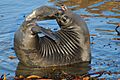
Young elephant seal at rookery, MBNMS
-
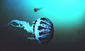
A purple striped jellyfish in the sanctuary
-
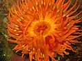
Anemone, MBNMS
-
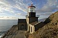
Point Sur Lighthouse


