Salinas River National Wildlife Refuge facts for kids
Quick facts for kids Salinas River National Wildlife Refuge |
|
|---|---|
|
IUCN Category IV (Habitat/Species Management Area)
|
|
 |
|
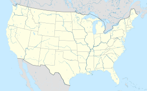
| Location | Monterey County, California, United States |
| Nearest city | Castroville, California |
| Area | 367 acres (1.49 km2) |
| Established | 1974 |
| Governing body | U.S. Fish and Wildlife Service |
| Website | Salinas River National Wildlife Refuge |
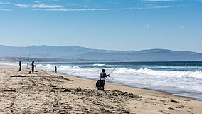
The Salinas River National Wildlife Refuge is a special place in California. It is about 11 miles north of Monterey, California. You can find it where the Salinas River meets Monterey Bay.
This refuge is 367-acre (1.49 km2) big. It has many different natural areas. These include sandy dunes, salty marshes with special plants like pickleweed, and a river lagoon. There are also river areas and a salty pond. The refuge started in 1974. It was created to help protect birds that travel long distances.
Many animals that are in danger live here. These include the California brown pelican and the western snowy plover. Special insects like the Smith's blue butterfly also call it home. Rare plants like the Monterey sand gilia and the Monterey spineflower grow here too. These are called "threatened" or "endangered" because their numbers are very low.
Lots of birds use the refuge. They come to breed, spend the winter, or rest during their long journeys. You might also see mammals like muskrats, beavers, and coyotes. Other animals include raccoons, skunks, and different types of mice.
The Salinas River National Wildlife Refuge is open to visitors. It has a parking lot and walking paths. However, you cannot bring dogs or horses. Camping is also not allowed. This helps keep the sensitive natural areas safe for the wildlife.
Contents
What is the Climate Like at the Refuge?
The area around the refuge has a Mediterranean climate. This means summers are warm and dry. Winters are usually wet and mild. On average, the area gets about 16 inches of rain each year. Most of this rain falls between November and April.
Winds usually come from the southeast in summer and fall. In winter and spring, the wind often blows steadily from the northwest.
Why is Water Quality Important?
The water in the Salinas River faces some challenges. Water is pumped out for different uses. Also, industries can affect the water. These things can change how salty the water is naturally.
The biggest problem for water quality comes from farms upstream. Chemicals from farming can get into the river. This can cause too much algae to grow, which is called eutrophication. Some old pesticides, like dichlorodiphenyltrichloroethane, have also been found in the water.
Poor water quality is a big threat to animals like the California slender salamander. This salamander is an endangered species. Because of this, government groups regularly check the water quality in the river.
What is the Geology of the Refuge?
The refuge is part of the California Coast Ranges. The oldest rocks along the coast are from the Mesozoic Era. These rocks are between 65 and 245 million years old. About seven million years ago, the local mountains grew much taller. There are also several geological faults in the area, like the San Gregorio-Hosgri fault system.
Most of the refuge sits on old sand dunes and clay. These layers were formed during the Pleistocene Ice Age. Scientists have studied the riverbanks. They found sand under the clay, but very dense clay deeper down. This means the ground is very stable.
Images for kids
 | Roy Wilkins |
 | John Lewis |
 | Linda Carol Brown |


