
The Californias facts for kids
Quick facts for kids
The Californias
Las Californias
|
|
|---|---|
.png) |
|
| Country |
|
| U.S. state | California |
| Mexican states | Baja California Baja California Sur |
| Principal cities | |
| Area | |
| • Total | 569,329 km2 (219,819 sq mi) |
| Population | |
| • Total | 43,636,740 |
| • Density | 77/km2 (200/sq mi) |
| Time zones | UTC-8 (Pacific Standard Time) |
| • Summer (DST) | UTC-7 (Pacific Daylight Time) |
| UTC-7 (Mountain Standard Time) | |
| • Summer (DST) | UTC-6 (Mountain Daylight Time) |
The Californias (in Spanish: Las Californias) is a name for a large region in North America. It includes the United States state of California and the Mexican states of Baja California and Baja California Sur. Sometimes people call it "The Three Californias" or "Two Californias."
Long ago, the term Californias described a huge area in the northwest part of Spanish America. It was known as the Province of the Californias. Later, it became a name for two main parts: Alta California and the Baja California Peninsula.
This area was once a single, giant territory under the Spanish Empire. Over time, as its borders became clearer, it was split. This split created Baja California (meaning Lower California) and Alta California (meaning Upper California). This happened several times, especially when Mexico controlled the region after its Mexican War of Independence.
During the Mexican–American War (1846–48), the United States took over Alta California. This huge territory was then given from Mexico to the United States. In 1850, the busy coastal part of Alta California became the State of California. The large, empty inland areas later became other states like Nevada, Utah, and parts of Arizona, Wyoming, Colorado, and New Mexico.
Today, "Californias" is a general term for the American and Mexican states that share the name California. These states have similar geography, history, cultures, and strong economic connections.
Contents
Why is it Called "The Californias"?
There has been some confusion about why Spanish rulers used the plural word Californias. A historian named Theodore Hittell explained it this way:
- In the very early days, people thought California was an island, or even several islands. So, they called it "Las Californias" (The Californias).
- Later, they found out it was a peninsula (land surrounded by water on three sides). Then, they just called it California. But this name covered a huge, undefined area.
- When Spanish explorers went to settle places like San Diego and Monterey, they were still in California, but a new part of it.
- The peninsula then became known as Antigua or Old California. The large, unexplored northern part was called Nueva or New California. This was later more commonly known as Alta or Upper California.
- At the same time, the old plural name "The Californias" came back. But now it meant something more specific: the old settled area and the new northern parts together.
History of the Californias
The first time Spain tried to settle California was in 1683. A Jesuit missionary named Eusebio Kino started a mission called Misión San Bruno. But it failed. It wasn't until 1697 that another Jesuit, Juan María de Salvatierra, successfully built Misión de Nuestra Señora de Loreto Conchó. This mission became the center of Loreto, which was the first permanent settlement and the first administrative capital of the province. The Jesuits built a total of 18 missions in the lower two-thirds of the Baja California Peninsula.
The Province of New Spain
.JPG)
In 1767, the Jesuits were removed from the missions. Franciscans were brought in to take over. Gaspar de Portolá was made governor to help with this change. At the same time, a new official from Spain, José de Gálvez, came with power to organize and expand the new province.
The bigger province name, Las Californias, was created in a message to the King on January 28, 1768. This message was from Viceroy de Croix and José de Gálvez. Gálvez wanted to show the difference between the Antigua (old) settled area and the Nueva (new) unexplored areas to the north. At that time, most of the explored and settled parts were around the old Jesuit missions. But once exploration and settlement of the northern frontier truly began, the names Alta (upper) and Baja (lower) became more popular.

The single province was divided in 1804. It became the Alta California province and the Baja California province. By 1804, the Alta province had grown to include coastal areas as far north as what is now the San Francisco Bay Area in the U.S. state of California. This growth happened through exploration and settlement trips. These were led by Portolá (1769), his replacement Pedro Fages (1770), Juan Bautista de Anza (1774–76), and Franciscan missionaries. When Mexico became independent, it kept this division. But the former provinces became territories because their populations were too small to be states.
The Californias as a Mexican Department
.jpg)
| Department of the Californias
Departamento de las Californias
|
|||||||||||||||
|---|---|---|---|---|---|---|---|---|---|---|---|---|---|---|---|
| Department of Centralist Republic of Mexico | |||||||||||||||
| 1836–1847 | |||||||||||||||
.png) |
|||||||||||||||
| Capital | Loreto, Ensenada, Pueblo de Los Angeles, & Monterey | ||||||||||||||
| Demonym | Californio | ||||||||||||||
| History | |||||||||||||||
|
• Established
|
1836 | ||||||||||||||
|
• Disestablished
|
1847 | ||||||||||||||
|
|||||||||||||||
| Today part of | California Baja California Baja California Sur Nevada Arizona Utah Wyoming |
||||||||||||||
In 1836, the name Las Californias was used again. Alta and Baja California were joined into one departamento (a type of region or state). This was part of new government changes in Mexico called the Siete Leyes (Seven Laws). But these Seven Laws were canceled in 1847, during the Mexican–American War. The two Californias were then split again.
California briefly became independent after the Bear Flag Revolt. But it quickly came under the control of American forces.
After Mexico lost the war, most of the former Alta California territory was given to the United States. This happened on February 2, 1848, under the Treaty of Guadalupe Hidalgo. The new border between Mexico and the United States was set a little north of the old Alta-Baja border. The terms Las Californias and Alta California were no longer officially used. The areas in North America that the U.S. gained were called "territory" and were managed by a military governor. California was the first part of this territory to become a state, two years later.
Geography of the Californias
The Baja California Peninsula has water on three sides: the Pacific Ocean (south and west) and the Gulf of California (east). Alta California had the Pacific Ocean to its west and deserts to its east. A northern border was set by the Adams–Onís Treaty in 1819. That border is still the northern boundary for the U.S. states of California, Nevada, and the western part of Utah.
The Spanish mostly did not explore the inland regions. So, these areas were generally not controlled by the Spanish rulers. Mountain ranges like the Peninsular Ranges, eastern Transverse Ranges, and the Sierra Nevada mountains acted as natural barriers to Spanish settlement. Also, the dry Colorado Desert, Mojave Desert, and Great Basin Desert to the east made it hard to settle.
The eastern border of upper Las Californias was never officially set by either Spanish or Mexican rule. Old government papers from 1781 described Alta California ("Upper California") as the areas west of the Sierra Nevada and the lower part of the Colorado River. This river now forms the border between the states of California and Arizona.
| Initial Spanish Colonialization (1767-1804) | Late Spanish Colonial Period - First Mexican Republic (1804-1835) | Centralist Republic of Mexico (1837-1847) | After Mexican–American War | Territory prior to statehood | Statehood |
|---|---|---|---|---|---|
| Provincia de las Californias |
Territorio de Baja California |
Departamento de las Californias
Fort Ross (Крѣпость Россъ) |
Territorio de Baja California
|
Territorio Sur de Baja California (1931-1974) | Baja California Sur |
| Territorio Norte de Baja California (1931-1952) | Baja California |
||||
| Territorio de Alta California Fort Ross (Крѣпость Россъ) |
Mexican Cession |
California |
|||
Nevada Territory (1861-1864)
|
Nevada |
||||
| Utah Territory (1850-1896) | Utah |
||||
| New Mexico Territory (1850-1866)
Arizona Territory (1863-1912) |
(Northern) Arizona |
||||
| Utah Territory (1850-1868)
Wyoming Territory (1868-1890) |
(Southwestern) Wyoming |
||||
Images for kids
-
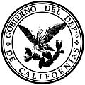
Seal of the Government of the Department of the Californias, from 1836 to 1846.
See also
 In Spanish: Las Californias para niños
