
Loreto, Baja California Sur facts for kids
Quick facts for kids
Loreto, Baja California Sur
|
||
|---|---|---|
.jpg) .jpg) _(cropped).jpg) .jpg) _(cropped).jpg) Top: view of Loreto from the Gulf of California; middle: Misión de Nuestra Señora de Loreto Conchó (left) and Posada de las Flores (right); bottom: City Hall (left) and downtown (right).
|
||
|
||

Loreto, Baja California Sur
Location in Baja California Sur

Loreto, Baja California Sur
Location in Mexico
|
||
| Country | ||
| State | Baja California Sur | |
| Municipality | Loreto Municipality | |
| Founded | October 25, 1697 | |
| Founded as | Real de Loreto | |
| Founded by | Juan María de Salvatierra | |
| Elevation | 3 m (10 ft) | |
| Population
(2020)
|
||
| • Total | 16,311 | |
| • Demonym | Loretano | |
| Time zone | UTC−7 (Pacific (US Mountain)) | |
| • Summer (DST) | UTC−6 (Pacific) | |
| Postal code |
23880
|
|
| Area code(s) | 613 | |
| Website | www.loreto.gob.mx | |

Loreto is a lively city located on the west coast of Mexico, right by the Gulf of California. In 2020, about 16,311 people lived there. Loreto is an important place for business and culture, and it's a very popular spot for tourists on the Baja California Peninsula.
The city was started in 1697 by Juan María de Salvatierra, who founded the Misión de Nuestra Señora de Loreto Conchó. For many years, Loreto was the capital of the region called Province of the Californias. It remained the capital of Baja California until 1829. In the 20th century, Loreto grew a lot and became the popular tourist spot and regional center it is today.
Contents
Loreto's Early History

Loreto was the very first Spanish settlement on the Baja California Peninsula. It was part of the Viceroyalty of New Spain, which was a large area controlled by Spain.
The town was founded in 1697 by Jesuit missionaries. They chose this spot because they found a good spring with fresh water. They built the Misión Nuestra Señora de Loreto there. Later, in 1767, the Jesuits had to leave, and the Franciscans took over the missions in Baja California.
In 1769, the Franciscans were asked to give control of the Baja missions to the Dominican Order. They then joined an expedition led by Gaspar de Portolá. This group went north to start new missions in an unknown area that later became Alta California. The expedition left Loreto on March 24, 1769.
Loreto was the capital of the province of Las Californias from when it was founded until February 3, 1777. On that date, the capital moved to Monterey. In 1768, the province had been split into Alta California (which is now the U.S. state of California) and Baja California. Even after the split, the two areas shared one governor for a while. Later, Loreto became the main office for the Lieutenant Governor of Baja California.
The Loreto Municipality was created in 1992. The people of Loreto elected their first Mayor in 1993.
Loreto's Location and Landscape

Loreto is on the east coast of the Baja California Peninsula. It sits right next to the Gulf of California on its eastern side. To the west, you'll find the Transpeninsular Highway. To the south, there's a dry creek bed called Arroyo Loreto, which only fills with water when it rains a lot.
The city is built on mostly flat land, about 10 meters (33 ft) above sea level. To the west, you can see the "La Giganta" Mountain Range, also known as the Sierra de la Giganta. These mountains stretch along the middle of Baja California Sur, running parallel to the coast.
The area around Loreto, from Bahía Concepción to Agua Verde, has a unique landscape. It includes narrow ridges, valleys, and plains right next to the mountains and the coast.
Loreto is a popular place for tourists, especially from the U.S.. There are daily flights from California to Loreto International Airport. Many American visitors love to go fishing for "dorado" (which is also called Mahi-mahi or Dolphin Fish) in small boats called "pangas." Local restaurants are happy to cook the fish that tourists catch. Loreto also has a museum next to its historic church. Loreto has friendly relationships with its sister cities in California: Hermosa Beach, Cerritos, and Ventura.
Loreto's Climate and Weather
.jpg)
Loreto has a tropical desert climate. This means it's hot and humid, with lots of sunshine. The average temperature is about 24.4 °C (76 °F).
- Summer (June to October): Temperatures are hot, with daily highs around 34 °C (93 °F) and high humidity. The highest temperature ever recorded in Loreto was 44.2 °C (112 °F) on July 2, 2006.
- Spring: The temperatures are mild and pleasant.
- Autumn and Winter: These months are usually windy. The lowest temperature ever recorded was 0.0 °C (32 °F) on December 15, 1987.
Loreto doesn't get much rain, averaging about 160 mm (6.3 in) per year. The wettest months are August and September, when there are short, occasional rainfalls. One thing to watch out for in Loreto is the Pacific hurricane season, which runs from June to November. Hurricanes can sometimes bring heavy rain and floods. For example, in September 2006, Hurricane John hit the area.
| Climate data for Loreto, Baja California Sur (1951–2010) | |||||||||||||
|---|---|---|---|---|---|---|---|---|---|---|---|---|---|
| Month | Jan | Feb | Mar | Apr | May | Jun | Jul | Aug | Sep | Oct | Nov | Dec | Year |
| Record high °C (°F) | 31.0 (87.8) |
34.6 (94.3) |
37.0 (98.6) |
39.5 (103.1) |
45.0 (113.0) |
44.2 (111.6) |
44.0 (111.2) |
44.0 (111.2) |
46.0 (114.8) |
41.0 (105.8) |
39.0 (102.2) |
36.5 (97.7) |
45.0 (113.0) |
| Mean daily maximum °C (°F) | 23.5 (74.3) |
24.6 (76.3) |
26.3 (79.3) |
28.9 (84.0) |
31.8 (89.2) |
34.6 (94.3) |
35.8 (96.4) |
36.1 (97.0) |
35.5 (95.9) |
33.1 (91.6) |
28.3 (82.9) |
24.4 (75.9) |
30.2 (86.4) |
| Daily mean °C (°F) | 17.2 (63.0) |
17.9 (64.2) |
19.3 (66.7) |
21.8 (71.2) |
24.7 (76.5) |
28.2 (82.8) |
30.7 (87.3) |
31.1 (88.0) |
30.2 (86.4) |
26.9 (80.4) |
22.0 (71.6) |
18.3 (64.9) |
24.0 (75.2) |
| Mean daily minimum °C (°F) | 11.0 (51.8) |
11.2 (52.2) |
12.4 (54.3) |
14.6 (58.3) |
17.6 (63.7) |
21.8 (71.2) |
25.6 (78.1) |
26.0 (78.8) |
24.8 (76.6) |
20.7 (69.3) |
15.8 (60.4) |
12.2 (54.0) |
17.8 (64.0) |
| Record low °C (°F) | 2.0 (35.6) |
3.0 (37.4) |
4.5 (40.1) |
6.5 (43.7) |
10.0 (50.0) |
11.0 (51.8) |
14.5 (58.1) |
16.0 (60.8) |
16.0 (60.8) |
11.5 (52.7) |
7.0 (44.6) |
0.0 (32.0) |
0.0 (32.0) |
| Average precipitation mm (inches) | 12.3 (0.48) |
5.0 (0.20) |
1.4 (0.06) |
0.0 (0.0) |
0.2 (0.01) |
0.4 (0.02) |
7.1 (0.28) |
36.6 (1.44) |
56.6 (2.23) |
18.7 (0.74) |
7.4 (0.29) |
14.3 (0.56) |
160.0 (6.30) |
| Average precipitation days (≥ 0.1 mm) | 1.3 | 0.7 | 0.2 | 0.1 | 0.1 | 0.1 | 1.1 | 2.3 | 2.1 | 1.0 | 0.7 | 1.2 | 10.9 |
| Average relative humidity (%) | 68 | 67 | 66 | 65 | 66 | 65 | 64 | 64 | 69 | 66 | 66 | 68 | 66 |
| Mean monthly sunshine hours | 248 | 293 | 297 | 309 | 360 | 352 | 326 | 305 | 289 | 289 | 255 | 240 | 3,563 |
| Source 1: Servicio Meteorológico Nacional (humidity, 1981–2000) | |||||||||||||
| Source 2: Ogimet (sun 1981–2010) | |||||||||||||
Loreto's Population and People
_(cropped).jpg)
In 2015, Loreto had 18,535 people living in 2,565 homes. Most of the people in charge of households (about 77.67%) were men.
Loreto has a young population. Almost 30% of the people are between 0 and 14 years old, and about 19% are between 15 and 24 years old. Only a small part of the population (about 6.42%) is 60 years or older. For every 100 females, there are about 102.5 males.
Because Loreto is a smaller town and not many new people move there, many families have lived there for a long time. This means you'll often find people with the same last names. For example, the "Davis" family is common in the east part of the city near the beach, and the "Murillo" family lives mostly in the south, near the Arroyo Loreto creek. Other big families in Loreto include the Amador, Arce, Cota, Higuera, Romero, and Villalejo families.
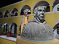
Loreto's Culture and Landmarks
.jpg)
Loreto has seven buildings that are considered historical monuments by the government. These buildings date from the 18th to the 20th century. The most important one is the Mission of Our Lady of Loreto. This mission is the starting point of El Camino Real, which means "The Royal Road." This historic path goes north, following the old route of Spanish missions all the way to Sonoma, California, USA.
In the nearby town of San Javier, there are five more historical buildings. The most important of these is the Mission of Saint Francis Xavier (Misión de San Francisco Javier). It is the best-preserved mission on the Baja California peninsula.
You can also find the ruins of Mission of San Bruno about 20 kilometers north of Loreto. This was the first mission in Baja California, founded in 1683 by a Jesuit missionary named Padre Eusebio Kino. However, the Spanish Crown ordered it to be abandoned just two years later.
Next to the Mission of Our Lady of Loreto, you can visit the Jesuit Missions Museum (Museo de las Misiones Jesuíticas). This museum has a collection of religious art, weapons, and tools from the 17th and 18th centuries. These items were used in the Spanish missions throughout Baja California.
In the "La Giganta" mountains (Sierra de la Giganta), there are amazing cave paintings in canyons and rock shelters. Some of the closest sites to Loreto are "Cuevas Pintas" (about 15 km to the west) and "La Pingüica" (about 60 km to the north). Some of these ancient cave paintings, made by the native groups of Baja California, are so important that they have been added to UNESCO's list of world heritage sites.
Fun Things to Do in Loreto
.jpg)
_(cropped).jpg)
Loreto is a great place for events and outdoor activities.
Loreto's Exciting Events
- Our Lady of Loreto Festivities: These celebrations happen on September 8th. They include religious ceremonies, community events, and cultural shows.
- Loreto Foundation Festivities: The city celebrates its founding from October 19th to 25th. This is one of the most important cultural events in the state.
- San Javier Festivities: From December 1st to 3rd, people celebrate Saint Francis Xavier, the patron saint of the nearby town of San Javier. Many people travel from all over the peninsula to join these festivities.
- Loreto 400: This is an exciting off-road racing event that takes place in September. The race follows a classic desert route that goes through Comondú, San Javier, and the old towns in the La Giganta mountain range.
- Loreto 300 Miles: Another off-road racing event held in December.
- Torneo de las Mision: This is a fishing charity tournament that started in 1993.
- Loreto Dorado International Fishing Tournament: This big fishing tournament happens in July.
- Copa Dorado Tournament: A state-level fishing tournament in September.
- Governor's Cup Fishing Tournament: Held in May.
Recreation and Fishing in Loreto
.jpg)
Loreto is famous for its excellent sport fishing. This is a big reason why tourists visit and a main source of jobs for the local people.
There are two main fishing seasons:
- Summer: From late May to November, you can catch "dorado" (also known as dolphin fish). You might also find marlin (like black, Atlantic blue, and striped marlin) and sailfish, which are great for fly fishing. The best time for dorado is from July to September, and there are two big tournaments in July and September.
- Winter: From November to late May, the main catch is "yellowtail" (jurel) and other fish that live deeper in the ocean rocks. The best time for yellowtail is from March to April.
Besides these seasonal fish, you can find snapper and seabass all year round in Loreto's waters. Because there are so many fish, Loreto has even set several IGFA records!
Learning in Loreto
.jpg)
Loreto has several schools for students of all ages.
Higher Education
The city has two public schools for higher education:
- The Regional Center of Normal Education "Marcelo Rubio Ruiz" (CREN) is a college that trains teachers. It offers two bachelor's degree programs: one in general education and one in special education.
- The Autonomous University of Baja California Sur (UABCS) has a campus in Loreto. Here, students can study for bachelor's degrees in topics like alternative tourism or political science and public administration.
There is also a private Catholic school called Colegio Calafia, which offers a degree in commerce.
High Schools
For high school students (grades 10-12), there are two public schools:
- Centro de Estudios de Bachillerato
- Colegio de Bachilleres (formerly known as Preparatoria Federal por Cooperación "Manuel Davis Ramírez")
Middle Schools
Middle school students (grades 7-9) attend two public schools:
- Escuela Secundaria Estatal "Benito Juárez"
- Escuela Secundaria Estatal "Modesto Sánchez Mayón"
Elementary Schools and Kindergartens
There are six public elementary schools (grades 1-6) and one private Catholic elementary school. Loreto also has five kindergarten schools.
_(cropped).jpg)
For children from mountain villages who need to attend school away from home, there is Boarding School Number 8 ("Albergue Escolar Número 8 "General Venustiano Carranza"). It provides a place to live for about 65 students.
Getting Around Loreto
Loreto has its own airport, Loreto International Airport. You can find domestic flights on airlines like Volaris and Calafia. It's also one of the few places in the Baja area where small planes can get fuel. For international travel, Alaska Airlines and Horizon Air offer flights to Los Angeles. Since 2015, WestJet has also offered seasonal weekly direct flights to Calgary. American Airlines has announced seasonal service to both Phoenix PHX and Dallas Ft. Worth DFW starting in 2021.
Images for kids
-
Historic center of Loreto at night.
.jpg)
See also
 In Spanish: Loreto (Baja California Sur) para niños
