Baja California Sur facts for kids
Quick facts for kids
Baja California Sur
|
|||
|---|---|---|---|
| Free and Sovereign State of Baja California Sur Estado Libre y Soberano de Baja California Sur (Spanish) |
|||
|
|||
| Nickname(s):
El Acuario Del Mundo
(The aquarium of the world)
|
|||
| Anthem: Canto a Baja California | |||
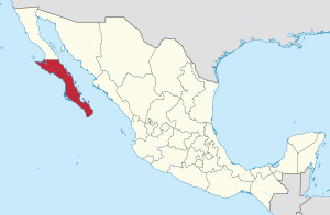
Baja California Sur within Mexico
|
|||
| Country | Mexico | ||
| Capital and largest city |
La Paz | ||
| Municipalities | 5 | ||
| Admission | 8 October 1974 | ||
| Order | 31st | ||
| Area | |||
| • Total | 73,909 km2 (28,536 sq mi) | ||
| Ranked 9th | |||
| Highest elevation | 2,080 m (6,820 ft) | ||
| Population
(2020)
|
|||
| • Total | 798,447 | ||
| • Rank | 31st | ||
| • Density | 11/km2 (30/sq mi) | ||
| • Density rank | 32nd | ||
| Demonym(s) | Sudcaliforniano (a) | ||
| GDP | |||
| • Total | MXN 262 billion (US$13.0 billion) (2022) |
||
| • Per capita | (US$15,556) (2022) | ||
| Time zone | UTC-7 (MST) | ||
| Postal code |
23
|
||
| Area code |
Area codes
|
||
| ISO 3166 code | MX-BCS | ||
| HDI | |||
Baja California Sur is a state in Mexico. Its official name is the Free and Sovereign State of Baja California Sur. It is the least populated state in Mexico. It is also the ninth-largest state by land area.
This state became part of Mexico on October 8, 1974. Before that, it was known as the "South Territory of Lower California." It covers about 73,909 square kilometers. This is about 3.57% of Mexico's total land. The state is located on the southern part of the Baja California Peninsula. It is south of the 28th parallel. The state also includes the uninhabited Rocas Alijos islands in the Pacific Ocean.
Baja California Sur shares its northern border with the state of Baja California. To the west, it meets the Pacific Ocean. To the east, it borders the Gulf of California. Across the Gulf of California, it has sea borders with the states of Sonora and Sinaloa.
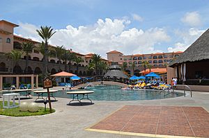
The state is famous for its tourist spots like Cabo San Lucas and San José del Cabo. Its biggest city and capital is La Paz.
Contents
- What's in a Name? The Etymology of Baja California Sur
- Journey Through Time: The History of Baja California Sur
- Exploring the Land: Geography of Baja California Sur
- Who Lives Here? Demographics of Baja California Sur
- Making a Living: The Economy of Baja California Sur
- Getting Around: Transportation in Baja California Sur
- Staying Informed: Media in Baja California Sur
- Life and Traditions: Culture of Baja California Sur
- See also
What's in a Name? The Etymology of Baja California Sur
The state gets its name from the peninsula it is on, which is called Baja California. "Baja" means "Lower" and "Sur" means "South." So, it's "South Lower California." The name California used to refer to this whole peninsula and the area that is now the state of California in the United States.
The state's official symbol, its coat of arms, shows its strong connection to the sea. It features images of silver fish and a silver shell on a blue background.
Journey Through Time: The History of Baja California Sur
Ancient Times: The Pre-Columbian Era
Scientists have found signs of people living in this area a very long time ago. Some remains found on Isla Espíritu Santo suggest people were here as far back as 40,000 years ago. Most evidence shows people have lived here continuously for the last 10,000 to 21,000 years.
Early humans left behind amazing rock and cave paintings. These paintings date back to about 1700 BCE. They show scenes of hunting and gathering. Baja California Sur is one of only five places in the world with so many important cave paintings. These artworks have a unique style. Some figures are as tall as 4 meters! Many animals are shown in silhouette and look like they are moving, often being hunted.
The most famous site is the Great Mural Rock Art in the north of the state. Other important sites include Cueva de Palma and San Gregorio. In some areas, archaeologists have found arrowheads, tools, and carvings on rocks.
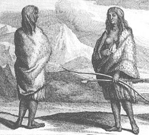
When the Spanish arrived, there were four main groups of native people. The Pericúes lived in the south, the Guaycuras lived north of them, the Monquis were near Loreto, and the Cochimí lived in the middle of the peninsula. All these groups hunted and gathered food. They did not farm or work with metal, but they did make pottery. They also fished, but only the Pericúes used rafts.
Spanish Arrival: The Colonial Era
The first Spaniard believed to have arrived here was Fortún Ximénez in 1533. His group didn't stay long. They took pearls from the area and treated the local women badly. This led to a fight with the native people, who killed Ximénez. The rest of his crew went back to Mexico City with the pearls and stories of great riches.
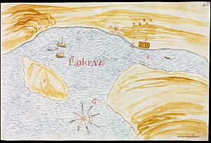
In 1535, Hernán Cortés sailed into the Gulf of California. He called it the Sea of Cortés. He landed in what is now La Paz Bay and named it Santa Cruz Port and Valley. This event is celebrated as the founding of La Paz. However, Cortés did not stay either.
It was hard for the Spanish to settle the region because it was so far away. Finally, in 1697, a Jesuit missionary named Juan María de Salvatierra started the first lasting mission. It was called the Nuestra Señora de Loreto Conchó Mission. From there, the Jesuits built sixteen missions across the state. They worked with the Pericú, Guaycura, and Cochimí peoples.
During the 1700s, more settlers arrived. They brought diseases that caused many native people to die.
In 1768, the Jesuits were asked to leave New Spain. The Franciscans took over the missions and continued to expand north. In 1773, the Dominicans replaced them. Many of these old mission churches still stand today. These include the Loreto Mission and the La Paz Cathedral.
Changes and Conflicts: The 19th Century
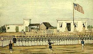
By the early 1800s, the missions had lost much of their power, and most of them closed. However, many mission sites became centers for ranching and some farming. Without the protection of the missionaries, and with little government control, the native peoples were treated poorly by ranchers.
The southern peninsula was too isolated to be involved in the Mexican War of Independence. Even though the war ended in 1821, the Spanish kept control of the southern peninsula until 1822. After that, it was divided into four areas.
Loreto was the first capital of the peninsula until 1830. Heavy rains destroyed the town, so the government moved the capital to La Paz. La Paz has been the capital ever since.
The United States invaded the peninsula during the Mexican–American War. They wanted it as part of a peace treaty. But the Mexican government managed to keep control of the territory. In 1853, William Walker and 45 other Americans tried to take La Paz. But they were quickly forced out by Mexican forces because they didn't have official U.S. support.
Later, during a conflict called the Reform War, Liberal forces took La Paz. French forces then invaded Mexico to support another side. The governor of Baja California Sur at the time recognized the French-backed Emperor Maximilian. However, Mexican forces led by Benito Juarez drove the French out.
The federal government officially divided the peninsula into northern and southern parts in 1888.
Modern Era: The 20th Century to Today
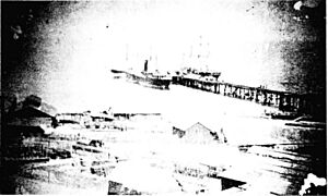
During the time of President Porfirio Diaz (1876-1910), the Mexican government invited foreign companies to invest in the country. In Baja California, this included mining operations. A large French mine called El Boleo was established near Santa Rosalia. New shipping routes were also created. President Diaz also divided the peninsula into two parts, each with its own government.
The southern part of the peninsula was not involved in the Mexican Revolution until after a leader named Francisco I. Madero was killed. Then, troops were formed to oppose the new leader, Victoriano Huerta. These troops defeated federal forces in 1914 and took control of La Paz.
From the end of the Mexican Revolution until 1974, the territory had ten governors chosen by the federal government. The division of the peninsula became even more official in 1931. A highway was built that ran the entire length of the peninsula that same year. Improving the area's infrastructure was a top goal. Schools were built, including the first college for teachers in 1942. Projects were also started to provide water and electricity.
The southern territory officially became a state on October 8, 1974. It started with three municipalities: La Paz, Comondú, and Mulegé. Two more have been created since then: Los Cabos (in 1981) and Loreto (in 1992).
Exploring the Land: Geography of Baja California Sur
Baja California Sur is on a narrow peninsula. This peninsula separated from the mainland about two million years ago due to movements in the Earth's crust. The state is mostly made up of mountains and coastal plains. The mountain ranges run parallel to the coast and are made of volcanic rock. The main mountain range is called the Sierra de la Giganta. The highest point is the Sierra de la Laguna, which is 2080 meters above sea level.
The coastal plains are much wider on the Pacific side, usually about 40 kilometers wide. Some plains, like Santa Clara and Magdalena, are even wider. These areas are mostly made of sedimentary rock, especially limestone from the ocean.
The state has five main natural areas:
- Central Desert: This area has desert plants that grow after short, irregular rains.
- La Serranía: These are the high mountain areas with many trees. Some of these trees are valuable.
- Vizcaíno Desert: This desert runs along the Pacific coast. It has smaller mountain ranges and volcanoes.
- Magdalena Plains: This is a large, flat area near the Pacific coast.
- Los Cabos: This region has different small climates due to its geology and rain patterns.
The climate in the state is generally dry. The average yearly temperature is between 18–22 °C. The average rainfall is less than 200mm per year. Lower areas are the driest and hottest, with summer daytime temperatures often above 40 °C. In winter, temperatures can drop below freezing. The Los Cabos region is an exception. It is considered semi-moist because of Pacific hurricanes that affect the area.
Most of the surface water comes from seasonal streams. These streams flow quickly only during storms. Most of them drain into the Pacific Ocean.
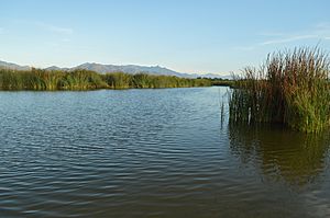
The state has a very long coastline, measuring 2230 kilometers. This makes it Mexico's longest coastline, accounting for 22% of the country's total. It also has the most islands, mostly in the Gulf of California. There are three islands in the Pacific: Natividad, Magdalena, and Santa Margarita (the largest). In the Gulf of California, there are many islands like San Marcos, Carmen, and Espiritu Santo. Major bays include Sebastian Vizcaino, Magdalena, and La Paz. There are also estuaries and lagoons, such as the San José estuary and the San Ignacio Lagoon.
The plants and animals here are quite unique, with many species found only in this region. Lower areas are dominated by desert plants. This includes the world's largest cactus, the cardón cactus, which can grow up to 15 meters tall. Other plants include mesquite and different types of cactus. Higher elevations have forests of pine and oak trees, some of which lose their leaves in the dry season.
Wildlife in the desert areas includes birds, reptiles, and small-to-medium mammals like rabbits and coyotes. In the higher, greener areas, you might find wild sheep, pumas, raccoons, deer, and foxes. Marine life is rich with whales, seals, dolphins, gray whales, manta rays, and sea turtles.
Baja California Sur has the largest protected natural area in Mexico. About 38.3% of the state is protected in 10 official areas. These include Bahía de Loreto National Park, Cabo Pulmo National Park, and El Vizcaíno Biosphere Reserve. The islands off the coast are also protected.
Who Lives Here? Demographics of Baja California Sur
| Historical population | ||
|---|---|---|
| Year | Pop. | ±% |
| 1895 | 42,875 | — |
| 1900 | 40,041 | −6.6% |
| 1910 | 42,512 | +6.2% |
| 1921 | 39,294 | −7.6% |
| 1930 | 47,089 | +19.8% |
| 1940 | 51,471 | +9.3% |
| 1950 | 60,864 | +18.2% |
| 1960 | 81,594 | +34.1% |
| 1970 | 128,019 | +56.9% |
| 1980 | 215,139 | +68.1% |
| 1990 | 317,764 | +47.7% |
| 1995 | 375,494 | +18.2% |
| 2000 | 424,041 | +12.9% |
| 2005 | 512,170 | +20.8% |
| 2010 | 637,026 | +24.4% |
| 2015 | 763,929 | +19.9% |
| 2020 | 798,447 | +4.5% |
Most of the people in Baja California Sur are of mixed European and Indigenous heritage (59%). About 40% are white, and 1% are Indigenous. In 2010, 86% of the people lived in cities. The 2020 Census showed that 3.3% of the population identified as Black or of African descent.
Major Cities in Baja California Sur
|
Largest cities or towns in Baja California Sur
Source: |
||
|---|---|---|
| Rank | Pop. | |
| 1 | La Paz | 250,141 |
| 2 | Cabo San Lucas | 202,694 |
| 3 | San José del Cabo | 136,285 |
| 4 | Ciudad Constitución | 43,805 |
| 5 | Loreto | 16,311 |
| 6 | Santa Rosalía | 14,357 |
| 7 | Guerrero Negro | 13,596 |
| 8 | Villa Alberto Andrés Alvarado Arámburo | 10,897 |
| 9 | Ciudad Insurgentes | 9,133 |
| 10 | Todos Santos | 7,185 |
People over 15 years old in Baja California Sur have, on average, 9.6 years of schooling. This is higher than the national average of 8.9 years. The state also has a low illiteracy rate of 3%, which is better than the country's average of 6.1%.
There are several colleges and universities in the state, including:
- Autonomous University of Baja California Sur (UABCS)
- Instituto Tecnologico de La Paz (ITLP)
- Centro de investigaciones biologicas del noroeste (CIBNOR)
| Religion in Baja California Sur (2010 census) | ||||
|---|---|---|---|---|
| Roman Catholicism | 81.3% | |||
| Other Christian | 9.8% | |||
| Other Religion | 0.1% | |||
| No religion | 6.3% | |||
| Unspecified | 2.5% | |||
Making a Living: The Economy of Baja California Sur
Historically, the state's economy relied on tourism, sport fishing, salt production, and mining. In 2012, the state's total economic output (GDP) was only 0.73% of Mexico's GDP. However, it grew by 3.13% compared to the year before. In 2013, this growth jumped to 7.8%.
Unemployment in 2013 was 5.1%. Jobs were shifting away from farming and fishing. More people started working in mining and industry (up 19.9%) and commerce (up 4.9%). Today, farming, fishing, and forestry make up only 3.89% of the state's GDP.
Important commercial fish species include tuna, sardines, anchovies, clams, and lobsters. These are sold both in Mexico and to other countries. Major crops grown here are garbanzo beans, tomatoes, and corn. Livestock includes pigs, cattle, and chickens.
Mining, construction, and utilities account for 26.61% of the economy. Minerals mined include plaster, limestone, and phosphorus. Copper, gold, and silver are also found. The state produces very pure salt, mostly near Guerrero Negro. There are also two major industrial parks.
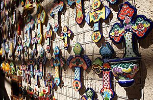
Traditional crafts are made throughout the state. These include items made from seashells and local wood. Baskets and other items are woven from palm leaves. Leatherwork is also important, especially making gear for horseback riding.
Commerce and services make up the largest part of the economy, at 69.5% of the GDP. La Paz was ranked 31st in Mexico for how easy it is to do business. Major activities in this sector include hotels and food service (16.43%) and housing sales (10.67%).
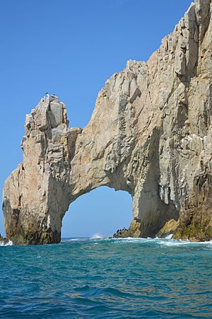
Tourism is the most active part of the economy. The state has many natural attractions. For example, gray whales come to the area to have their babies. The natural rock arch at Land's End in Cabo San Lucas is a very popular photo spot. Tourist areas are divided into three regions: north, center, and south.
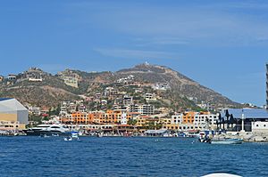
The two main resort areas are Cabo San Lucas and San José del Cabo. Both are at the southern tip of the peninsula. A highway called the Corridor connects these two towns. Other fun activities include deep sea fishing, golf, tennis, scuba diving, and snorkeling. You can also go windsurfing at Medano Beach and surfing at Todos Santos.
Other important economic activities include fishing, making alternative energy, and film production. Local fruits include dates and pitahaya. Santa Rosalia is known for its delicious breads.
Getting Around: Transportation in Baja California Sur
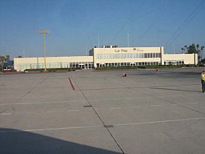
As of 2011, the state has 5,651 kilometers of highways. It also has eleven ports, with five of them being international. There are four international airports.
The main road on the peninsula is Mexican Federal Highway 1. It runs from the southern end at Cabo San Lucas all the way to the United States-Mexico border at San Ysidro.
Mexican Federal Highway 19 offers another way to travel between Cabo San Lucas and La Paz.
There is also a toll road, Mexican Federal Highway 1D. This road provides an alternate route from Los Cabos International Airport to Cabo San Lucas.
Ferries also connect the east coast of the peninsula to mainland Mexico. Most ferries go to Mazatlán in the state of Sinaloa. This trip takes about thirteen hours. The state's main airports are Los Cabos International Airport and Manuel Márquez de León International Airport.
Staying Informed: Media in Baja California Sur
Newspapers published in Baja California Sur include: El Peninsular, El Periódico, El Sudcaliforniano, and Tribuna de los Cabos.
Life and Traditions: Culture of Baja California Sur
Three of the original native cultures still exist here: the Cochimí, the Guaycura, and the Pericú.
Traditional music is often played by trios. These groups, called "cochi," usually have an accordion and two guitars. They play styles like corridos, waltzes, polkas, and mazurkas, similar to norteño music.
Traditional clothing for women includes a red skirt decorated with local flowers and a flowered blouse. You can often see this at festivals where traditional dances are performed. Some of these dances are Las Pitahayas, El Conejo, and La Yuca.
Because of the long coastline, much of the state's food is based on seafood. This includes types of fish not usually eaten in other parts of Mexico, like manta rays. Oregano and a local herb called damiana are common seasonings. Damiana is also used to flavor a local liquor. Traditional dishes include breaded and fried clams, and machaca (dried meat), often served with flour tortillas.
See also
 In Spanish: Baja California Sur para niños
 | Delilah Pierce |
 | Gordon Parks |
 | Augusta Savage |
 | Charles Ethan Porter |


