Mexicali facts for kids
Quick facts for kids
Mexicali
|
|||
|---|---|---|---|
|
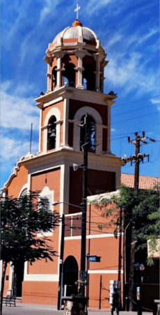
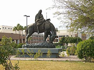
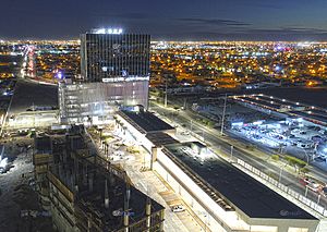
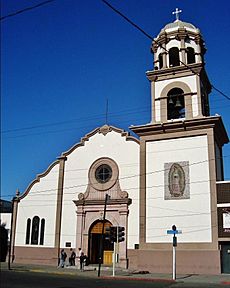
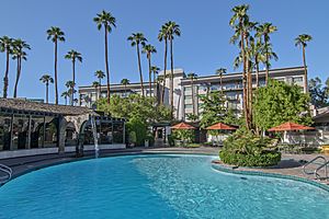
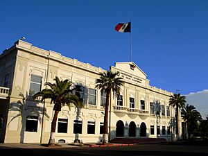
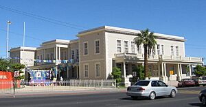
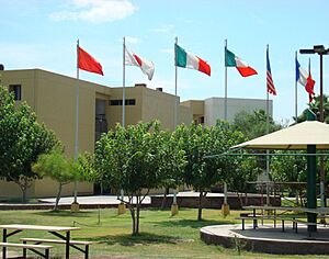
Top: Autonomous University of Baja California, Mexicali (left), Plaza Calafia (right); middle: Lázaro Cárdenas Monument (left), Our Lady of Guadalupe Cathedral (center), Punta Este (right); bottom: Bosque de la Ciudad Park.
|
|||
|
|||
| Nickname(s):
The City that Captured the Sun
|
|||
| Country | Mexico | ||
| State | |||
| Municipality | Mexicali | ||
| Founded | March 14, 1903 | ||
| Government | |||
| • Type | Ayuntamiento | ||
| Area | |||
| • City | 113.7 km2 (43.9 sq mi) | ||
| Elevation | 8 m (27 ft) | ||
| Population
(2018)
|
|||
| • City | 1,032,686 | ||
| • Density | 6,066.62/km2 (15,712.5/sq mi) | ||
| • Urban | 1,102,342 | ||
| Demonym(s) | Mexicalense, cachanilla | ||
| GDP (PPP, constant 2015 values) | |||
| • Year | 2023 | ||
| • Total | $25.1 billion | ||
| • Per capita | $21,300 | ||
| Time zone | UTC−8 (PST) | ||
| • Summer (DST) | UTC−7 (PDT) | ||
| Postal code |
21000-21399 (urban area)
|
||
| Area code(s) | +52 686 | ||
Mexicali is the capital city of the Mexican state of Baja California. It is located right on the border with the United States. The city is home to about 690,000 people. If you include the nearby city of Calexico in the U.S., the total area has over 1 million residents.
Mexicali is an important center for business and culture in the border region. It is sometimes called "The City that Captured the Sun" because of its very hot summers. The city was founded in the early 1900s. Back then, farming was the main activity. Over time, many factories called maquiladoras were built here. This made Mexicali's economy closely linked with businesses across the border. Today, Mexicali is a big manufacturing hub and a growing place for tourists.
Contents
Exploring Mexicali's Past
Long ago, Spanish explorers arrived in this area. They traveled through the "Devil's Road" in the Sonoran Desert. Catholic missionaries came to teach the local people. This also led to a decrease in the number of native people. Today, some Cocopah people still live near the Colorado River. They often work in farming or fishing.
Early Europeans didn't stay much in this area. They saw it as a wild, flood-prone desert. Later, in the 1820s, Mexican leaders made peace with the local Yuma people. They reopened a trade route called the Sonoran Road.
The 1800s: A Quiet Beginning
In the mid-1800s, a geologist found that the river soil was great for farming. This was something the native Yumans already knew. But the area stayed mostly empty until the 1880s because of its harsh climate. In 1888, the Mexican government gave land to Guillermo Andrade. The goal was to bring people to this new border area. However, around 1900, only a small town called Los Algodones had many people.
The 1900s: Growth and Change
In 1900, a U.S. company got permission to dig a canal from the Colorado River. This canal would bring water to the dry basin. They called this new farming area the "Imperial Valley." By 1903, the first farmers arrived. Soon, thousands of people were growing cotton, fruits, and vegetables.
The small group of houses on the border was named Calexico on the U.S. side. On the Mexican side, it was named Mexicali. The name Mexicali combines "Mexico" and "California." Instead of hiring Mexican workers, many Chinese laborers were brought in. This gave Mexicali a strong Chinese cultural influence.
Mexicali officially became a town on March 14, 1903. In 1914, it became its own municipality, like a local government area.
For many years, foreign companies rented land in Mexicali to farmers. These farmers were often from China, India, or Japan. Mexican people usually worked only as seasonal laborers. This led to a conflict in 1937 called the "Assault on the Lands." During this event, Mexican people took back land that was rightfully theirs.
Farming continued to grow. Cotton became very important and helped create textile factories. In the 1950s, the Mexicali Valley was the biggest cotton producer in Mexico.
Factories, called maquiladoras, started to appear in the 1960s. These factories assemble products using parts from other countries. By 1988, there were about 100 factories in the city. Many were for electronics, car parts, and textiles. Most of these factories were run by U.S. companies.
The 2000s: Modern Mexicali
Today, Mexicali is a key center for maquiladora production. These factories make things for cars, airplanes, and health products. They export goods to many countries.
In 2010, a big earthquake happened near Mexicali. It had a magnitude of 7.2. People felt it strongly in Baja California and even in cities like San Diego and Los Angeles.
Geography and Environment
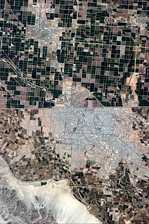
The Mexicali Valley is one of Mexico's largest and most fertile valleys. Farmers grow over fifty different crops here. Many companies have invested in Mexicali because of its special tax status. The valley also provides a lot of water for the region.
Mexicali has faced challenges with air quality. This is partly due to dust from unpaved roads and a lack of wind. The city is also working to manage large amounts of trash. This includes old electronics and used tires.
Water and Nature
Even though Mexicali is in a desert, it gets water from underground sources and the Colorado River. A treaty from 1944 guarantees the city a certain amount of water each year. However, there have been concerns about water loss from canals in the U.S. that could affect farming in Mexicali.
Near Mexicali is the Cerro Prieto volcano. Next to it is a geothermal power plant. This plant produces energy but also releases some pollutants. The government is creating a special zone around the plant due to these concerns.
Mexicali's Climate: Hot and Dry
Mexicali has a desert climate. This means it has very long, extremely hot summers and mild winters. The city gets very little rain, only about 70.9 millimeters (2.8 inches) per year. Most rain falls in December, January, and February. Summer rain is rare, but sometimes thunderstorms or tropical storms can bring heavy rain.
In winter, snowstorms in the nearby mountains can make Mexicali cooler for a few days. The hottest temperature ever recorded in Mexico was in Mexicali. It reached 52.0°C (125.6°F) on July 28, 1995.
| Climate data for Mexicali (1951–2010) | |||||||||||||
|---|---|---|---|---|---|---|---|---|---|---|---|---|---|
| Month | Jan | Feb | Mar | Apr | May | Jun | Jul | Aug | Sep | Oct | Nov | Dec | Year |
| Record high °C (°F) | 34.0 (93.2) |
34.0 (93.2) |
39.5 (103.1) |
41.0 (105.8) |
47.0 (116.6) |
51.4 (124.5) |
52.4 (126.3) |
50.4 (122.7) |
47.1 (116.8) |
47.4 (117.3) |
39.8 (103.6) |
31.3 (88.3) |
52.4 (126.3) |
| Mean daily maximum °C (°F) | 20.5 (68.9) |
23.0 (73.4) |
26.0 (78.8) |
29.7 (85.5) |
35.0 (95.0) |
40.0 (104.0) |
42.3 (108.1) |
41.5 (106.7) |
38.7 (101.7) |
32.5 (90.5) |
25.3 (77.5) |
20.4 (68.7) |
31.2 (88.2) |
| Daily mean °C (°F) | 13.1 (55.6) |
15.3 (59.5) |
18.0 (64.4) |
21.3 (70.3) |
25.8 (78.4) |
30.5 (86.9) |
33.9 (93.0) |
33.5 (92.3) |
30.4 (86.7) |
24.3 (75.7) |
17.5 (63.5) |
13.1 (55.6) |
23.1 (73.6) |
| Mean daily minimum °C (°F) | 5.8 (42.4) |
7.6 (45.7) |
10.0 (50.0) |
12.8 (55.0) |
16.7 (62.1) |
20.9 (69.6) |
25.6 (78.1) |
25.5 (77.9) |
22.1 (71.8) |
16.1 (61.0) |
9.8 (49.6) |
5.7 (42.3) |
14.9 (58.8) |
| Record low °C (°F) | −7.0 (19.4) |
−3.5 (25.7) |
−0.9 (30.4) |
0.0 (32.0) |
6.0 (42.8) |
9.1 (48.4) |
13.5 (56.3) |
14.5 (58.1) |
8.0 (46.4) |
0.3 (32.5) |
−1.5 (29.3) |
−8.0 (17.6) |
−8.0 (17.6) |
| Average rainfall mm (inches) | 10.6 (0.42) |
7.2 (0.28) |
5.8 (0.23) |
1.6 (0.06) |
0.5 (0.02) |
0.2 (0.01) |
3.8 (0.15) |
10.1 (0.40) |
7.5 (0.30) |
8.4 (0.33) |
4.9 (0.19) |
10.3 (0.41) |
70.9 (2.79) |
| Average rainy days (≥ 0.1 mm) | 2.7 | 2.2 | 2.1 | 0.7 | 0.3 | 0.1 | 1.0 | 1.3 | 1.1 | 1.1 | 1.2 | 2.2 | 16.0 |
| Source 1: Servicio Meteorológico Nacional | |||||||||||||
| Source 2: El Sol de México, Servicio Meteorológico Nacional Twitter, and La Voz de la Frontera | |||||||||||||
People of Mexicali
| Historical population | ||
|---|---|---|
| Year | Pop. | ±% |
| 1910 | 462 | — |
| 1921 | 6,782 | +1368.0% |
| 1930 | 14,842 | +118.8% |
| 1940 | 18,775 | +26.5% |
| 1950 | 64,609 | +244.1% |
| 1960 | 174,540 | +170.1% |
| 1970 | 263,498 | +51.0% |
| 1980 | 341,559 | +29.6% |
| 1990 | 438,377 | +28.3% |
| 1995 | 505,016 | +15.2% |
| 2000 | 549,873 | +8.9% |
| 2005 | 653,046 | +18.8% |
| 2010 | 689,775 | +5.6% |
| 2020 | 854,186 | +23.8% |
| INEGI: Archivo Histórico de localidades | ||
In 2020, the city of Mexicali had a population of over 854,000 people. The population is always growing. This is due to the many factories and people moving in and out of the city.
Mexicali's Economy
Mexicali's economy used to be mostly about farming. Farming is still a big part of it today. However, the economy has grown to include many industries. The main industry is maquiladoras. These are factories where parts from other countries are put together. Then, the finished products are sent back to those countries.
The Mexicali Valley is one of Mexico's best farming regions. It produces a lot of wheat, cotton, and vegetables. Mexicali is a top exporter of vegetables like asparagus, broccoli, and lettuce.
In the past, cotton was very important for export. But when new fabrics came out, the demand for cotton went down. Now, growing vegetables is the most successful farming activity.
Today, Mexicali's economic growth comes from these assembly plants. Companies like Mitsubishi, Honeywell, and Kellogg's have factories here. Many of these companies are from the U.S., South Korea, and Japan. In December 2018, there were 180 such factories, employing 70,000 people.
Mexicali became a key center for the aerospace industry in Mexico. This happened when Rockwell Collins opened a factory there in 1966. It was one of the first companies to join the maquiladora program.
Silicon Border Project
The Silicon Border is a large empty area outside Mexicali. It was planned to be a hub for high-tech manufacturing. The idea was to make Mexicali a major center for making computer chips. The Mexican government invested money in this project. However, as of 2022, the area remains empty.
Tourism and Fun
Tourism is also important for Mexicali's economy. Many visitors come from Calexico, California, every day. They enjoy local food, restaurants, and shops. People from Arizona and Nevada also visit for medical and dental services. These services are often less expensive than in the United States.
Mexicali hosts Baja Prog, a big event for progressive rock music.
The city has four main shopping malls. Plaza La Cachanilla is very popular and close to the U.S. border. It has many shops and is a great place to socialize. Especially in summer, families go there to enjoy the air conditioning.
For fun, Mexicali offers bowling alleys, movie theaters, and museums. There is also a zoo and a convention center. Galerias del Valle is another large mall with a Walmart, a movie theater, and many stores.
Education in Mexicali
Mexicali has many schools and universities. In 2008, thousands of students graduated from different levels of education.
Some public universities include the Autonomous University of Baja California, Mexicali. Private universities include Centro de Enseñanza Técnica y Superior.
Culture and Identity
People from Mexicali are called "Cachanillas." This name comes from a local plant used by the native Cucapah tribe to build their homes. Mexicali is a very diverse city. People from many different backgrounds live here.
There is a famous song called "Puro Cachanilla" that celebrates people from Mexicali. It was first recorded in 1963.
In 2004, the city had eight theaters for plays and shows. Mexicali also hosts the Baja Prog festival. This festival features progressive rock bands from around the world.
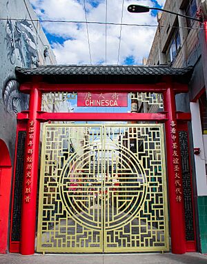
La Chinesca: A Chinese Legacy
Mexicali has a strong Chinese influence. Many Chinese immigrants came to the area to work on irrigation systems. Some came from the U.S., escaping anti-Chinese rules there. Others sailed directly from China. They were promised good wages, but often didn't get them.
Today, new Chinese immigrants still come to Mexicali. Many are from the same areas in China as those who came before 1960.
Sports in Mexicali
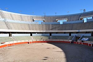
Mexicali has many places for sports and entertainment. The Plaza Calafia bullring hosts bullfights a couple of times a year. There is also a professional 18-hole golf course called Club Campestre.
The city's professional basketball team is Soles de Mexicali. They have won national championships several times. Their home stadium is the Auditorio del Estado.
Mexicali also has a football (soccer) stadium. The Mexicali Fútbol Club plays there.
Baseball is very popular in Mexicali. The Águilas de Mexicali play in the winter baseball league. Young baseball players from Mexicali have even played in the Little League World Series five times!
Getting Around Mexicali
Mexicali is connected by major highways. Interstate 8 goes from San Diego to Arizona. Mexican Federal Highway 2 goes east to San Luis Río Colorado and west to Tijuana. Mexican Federal Highway 5 connects Mexicali with San Felipe.
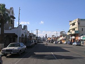
The city has many long, wide boulevards. Most have six lanes and a middle divider. Boulevard Lázaro Cárdenas is a main road that runs from east to west. Other important roads include Adolfo Lopez Mateos and Benito Juárez.
Airport
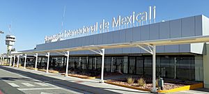
The city has its own airport, Mexicali International Airport. It connects Mexicali to other cities in Mexico.
Public Transportation
Mexicali has bus routes that serve the city and its surrounding areas. Several companies offer bus services for getting around.
Global Connections
Sister Cities
Mexicali has special partnerships with other cities around the world. These are called "sister cities." They include:
- San Bernardino, California, United States
- Nanjing, China
- Gumi, North Gyeongsang, South Korea
- Sacramento, California, United States
- Calexico, California, United States
See also
 In Spanish: Mexicali para niños
 | Aaron Henry |
 | T. R. M. Howard |
 | Jesse Jackson |


