Tijuana facts for kids
Quick facts for kids
Tijuana
|
|||
|---|---|---|---|
|
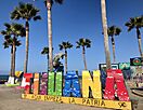
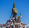
Skyline of Tijuana
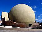
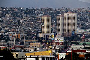
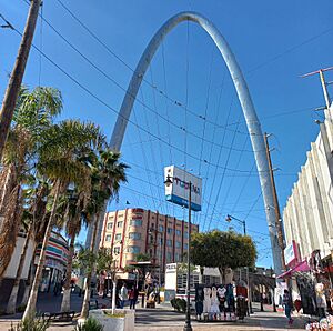
Arco Monumental
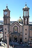
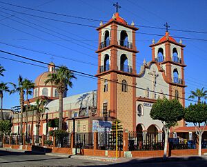
Tijuana Cathedral
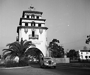
Grand Hotel Tijuana
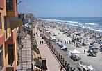
Panoramic view of Tijuana
|
|||
|
|||
| Nickname(s):
Gateway to Mexico
|
|||
| Motto(s):
Aquí empieza la patria ("The fatherland begins here")
|
|||
| Country | Mexico | ||
| State | |||
| Municipality | Tijuana | ||
| Founded | 11 July 1889 | ||
| Government | |||
| • Type | Ayuntamiento | ||
| Area | |||
| • City | 637 km2 (246 sq mi) | ||
| • Metro | 1,392.5 km2 (537.9 sq mi) | ||
| Elevation | 20 m (65 ft) | ||
| Population
(2020)
|
|||
| • City | 1,810,645 | ||
| • Rank | 8th in North America 2nd in Mexico |
||
| • Density | 2,832.5/km2 (7,336/sq mi) | ||
| • Urban | 2,002,000 (estimated) | ||
| • Metro | 2,157,853 | ||
| • Metro density | 1,549.63/km2 (4,011.6/sq mi) | ||
| Demonym(s) | Tijuanan (in Spanish) Tijuanense |
||
| GDP (PPP, constant 2015 values) | |||
| • Year | 2023 | ||
| • Total (Metro) | $61.0 billion | ||
| • Per capita | $27,600 | ||
| Time zone | UTC−8 (PST) | ||
| • Summer (DST) | UTC−7 (PDT) | ||
| Postal codes |
22000–22699
|
||
| Area code(s) | + 52 664/663 | ||
| Website | www.tijuana.gob.mx | ||
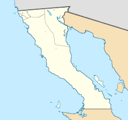
Tijuana is a very large city in the state of Baja California, Mexico. It's located on the northwestern Pacific Coast of Mexico. Tijuana is the main city of the Tijuana Municipality and a key part of the Tijuana metropolitan area. It is very close to the Mexico–United States border, forming part of the San Diego–Tijuana metro area.
Tijuana is the westernmost city in Mexico. It is also one of the largest cities in the Americas. In 2024, Tijuana's population grew to about 2.3 million people. The city is known for being one of the fastest-growing areas in Mexico. It's also seen as a "High Sufficiency" global city by experts who study world cities.
Tijuana's modern story began in the 1500s when Spanish explorers arrived. After the Californias were divided, Tijuana became a border city. This led to new ways of life and business. The city officially started on July 11, 1889. It has been a popular place for visitors since the 1880s. Today, Tijuana is a major center for making things in North America. Many large international companies have factories here. In the early 2000s, Tijuana became a top spot for making medical devices. It's also becoming known as an important cultural center for the border region. Tijuana is the most visited border city in the world. It shares a border of about 24 kilometers (15 miles) with its sister city San Diego. More than 50 million people cross this border every year.
Contents
What's in a Name?
The city's name comes from a large ranch. This ranch was called Rancho Tía Juana. It was set up in 1829 by Santiago Argüello Moraga.
Early Spanish records called the area Rancho Tía Juana, Tihuan, and finally Tijuana. Even though the city was founded as "Tijuana" in 1889, "Tia Juana" was used in English for the river and a U.S. settlement until about 1916.
Historians believe Tía Juana comes from the Kumeyaay word Tiwan. This word means "by the sea." The Kumeyaay are the native people of the San Diego-Tijuana area. A popular story says Tía Juana (which means "Aunt Jane" in Spanish) was a real person who ran an inn. But there's no proof of such an inn. The first building was actually built by Argüello after he named his ranch.
In California, people often call Tijuana T.J. for short.
Tijuana's Past: A Journey Through Time
The land where Tijuana is now was first home to the Kumeyaay people. They were hunter-gatherers who spoke the Yuman language. Europeans arrived in 1542. Juan Rodríguez Cabrillo explored the coast, and Sebastián Vizcaíno mapped it in 1602. In 1769, Juan Crespí wrote more details about the area, which later became the Valley of Tijuana.
The 1800s: A New Beginning
More people settled here in the late 1700s. In 1829, José María de Echeandía, the governor, gave a large piece of land to Santiago Argüello. This became the big cattle ranch, Rancho Tía Juana. It covered about 100 square kilometers (39 square miles). The name "Tia Juana" was an adaptation of the Kumeyaay word 'Tihuan' or 'Tijuán'.
In 1848, after the Mexican–American War, Mexico lost Alta California to the United States. Many Hispanic families moved south to Tijuana to stay in Mexico. This made Tijuana an important city right on the new international border. It became a place for farming, raising animals, and a stop for people looking for gold.
City life began in 1889. Santiago Argüello's family and Augustín Olvera agreed to start building the city of Tijuana. July 11, 1889, is celebrated as the city's founding day. Tijuana quickly saw its future in tourism. From the late 1800s to the early 1900s, many Californians visited for trade and fun.
The 1900s: Growth and Change
In 1911, during the Mexican Revolution, some revolutionaries briefly took over the city. But federal troops soon arrived and took it back.
The Panama-California Exposition in San Diego in 1915 brought many visitors. Tijuana attracted these tourists with a "Typical Mexican Fair." This fair had shops, local food, baths, horse racing, and boxing.
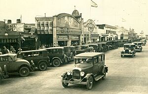
The first professional race track opened in 1916 but was soon destroyed by a flood. A new track, Agua Caliente Racetrack, opened in 1929. The Avenida Revolución area became the main tourist spot in the 1920s. It had casinos and the famous Hotel Caesar's, where the Caesar salad was invented!
In 1925, the city's name was changed to Ciudad Zaragoza by the president. But it went back to Tijuana in 1929.
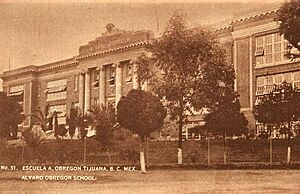
In 1928, the Agua Caliente Touristic Complex opened. It had a hotel, spa, dog track, airport, golf course, and casino. Many Hollywood stars visited this famous place. In 1935, gambling was stopped in Baja California. The Agua Caliente complex closed and later became a school.
Tijuana's population grew a lot between 1940 and 1950. In the 1950s, the city changed its focus to attract more families. It added more types of attractions for visitors.
In 1965, the Mexican government started a program to attract foreign businesses. Tijuana became popular for foreign companies to open factories called maquiladoras. This helped Tijuana's economy grow and become more diverse. Many people moved to Tijuana for these jobs.
In 1972, work began to control the Tijuana River with concrete channels. This project created new land where the Zona Río was built. With the opening of the Plaza Río Tijuana mall in 1981 and the Tijuana Cultural Center (CECUT) in 1982, Zona Río became the new business heart of a modern Tijuana.
The 2000s: A Modern Hub
After 2001, border controls became stricter, causing longer waits to cross into the U.S. This led to fewer U.S. visitors.
However, Tijuana has become a very important city for business and people moving to Mexico and the U.S. It still welcomes many visitors from the U.S., China, Japan, and other parts of Mexico. The city has improved its image by holding cultural and business festivals. It is now known as a good place for investment. The food scene, craft beer, entertainment, and medical tourism are all growing.
Tijuana's Landscape

Tijuana is the westernmost city in Mexico and in Latin America. It's about 210 kilometers (130 miles) west of Mexicali, the state capital. To the north, it borders U.S. cities like Imperial Beach and San Ysidro. To the southwest is Rosarito Beach.
The city is built among hills, canyons, and valleys. The main part of the city is in a valley where the Tijuana River flows. Building homes on the Tijuana Hills has removed many small streams. This means some parts of the city can have landslides during the rainy season. Tijuana has varied heights, from sea level to 790 meters (2,590 feet). Downtown Tijuana, built in the river valley, can flood when it rains a lot.
Tijuana is known for its hilly land, with many canyons, steep hills, and flat-topped mountains (mesas). Big hills include the Cerro Colorado and the Cerro de las Abejas.
The city is near the end of the Tijuana River. This river is 195 kilometers (121 miles) long. It flows through Mexico for most of its path, then crosses into the U.S. for the last 8 kilometers (5 miles) before reaching the ocean.
City Buildings and Views
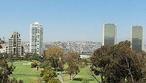
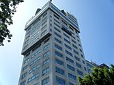
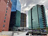
Tijuana's tall buildings are quite new. The twin towers of Grand Hotel Tijuana were some of the first. The city had a building boom, but it slowed down during the Great Recession. The Trump Ocean Resort Baja Mexico, which would have been 98 meters (322 feet) tall, was one project that didn't get built. The tallest building now is New City Residential, reaching 102 meters (335 feet). Tijuana has 33 completed tall buildings.
Tijuana's skyline is the fifth largest in Mexico. You can see it mainly in the Zona Rio and some parts of Playas de Tijuana. In Zona Rio, buildings are along the Tijuana River and near the Tijuana Country Club. In Playas, tall buildings are mostly on the coast. From Tijuana's skyline, you can also see the San Diego skyline.
City Sections (Boroughs)
The city of Tijuana is divided into eight main areas called Delegaciones (boroughs). Each borough has its own local government services. These services help with city planning, public works, and community projects.
- Centro – This is the old downtown area (Zona Centro) and the new business district (Zona Río). It's the historical center of Tijuana. Most tourist areas, like Avenida Revolución, are here. The Tijuana Cultural Center (CECUT) and Plaza Río Tijuana mall are also in this area.
- Cerro Colorado – The "Red Hill" is located here and is surrounded by homes. Many radio and TV antennas are on its peak because it's so high.
- La Mesa – Here you'll find Morelos Park, the city's largest public park. It's also home to the shopping and transit hub Cinco y Diez, Plaza Mundo Divertido, and the CETYS University.
- Otay Centenario – This borough was created in 2014. The Tijuana International Airport is here. The Tijuana campus and many factories (maquiladoras) are also located here. This area has the most factories. It also has the Otay Mesa border crossing to the U.S.
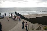
- Playas de Tijuana – This is the westernmost part of the city, next to the Pacific Ocean and the U.S. border. This is where Tijuana's beaches are. It's also one of the main roads south to Rosarito and Ensenada.
- La Presa – Meaning "the dam," this is the largest borough. The Abelardo L. Rodríguez Dam is within its borders. The Corredor Tijuana-Rosarito 2000 and Tijuana-Tecate freeways run through it.
- San Antonio de los Buenos – This is mostly a residential area, but it also has two industrial parks.
- Sanchez Taboada – Like San Antonio de los Buenos, this is mainly a residential area. It also has many "maquiladoras," especially in the Pacific Industrial Park.
Tijuana's Weather
Tijuana has a semi-arid climate. This means it's generally mild to warm all year, with about 231 millimeters (9 inches) of rain each year. Most of the rain falls in winter, from November to March.
From November to March, storms come from the Pacific Ocean. January is the wettest and coolest month. In April, the Santa Ana winds begin. Summers are very dry. Tropical cyclones can affect the city sometimes, like Hurricane Hilary in 2023, which brought heavy rain.
Air pollution can happen during certain weather conditions, but it's usually not severe. Frost and snow are rare because temperatures are usually above freezing. However, snow did fall in December 1967 and January 2007. The lowest temperature ever recorded was -6°C (21°F), and the highest was 49°C (120°F).
| Climate data for Tijuana (Tijuana International Airport) | |||||||||||||
|---|---|---|---|---|---|---|---|---|---|---|---|---|---|
| Month | Jan | Feb | Mar | Apr | May | Jun | Jul | Aug | Sep | Oct | Nov | Dec | Year |
| Record high °C (°F) | 34.5 (94.1) |
39.0 (102.2) |
34.0 (93.2) |
36.0 (96.8) |
38.5 (101.3) |
41.8 (107.2) |
39.0 (102.2) |
41.0 (105.8) |
49.0 (120.2) |
47.0 (116.6) |
42.0 (107.6) |
37.0 (98.6) |
49.0 (120.2) |
| Mean daily maximum °C (°F) | 20.3 (68.5) |
20.8 (69.4) |
20.8 (69.4) |
22.1 (71.8) |
23.5 (74.3) |
25.2 (77.4) |
27.8 (82.0) |
28.1 (82.6) |
27.8 (82.0) |
26.0 (78.8) |
23.5 (74.3) |
21.1 (70.0) |
23.9 (75.0) |
| Daily mean °C (°F) | 13.6 (56.5) |
14.3 (57.7) |
14.8 (58.6) |
16.1 (61.0) |
18.0 (64.4) |
19.8 (67.6) |
22.2 (72.0) |
22.8 (73.0) |
22.0 (71.6) |
19.5 (67.1) |
16.6 (61.9) |
14.0 (57.2) |
17.8 (64.0) |
| Mean daily minimum °C (°F) | 6.9 (44.4) |
7.8 (46.0) |
8.8 (47.8) |
10.2 (50.4) |
12.4 (54.3) |
14.3 (57.7) |
16.5 (61.7) |
17.5 (63.5) |
16.1 (61.0) |
13.0 (55.4) |
9.8 (49.6) |
6.9 (44.4) |
11.7 (53.1) |
| Record low °C (°F) | −3.0 (26.6) |
0.0 (32.0) |
0.5 (32.9) |
1.0 (33.8) |
5.5 (41.9) |
5.0 (41.0) |
7.5 (45.5) |
10.5 (50.9) |
0.0 (32.0) |
5.0 (41.0) |
1.0 (33.8) |
−5.0 (23.0) |
−5.0 (23.0) |
| Average rainfall mm (inches) | 43.8 (1.72) |
36.5 (1.44) |
42.7 (1.68) |
17.6 (0.69) |
4.4 (0.17) |
0.7 (0.03) |
0.7 (0.03) |
0.9 (0.04) |
5.0 (0.20) |
7.8 (0.31) |
33.8 (1.33) |
37.0 (1.46) |
230.9 (9.09) |
| Average rainy days (≥ 0.1 mm) | 5.9 | 4.7 | 5.9 | 3.1 | 1.4 | 0.5 | 0.4 | 0.2 | 0.7 | 1.7 | 3.9 | 4.3 | 32.7 |
| Average relative humidity (%) | 70 | 74 | 73 | 75 | 77 | 79 | 80 | 80 | 79 | 76 | 69 | 69 | 75 |
| Source: Servicio Meteorologico Nacional | |||||||||||||
Tijuana's People
| Historical population | ||
|---|---|---|
| Year | Pop. | ±% |
| 1980 | 461,267 | — |
| 1985 | 584,267 | +26.7% |
| 1990 | 698,752 | +19.6% |
| 1995 | 966,097 | +38.3% |
| 2000 | 1,210,820 | +25.3% |
| 2005 | 1,410,687 | +16.5% |
| 2010 | 1,559,683 | +10.6% |
| 2015 | 1,641,570 | +5.3% |
| 2020 | 1,922,523 | +17.1% |
| sources: | ||
Tijuana has a very diverse population. Many people move here from other parts of Mexico and from all over the world. Tijuana has one of Mexico's largest Asian populations, mostly Chinese immigrants. There's also a large and growing number of Americans, mainly from Southern California. Many people from Latin American countries, like Cubans and Guatemalans, have made Tijuana their home. The city also has many people from Lebanon, Italy, France, and Spain. Recently, many Haitian immigrants have arrived.
Most Mexican people who move to Tijuana come from states like Sinaloa, Michoacán, Jalisco, Oaxaca, and the Federal District. Because so many people from different places come to Tijuana, it's hard to know the exact mix of ethnic groups. This large number of new residents has led to many jobs. Over 700 factories, called "maquiladoras," provide jobs for most working-class people in northern Mexico. Tijuana is seen as a place where people can find work, get a better education, and hope to cross the border for more opportunities. Tijuana and Baja California generally have stronger economies and higher incomes than other Mexican cities along the U.S. border.
Tijuana is one of the fastest-growing cities in Mexico. About 80,000 people move to Tijuana every year. The city grows by about three hectares (7.4 acres) a day. This growth happens mostly to the east and south. As the city expands, new supermarkets and stores open in these areas, and roads are paved.
In 2005, most of the city's population (96%) were Christians. Among them, 61% were Catholic and 35% were Protestant. Other beliefs, including Asian and European religions, Taoism, atheism, and agnosticism, made up 4%.
Tijuana's Economy
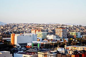
Tijuana is the main economic hub of Baja California. It's also an important center for international trade in The Californias. The city is one of North America's leading manufacturing centers and a popular place for tourists.
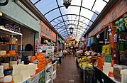
Plaza Rio Tijuana is a large shopping mall with stores like Cinépolis, Sanborns, and Sears. Another important shopping area is Cinco y Diez, named after a former American-style store. This area is also a major public transportation hub.
Tijuana has become a popular place for food lovers. It's known for its unique Baja Med cuisine, as well as delicious tacos, street food, food trucks, coffee shops, and craft beer.
Tijuana welcomes about 2.5 million medical tourists every year. These are people who come to the city for medical services.
Tourism in Tijuana
Tourism brings a lot of money to Tijuana. About 300,000 visitors cross the border from the San Ysidro entry point every day. Restaurants, taco stands, pharmacies, and shops selling Mexican crafts and souvenirs attract many tourists. Many of these places are close to the border.
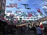
Popular tourist spots include Downtown Tijuana, with its nightlife around La Sexta and Avenida Revolución. You can also find souvenir shopping at the Mercado de Artesanías and Plaza Viva Tijuana. The CECUT and the Plaza Río Tijuana shopping center are also popular. Tijuana is famous for being the birthplace of the Caesar salad.
Many pharmacies in Tijuana serve visitors from the United States. They sell some medicines without a prescription or at lower prices than in the U.S. Doctors' offices are often nearby to provide Mexican prescriptions if needed.
Services like car detailing, medical and dental care, and plastic surgery are also popular. They are usually much cheaper than in the U.S.
Making Things: Manufacturing
Tijuana is a big manufacturing center, which is a key part of its economy. In the last ten years, Tijuana became the top place in North America for making medical devices. This means it makes things like hospital equipment and tools.
Tijuana is close to Southern California. It also has many skilled workers who can work for lower costs. This makes it a good place for foreign companies to build large industrial parks with assembly plants called maquiladoras. These companies use the North American Free Trade Agreement (NAFTA) to export their products. In 2001, Tijuana had about 820 of these factories. Companies like Medtronic, Hyundai, Sony, Toyota, Dell, Samsung, and Microsoft have maquiladoras in Tijuana. Many of these factories are in the Otay Mesa and Florido areas of Tijuana.
The main business area is Zona Río. This area, along with Boulevard Agua Caliente, has most of the city's high-end office buildings.
Learning in Tijuana
Tijuana has many private schools for all ages, from primary to high school. It also has highly-ranked colleges and universities.
The Instituto México is a well-known secondary school.
- Higher Education
Universities in Tijuana include:
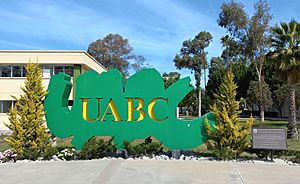
- Autonomous University of Baja California, Tijuana
- Ibero-American University
- Xochicalco University
- Cetys Universidad, Tijuana
- Tijuana Institute of Technology
- UNIVERSITAM Technology University
Tijuana's Culture and Fun
Many visitors come to Tijuana for entertainment, shopping, and local crafts. Locals and regular tourists often visit clubs in Plaza Fiesta or other areas of the Zona Río to avoid crowded tourist spots.
Parque Morelos has a small zoo and park space. Parque de la Amistad in Otay Centenario has a small pond and tracks for running and dirt bikes. Parque Teniente Guerrero is a downtown park with a public library and weekend shows by clowns.
Entertainment and Arts
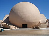
In 1982, the Tijuana Cultural Center (CECUT) opened. This was a big step for Tijuana. CECUT's goal was to show Tijuana as a place for culture, not just shopping. The center has an OMNIMAX cinema, the Museum of the Californias, art exhibition halls, a restaurant, a café, and a bookstore.
La Casa de la Cultura is another cultural center. It has a school, a theater, and a public library. It teaches dance, painting, music, and photography.
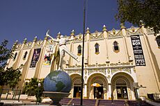
Other cultural places include the Municipal Institute of Art and Culture, the Tijuana Wax Museum, the Museo El Trompo (a children's science museum), and El Foro, which used to be a Jai Alai Palace and is now a concert venue. Concerts are also held at the Estadio Caliente stadium and the Hipódromo Agua Caliente Racetrack.
The Tijuana Country Club has a famous golf course and hosts events. Tijuana also has a large Rotary Club.
- Nightlife

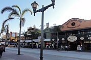
Avenida Revolución is known for its many nightclubs, especially for tourists. The area around "La Sexta" (Calle Sexta and Av. Revolución) is now a major spot for new bars and dance clubs. Zona Rio, Tijuana's new downtown, has some of the city's best restaurants and bars.
Art Scene
Tijuana has a very active and independent artist community. Their work is recognized internationally. Newsweek magazine called Tijuana "one of the most important new cultural meccas." Art groups like Bulbo create films and media to show different sides of Tijuana.
Graffiti is common in Tijuana. It includes spray-painted words and pictures, often with social messages. You can also see stenciled images of important Hispanic figures and artists like Salvador Dalí. Large, colorful graffiti murals are made by both local and visiting artists.
Music Scene
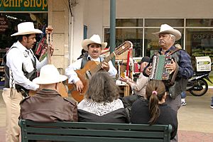
Since the 1920s, Tijuana has been important in music. Early ranchera music groups played in tourist spots.
Javier Batiz started a group called "Los TJ's" in 1957. They were inspired by black music, blues, and R&B from artists like T-Bone Walker and B.B. King. Later, Batiz started his solo career.
In the 1960s, American trumpeter Herb Alpert found musical inspiration in Tijuana. He formed "The Tijuana Brass," which became very famous.
In the 1990s, the band Tijuana No! brought rock music back to the city. They mixed ska, punk, and reggae. Their album "No" had hits like "Pobre de ti," featuring Julieta Venegas as a singer. Julieta Venegas later became a successful solo artist, winning many awards.
Tijuana is also known as the birthplace of the Nortec music style and Ruidoson. These styles led to a big electronic music scene with groups like Los Macuanos. Tijuana also has strong hip hop, reggae, punk, and house music scenes. Famous musicians from Tijuana include Lynda Thomas and Vanessa Zamora.
Since 1996, the Tijuana Youth Symphony (SJT) has helped children and young people learn music. Tijuana also has an opera season and several music festivals throughout the year.
The Baja California Orchestra, based in Tijuana, is one of Mexico's most respected artistic groups. They were nominated for a Latin Grammy and won "Best Classical Album of the year 2001."
Sports in Tijuana
| Club | Sport | Founded | League | Venue |
|---|---|---|---|---|
| Club Tijuana | Association football | 2007 | Liga MX | Estadio Caliente |
| Toros de Tijuana | Baseball | 2013 | Mexican League | Estadio Chevron |
| Tijuana Zonkeys | Basketball | 2010 | Circuito de Baloncesto de La Costa Del Pacifico | Auditorio Fausto Gutierrez Moreno |
| Galgos de Tijuana | American Football | 2021 | Liga de Fútbol Americano Profesional | Estadio Caliente |
The city has the Tijuana Zonkeys professional basketball team. They play in the CIBACOPA league from February to July at the Municipal Auditorium.
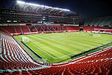
Tijuana also has a strong history with association football (soccer). The Club Tijuana team started playing in Mexico's top league, Liga MX, in 2011/12. They won the 2012 Apertura title. They play their games at the Estadio Caliente, a stadium with 33,000 seats. The team's mascot is the Xoloitzcuintle, a famous Mexican hairless dog.
Many world champion professional boxers, like Antonio Margarito and Erik Morales, come from Tijuana.
Sports Stadiums
- Estadio Caliente
Estadio Caliente is a stadium in Tijuana used for many events. It is the home stadium for Club Tijuana, the soccer team. It can hold 27,333 fans.
- Estadio Chevron
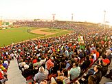
The Chevron Stadium is the home of the Toros de Tijuana baseball team. It opened in 1977. In 2004, professional baseball returned to the stadium. It was remodeled in 2013.
Getting Around Tijuana
Tijuana is a major entry point to Mexico. You can travel from Tijuana to other parts of Mexico by air and road. You can also travel by sea through the ports of Ensenada and San Diego. Within Tijuana, there are freeways and other roads, as well as buses.
Local public transportation in Tijuana is run by private companies. It has a very complex network of routes.
By Air
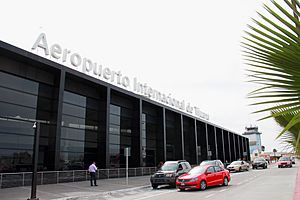
The Tijuana International Airport is the city's main airport. It's one of the busiest in Mexico. It has flights to many cities across Mexico. The Tijuana Airport is also a second airport for the San Diego area. Passengers going to Mexico and Latin America can use the airport's Cross Border Xpress terminal. This terminal is on the U.S. side of the border and connects to the airport in Mexico by a pedestrian bridge.
By Road
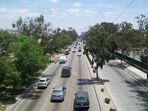
Two important Mexican federal highways start in Tijuana. One is Fed 1, which goes south through the Baja California Peninsula to Cabo San Lucas. From Tijuana to Ensenada, many travelers take Fed 1D, a four-lane toll road along the coast. Fed 2 goes east for 1,000 kilometers (620 miles) near the international border.
Within the city, the Corredor Tijuana-Rosarito 2000 freeway connects Mesa de Otay in the northeast with Rosarito Beach in the southwest.
Just north of the San Ysidro border crossing, Interstate 5 and Interstate 805 head north into San Diego. From the Otay Mesa border crossing, California State Route 905 connects to other highways in California.
Public Transport
The city's main bus station is in its eastern part. A smaller station downtown serves some Mexican bus lines and U.S. lines like Greyhound Lines. Another bus station near the border has frequent service to Ensenada and other major cities in Mexico.
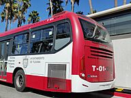
A bus rapid transit system, called SITT, runs one route from Downtown Tijuana to the southeast of the city. This system is part of a plan to replace other buses and minibuses.
Public transportation in Tijuana is inexpensive. Bus tickets cost about US$0.75. Fixed-route taxis are a bit more expensive, up to US$2.00. Different bus and taxi lines are known by their vehicle colors. However, there are no public timetables or fixed bus stops, so locals usually share information about routes by word of mouth.
In 2021, a plan was approved to build the first phase of a Tijuana-Tecate train line. This 27-kilometer (17-mile) segment will connect the San Ysidro-Tijuana border crossing to Ejido Maclovio Rojas in eastern Tijuana. It will have seven stops along the way.
Tijuana's Global Connections
Tijuana has many sister cities and twin towns around the world. These connections help build friendships and cooperation between cities.
| City | Nation | Since |
|---|---|---|
| Busan | 1995 | |
| San Diego | ||
| La Paz | 2018 | |
| León | ||
| Mazatlán | ||
| Panjin | ||
| Havana | ||
| Cincinnati | ||
| Zaragoza | ||
| Medellín | ||
| Laredo | ||
| Słubice | 1998 | |
| Wuhan | 2013 |
Famous People from Tijuana
See also
 In Spanish: Tijuana para niños
 | George Robert Carruthers |
 | Patricia Bath |
 | Jan Ernst Matzeliger |
 | Alexander Miles |


