Otay Centenario facts for kids
Quick facts for kids
Otay Centenario
|
|
|---|---|
|
Borough (Delegación) of Tijuana
|
|
| Delegación Otay Centenario | |
| Country | Mexico |
| State | Baja California |
| Municipality (municipio) | Tijuana |
| Area code(s) | 664 |
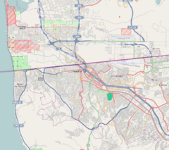
Otay Centenario is an important part of Tijuana, a large city in Baja California, Mexico. It is called a "borough" or delegación. This area was formed on January 1, 2014. It was created when two older boroughs, Mesa de Otay and Centenario, joined together.
Otay Centenario is located in a key spot. It is east of Tijuana's downtown area, known as Centro. It is also south of the border with the United States. Across the border is the Otay Mesa, San Diego neighborhood in San Diego. To the north of Otay Centenario is La Mesa borough.
This area is home to the Tijuana International Airport. Many factories, called maquiladoras, are also found here. You can find major shopping centers like Centro Comercial Otay. Plaza Americana Otay is right across from it. Otay Centenario is also known for its many restaurants. It is considered the second best place in Tijuana for food.
Contents
Factories and Industry
The part of Otay Centenario that used to be the Centenario borough has the most factories in Tijuana. These factories are often called maquiladoras. The biggest neighborhood in this area is Ciudad Industrial, which means "Industrial City."
Three very important streets run through this area. They are Boulevard Bellas Artes, Boulevard Industrial, and Mexican Federal Highway 2. These roads help connect the factories and businesses.
Parks and Recreation
Otay Centenario has a large park called Parque de la Amistad. This name means "Friendship Park." It is a great place for people to relax and play.
It is important not to confuse this park with another one. There is a different Friendship Park located right at the border. That one is in Playas de Tijuana.
Learning and Education
Otay Centenario is a center for learning. It has two important universities. The Instituto Tecnológico de Tijuana is located here. This is a technology institute.
The Autonomous University of Baja California, Tijuana also has a campus in this borough. These schools help students get a good education.
Border Crossings
This area is very important for crossing the border. It has the Otay Mesa Port of Entry. This is where people and goods can cross into Otay Mesa, San Diego in the United States.
There are also plans for a new border crossing. It will be called the Otay Mesa East Port of Entry. This new crossing will connect Otay Centenario with the East Otay Mesa area in San Diego County.
See also
 In Spanish: Otay Centenario (Tijuana) para niños
 | Emma Amos |
 | Edward Mitchell Bannister |
 | Larry D. Alexander |
 | Ernie Barnes |


