San Luis Dam facts for kids
Quick facts for kids San Luis Dam |
|
|---|---|

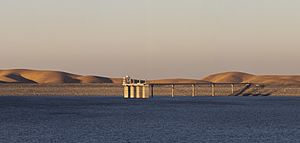
View of San Luis Dam and the intake structure.
|
|
| Country | United States |
| Location | Merced County, California |
| Coordinates | 37°03′33″N 121°04′29″W / 37.05917°N 121.07472°W |
| Construction began | 1963 |
| Opening date | 1968 |
| Owner(s) | U.S. Bureau of Reclamation and California Department of Water Resources |
| Dam and spillways | |
| Type of dam | Embankment |
| Height (foundation) | 382 ft (116 m) |
| Length | 18,600 ft (5,700 m) |
| Dam volume | 77,656,000 cu yd (59,372,000 m3) |
| Reservoir | |
| Creates | San Luis Reservoir |
| Total capacity | 2,041,000 acre⋅ft (2.518 km3) |
| Catchment area | 82.6 sq mi (214 km2) |
| Surface area | 12,700 acres (5,100 ha) |
| Normal elevation | 544 ft (166 m) |
| Power station | |
| Name | William R. Gianelli Powerplant |
| Commission date | 1968 |
| Type | Pumping-generating |
| Hydraulic head | 323 ft (98 m) max |
| Turbines | 8 x 53.0 MW Francis turbines |
| Installed capacity | 424 MW |
The San Luis Dam is a huge earth-filled dam in Merced County, California. It creates the San Luis Reservoir, which is the biggest reservoir in the United States that is not built directly on a river. This means water is pumped into it from other places. The dam is also known as B.F. Sisk Dam, named after Bernie Sisk.
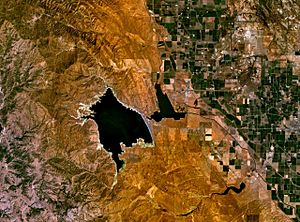
The dam and reservoir are located in the Diablo Range, about 10 miles (16 km) west of Los Banos. San Luis Dam is a joint project between the state and federal governments. It holds over 2 million acre feet (2.5 km3) of water. This water is used for the California State Water Project and the federal Central Valley Project. Even though the dam is in the valley of San Luis Creek, most of its water comes from man-made canals. These canals bring water from rivers in Northern California.
San Luis Dam mainly provides water for irrigation in the San Joaquin Valley. It helps supply water for more than 1 million acres (400,000 ha) of farms. Some water is also used for cities and for environmental needs. The dam was built between 1963 and 1968. It was filled with water for the first time in 1969. The dam helps California's water system by collecting water during the wet season (November-April). This water would otherwise flow from the Sacramento–San Joaquin River Delta into the Pacific Ocean. The dam also makes hydroelectricity by releasing water when needed. However, it has changed the environment by allowing more water to be taken from sensitive river areas. In recent years, dry weather and rules to protect endangered fish have caused low water levels at San Luis Reservoir.
You can see the dam and reservoir from the Romero Overlook Visitors Center. This center is located along Highway 152.
Contents
How San Luis Dam Works
San Luis Reservoir is designed to catch extra water flowing from the Sacramento–San Joaquin River Delta. This Delta is the largest river system in California. The dam collects water during the winter and spring rainy season. This water is then saved to be used during the dry season. The water includes natural river flows and water released from other reservoirs like Shasta Lake and Lake Oroville. This is done to help control floods. A system of canals and pumping stations moves water from the Delta south to where it is needed.
The San Luis Dam is a type of dam called a zoned compacted earthfill structure. It is one of the largest earth dams in the United States. It stands 382 feet (116 m) tall and is 18,600 feet (5,700 m) long. The dam contains 77,656,000 cubic yards (59,372,000 m3) of material. When full, San Luis Reservoir is more than 300 feet (91 m) deep. It covers 12,700 acres (5,100 ha) and holds 2,041,000 acre-feet (2.518 km3) of water. The state of California owns 55 percent of the reservoir's storage space. The federal government owns the other 45 percent.
Water Delivery System
The Delta-Mendota Canal was built in 1951. It carries water for the federal Central Valley Project (CVP). This water goes to farms in the San Joaquin Valley. The California Aqueduct was built in 1968. It is part of the State Water Project (SWP). This canal delivers water to Los Angeles and other cities and farms in Southern California. Both canals start at the Clifton Court Forebay near Tracy, California. Here, large pumps like the Jones and Banks Pumping Plants pull water from the Delta.
The canals connect to O'Neill Forebay. This is a smaller reservoir right in front of San Luis Dam. Water is temporarily stored here before it is sent out. Most CVP water is used for farming. SWP water is split: 30 percent for farming and 70 percent for cities.
Making Electricity at the Dam
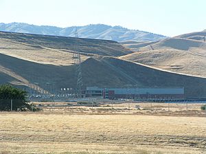
The San Luis Pumping-Generating Plant is also called the William R. Gianelli Power Plant. It is located between O'Neill and San Luis Reservoirs. This plant can pump water uphill into San Luis Reservoir when electricity demand is low. Then, it can release the water downhill to generate electricity when demand is high.
The plant has eight special Francis turbine units. These units can work in reverse. They can generate up to 424 megawatts of power when water is released. When pumping water uphill, the plant uses 376 megawatts of power. The maximum water flow when generating electricity is 13,120 cubic feet per second (372 m3/s). The maximum pumping rate is 11,000 cubic feet per second (310 m3/s).
Selling this "peaking power" helps lower the cost of running the State Water Project. This is especially true for the huge electric pumps along the California Aqueduct. A power line carries this electricity to Northern California's main power grid. However, some energy is lost due to friction when pumping water uphill. Only about 70 percent of the energy can be recovered when the water is released.
History of San Luis Dam
The valley where San Luis Reservoir now sits was once home to the Yokuts people. In the early 1800s, it became part of Rancho San Luis Gonzaga. Small farms started in the area, using water from underground and from the San Joaquin River. In the 1930s, the Central Valley Project began. It brought more water to the area, allowing many more farms to grow. However, there wasn't enough local water storage. This made it hard to supply water all year.
During the dry summer months, farmers pumped a lot of water from underground. This caused the local water supply to drop a lot. The Bureau of Reclamation, a government agency, saw the need for a large reservoir. This reservoir would provide water year-round. They started studying this idea in 1955.
Building the Dam
In the 1950s, California also started building its own water project. This project also needed a reservoir that wasn't on a main river. The state offered to work with the federal government to build a shared facility. After several years, the Bureau of Reclamation agreed. On May 16, 1960, the state and the Bureau of Reclamation signed an agreement. This plan included building the San Luis Dam and Power Plant together. The state would pay 55 percent of the cost, and the federal government would pay the rest. On June 3, 1960, President Dwight D. Eisenhower signed a law allowing the San Luis Unit Project to begin.
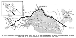
Plans for the dam were finished by 1961. The groundbreaking ceremony happened on August 18, 1962. President John F. Kennedy and California Governor Pat Brown were there. They gave the signal to set off the first explosives at the dam site. Work began that same month to move Pacheco Pass Highway (now SR 152) around where the reservoir would be. The main contract for building the dam went to a group of companies in 1963 for $85.9 million.
Construction of San Luis Dam lasted from 1963 to early 1968. The dam was built in layers using earth and rock from local quarries. Workers moved as much as 130,000 cubic yards (99,000 m3) of material each day. The 100-ton Caterpillar dump trucks used were the biggest in the US at that time. Building the four water intake towers, each 284 feet (87 m) high, was the first time tower cranes were used in the US. The number of workers reached its highest point in October 1965. In January 1968, as construction finished, water from the California Aqueduct began filling the reservoir. The dam was officially opened on April 20, 1968. However, San Luis Reservoir did not completely fill for the first time until May 31, 1969.
Dam Repairs
In 1981, when water levels in San Luis Reservoir were low, a part of the dam's front side collapsed. A 1,100-foot (340 m) long section fell into the reservoir. About 400,000 cubic yards (310,000 m3) of material moved. Because the water level was low, the dam was not in danger of breaking. However, it could not be safely refilled until it was fixed. By August 1982, the area was made stable again. This was done by adding 1,400,000 cubic yards (1,100,000 m3) of extra material. This repair cost $6.1 million. In July 1984, another crack appeared in the dam, but it soon stopped growing. No similar problems have happened since then.
Water Supply and Uses
Most of the water stored behind San Luis Dam is used for farming. The water belonging to the Central Valley Project (CVP) is released into the Delta-Mendota Canal. It then flows into the San Joaquin River. This water helps irrigate 380,000 acres (150,000 ha) of farmland in the central San Joaquin Valley. Some CVP and State Water Project (SWP) water goes to the Westlands Water District. This district is in Fresno and Kings Counties. It irrigates up to 735,000 acres (297,000 ha) of land on the west side of the San Joaquin Valley. Before San Luis Dam was built, this area relied completely on underground water. In 2016, the main crops grown here were almonds, tomatoes, pistachios, and wheat. Most of the Westlands district has very large farms. The SWP also provides more than 980,000 acre-feet (1.21 km3) of water each year for farmers in Kern County.
San Luis Reservoir also stores water for the Metropolitan Water District of Southern California (MWD). This district is a main water provider for the Greater Los Angeles Area. This water reaches Southern California through the East and West Branches of the California Aqueduct. It also provides water for Central Coast cities like San Luis Obispo and Santa Barbara. This water travels through the Coastal Branch of the California Aqueduct.
Local water agencies and irrigation districts can "bank" water in San Luis Reservoir. This means they buy water during the rainy season when it's cheaper and save it for later. However, they can only store this extra water when San Luis is not full. This is because state and federal water supplies are the priority. If the reservoir fills up, any "banked" water that hasn't been used is transferred to the CVP and SWP supplies.
Besides supplying the main CVP and SWP canals, San Luis Reservoir also sends water to the Santa Clara Valley. This water travels through the Pacheco Tunnel and Hollister Conduit, which go under the Diablo Range. At the western end of the tunnel, the water is stored behind San Justo Dam. This dam is an earthfill dam completed in 1986. These facilities are all part of the San Felipe Division of the Central Valley Project.
The San Luis & Delta-Mendota Water Authority represents the 29 federal water users served by the San Luis Unit. This area covers 2,100,000-acre (850,000 ha) in the San Joaquin and Santa Clara Valleys. The Authority operates the federal part of the San Luis Reservoir and its water supply system.
Environmental Concerns
Before San Luis Dam was built, most water pumping from the Delta happened in the summer. This was when farms needed the most water. San Luis Dam allowed more water to be captured in winter. This water would otherwise flow into the ocean. However, pumping water during certain times in winter and early spring can affect fish migration. This is especially true for the Sacramento River chinook salmon. The pumping changes the main direction of water flow in the Delta. This can confuse the fish.
Because of this, rules have been in place since the 1990s. These rules limit pumping during the spring chinook salmon run (March-April). This has often led to low water levels at San Luis Reservoir. In late summer 2016, the reservoir fell to only 10 percent of its capacity. This was the lowest level since 1991.
Water agencies have said these rules are too strict, especially during California's long drought. In winter 2016, at least 180,000 acre-feet (220,000,000 m3) of water was allowed to flow from the Delta into the Pacific Ocean. This water could have been pumped into San Luis Reservoir. In December 2016, Congress passed a bill. This bill allows more water pumping when fish are not at high risk. This will generally allow more water to be stored at San Luis Reservoir. The bill requires daily monitoring of fish. This helps make sure environmental laws are followed. It moves away from strict limits that might not fit current conditions. California Senator Dianne Feinstein said the goal is to run California's water system based on science, not just guesses.
Future Plans for San Luis Dam
In 2013, the Bureau of Reclamation suggested making San Luis Dam 20 feet (6.1 m) taller. This would create about 130,000 acre-feet (160,000,000 m3) of extra storage space. A larger reservoir could hold more water in wet years. This would help make up for less water being pumped in dry years due to environmental rules. This project would cost $360 million. It would also include upgrades to protect the dam from earthquakes. This dam expansion is one of several big water projects. These projects could get some funding from a $2.7 billion bond measure. California voters approved this measure in 2014.
 | Roy Wilkins |
 | John Lewis |
 | Linda Carol Brown |


