Santa Barbara, California facts for kids
Quick facts for kids
Santa Barbara
|
|||
|---|---|---|---|
|
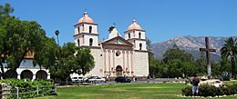
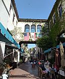
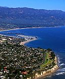
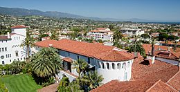
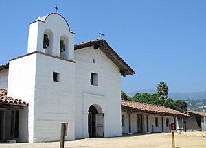
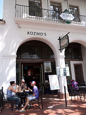
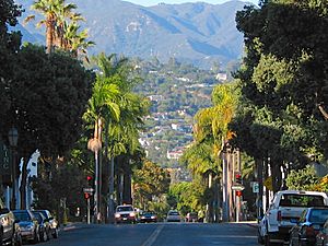
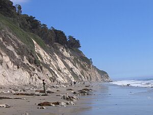
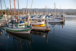
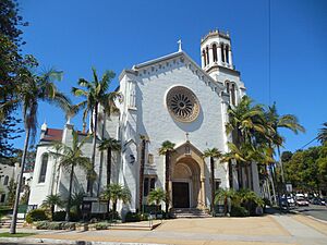
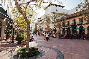
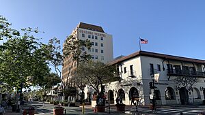
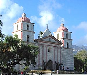
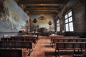
Clockwise: Mission Santa Barbara; California Riviera; Santa Barbara County Courthouse; View of Downtown; Presidio of Santa Barbara; Downtown Santa Barbara; Santa Barbara Beach
|
|||
|
|||
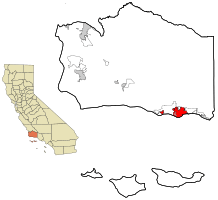
Location in Santa Barbara County and the state of California
|
|||
| Country | United States | ||
| State | California | ||
| County | Santa Barbara | ||
| Incorporated | April 9, 1850 | ||
| Named for | Saint Barbara | ||
| Government | |||
| • Type | Council–manager | ||
| Area | |||
| • City | 42.00 sq mi (108.78 km2) | ||
| • Land | 19.50 sq mi (50.51 km2) | ||
| • Water | 22.50 sq mi (58.27 km2) 53.61% | ||
| Elevation | 49 ft (15 m) | ||
| Population
(2020)
|
|||
| • City | 88,665 | ||
| • Rank | 91st in California | ||
| • Density | 4,546.92/sq mi (1,755.58/km2) | ||
| • Urban | 202,197 (US: 190th) | ||
| • Urban density | 3,688.9/sq mi (1,424.3/km2) | ||
| • Metro | 446,475 (US: 123rd) | ||
| Time zone | UTC−8 (Pacific Time Zone) | ||
| • Summer (DST) | UTC−7 (PDT) | ||
| ZIP Codes |
93101–93103, 93105–93111, 93116–93118, 93120–93121, 93130, 93140, 93150, 93160, 93190, 93199
|
||
| Area code | 805 | ||
| FIPS code | 06-69070 | ||
| GNIS feature IDs | 1661401, 2411815 | ||
Santa Barbara is a beautiful coastal city in California. It is the main city of Santa Barbara County, California. The city sits between the tall Santa Ynez Mountains and the Pacific Ocean. Santa Barbara is known for its mild, sunny weather, much like the Mediterranean Sea region. Because of this, it is often called "The American Riviera." In 2020, about 88,665 people lived here.
Santa Barbara is a popular place for tourists and vacations. It also has many different types of jobs. These include services, education, technology, healthcare, and local government. Many people work in these areas.
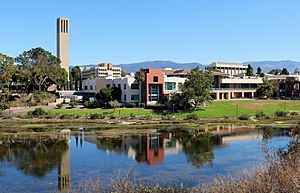
The city is home to several colleges and universities. These include the University of California, Santa Barbara and Santa Barbara City College. You can get to Santa Barbara by flying into Santa Barbara Municipal Airport. You can also take a train with Amtrak, which runs the Pacific Surfliner service.
Santa Barbara is connected to other major cities by U.S. Highway 101. Los Angeles is about 100 miles (160 km) to the southeast. San Francisco is about 325 miles (523 km) to the northwest. Behind the city, in the Santa Ynez Mountains, is the Los Padres National Forest. This forest has many wild areas. The Channel Islands National Park is about 20 miles (32 km) offshore.
Contents
- History of Santa Barbara
- Geography and Landscape
- Climate and Weather
- Geology and Soils
- Architecture and Design
- Neighborhoods of Santa Barbara
- Population and People
- Economy and Jobs
- Arts and Culture
- Sports and Recreation
- Parks and Outdoor Fun
- Education and Learning
- Media and News
- Transportation Options
- Sister Cities Around the World
- Notable People from Santa Barbara
- See also
History of Santa Barbara
![]() Spanish Empire 1769–1821
Spanish Empire 1769–1821
![]() First Mexican Empire 1821–1823
First Mexican Empire 1821–1823
![]() United Mexican States 1823–1848
United Mexican States 1823–1848
![]() United States 1848–present
United States 1848–present
People have lived in the Santa Barbara area for at least 13,000 years. Ancient tools and human remains show that people were here a very long time ago. Before Europeans arrived, about 25,000 Chumash natives lived in the region. Five Chumash villages were in the area where Santa Barbara is today.
Spanish Exploration and Settlement
In 1542, Portuguese explorer Juan Rodríguez Cabrillo sailed through the Santa Barbara Channel. He was sailing for Spain. In 1602, another Spanish explorer, Sebastián Vizcaíno, named the channel and one of the Channel Islands "Santa Barbara."
A land trip led by Gaspar de Portolà came through in 1769. A missionary with him, Juan Crespi, named a large native town "Laguna de la Concepción." But Cabrillo's earlier name, Santa Barbara, stuck.
The first permanent European settlers arrived in 1782. They were Spanish missionaries and soldiers led by Felipe de Neve. They built the Presidio, which was like a fort. Their goals were to claim the land for Spain and to teach the native people about Catholicism. Many Spanish families came with them, forming the first small town around the Presidio.
The Mission Santa Barbara was started on December 4, 1786. This was the tenth mission founded in California by the Spanish Franciscans. Chumash workers helped build a water system for the Mission. Sadly, many native people died from diseases like smallpox during this time. They had no natural protection against these new illnesses.
A big earthquake and tsunami hit in 1812. It destroyed the Mission and the town. Water from the ocean reached far inland. The Mission was rebuilt by 1820. The new Mission building is still standing today. It is one of the best-preserved California Missions and is still an active church.
The Spanish period ended in 1822. This was when Mexico became independent from Spain. Many Santa Barbara street names, like de la Guerra and Carrillo, come from important Spanish families.
Mexican Rule and American Takeover
After Mexico took over, the missions were no longer controlled by the church. The Mexican government gave large pieces of land to important families. This started the "Rancho Period." The population was small, with wealthy families running huge cattle farms.
During the Mexican–American War, American soldiers took over Santa Barbara without a fight on December 27, 1846. After the war, in 1848, Santa Barbara became part of the United States.
Growth and Change After 1848
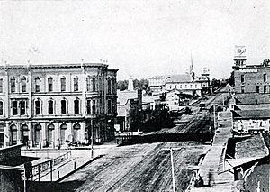
After becoming part of the U.S., Santa Barbara grew quickly. The population doubled between 1850 and 1860. New buildings were made of wood instead of adobe. During the California Gold Rush, the town became a bit wild with bandits.
English slowly replaced Spanish as the main language. The first newspaper started in 1855. A terrible drought in 1863 ended the Rancho Period. Most of the cattle died, and large ranches were broken up.
In 1872, Stearns Wharf was built. This made it easier for ships to bring goods and visitors to Santa Barbara. Before this, people and goods had to be rowed ashore. In the 1870s, writer Charles Nordhoff wrote about Santa Barbara as a health resort. Many wealthy travelers came and stayed. The railroad reached Los Angeles in 1887 and San Francisco in 1901. This made Santa Barbara much easier to reach.
Santa Barbara also had a streetcar system from 1875 to 1929. It started with mule-drawn cars and later became electric.
Early 1900s to World War II
Around 1900, oil was found near the coast. This led to the world's first offshore oil drilling. Oil drilling near Santa Barbara has been a debated topic ever since.
Santa Barbara was once a big center for silent movies. Flying A Studios operated here from 1910 to 1922. They made about 1,200 films. The movie industry later moved to Hollywood. The Loughead Aircraft Company, which later became Lockheed, also started here. They tested seaplanes off East Beach.
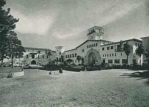
On June 29, 1925, a strong earthquake hit Santa Barbara. It destroyed much of downtown and killed 13 people. The city rebuilt in a beautiful Spanish Colonial style. The Santa Barbara County Courthouse was built then. It is often called one of the most beautiful public buildings in the U.S.
During World War II, Santa Barbara was important for the military. On February 23, 1942, a Japanese submarine fired shells at the Ellwood Oil Field. This was the first time an enemy had attacked the U.S. mainland since World War I. Many residents were scared and left the city.
After World War II: Growth and Environmental Awareness

After World War II, many soldiers who had seen Santa Barbara came back to live there. The population grew quickly. Highway 101 was built through town. Lake Cachuma was created to supply water.
People in Santa Barbara became more concerned about the oil industry. A major event was the oil spill on January 28, 1969. About 100,000 barrels of oil spilled into the ocean. It covered hundreds of square miles and much of the coastline. This disaster helped start the modern environmental movement. Two important laws, the California Environmental Quality Act and the National Environmental Policy Act, were passed because of it.
In 1975, the city decided to limit its growth to 85,000 residents. This helped keep Santa Barbara from becoming too crowded. However, it also made housing prices very high. Many people who work in Santa Barbara now live in nearby, more affordable towns.
Wildfires in Santa Barbara
Santa Barbara has faced several big wildfires.
- The 1964 Coyote Fire burned 67,000 acres (271 km²) and 106 homes.
- The 1977 Sycamore Fire burned 200 homes quickly.
- The 1990 Painted Cave Fire destroyed over 500 homes in hours.
- The 2008 Tea Fire destroyed 210 homes in the foothills.
- The 2009 Jesusita Fire burned 8,733 acres (35 km²) and 160 homes.
- The Thomas Fire in 2017-2018 was the largest fire in Santa Barbara County history. It burned 281,893 acres (1,141 km²) and destroyed 1,050 structures.
Geography and Landscape
Santa Barbara is about 90 miles (145 km) northwest of Los Angeles. It is on the Pacific coast. This part of the coast is called "The American Riviera." This is because its landscape and weather are similar to the Riviera in southern France and Italy.
The Santa Ynez Mountains rise steeply behind the city. Some peaks are over 4,000 feet (1,200 m) tall. These mountains are covered with chaparral plants and oak trees. They form a beautiful background for the city. Sometimes, snow falls on the mountains, but it usually melts quickly.
The city covers about 42 square miles (109 km²). About 19.5 square miles (50.5 km²) is land, and 22.5 square miles (58.3 km²) is water. The large water area is because the city limits extend into the ocean. This includes a strip that reaches the Santa Barbara Municipal Airport to keep it within the city.
Climate and Weather
Santa Barbara has a warm-summer Mediterranean climate. This type of climate is common along the California coast. U.S. News & World Report ranked Santa Barbara's weather as number 1 in the United States in 2023–2024.
Because the city is by the ocean, sea breezes keep temperatures mild. Winters are warmer and summers are cooler than places further inland.
In winter, storms bring rain. The mountains can affect how much rain falls. On average, there are only about two nights a year with freezing temperatures.
Summers are warm with very few extremely hot days. Most days from December to February are around 63–69°F (17–21°C). Most days from June to August are around 72–84°F (22–29°C).
Summers are usually dry. This is because of a high-pressure system over the Pacific Ocean. Sometimes, strong, dry winds called "Sundowners" blow in the fall. These winds can make temperatures rise and increase the risk of wildfires.
Rainfall varies a lot each year. Some years get over 40 inches (1,000 mm) of rain. Other years get less than 6 inches (150 mm). Snow is very rare in the city itself. The last time snow fell near sea level was in January 1949.
| Climate data for Santa Barbara, California, 1991–2020 Normals, extremes 1893–present | |||||||||||||
|---|---|---|---|---|---|---|---|---|---|---|---|---|---|
| Month | Jan | Feb | Mar | Apr | May | Jun | Jul | Aug | Sep | Oct | Nov | Dec | Year |
| Record high °F (°C) | 90 (32) |
94 (34) |
96 (36) |
101 (38) |
101 (38) |
101 (38) |
105 (41) |
98 (37) |
108 (42) |
103 (39) |
98 (37) |
92 (33) |
108 (42) |
| Mean maximum °F (°C) | 78.8 (26.0) |
78.8 (26.0) |
81.1 (27.3) |
86.2 (30.1) |
84.7 (29.3) |
82.1 (27.8) |
85.1 (29.5) |
85.8 (29.9) |
88.9 (31.6) |
91.4 (33.0) |
84.0 (28.9) |
75.8 (24.3) |
95.1 (35.1) |
| Mean daily maximum °F (°C) | 66.8 (19.3) |
66.9 (19.4) |
68.3 (20.2) |
71.0 (21.7) |
71.6 (22.0) |
73.0 (22.8) |
76.4 (24.7) |
77.7 (25.4) |
77.7 (25.4) |
75.7 (24.3) |
71.0 (21.7) |
66.2 (19.0) |
71.9 (22.2) |
| Daily mean °F (°C) | 56.6 (13.7) |
57.1 (13.9) |
58.8 (14.9) |
61.2 (16.2) |
63.0 (17.2) |
65.1 (18.4) |
68.3 (20.2) |
69.0 (20.6) |
68.6 (20.3) |
65.8 (18.8) |
60.6 (15.9) |
56.2 (13.4) |
62.5 (17.0) |
| Mean daily minimum °F (°C) | 46.5 (8.1) |
47.3 (8.5) |
49.4 (9.7) |
51.4 (10.8) |
54.3 (12.4) |
57.3 (14.1) |
60.2 (15.7) |
60.3 (15.7) |
59.5 (15.3) |
56.0 (13.3) |
50.2 (10.1) |
46.1 (7.8) |
53.2 (11.8) |
| Mean minimum °F (°C) | 38.4 (3.6) |
40.2 (4.6) |
42.0 (5.6) |
44.3 (6.8) |
48.2 (9.0) |
52.5 (11.4) |
54.6 (12.6) |
54.7 (12.6) |
52.5 (11.4) |
48.3 (9.1) |
43.7 (6.5) |
38.5 (3.6) |
36.2 (2.3) |
| Record low °F (°C) | 20 (−7) |
27 (−3) |
30 (−1) |
30 (−1) |
34 (1) |
40 (4) |
44 (7) |
40 (4) |
33 (1) |
31 (−1) |
28 (−2) |
23 (−5) |
20 (−7) |
| Average precipitation inches (mm) | 4.43 (113) |
4.41 (112) |
3.20 (81) |
1.01 (26) |
0.41 (10) |
0.14 (3.6) |
0.01 (0.25) |
0.01 (0.25) |
0.05 (1.3) |
0.84 (21) |
1.40 (36) |
3.07 (78) |
18.98 (482.4) |
| Average precipitation days (≥ 0.01 in) | 6.8 | 7.4 | 6.7 | 3.1 | 2.0 | 1.5 | 0.3 | 0.4 | 0.9 | 2.2 | 3.3 | 5.9 | 40.5 |
| Mean monthly sunshine hours | 186 | 197.8 | 279 | 300 | 310 | 300 | 341 | 310 | 270 | 240 | 180 | 186 | 3,099.8 |
| Mean daily sunshine hours | 6 | 7 | 9 | 10 | 10 | 10 | 11 | 10 | 9 | 8 | 6 | 6 | 9 |
| Percent possible sunshine | 59 | 64 | 75 | 76 | 71 | 69 | 77 | 75 | 73 | 71 | 58 | 61 | 69 |
| Source 1: NOAA | |||||||||||||
| Source 2: Weather Atlas (sun) | |||||||||||||
Geology and Soils
Santa Barbara is on a flat area between the Santa Ynez Mountains and the sea. This area has many layers of soil, sand, and rock from different time periods. The soils are mostly fine brown sandy loam. The land in this region is rising quickly, which you can see from the coastal cliffs and narrow beaches.
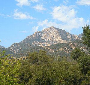
Downtown Santa Barbara sits on a floodplain between two major geologic faults. These faults are the Mission Ridge Fault Zone to the north and the Mesa Fault to the south. The Mesa Fault is thought to have caused the big earthquake of 1925.
The Santa Barbara Formation is a key part of the aquifer (underground water source) beneath the city. This water source is protected from seawater by a fault. Most of the water wells in the area get their water from this rock layer.
The Santa Ynez Mountains north of the city are made of many layers of sandstone and conglomerate rock. These mountains have risen quickly over time, giving them their rugged look. Many landslides happen here because of the active geology.
Architecture and Design
Santa Barbara's buildings mostly follow the Mediterranean Revival and Spanish Colonial Revival styles. This was encouraged after the 1925 earthquake destroyed much of the downtown area. City leaders wanted a unified look.
You can still see many Victorian homes from the late 1800s. California bungalows were popular in the early 1900s. After 1925, Spanish Colonial Revival homes became common, especially in newer, fancier areas like Montecito and Hope Ranch.
Many famous architects have worked in Santa Barbara. They include Peter J. Barber, Mary Craig, and George Washington Smith.
Neighborhoods of Santa Barbara
Santa Barbara has many neighborhoods, each with its own history and style. Here are some of them:
- The Mesa is a coastal area about 2.5 miles (4 km) long. It has a relaxed beach feel and offers access to Mesa Lane Beach and Thousand Steps Beach. People like living here because it's close to the ocean and the college.
- Bel Air and Alta Mesa are mostly residential areas north of The Mesa. They include the Honda Valley natural area and Elings Park, a large private park. Many homes here have great views of the city, mountains, and ocean.
- Mission Canyon is a hilly, wooded area near the Old Mission. It's popular for hiking but has a high risk of wildfires. It is known for its natural beauty.
- The Riviera is a hillside area with ocean views. It's called "the Riviera" because it looks like coastal towns in France and Italy. It has winding streets and stone terraces built by Italian immigrants long ago. Homes here often have amazing views.
- The Westside is mainly in the lowlands between State Street and the Mesa. It includes Santa Barbara City College.
- The Eastside is the area east of State Street, up to the Riviera. It includes Santa Barbara Junior High School, Santa Barbara High School, and the Santa Barbara Bowl.
- The Waterfront has many shops and tourist spots along Cabrillo Boulevard. This area includes Stearns Wharf, the Santa Barbara Harbor, and the breakwater.
- Upper State Street is a mix of homes and businesses. It has many offices and medical facilities. The Santa Barbara Mission is in this area.
- San Roque is northwest of downtown. It's often a bit warmer than coastal areas because it's further from the ocean. Locals say it has the most comfortable weather in Santa Barbara.
- Samarkand is a neighborhood with about 630 homes. Its name means "the land of heart's desire." It was named after a fancy hotel that used to be there. An early resident, Earle Ovington, built an airfield here in 1920.
Population and People
| Historical population | |||
|---|---|---|---|
| Census | Pop. | %± | |
| 1880 | 3,460 | — | |
| 1890 | 5,864 | 69.5% | |
| 1900 | 6,587 | 12.3% | |
| 1910 | 11,659 | 77.0% | |
| 1920 | 19,441 | 66.7% | |
| 1930 | 33,613 | 72.9% | |
| 1940 | 34,958 | 4.0% | |
| 1950 | 44,854 | 28.3% | |
| 1960 | 58,768 | 31.0% | |
| 1970 | 70,215 | 19.5% | |
| 1980 | 74,414 | 6.0% | |
| 1990 | 85,571 | 15.0% | |
| 2000 | 92,325 | 7.9% | |
| 2010 | 88,410 | −4.2% | |
| 2020 | 88,665 | 0.3% | |
| 2023 (est.) | 85,418 | −3.4% | |
| U.S. Decennial Census | |||
Population Facts from 2020
| Race / Ethnicity (NH = Non-Hispanic) | Pop 2000 | Pop 2010 | Pop 2020 | % 2000 | % 2010 | % 2020 |
|---|---|---|---|---|---|---|
| White alone (NH) | 53,849 | 48,417 | 45,882 | 58.33% | 54.76% | 51.75% |
| Black or African American alone (NH) | 1,418 | 1,177 | 1,086 | 1.54% | 1.33% | 1.22% |
| Native American or Alaska Native alone (NH) | 405 | 313 | 275 | 0.44% | 0.35% | 0.31% |
| Asian alone (NH) | 2,467 | 2,927 | 3,047 | 2.67% | 3.31% | 3.44% |
| Pacific Islander alone (NH) | 98 | 94 | 61 | 0.11% | 0.11% | 0.07% |
| Other Race alone (NH) | 180 | 186 | 569 | 0.19% | 0.21% | 0.64% |
| Mixed race or Multiracial (NH) | 1,578 | 1,705 | 3,401 | 1.71% | 1.93% | 3.84% |
| Hispanic or Latino (any race) | 32,330 | 33,591 | 34,344 | 35.02% | 37.99% | 38.73% |
| Total | 92,325 | 88,410 | 88,665 | 100.00% | 100.00% | 100.00% |
In 2020, the U.S. census counted 88,665 people in Santa Barbara. There were 35,383 households. About 23.5% of households had children under 18. The average household had 2.4 people.
About 16.6% of the population was under 18 years old. The median age was 40.2 years. For every 100 females, there were about 104.5 males.
The median household income was about $81,618. About 12.3% of the population lived below the poverty line.
Economy and Jobs
Santa Barbara has a strong economy with many different types of jobs. Companies in aerospace and defense, like Raytheon, have big operations here. Since Santa Barbara is a popular place to visit, the tourism industry is also very important.
Some famous businesses started in Santa Barbara. Motel 6 began here in 1962. The Egg McMuffin was invented at a local McDonald's. The Habit Burger Grill restaurant chain also started nearby. Kinko's (now FedEx Office) was founded near UC Santa Barbara.
The largest employers in Santa Barbara County include:
- County of Santa Barbara
- University of California, Santa Barbara
- Cottage Health Organization
- Mission Linen Supply
- AppFolio
- Santa Barbara Unified School District
- City of Santa Barbara
- Sansum Medical Foundation Clinic
- Raytheon Electronic Systems
- Procore
Other big employers are Jordano's, Marborg Industries, and several hotels. Shopping areas include Paseo Nuevo downtown and La Cumbre Plaza on upper State Street.
Arts and Culture
Performing Arts Venues
Santa Barbara has many places for performances.
- The Arlington Theatre is the largest indoor venue. It hosts the annual Santa Barbara International Film Festival.
- The Lobero Theatre is a historic building for smaller concerts.
- The Granada Theater is the tallest building downtown. It was reopened in 2008 after being remodeled.
- The Santa Barbara Bowl is a large outdoor amphitheater.
The city is also known for classical music. It has the Santa Barbara Symphony Orchestra and other music groups. The Music Academy of the West in Montecito holds a music festival every summer.
Tourism and Attractions
Santa Barbara is a popular place for tourists all year. People love its good weather, beaches, and Spanish-style buildings. Tourism brings over a billion dollars to the local economy each year.
The waterfront along Cabrillo Boulevard is a big draw. Stearns Wharf has shops, restaurants, and the Ty Warner Sea Center.
Mission Santa Barbara is an active church and a national historic landmark. It is known as "The Queen of the Missions." Every year, a chalk-art festival called I Madonnari takes place in front of the mission.
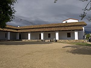
The Santa Barbara County Courthouse is a beautiful Spanish-Moorish building. You can go up its tower for a great view of the city. The Presidio of Santa Barbara was a Spanish military fort built in 1782. It was very important in the early days of the town.
Events and Festivals
- The annual Fiesta (also called "Old Spanish Days") happens every August. It started in the 1920s to attract tourists. Girls called Flower Girls and Las Señoritas march in parades and throw flowers.
- The annual Santa Barbara French Festival takes place in July on Bastille Day weekend. It is the biggest French Festival in the western U.S.
- New Noise Music Conference and Festival is a four-day music event. It brings many bands and speakers to the city.
- The Santa Barbara Arts and Crafts Show is held on Cabrillo Boulevard. Artists and craftspeople from Santa Barbara County sell their handmade works.
- The Santa Barbara International Film Festival happens in late January. It brings many celebrities, movie premieres, and films from around the world.
- The annual Summer Solstice Parade draws up to 100,000 people. It is a colorful parade with floats and costumes made by local residents. No written messages or banners are allowed.
Other Interesting Places
- Rafael Gonzalez House – An old adobe home of a Santa Barbara leader from the 1820s.
- Santa Barbara's Moreton Bay Fig Tree – A huge fig tree with one of the largest shaded areas in North America.
- Burton Mound – This mound is thought to be the site of an ancient Chumash village.
- De La Guerra Plaza – The site of the first City Hall.
- Covarrubias Adobe – A historic building from 1817.
- Cold Spring Tavern – A historic stagecoach stop.
- Santa Barbara Zoo – A fun place to see animals.
- Channel Islands National Marine Sanctuary and Channel Islands National Park – Located offshore, great for nature lovers.
- El Presidio de Santa Bárbara State Historic Park – The historic Spanish fort.
Museums to Explore
- The Santa Barbara Museum of Art (SBMA) has important collections of art from different time periods and places.
- The Museum of Contemporary Art Santa Barbara (MCASB) shows modern art. Admission is free.
- The Santa Barbara Museum of Natural History is behind the Santa Barbara Mission. It has exhibits on nature and a planetarium.
- The Santa Barbara Historical Museum tells the story of the city.
- The Santa Barbara Maritime Museum is on the waterfront. It focuses on the area's ocean history.
- The Karpeles Manuscript Library Museum has historical documents and manuscripts.
- Lotusland and Casa del Herrero are outdoor museums with beautiful gardens and homes.
- Casa Dolores celebrates the popular arts of Mexico.
- The Reagan Ranch Center is a museum about Rancho del Cielo and Ronald Reagan's life.
Sports and Recreation
The UC Santa Barbara Gauchos sports teams are very popular. They have 20 teams in NCAA Division I. Their men's soccer and basketball teams draw large crowds.
Santa Barbara hosts the Semana Nautica Summer Sports Festival every year. This includes the Semana Nautica 15K race, which is the oldest continuous race on California's central coast.
Surfing is a big part of Santa Barbara's culture. Many famous surfers have lived here. The Channel Islands block summer waves, so Santa Barbara is known as a winter surfing spot.
Parks and Outdoor Fun
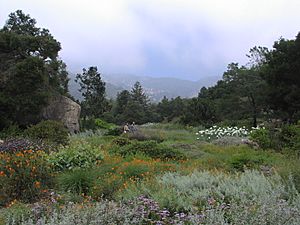
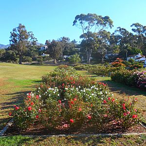
Santa Barbara has many parks, from small city spaces to large natural areas. Some notable parks within the city are:
- Alameda Park
- Alice Keck Park Memorial Garden
- Andree Clark Bird Refuge
- Butterfly Beach
- De La Guerra Plaza
- Douglas Family Preserve
- East Beach
- Elings Park
- Franceschi Park
- Hendry's Beach (Arroyo Burro)
- Hilda Ray Park
- Leadbetter Beach
- Mission Historical Park
- Parma Park
- Shoreline Park
- Skofield Park
- West Beach
Parks and open spaces just outside the city include:
- Chumash Painted Cave State Historic Park
- Gould Park
- Rattlesnake Canyon, a popular hiking spot.
- Santa Barbara Botanic Garden, which has many plants from California.
- Goleta Beach, with BBQ grills and picnic tables.
There are also many hiking trails in Santa Barbara. A path connects the University of California, Santa Barbara to downtown. Santa Barbara is a great place for cycling. The city is recognized as a "Silver Level" city for biking by the League of American Bicyclists.
Education and Learning
Colleges and Universities
Santa Barbara and the nearby area have several colleges and universities:
Research University
Liberal Arts Colleges
- Westmont College
- Antioch University
Community College
- Santa Barbara City College
Other Schools
- Santa Barbara Business College (Trade school)
- Music Academy of the West (Conservatory)
- Pacifica Graduate Institute (Graduate school)
- Fielding Graduate University (Graduate school)
High Schools for Teens
Students attend schools in the Santa Barbara and Hope districts. There are also private schools. These schools are on the south coast of Santa Barbara County:
- The Anacapa School (Grades 7–12)
- San Marcos High School (Grades 9–12)
- Dos Pueblos High School (Grades 9–12)
- Santa Barbara High School (Grades 9–12)
- Laguna Blanca School (Grades K–12)
- Bishop Garcia Diego High School (Grades 9–12)
- Cate School (Grades 9–12)
- Providence Santa Barbara (Grades 9–12)
- Carpinteria High School (Grades 9–12)
Junior High and Middle Schools
- Carpinteria Middle School (Grades 6–8)
- Goleta Valley Junior School (Grades 7–8)
- La Colina Junior High School (Grades 7–8)
- La Cumbre Junior High School (Grades 7–8)
- Santa Barbara Junior High School (Grades 7–8)
- Santa Barbara Middle School (Grades 6–9)
- Santa Barbara Montessori School (Grades Pre-K to 8)
Media and News
Local Newspapers
Santa Barbara has two main newspapers:
- The daily Santa Barbara News-Press
- The Santa Barbara Independent, a weekly newspaper.
There are also online news sites:
- Noozhawk
- Edhat
Television Channels
The following TV stations broadcast in the Santa Barbara area:
- KEYT 3 (ABC/CBS/MNTV)
- K10PV-D 10 (NBC)
- KCOY 12 (Telemundo)
- KSBB-CD 17 (FOX)
- K26FT-D 26 (PBS)
- KTAS 33 (TeleXitos)
- KPMR 38 (Univision)
- KBAB-LD 50 (PBS)
- TV Santa Barbara (Public access channels)
Radio Stations
Santa Barbara has many radio stations, including:
- KTMS (990 AM) News/Talk
- KZSB (1290 AM) News/Talk
- KCLU (1340 AM) NPR
- KJEE (92.9 FM) Alternative rock
- KDB (93.7 FM) Classical Music
- KTYD (99.9 FM) Classic Rock
- KSBL (101.7 FM) Adult Contemporary (KLITE)
- KRUZ (103.3 FM) Classic Hits
- KCSB-FM (91.9 FM) is a non-commercial radio station run by UCSB.
Some Los Angeles radio stations can also be heard.
Transportation Options
U.S. Route 101 runs through Santa Barbara, connecting it to other parts of California. You can fly into Santa Barbara Municipal Airport. Private jet services are also available.
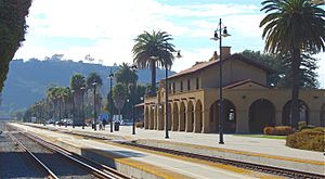
Amtrak offers train service at the Santa Barbara station and Goleta Station. The Coast Starlight and Pacific Surfliner trains stop here.
The Santa Barbara Metropolitan Transit District (MTD) provides local bus service. Greyhound buses also serve downtown Santa Barbara. Electric shuttles run along lower State Street and to the wharf for tourists. Other bus services connect to nearby towns like Lompoc, Santa Maria, and Ventura. The Santa Barbara Airbus offers daily service to LAX.
Santa Barbara has many bike trails. The League of American Bicyclists calls Santa Barbara a "Silver Level" city for biking. You can rent bikes to explore the area. Many professional cyclists train here in winter. In 2009, Santa Barbara was ranked sixth in the U.S. for the percentage of people who bike to work.
From 1875 to 1929, Santa Barbara had a tramway system.
Sister Cities Around the World
Santa Barbara has several sister cities:
 Kotor, Montenegro (since 2009)
 Patras, Greece (since 2010)
 Puerto Vallarta, Mexico (since 1973)
 Toba, Japan (since 1966)
 Weihai, China (since 1993)
Notable People from Santa Barbara
See also
 In Spanish: Santa Bárbara (California) para niños
 | Audre Lorde |
 | John Berry Meachum |
 | Ferdinand Lee Barnett |


